

Craig Cwm Silyn
Good walks are even better shared.
SH5250 : Craig Cwm Silyn
Eric Jones Photo source
Overview
Craig Cwm Silyn
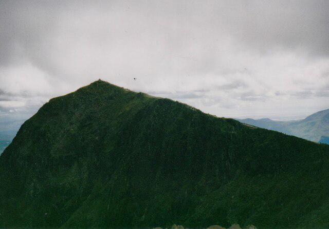
Craig Cwm Silyn is a 734 m mountain on the Nantlle Ridge in Eryri, with 398 m prominence. Its summit has a windshelter on an ancient cairn. Summit record
Walking
Explore Wild Wales describes an 8.5 km circular route from the lane-end parking at SH49545106 via the Cwm Silyn lakes, the steep climb to Bwlch Dros-bern and the summit. The descent crosses the broad summit ground and follows the crag-edge path back to the outward track. Its published figures are 530 m ascent and three hours for the complete circuit; allow more time for your pace and conditions. This is demanding mountain ground with faint paths, exposed sections and occasional use of hands. The optional Mynydd Tal-y-mignedd or Garnedd Goch extensions are outside these totals. Full route
Landscape and outlook
BGS describes volcanic ash-flow tuffs around Cwm Silyn and a glacial moraine on the mountain's northern side. Geology
Clear weather gives views along the ridge, towards Yr Wyddfa and across western Eryri. Mynydd Mawr is 697.5 m, rather than 904 m. A separate longer walking guide covers Garnedd Goch and the two lakes; its totals should not be substituted for the shorter summit circuit. Independent approach account
Planning
Use the narrow-lane approach from Llanllyfni, near Penygroes. Parking is limited and has no facilities. The published start is SH49545106, not SH525511. Keep access clear and carry supplies. Stay away from cliff edges and be prepared to navigate in cloud.
Sources checked 18 October 2026. Route durations are planning estimates, and this account does not establish current access permission or on-foot conditions.
Explore routes near Craig Cwm Silyn
Walks starting near this hill. Open a route to check its map, distance and full itinerary.
Beddgelert Forest: Llyn Llywelyn Woodland Circuit
View route
Beddgelert Forest: Derwen Circuit and Llyn Llywelyn
View route
Snowdon Pyg Track returning by Miner's Track
View route
Yr Eifl and the Gyrns guided mountain walk
View route
Route planning notes
These notes describe possible approaches. Check a route's map and access information when planning your walk.
Craig Cwm Silyn via the lakes: circular route
From the lane-end parking at SH49545106, visit the Cwm Silyn lakes, climb steep broken ground to Bwlch Dros-bern and continue to the summit. Return across the plateau and above the crags to the outward track and the same parking. Explore Wild Wales publishes 8.5 km, 530 m ascent and 3 hours for this full circuit; extensions are excluded. This is exposed mountain walking, not a casual valley stroll. Source: https://explorewildwales.co.uk/shorter-mountain-walks-in-eryri-craig-cwm-silyn/
Make a day of it, together
Find someone to share the walk with, or organise a day out along a route you like.
Photo Gallery
View all Photo could not load
SH5250 : Craig Cwm Silyn
Eric Jones
 Photo could not load
SH5250 : Approaching the Summit Cairn of Craig Cwm Silyn
Eric Jones
 Photo could not load
SH5250 : Boulder Fields at the 'back' of Craig Cwm Silyn
Eric Jones
 Photo could not load
SH5250 : Bouldery slope at summit area of Craig Cwm Silyn
Trevor Littlewood
 Photo could not load
SH5250 : Approaching the summit of Craig Cwm Silyn
Richard Law
 Photo could not load
SH5250 : Craig Cwm Silyn
Rude Health
 Photo could not load
SH5250 : Craig Cwm Silyn summit
Richard Webb
 Photo could not load
SH5250 : Craig Cwm Silyn
David Brown
 Photo could not load
SH5250 : Craig Cwm Silyn
Chris Andrews
 Photo could not load
SH5250 : Craig Cwm Silyn
Alan Richards
Hill facts and local notes
Classifications
Elevation
734m
2,408 ft
Prominence
398m
Coordinates
53.0293, -4.2001
SH525502
OS Map
115
Explorer: OL17W 254
At the Summit
DoBIH records a windshelter on an ancient cairn at the 734 m summit, SH5255950267. The broad rocky summit is distinct from the cliffs below.
Terrain & Geology
The Cwm Silyn area contains welded volcanic ash-flow tuffs. BGS also records a glacial moraine against the north side of Craig Cwm Silyn. The cliffs and lakes reflect both the bedrock and later glacial shaping.
Views & Scenery
In clear weather there are views along the Nantlle Ridge, towards Yr Wyddfa (Snowdon), and across the western Eryri landscape towards the coast.
History & Heritage
Historical Significance
The summit feature is recorded by DoBIH as an ancient cairn with a windshelter. Treat the cairn with care and leave its stones in place.
Getting There & Facilities
Parking
Limited rough parking at the end of Lon Tyddyn Agnes, east of Llanllyfni, around SH49545106 (also given as SH495510). The approach is a narrow lane. Keep gates and farm access clear; SH525511 is not this trailhead.
Public Transport
For the Cwm Silyn start, plan travel to the Llanllyfni/Penygroes side and arrange the onward connection to the lane-end trailhead. Rhyd Ddu is associated with the other end of the Nantlle Ridge, not the start of this circular walk; check current connections before travelling.
Nearby Facilities
The published lane-end start has no toilets, information point or other facilities. Arrange refreshments and toilets before arriving and carry food and water.
Safety Information
Known Hazards
- The lakes circuit includes steep broken ground with little or no visible path and sections where hands may be needed.
- The return passes above very steep crags. Keep well back from edges, especially in wind, wet conditions or poor visibility.
- Carry a map and compass and be able to navigate on open mountain ground. Low cloud can hide both the route and the drops.
General Safety Tips
- Check weather conditions before setting out
- Carry appropriate clothing and equipment
- Let someone know your planned route
- Take a map, compass, and GPS device
- Carry emergency supplies: food, water, first aid kit, torch
Hills
Some common questions about the hills answered
Are there group walks up Craig Cwm Silyn?
Many walkers use Walkmates to join or organise walks with others. You can check for group walks around Craig Cwm Silyn through the maps
Are there other walkers around Craig Cwm Silyn?
Activity varies by location and time, but Walkmates lets you see whether others have shared walks or shown interest in this area. Find other people through the walking friends search walking friends for Craig Cwm Silyn search or of course create your own walk for Craig Cwm Silyn
Can I organise a walk to Craig Cwm Silyn?
Yes. If there aren’t any walks listed already, you can create a walk and make it available for others to join.
If you're signed up to Walkmates, you can create a walk to Craig Cwm Silyn.
How do I find a walk up this hill?
There are often multiple ways to walk this hill, depending on experience and route preference. Walkmates helps you explore walks and routes that others have shared.
Can I suggest a new route up Craig Cwm Silyn?
Yes. You can suggest or create routes to share with others. Walkmates focuses on the social side of walking, so routes are used to help people organise walks and explore areas together, rather than as detailed navigation tools or route libraries.
Other uses really appreciate knowledgeable walkers sharing their routes. Share your favourite route to Craig Cwm Silyn here
The is an error or something incorrect about this hill. How do I let you know?
We always strive to keep the information on Walkmates as accurate as possible. If you find an error, please let us know through the contact form and we'll aim to correct it as quickly as possible
Community Discussion
Comments
Location
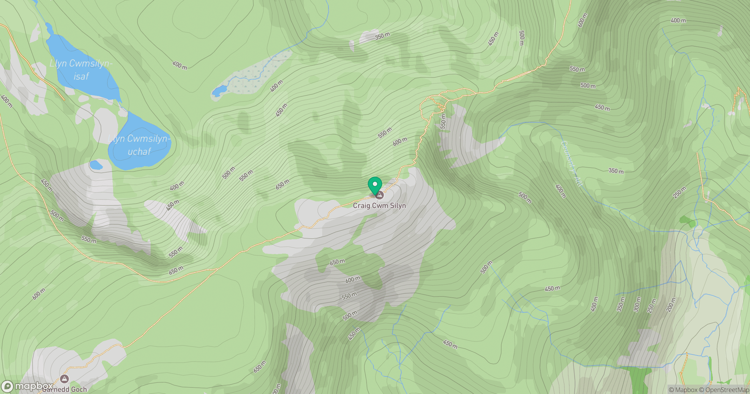
Grid reference: SH525502
View on OpenStreetMapOpens a map in a new tab, centred on the hill.
No comments yet. Be the first.