

Cowlow Hill
Good walks are even better shared.
SK1072 : Cowlow tumulus
Richard Law Photo source
Overview
Cowlow Hill: The Jewel of the Peak District
Overview
Nestled in the heart of the Peak District and standing at a respectable 419 meters, Cowlow Hill may not be the highest in the area, but it more than makes up for it with its breathtaking views and accessible routes. Perfect for an afternoon's stroll, or a more ambitious hike, this hill serves as a great introduction to the wonders of the Peak District.
Geology
Cowlow Hill is composed mainly of limestone, a rock that underpins much of this resilient and picturesque landscape. This geology creates interesting formations and lush vegetation that offer plenty of opportunities for exploration and learning. If you're keen on geology, keep your eyes peeled for interesting limestone features and fossils!
Routes
The Cowlow Hill Circular Walk is a favorite amongst both amateur and seasoned hikers alike. Spanning approximately 7.5 km, this moderate route takes you straight to the summit and back. Expect a well-marked path that winds through the delightful countryside, offering a taste of the natural beauty that surrounds this gem of a hill.
Summit Features
Reaching the trig point at the summit is like hitting the very pinnacle of the world—well, at least the Peak District! Don’t forget to take a moment to appreciate the views and revel in your triumph. Maybe you'll even want to bring a flag to plant—though keep it small; this isn't an expedition to Everest!
Terrain Type
The terrain is predominantly grassy, with occasional rocky outcrops that make for an engaging walk. The soft grass is gentle on the feet, whilst the rocky sections add a bit of spice to your hike. Always a delight!
Views
From the summit, you’ll be treated to panoramic views that will make your heart sing. Notable landmarks visible include the majestic Mam Tor and the picturesque Hope Valley. The best times to soak in these stunning vistas are during the spring and autumn when the foliage is vibrant, and the skies are typically clearer.
Hazards
As with any hike, we must be sensible. Keep an eye out for sheep, who believe they own the place! Additionally, take care on muddy sections after a rain; it's best to wear sturdy footwear to avoid any unwarranted slips.
Nearby Summits
- Cromford Hill (380 meters): Just a stone's throw away, this hill offers further opportunities for exploration.
- Mam Tor (517 meters): A must-visit for those who wish to conquer the highest peaks in the region.
Access
Nearest Parking
Parking can be found in the nearby village of Hope, located approximately 2 km from the start of the hiking route.
Public Transport
Access is convenient with bus services that run from Sheffield and other nearby towns, making it easy to start your adventure without needing a car.
Nearest Town
The closest town to Cowlow Hill is Hope, providing essential amenities before or after your hike.
Facilities
The village of Hope boasts several charming cafes and pubs, ideal for a post-hike refreshment. Public toilets are also available, ensuring that you are well looked after during your excursion.
History
Name Meaning
The name 'Cowlow' stems from the Old English term for a 'hill' or 'mound', which is quite fitting considering our subject's stature!
Significance
Cowlow Hill, with its storied landscapes and rich cultural significance, is beloved by both locals and those discovering the beauty of the Peak District for the first time.
So gather your gear, grab a friend, and head out to Cowlow Hill for an adventure that promises to be both refreshing and invigorating! Happy hiking!
Explore routes near Cowlow Hill
Walks starting near this hill. Open a route to check its map, distance and full itinerary.
Miller’s Dale to Bakewell guided walk
View route
Miller’s Dale to Bakewell guided walk
View route
Miller’s Dale to Bakewell guided walk
View route
Miller’s Dale to Bakewell guided walk
View route
Route planning notes
These notes describe possible approaches. Check a route's map and access information when planning your walk.
Cowlow Hill Circular Walk
A scenic circular route that takes you directly to the summit and returns via beautiful countryside paths.
Make a day of it, together
Find someone to share the walk with, or organise a day out along a route you like.
Photo Gallery
View all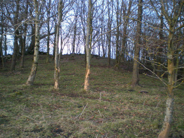 Photo could not load
SK1072 : Cowlow tumulus
Richard Law
Hill facts and local notes
Classifications
Elevation
350m
1,148 ft
Prominence
40m
Coordinates
53.2538, -1.8475
SK102729
OS Map
119
Explorer: OL24W
At the Summit
The summit features a well-marked trig point and a small stone cairn, a perfect spot for a victorious selfie or twinkling eyes at the panorama.
Terrain & Geology
Cowlow Hill is primarily composed of limestone rock, characteristic of much of the Peak District. The surrounding landscape is dotted with sedimentary deposits, making it a fascinating area for geology buffs.
Views & Scenery
Stunning views of the surrounding Peak District, including the famous Mam Tor and the Hope Valley.
History & Heritage
Name Origin
The name 'Cowlow' is derived from the Old English 'cowl' meaning a 'hill' or 'mound'.
Historical Significance
Cowlow Hill is a part of the rich cultural tapestry of the Peak District, often frequented by locals and visitors for leisure and adventure.
Getting There & Facilities
Parking
There is parking available at the nearby village of Hope, approximately 2 km from the base of Cowlow Hill.
Public Transport
The area is accessible via bus services from Sheffield and other nearby towns, with a short walk to the start of the trails.
Nearby Facilities
The village of Hope has several cafes, pubs, and public toilets, making it a handy stop for hikers before or after their adventure.
Safety Information
Known Hazards
- Watch out for sheep on the paths, they have right of way! Also, muddy patches can appear after rain; sturdy footwear is advised.
General Safety Tips
- Check weather conditions before setting out
- Carry appropriate clothing and equipment
- Let someone know your planned route
- Take a map, compass, and GPS device
- Carry emergency supplies: food, water, first aid kit, torch
Hills
Some common questions about the hills answered
Are there group walks up Cowlow Hill?
Many walkers use Walkmates to join or organise walks with others. You can check for group walks around Cowlow Hill through the maps
Are there other walkers around Cowlow Hill?
Activity varies by location and time, but Walkmates lets you see whether others have shared walks or shown interest in this area. Find other people through the walking friends search walking friends for Cowlow Hill search or of course create your own walk for Cowlow Hill
Can I organise a walk to Cowlow Hill?
Yes. If there aren’t any walks listed already, you can create a walk and make it available for others to join.
If you're signed up to Walkmates, you can create a walk to Cowlow Hill.
How do I find a walk up this hill?
There are often multiple ways to walk this hill, depending on experience and route preference. Walkmates helps you explore walks and routes that others have shared.
Can I suggest a new route up Cowlow Hill?
Yes. You can suggest or create routes to share with others. Walkmates focuses on the social side of walking, so routes are used to help people organise walks and explore areas together, rather than as detailed navigation tools or route libraries.
Other uses really appreciate knowledgeable walkers sharing their routes. Share your favourite route to Cowlow Hill here
The is an error or something incorrect about this hill. How do I let you know?
We always strive to keep the information on Walkmates as accurate as possible. If you find an error, please let us know through the contact form and we'll aim to correct it as quickly as possible
Community Discussion
Comments
Location
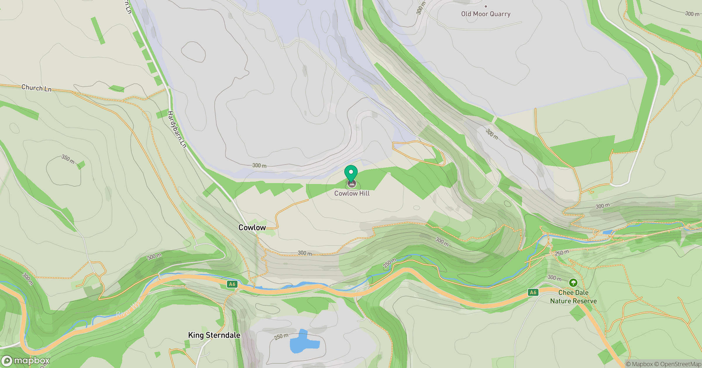
Grid reference: SK102729
View on OpenStreetMapOpens a map in a new tab, centred on the hill.
Nearby Hills

Kinder Scout
636m
The Roaches
505m
Rombalds Moor [Ilkley Moor]
402m

Pendle Hill
557m
Winter Hill
456m
No comments yet. Be the first.