

Ben Buie
Good walks are even better shared.
NM6026 : The rocky upper slopes of Ben Buie
Iain A Robertson Photo source
Overview
Exploring Ben Buie
Overview
Ben Buie, towering at 708 meters, graces the beautiful island of Mull in the Inner Hebrides. This Marilyn offers a moderately challenging hike with breathtaking views that repay even the most reluctant uphill struggles.
Geology
The mountain’s geological characteristics include basalt formations and granite outcrops, providing both geological interest and wildlife habitats. It's a wonderful spot for those keen to observe how the land has evolved over millennia.
Routes
The well-trodden Ben Buie Circuit from Tobermory is favoured among hikers. Covering approximately 10 km and requiring around four hours, this route takes you through verdant woodlands before leading to the summit, making it ideal for both avid hikers and casual walkers.
Summit Features
On reaching the summit, visitors are greeted by a small cairn, perfect for a memorable photo. The rocky outcrops offer additional vantage points that may inspire poetic thoughts (or at least a desire to sit down).
Terrain
Expect a mix of rocky paths, grassy slopes, and the occasional boggy patch. Proper footwear is essential unless you fancy an impromptu disguise as a swamp creature.
Scenic Views
One of the highlight features of hiking Ben Buie is the exceptional views. From the top, you can see Ben More, the striking coastline of Mull, and the tranquil Sound of Mull — don’t forget your camera! The best time to appreciate these views is during late spring or autumn when the landscapes truly come alive.
Hazards
As ever in the Scottish Highlands, keep an eye on the weather. Conditions can change rapidly, turning a sunny day into a soggy affair in minutes. Be cautious of slippery paths, particularly after rainfall.
Access
Getting to Ben Buie is straightforward, with a small car park available in Tobermory. There are also bus services for those relying on public transport. Plus, Tobermory itself offers a lovely spot to relax after your adventure.
Facilities
In the nearby town of Tobermory, you’ll find a variety of cafes and local shops—all essential for that post-hike cake and cup of tea. Restrooms are also conveniently located here.
History
The name Ben Buie signifies the 'yellow' heather populating the area. The mountain remains a beacon for many, steeped in local lore and serving as a navigation point for seafarers.
In conclusion, a hike up Ben Buie promises more than just a stroll in the hills; it’s an experience worthy of every outdoor enthusiast's bucket list. Get out there, and don’t forget to document the journey!
Explore routes near Ben Buie
Walks starting near this hill. Open a route to check its map, distance and full itinerary.
Crinan Canal: Bellanoch and Dunardry towpath return
View route
Ben Nevis via Mountain Path
View route
Glen Kin group walk
View route
Banavie to Glen Loy Aqueduct: Neptune’s Staircase Canal Towpath
View route
Route planning notes
These notes describe possible approaches. Check a route's map and access information when planning your walk.
Ben Buie Circuit
A popular loop starting from the village of Tobermory, offering stunning views all along the trail. The route takes you through lush woodlands before ascending to the summit.
Make a day of it, together
Find someone to share the walk with, or organise a day out along a route you like.
Photo Gallery
View all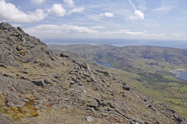 Photo could not load
NM6026 : The rocky upper slopes of Ben Buie
Iain A Robertson
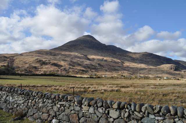 Photo could not load
NM6027 : Ben Buie rising above Lochbuie
Robert Struthers
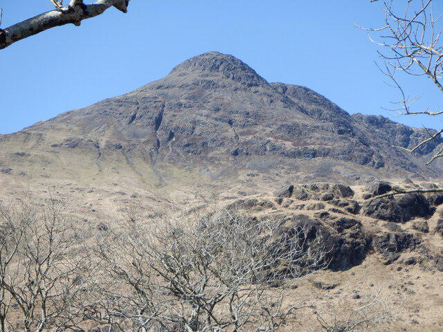 Photo could not load
NM6027 : Ben Buie
Richard Webb
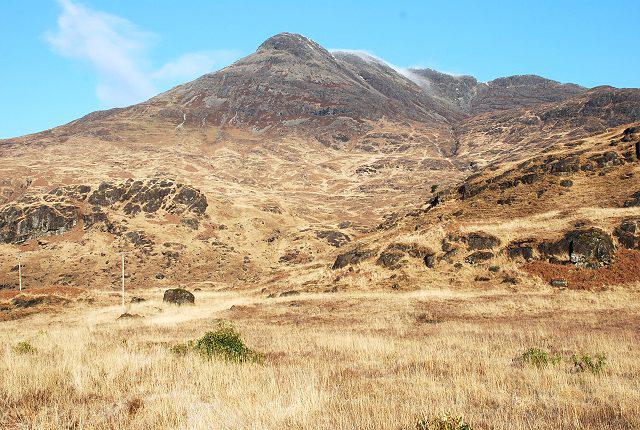 Photo could not load
NM6027 : Ben Buie
Patrick Mackie
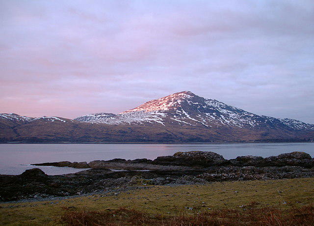 Photo could not load
NM6027 : Ben Buie alpenglow
Andy Waddington
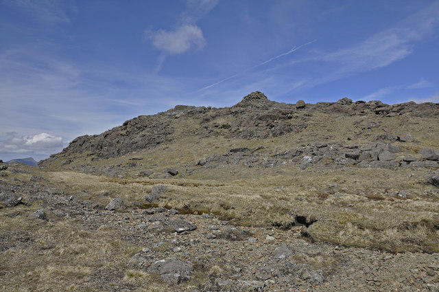 Photo could not load
NM6027 : Summit cairn, Ben Buie
Iain A Robertson
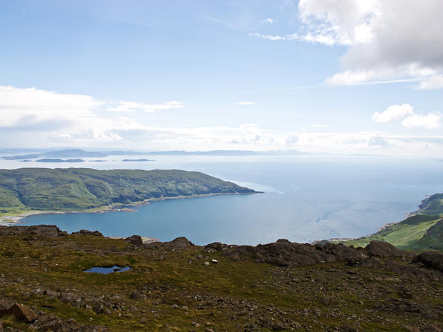 Photo could not load
NM6027 : Summit of Ben Buie
William Starkey
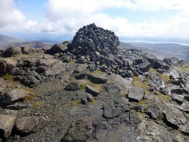 Photo could not load
NM6027 : Ben Buie
Rude Health
Hill facts and local notes
Classifications
Elevation
718m
2,356 ft
Prominence
515m
Coordinates
56.3751, -5.8818
NM604270
OS Map
49
Explorer: 375E
At the Summit
At the summit, you'll find a charming pebble cairn that serves as a great photo op. There's also a rocky outcrop that offers additional views, for those who like to perch as if they own the place.
Terrain & Geology
Ben Buie is predominantly formed from basalt, alongside schist and granite outcrops. These geological features have created dramatic landscapes and habitat diversity, perfect for a nature enthusiast or a geology buff with a penchant for rock collecting.
Views & Scenery
From the summit, bask in views of Ben More, the Sound of Mull, and the unspoiled coastline of Mull — heaven for the Instagram aficionado.
History & Heritage
Name Origin
The name 'Buie' is derived from Gaelic, meaning 'yellow', a reference to the yellow heather that blossoms in the area.
Historical Significance
Ben Buie has been an important landmark for sailors navigating the Sound of Mull, and is intertwined with local folklore about faeries and mystical creatures.
Getting There & Facilities
Parking
There’s a small car park at the start of the path from the village of Tobermory (approx. NM505519), suitable for about 10 cars. Arrive early to nab a spot.
Public Transport
Buses run regularly from different parts of Mull to Tobermory, making it relatively easy to access without a car.
Nearby Facilities
Tobermory boasts several cafes and restaurants, as well as public toilets. A good idea to refuel after your trek or to enjoy a cream tea (it’s practically a rule!).
Safety Information
Known Hazards
- Be wary of sudden weather changes, as the Scottish Highlands are notorious for their mercurial moods. An unsuspecting hiker may turn into a soggy noodle without warning.
- Some paths can be overgrown, so keep your wits about you and watch your footing.
General Safety Tips
- Check weather conditions before setting out
- Carry appropriate clothing and equipment
- Let someone know your planned route
- Take a map, compass, and GPS device
- Carry emergency supplies: food, water, first aid kit, torch
Hills
Some common questions about the hills answered
Are there group walks up Ben Buie?
Many walkers use Walkmates to join or organise walks with others. You can check for group walks around Ben Buie through the maps
Are there other walkers around Ben Buie?
Activity varies by location and time, but Walkmates lets you see whether others have shared walks or shown interest in this area. Find other people through the walking friends search walking friends for Ben Buie search or of course create your own walk for Ben Buie
Can I organise a walk to Ben Buie?
Yes. If there aren’t any walks listed already, you can create a walk and make it available for others to join.
If you're signed up to Walkmates, you can create a walk to Ben Buie.
How do I find a walk up this hill?
There are often multiple ways to walk this hill, depending on experience and route preference. Walkmates helps you explore walks and routes that others have shared.
Can I suggest a new route up Ben Buie?
Yes. You can suggest or create routes to share with others. Walkmates focuses on the social side of walking, so routes are used to help people organise walks and explore areas together, rather than as detailed navigation tools or route libraries.
Other uses really appreciate knowledgeable walkers sharing their routes. Share your favourite route to Ben Buie here
The is an error or something incorrect about this hill. How do I let you know?
We always strive to keep the information on Walkmates as accurate as possible. If you find an error, please let us know through the contact form and we'll aim to correct it as quickly as possible
Community Discussion
Comments
Location
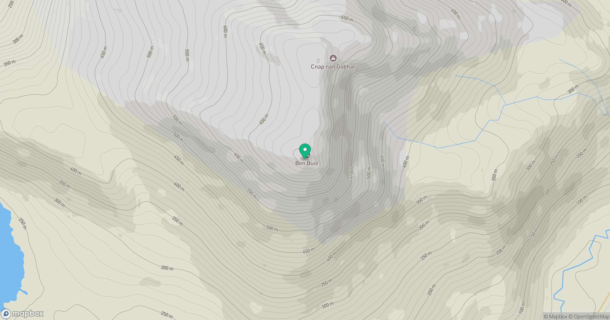
Grid reference: NM604270
View on OpenStreetMapOpens a map in a new tab, centred on the hill.
No comments yet. Be the first.