

Corby's Crags
Good walks are even better shared.
NU1309 : Moorland fences on Alnwick Moor
Graham Robson Photo source
Overview
Corby's Crags
Corby's Crags, standing proudly at an elevation of 320 meters, beckons hikers and outdoor enthusiasts to a remarkable experience in the stunning North Pennines. Its rugged terrain and striking geologic features provide not only a good workout but also a feast for the eyes.
Geology
The crags are primarily composed of sandstone, a rock that tells tales of ancient riverbeds and shifting landscapes. Glacial features can also be spotted, remnants from the Ice Age that sculpted this area into its current form. If rocks could talk, these would have quite the adventure story!
Access & Facilities
Getting to Corby's Crags is relatively straightforward. The nearest parking is conveniently located in the charming village of Alston, just around 5 km from the trailhead. If you’re relying on public transport, rest easy—Alston has a bus service that connects it to nearby towns, though schedules can be a touch unreliable, so do check beforehand. As for facilities, you’ll find plenty of options in Alston, including lovely cafes and well-placed public toilets—coffee and a clean lavatory are a hiker’s best friends!
The Trail
The Corby's Crags Circular route is a delightful path that covers approximately 6.5 km and takes about 2.5 hours to complete. While it’s classified as moderate, the terrain varies from rocky crags to soft, springy grass—perfect for those wanting to stretch their legs without stressing them too much. Just remember your boots, as you wouldn’t want to slip and slide like a penguin at a skating rink!
Summit Features
Upon reaching the summit, expect to be greeted by a sturdy cairn which invites weary walkers to rest their legs and take in the 360-degree views. With the rolling hills of the North Pennines, Hadrian’s Wall, and the peaks of the Lake District in the distance, your camera will have more work to do than you will climbing up!
Hazards
As always in the mountains, the weather is a fickle beast. Be prepared for sudden changes; a sunny morning can turn into a downpour quicker than you can say 'Corby's Crags!' Ensure you have suitable clothing and always carry a map. Some paths can be muddy, particularly following rainfall, so watch your step to avoid looking like you’ve just lost a battle with the local bog!
Nearby Summits
Don’t stop your explorations here! Nearby summits such as Cross Fell and Great Dun Fell offer additional challenges and spectacular views, making Corby's Crags a perfect jumping-off point for a more adventurous day out.
Conclusion
Whether you’re a seasoned hiker or just fancy a gentle stroll in the fresh air, Corby's Crags is a fit for your boots (and your heart). The blend of geological wonders, vibrant landscapes, and historical significance makes for a truly rewarding outing.
So, grab your gear, tie your laces, and hit the trail to Corby’s Crags! Happy hiking!
Explore routes near Corby's Crags
Walks starting near this hill. Open a route to check its map, distance and full itinerary.
Edlingham Castle, Church and Birsley Wood
View route
Friday Greenway Lunch Loop
View route
Alnwick Juniors FC Loop (Alnwick Greenway)
View route
Alnwick - Green Way Town Loop
View route
Route planning notes
These notes describe possible approaches. Check a route's map and access information when planning your walk.
Corby's Crags Circular
A delightful circular route that starts from the nearest village and takes in the stunning views of the surrounding moorland.
Make a day of it, together
Find someone to share the walk with, or organise a day out along a route you like.
Photo Gallery
View all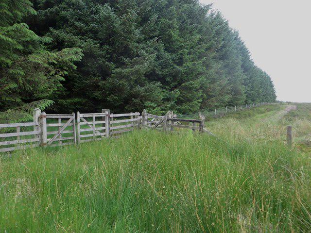 Photo could not load
NU1309 : Moorland fences on Alnwick Moor
Graham Robson
Hill facts and local notes
Classifications
Elevation
253m
830 ft
Prominence
39m
Coordinates
55.3818, -1.7842
NU137097
OS Map
81
Explorer: 332
At the Summit
At the summit, you'll find a well-maintained cairn that offers a perfect photo opportunity and a chance to give your legs a well-deserved rest.
Terrain & Geology
The crags are primarily composed of sandstone, giving rise to stunning cliff formations and unique rock strata. The area is also home to a variety of glacial features from the last Ice Age.
Views & Scenery
From the summit, you can see the rolling hills of the North Pennines, Hadrian's Wall, and on clear days, even the distant Lake District peaks.
History & Heritage
Name Origin
The name 'Corby's' is derived from the Old Norse 'korbe', which refers to a crow, while 'Crags' indicates the rocky outcrops in the area.
Historical Significance
Historically, this area has been significant for its lead mining, with many remnants of mining activities still visible along the trails.
Getting There & Facilities
Parking
Parking is available at the village of Alston, which is approximately 5 km from the trailhead.
Public Transport
Alston has a bus service from nearby towns. Check local schedules for reliability.
Nearby Facilities
Alston provides cafes, pubs, and public toilets for hikers to refresh themselves before or after the trek.
Safety Information
Known Hazards
- Beware of sudden weather changes; carry suitable clothing. Some paths may be muddy after rain.
General Safety Tips
- Check weather conditions before setting out
- Carry appropriate clothing and equipment
- Let someone know your planned route
- Take a map, compass, and GPS device
- Carry emergency supplies: food, water, first aid kit, torch
Hills
Some common questions about the hills answered
Are there group walks up Corby's Crags?
Many walkers use Walkmates to join or organise walks with others. You can check for group walks around Corby's Crags through the maps
Are there other walkers around Corby's Crags?
Activity varies by location and time, but Walkmates lets you see whether others have shared walks or shown interest in this area. Find other people through the walking friends search walking friends for Corby's Crags search or of course create your own walk for Corby's Crags
Can I organise a walk to Corby's Crags?
Yes. If there aren’t any walks listed already, you can create a walk and make it available for others to join.
If you're signed up to Walkmates, you can create a walk to Corby's Crags.
How do I find a walk up this hill?
There are often multiple ways to walk this hill, depending on experience and route preference. Walkmates helps you explore walks and routes that others have shared.
Can I suggest a new route up Corby's Crags?
Yes. You can suggest or create routes to share with others. Walkmates focuses on the social side of walking, so routes are used to help people organise walks and explore areas together, rather than as detailed navigation tools or route libraries.
Other uses really appreciate knowledgeable walkers sharing their routes. Share your favourite route to Corby's Crags here
The is an error or something incorrect about this hill. How do I let you know?
We always strive to keep the information on Walkmates as accurate as possible. If you find an error, please let us know through the contact form and we'll aim to correct it as quickly as possible
Community Discussion
Comments
Location
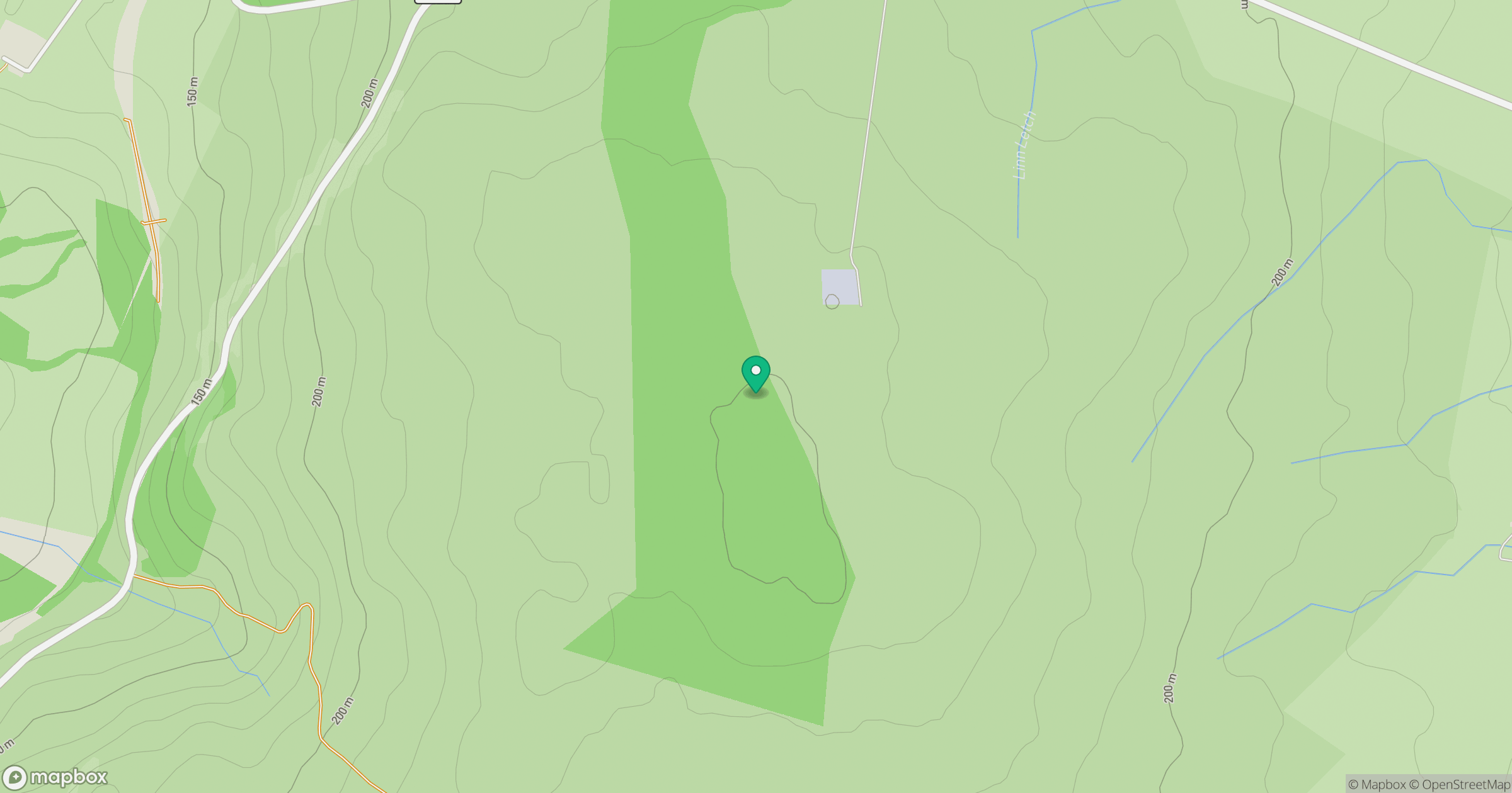
Grid reference: NU137097
View on OpenStreetMapOpens a map in a new tab, centred on the hill.




No comments yet. Be the first.