
Cnoc Mhichie
Good walks are even better shared.
Overview
Cnoc Mhichie: An Accessible Jewel in the Scottish Highlands
Located in the stunning Scottish Highlands, Cnoc Mhichie stands at a proud elevation of 173 meters. This Marilyn might not be the tallest in the region, but don’t let that fool you; it offers a delightful hiking experience with rewarding views of Loch Ussie and the surrounding peaks.
Geology
Cnoc Mhichie is primarily made up of schist, a rock type that tells tales of ancient geological processes. The landscape features interesting formations that have been shaped by weathering over millennia.
Routes
For those wishing to explore Cnoc Mhichie, the Cnoc Mhichie Circular route serves as a popular hiking trail. Spanning approximately 8.5 km, this moderately challenging route departs from the charming hamlet of Gairloch. The path, while generally manageable, can present a splash of mud if the weather has been less than cooperative. So, pack those waterproof boots!
Summit Features
As you reach the summit, you will be greeted by a simple cairn, perfect for that all-important selfie or a well-deserved snack. Nearby, a small pond can add an extra touch of tranquillity to your stop.
Terrain Type
Expect a mixture of grassy slopes and rocky outcrops. However, be mindful of muddy areas that might surprise you if you're not paying attention—soggy socks make for an uncomfortable return trip!
Views
The summit of Cnoc Mhichie offers picturesque views, especially in spring and summer when the heather blooms. Look out towards the distant Ben Wyvis, a notable landmark for those familiar with the region.
Hazards
Be aware of the potential boggy patches, and tread carefully to maintain dry footwear and a dry mood. Nobody likes a soggy bottom!
Nearby Summits
If you're in the mood for more adventure, consider tackling nearby summits like the majestic Ben Wyvis.
Access
Accessing Cnoc Mhichie is straightforward, with a small parking lot located in Gairloch. Keep an eye out for public transport options, as buses operate from Inverness—but check schedules to avoid being left in the lurch.
Facilities
Gairloch provides several pleasant cafes and shops. Before heading off into the hills, do make use of public toilets available near the parking area.
History
Cnoc Mhichie's name translates to 'Micheal's Hill' in Gaelic, hinting at the historical significance and possibly a local character associated with the region. Today, it remains a beloved destination among hikers.
Get your boots on and explore the charming Cnoc Mhichie, where nature and breathtaking views await!
Explore routes near Cnoc Mhichie
Public walks starting within 80 km of this hill. Nearby does not mean a route reaches the summit; check its map and access before setting out.
Ben Klibreck
View route
Loch Migdale from Torroy: Spinningdale pinewood and loch shore walk
View route
Route planning notes
These notes describe possible approaches, not verified navigable routes or permission to cross land. Check current paths, local access rules and conditions before setting out.
Cnoc Mhichie Circular
A pleasant circular route starting from the nearby hamlet of Gairloch, this trail offers scenic views and manageable inclines.
Make a day of it, together
Find someone to share the walk with, or organise a day out along a route you like.
Hill facts and local notes
Classifications
Elevation
208m
682 ft
Prominence
112m
Coordinates
58.3688, -5.1272
NC171465
OS Map
9
Explorer: 445
At the Summit
The summit features a modest cairn, which is ideal for a photo op or a cuppa if you fancy. There's also a small pond nearby that adds charm to the summit area.
Terrain & Geology
Cnoc Mhichie is primarily composed of schist, a metamorphic rock that lends a rugged character to the terrain. The weathering processes have created fascinating formations and a diverse landscape.
Views & Scenery
From the summit, you can enjoy stunning views of Loch Ussie and the surrounding peaks, including the distant Ben Wyvis.
History & Heritage
Name Origin
The name 'Cnoc Mhichie' translates from Gaelic as 'Micheal's Hill', indicating a historical figure possibly linked to the area.
Historical Significance
The hill is an important local landmark and is popular among hikers for its accessible routes and beautiful views.
Getting There & Facilities
Check current local access restrictions, parking rules and transport timetables before travelling. These notes do not confirm public access to the summit.
Parking
There is a small parking area near the start of the trail at Gairloch. It fills up quickly on sunny weekends, so arrive early to grab a space.
Public Transport
Buses run from Inverness to Gairloch, but check local schedules as they can change.
Nearby Facilities
Gairloch offers several small cafes and shops. Public toilets can be found near the parking area, so make use of them before hitting the trail.
Safety Information
Known Hazards
- The area can be boggy in parts, especially after rain. Watch your step to avoid a soggy sock situation.
General Safety Tips
- Check weather conditions before setting out
- Carry appropriate clothing and equipment
- Let someone know your planned route
- Take a map, compass, and GPS device
- Carry emergency supplies: food, water, first aid kit, torch
Hills
Some common questions about the hills answered
Are there group walks up Cnoc Mhichie?
Many walkers use Walkmates to join or organise walks with others. You can check for group walks around Cnoc Mhichie through the maps
Are there other walkers around Cnoc Mhichie?
Activity varies by location and time, but Walkmates lets you see whether others have shared walks or shown interest in this area. Find other people through the walking friends search walking friends for Cnoc Mhichie search or of course create your own walk for Cnoc Mhichie
Can I organise a walk to Cnoc Mhichie?
Yes. If there aren’t any walks listed already, you can create a walk and make it available for others to join.
If you're signed up to Walkmates, you can create a walk to Cnoc Mhichie.
How do I find a walk up this hill?
There are often multiple ways to walk this hill, depending on experience and route preference. Walkmates helps you explore walks and routes that others have shared.
Can I suggest a new route up Cnoc Mhichie?
Yes. You can suggest or create routes to share with others. Walkmates focuses on the social side of walking, so routes are used to help people organise walks and explore areas together, rather than as detailed navigation tools or route libraries.
Other uses really appreciate knowledgeable walkers sharing their routes. Share your favourite route to Cnoc Mhichie here
The is an error or something incorrect about this hill. How do I let you know?
We always strive to keep the information on Walkmates as accurate as possible. If you find an error, please let us know through the contact form and we'll aim to correct it as quickly as possible
Community Discussion
Comments
Location
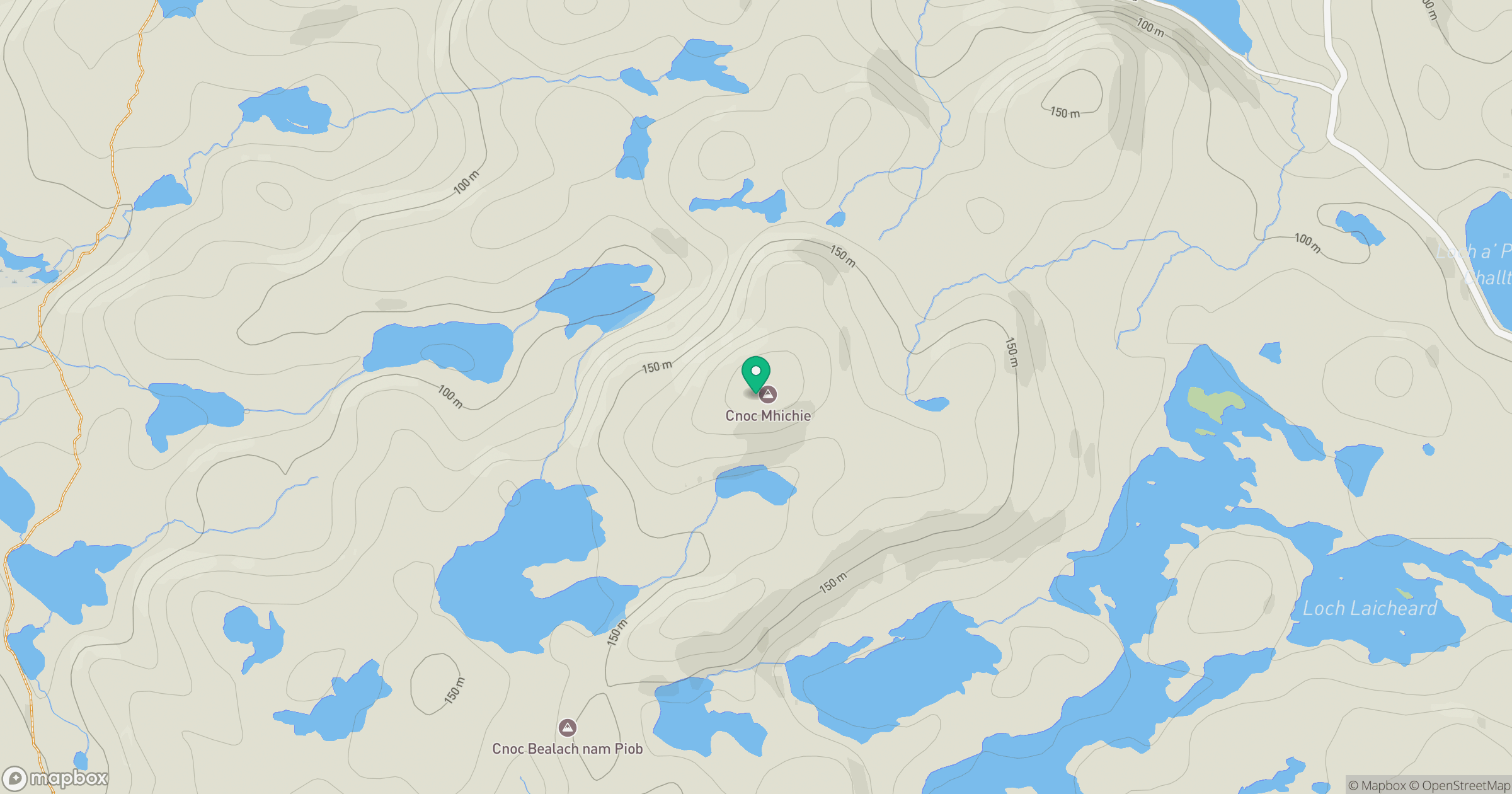
Grid reference: NC171465
View on OpenStreetMapOpens a map in a new tab, centred on the hill.
Hills within 30 km
Straight-line distance, not a walking route or confirmation of access.
Quinag - Sail Ghorm [Sail Gorm]
776m
Quinag - Sail Gharbh
809m
Ben Stack
721m
Quinag - Spidean Coinich
764m
Suilven
731m
No comments yet. Be the first.