

Cnap Cruinn
Good walks are even better shared.
NN3077 : Cnap Cruinn tundra
Calum McRoberts Photo source
Overview
Cnap Cruinn: The Round Hill of the Highlands
Cnap Cruinn, with its modest height of 774 meters, is a Corbett nestled within the captivating Scottish Highlands. Although it may not be the tallest peak around, it boasts stunning views and a rich geology that is well worth the ascent.
Geology
Cnap Cruinn showcases the traditional granitic gneiss prevalent in the Highlands, etched beautifully by glacial action. Keep an eye out for striations and meltwater channels as you ascend—the mountain itself is a testament to the ancient forces that shaped it.
Routes
The North East Ridge is the most popular route, with a distance of approximately 8 km. Expect a moderate climb that rewards you with increasingly breathtaking vistas as you gain elevation. The recommended time is about 3.5 hours, so pack your lunch—what’s a hike without a picnic?
Summit Features
At the peak, you’ll find a sturdy stone cairn. It’s a great spot to catch your breath and snap some photographs. Remember, a great selfie in front of Cnap Cruinn will surely get you likes on social media!
Terrain Type
The ascent features a delightful mix of rocky outcrops, grassy slopes, and a few boggy patches, perfect for those who enjoy a bit of unpredictability underfoot. Wear sturdy boots, unless you fancy a squelch or two!
Views
From the summit, prepare to be enchanted by sweeping views that include the iconic Ben Nevis and the vast expanse of Rannoch Moor. For the best clear views, aim for late spring through to early autumn—there’s no point struggling up for a peek behind the fog!
Hazards
As is standard for the Highlands, weather can change faster than you can say Scottish whisky. Ensure you’re prepared for all conditions, and watch for loose rocks on the ascent. This mountain has its personality!
Access
Accessing Cnap Cruinn is straightforward. The nearest parking area is located near Kingshouse, and local bus services can cater to your transport needs. If in doubt, follow the faint sound of bagpipes—there’s usually a pub nearby!
Nearby Summits
Don't forget to explore nearby Cnap Cruinn itself. Meall a' Bhuiridh and the infamous Ben Nevis provide great additional challenges for the adventurous spirit.
Facilities
After your hike, especially if you’re feeling a bit peckish, the Kingshouse Hotel is a wonderful destination for refreshments or to regale fellow mountaineers with tales of your epic journey.
History
The name 'Cnap Cruinn' hints at its distinctive form, meaning 'Round Hill'. The mountain holds significant cultural tales from Highland folklore, connecting the ancient clans to the land.
So lace up your boots, grab your map, and discover the serenity that Cnap Cruinn has to offer. Happy hiking!
Explore routes near Cnap Cruinn
Walks starting near this hill. Open a route to check its map, distance and full itinerary.
Ben Nevis via Mountain Path
View route
Banavie to Glen Loy Aqueduct: Neptune’s Staircase Canal Towpath
View route
Fort Augustus to Kytra Lock: Caledonian Canal Towpath
View route
Glen Affric: Coire Loch Woodland Trail
View route
Route planning notes
These notes describe possible approaches. Check a route's map and access information when planning your walk.
North East Ridge
A scenic ascent beginning from the east, following a well-trodden path through heather and grassy slopes.
Make a day of it, together
Find someone to share the walk with, or organise a day out along a route you like.
Photo Gallery
View all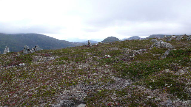 Photo could not load
NN3077 : Cnap Cruinn tundra
Calum McRoberts
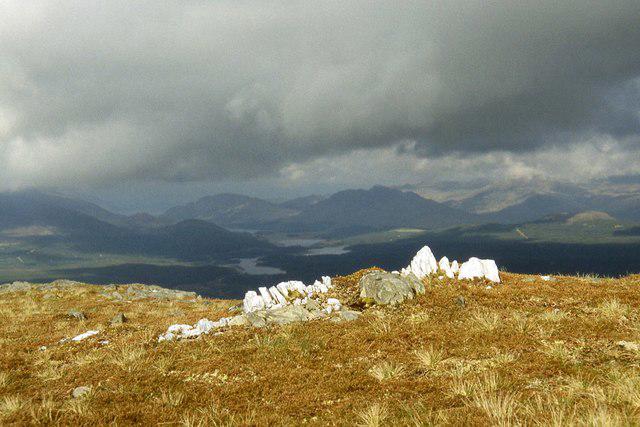 Photo could not load
NN3077 : A small quartzite outcrop on Cnap Cruinn
Alan Reid
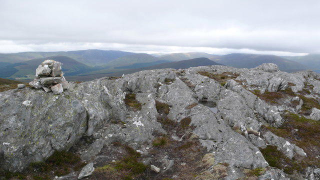 Photo could not load
NN3077 : Summit cairn, Cnap Cruinn
Calum McRoberts
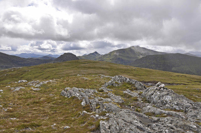 Photo could not load
NN3077 : The modest summit cairn on Cnap Cruinn
Iain A Robertson
Hill facts and local notes
Classifications
Elevation
742m
2,434 ft
Prominence
245m
Coordinates
56.8577, -4.7852
NN302774
OS Map
41
Explorer: 392
At the Summit
The summit features a prominent stone cairn that provides a perfect photo opportunity, alongside impressive views over the surrounding Highlands.
Terrain & Geology
Cnap Cruinn is comprised of granitic gneiss, characteristic of the Scottish Highlands, with fascinating glacial features such as striations and cirques visible on its flanks.
Views & Scenery
Panoramic views of the surrounding peaks including Ben Nevis, Rannoch Moor, and the Great Glen.
History & Heritage
Name Origin
The name 'Cnap Cruinn' translates to 'Round Hill', reflecting its smooth, rounded summit profile.
Historical Significance
Cnap Cruinn has been a part of local folklore, often mentioned in tales of the early Highland clans.
Getting There & Facilities
Parking
Car park available at the foot of the hill near the village of Kingshouse (NN33 1AH)
Public Transport
Bus services from Fort William to Kingshouse operate several times a day.
Nearby Facilities
The nearby Kingshouse Hotel provides a delightful stop for refreshments and a warm meal after your trek.
Safety Information
Known Hazards
- Careful navigation is required due to potential poor weather conditions varying rapidly; also be aware of loose rocks on the ascent.
General Safety Tips
- Check weather conditions before setting out
- Carry appropriate clothing and equipment
- Let someone know your planned route
- Take a map, compass, and GPS device
- Carry emergency supplies: food, water, first aid kit, torch
Hills
Some common questions about the hills answered
Are there group walks up Cnap Cruinn?
Many walkers use Walkmates to join or organise walks with others. You can check for group walks around Cnap Cruinn through the maps
Are there other walkers around Cnap Cruinn?
Activity varies by location and time, but Walkmates lets you see whether others have shared walks or shown interest in this area. Find other people through the walking friends search walking friends for Cnap Cruinn search or of course create your own walk for Cnap Cruinn
Can I organise a walk to Cnap Cruinn?
Yes. If there aren’t any walks listed already, you can create a walk and make it available for others to join.
If you're signed up to Walkmates, you can create a walk to Cnap Cruinn.
How do I find a walk up this hill?
There are often multiple ways to walk this hill, depending on experience and route preference. Walkmates helps you explore walks and routes that others have shared.
Can I suggest a new route up Cnap Cruinn?
Yes. You can suggest or create routes to share with others. Walkmates focuses on the social side of walking, so routes are used to help people organise walks and explore areas together, rather than as detailed navigation tools or route libraries.
Other uses really appreciate knowledgeable walkers sharing their routes. Share your favourite route to Cnap Cruinn here
The is an error or something incorrect about this hill. How do I let you know?
We always strive to keep the information on Walkmates as accurate as possible. If you find an error, please let us know through the contact form and we'll aim to correct it as quickly as possible
Community Discussion
Comments
Location
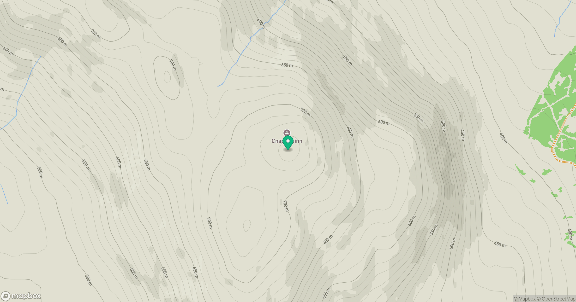
Grid reference: NN302774
View on OpenStreetMapOpens a map in a new tab, centred on the hill.
No comments yet. Be the first.