

Chrome Hill
Good walks are even better shared.
SK0767 : Chrome Hill from Parkhouse Hill
Dave Dunford Photo source
Overview
Chrome Hill is a 439.2 m limestone hill above the upper Dove Valley in the Peak District. Its distinctive Dragon’s Back ridge offers views towards Parkhouse Hill and Hollins Hill. Signed permissive paths link the ridge with surrounding routes; steep ground and slippery wet limestone require care.
Chrome Hill
Chrome Hill rises above the upper Dove Valley near Earl Sterndale and Hollinsclough, on the Derbyshire side of the Peak District. Its jagged limestone crest is often called the Dragon’s Back. The nickname is also used for walks linking it with neighbouring Parkhouse Hill, a separate, lower summit with particularly steep ground.
Summit and landscape
The Database of British and Irish Hills records Chrome Hill at 439.2 m (1,441 ft), with 57 m prominence, in its May 2025 record revision. The summit feature is a limestone outcrop at SK070673. Parkhouse Hill is 375 m. Views take in Parkhouse, Hollins Hill and the upper Dove Valley.
These hills expose fossil-rich Carboniferous reef limestone. The British Geological Survey describes reef and fore-reef deposits on their ridges and slopes, helping explain the striking contrast with the surrounding softer-rock landscape. A small natural arch lies beside Chrome Hill’s north-western ridge path.
Approaching the hill
Use the signed permissive paths to reach the ridge. From the south-east, the approach leaves the minor road near the cattle grid at SK076670, between Chrome Hill and Parkhouse Hill, then climbs through a gate beneath a tree. At the north-west end, the signed junction near SK064682, by the Stoop Farm access road, leads past the eastern side of Tor Rock towards the ridge. Follow the gates and waymarks where the path bends; the surrounding farmland is not a general shortcut.
Open access on the hill and permission to cross the approach fields are different things. Follow signs and any current restrictions, and carry a map rather than relying on a visible track alone.
Choosing a walk
- Hollinsclough circuit: Walking Britain’s Chrome Hill route is 7.3 km, with a published time of 3 hours and an easy/mod grade. It returns via Booth Farm and Washgate Bridge without requiring Parkhouse Hill.
- Earl Sterndale circuit: Countryfile’s 8.7 km, 3.5-hour walk combines Parkhouse Hill, Chrome Hill and Hollinsclough. Its moderate grade is the publisher’s; Parkhouse adds a notably steep descent.
- Brandside circuit: The Great Outdoors’ route is 9.6 km, with a published duration of 4–5 hours, through the upper Dove Valley. Its main circuit leaves out the optional Parkhouse scramble.
These distances and times describe complete published circuits, not one-way summit ascents. Weather, footing and the group’s pace can change how long a walk takes.
Terrain and safety
Expect steep grassy slopes, uneven limestone, narrow ridge sections and awkward steps. Wet limestone can be exceptionally slippery. A fall on steep ground can be serious, so allow time for careful descent and choose another walk if wind, ice or wet footing makes the ridge unsuitable. Parkhouse Hill’s sharp western end is a separate challenge and should not be treated as an automatic extension to a Chrome Hill outing.
Getting there
There is limited roadside parking in Earl Sterndale and Hollinsclough; leave gates, drives and passing places clear. The Brandside route also starts where roadside space is limited. High Peak’s 442 serves Earl Sterndale from Buxton; check the timetable for your travel day and the last return before setting off.
Bring food and water. Do not rely on the former Quiet Woman pub in Earl Sterndale for refreshments.
The name
The Royal Geographical Society’s Discovering Britain guide links “Chrome” to an Old English word meaning bent or twisted and gives a pronunciation rhyming with “broom”.
Explore routes near Chrome Hill
Walks starting near this hill. Open a route to check its map, distance and full itinerary.
Three Villages and Five Wells
View route
Three Villages and Five Wells
View route
Three Villages and Five Wells
View route
Tissington Trail: Parsley Hay, Hartington Station and Heathcote
View route
Route planning notes
These notes describe possible approaches. Check a route's map and access information when planning your walk.
Chrome Hill from Hollinsclough (Walking Britain circuit)
Walking Britain’s full circuit starts and finishes in Hollinsclough (SK065665), crossing the Dove, climbing Chrome Hill from the south-east and returning via Tor Rock, Booth Farm and Washgate Bridge. The published 7.3 km and 3 hours cover the whole walk. Follow the signed permissive approach; steep slopes and wet limestone need care.
Parkhouse and Chrome Hills from Earl Sterndale (Countryfile circuit)
Countryfile’s complete Earl Sterndale circuit links Parkhouse Hill, Chrome Hill and Hollinsclough. Its 8.7 km and 3.5 hours cover the whole walk. The publisher grades it moderate, but Parkhouse’s descent is especially steep. Follow the signed Chrome Hill approach and the waymarked path towards Stoop Farm after leaving its ridge.
Chrome Hill and Upper Dove Valley from Brandside (TGO circuit)
The Great Outdoors’ main circuit starts and ends at Brandside parish hall (SK043685), reaching Chrome Hill via the signed permissive path near Stoop Farm and returning through Hollinsclough and Tenterhill. Its 9.6 km covers the whole route; allow the publisher’s 4–5 hours. These figures exclude the optional Parkhouse Hill scramble.
Make a day of it, together
Find someone to share the walk with, or organise a day out along a route you like.
Photo Gallery
View all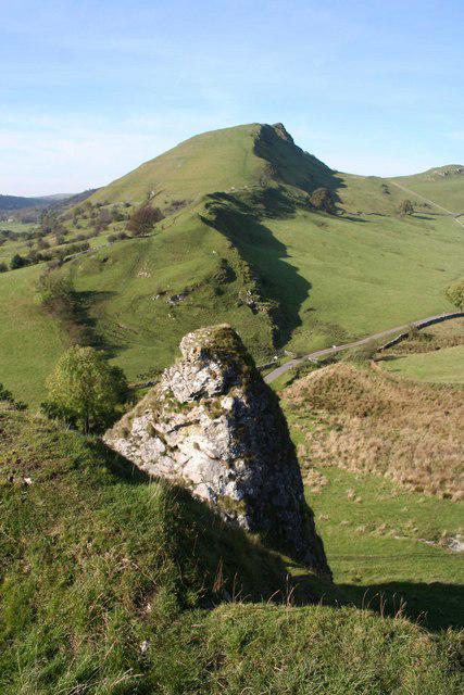 Photo could not load
SK0767 : Chrome Hill from Parkhouse Hill
Dave Dunford
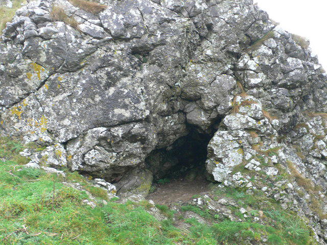 Photo could not load
SK0667 : Limestone outcrop on Chrome Hill
Eirian Evans
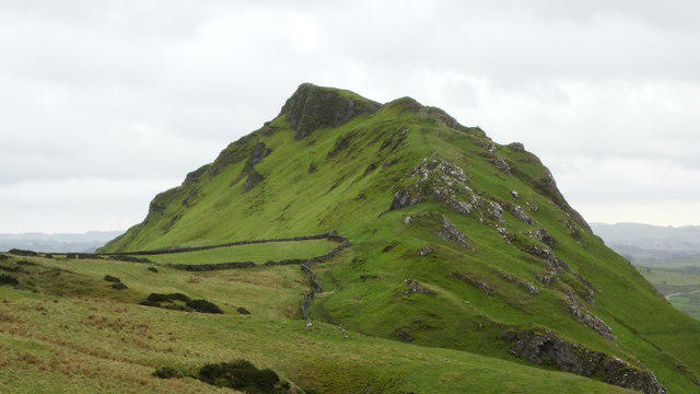 Photo could not load
SK0667 : View SE towards Chrome Hill from concessionary path
Colin Park
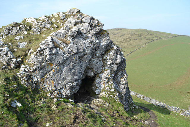 Photo could not load
SK0667 : Limestone cave on Chrome Hill
Neil Theasby
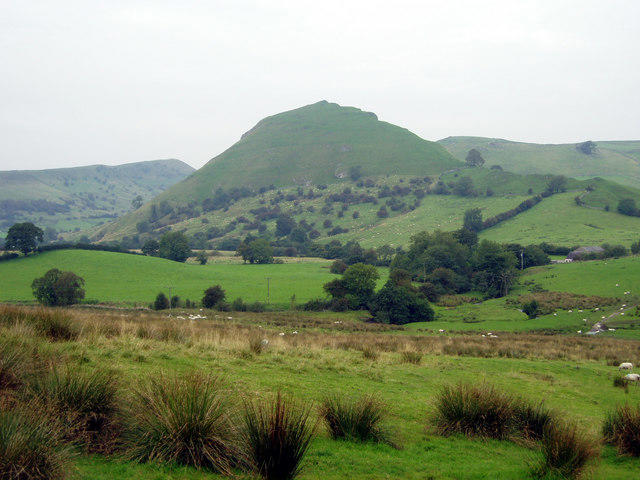 Photo could not load
SK0767 : Looking Northwest towards Chrome Hill
John Maris
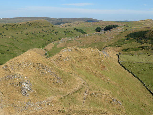 Photo could not load
SK0667 : View west from Chrome Hill
Gareth James
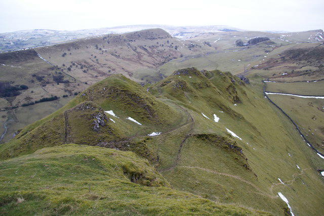 Photo could not load
SK0667 : Ridge on the western side of Chrome Hill
Bill Boaden
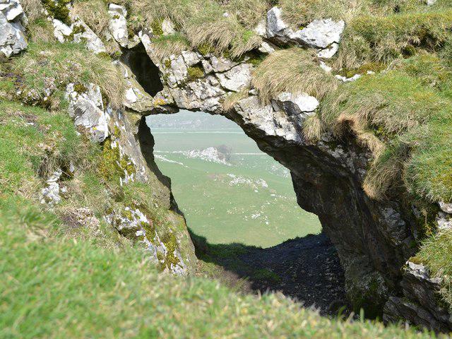 Photo could not load
SK0667 : Natural arch on Chrome Hill
Neil Theasby
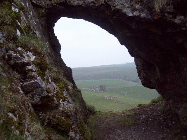 Photo could not load
SK0667 : The Limestone Arch on Chrome Hill
Jonathan Clitheroe
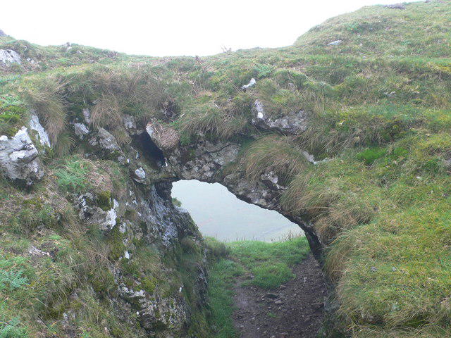
SK0667 : Stone "bridge" on Chrome Hill
Eirian Evans
Hill facts and local notes
Classifications
Elevation
439m
1,441 ft
Prominence
57m
Coordinates
53.2031, -1.8957
SK070673
OS Map
119
Explorer: OL24W
At the Summit
Limestone outcrop on the ridge, recorded by the Database of British and Irish Hills at SK070673.
Terrain & Geology
Carboniferous reef limestone. The British Geological Survey describes fossiliferous reef and fore-reef limestones on Chrome Hill and neighbouring Parkhouse Hill, with steep slopes contrasting with the surrounding softer mudstone landscape.
Views & Scenery
Views along the upper Dove Valley, towards Parkhouse Hill, Hollins Hill and the Staffordshire countryside.
History & Heritage
Name Origin
The Royal Geographical Society’s Discovering Britain guide links “Chrome” to an Old English word meaning bent or twisted and gives a pronunciation rhyming with “broom”.
Getting There & Facilities
Parking
Limited roadside parking in Earl Sterndale and Hollinsclough. Park considerately without blocking gates, drives or passing places. The Brandside parish-hall start (SK043685) also has limited roadside space.
Public Transport
High Peak bus 442 links Buxton with Earl Sterndale Main Road. Check the operator’s timetable for your travel day and last return before setting off; the hill is reached on foot from the village.
Nearby Facilities
Bring your own food and water. Do not rely on the former Quiet Woman pub in Earl Sterndale for refreshments; check any planned refreshment stop before travelling.
Safety Information
Known Hazards
- Steep grassy slopes, narrow ridge sections and uneven limestone; a slip on steep ground can have serious consequences.
- Wet limestone can be exceptionally slippery. Take particular care descending.
- Parkhouse Hill is a separate, steeper objective with awkward rocky ground; do not add it unless it suits the group’s ability.
Seasonal Hazards
Rain makes the limestone especially slippery. Strong wind and ice can make the ridge unsuitable; choose conditions that match your experience.
General Safety Tips
- Check weather conditions before setting out
- Carry appropriate clothing and equipment
- Let someone know your planned route
- Take a map, compass, and GPS device
- Carry emergency supplies: food, water, first aid kit, torch
Hills
Some common questions about the hills answered
Are there group walks up Chrome Hill?
Many walkers use Walkmates to join or organise walks with others. You can check for group walks around Chrome Hill through the maps
Are there other walkers around Chrome Hill?
Activity varies by location and time, but Walkmates lets you see whether others have shared walks or shown interest in this area. Find other people through the walking friends search walking friends for Chrome Hill search or of course create your own walk for Chrome Hill
Can I organise a walk to Chrome Hill?
Yes. If there aren’t any walks listed already, you can create a walk and make it available for others to join.
If you're signed up to Walkmates, you can create a walk to Chrome Hill.
How do I find a walk up this hill?
There are often multiple ways to walk this hill, depending on experience and route preference. Walkmates helps you explore walks and routes that others have shared.
Can I suggest a new route up Chrome Hill?
Yes. You can suggest or create routes to share with others. Walkmates focuses on the social side of walking, so routes are used to help people organise walks and explore areas together, rather than as detailed navigation tools or route libraries.
Other uses really appreciate knowledgeable walkers sharing their routes. Share your favourite route to Chrome Hill here
The is an error or something incorrect about this hill. How do I let you know?
We always strive to keep the information on Walkmates as accurate as possible. If you find an error, please let us know through the contact form and we'll aim to correct it as quickly as possible
Community Discussion
Comments
Location
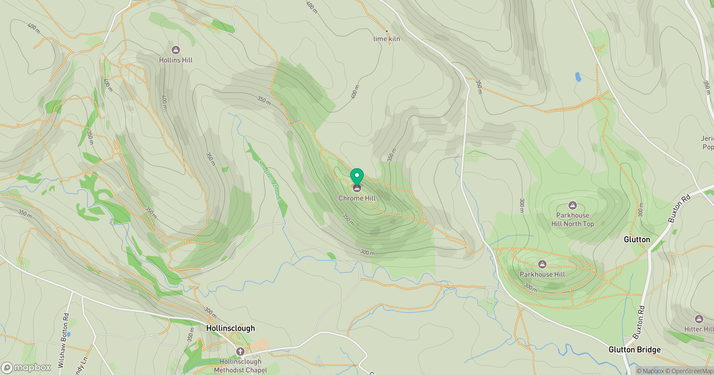
Grid reference: SK070673
View on OpenStreetMapOpens a map in a new tab, centred on the hill.
Nearby Hills
The Roaches
505m

Kinder Scout
636m
Rombalds Moor [Ilkley Moor]
402m
Winter Hill
456m

Pendle Hill
557m
No comments yet. Be the first.