

Charborough Tower
Good walks are even better shared.
SY9297 : Pond in Highwood Gardens, Drax Estate
John Lamper Photo source
Overview
Charborough Tower
Charborough Tower sits gracefully in the Dorset landscape, a regal structure that invites explorers to discover its secrets. At a humble elevation of 57 meters, it may not be the highest hill in the land, but it certainly is a notable Marilyn worth your while.
Geology
Constructed from local sandstone, Charborough Tower demonstrates how softer rock can create a unique, weathered beauty. The surrounding area is predominantly clay and limestone, providing a fertile landscape that bursts with life.
Routes
The most popular route is the Charborough Park Route, a family-friendly path that meanders through picturesque parkland. It stretches around 3.5 km and typically takes about an hour to complete. Perfect for those who want to stretch their legs without breaking a sweat!
Summit Features
Reaching the summit, you'll be greeted by the towering structure itself - a delightful throwback to a time when towers weren't just for Instagram selfies. Surrounding the summit is a grassy knoll, ideal for resting and enjoying that packed sandwich – or a cheeky chocolate bar, we won’t judge.
Terrain Type
The terrain leading up to Charborough Tower is mainly grassy, dotted with the occasional sandy patch, perfect for a gentle ascent. Just remember to wear appropriate footwear; we wouldn’t want anyone ending up in the mud!
Views
Once at the top, you'll be rewarded with sweeping views of the rolling hills of Dorset and a peek at the Purbeck Hills in the distance. The best time to catch these sights is in spring, when everything is notably greener, or in autumn when vibrant reds and golds blanket the landscape.
Hazards
While the route is generally safe, uneven ground can be a tripping hazard, and you might encounter a sprightly cow or two who are most likely to think they own the glorious grounds.
Nearby Summits
For those with energy to spare, Blandford Hill is a nearby summit standing at 226 meters. It is worth considering for a further venture!
Access
Parking
There’s a small car park located around 500 metres from the tower, providing easy access to this hidden gem.
Public Transport
If you’re relying on public transport, hop off in the village of Charborough, just a 20-minute walk away from the park.
Nearest Town
Wareham is the closest town, where you can find cafes, shops, and other essential amenities.
Facilities
While there are no facilities directly at the tower, venture to Wareham to quench your thirst or grab a scone!
History
The name Charborough comes from 'Cearoburg', indicating a place rich in history. The tower itself is a charming reminder of love from the 19th century — much nicer than a fortress, if you ask us!
Whether you’re looking for a quick jaunt or a romantic picnic spot, Charborough Tower promises a delightful experience amidst stunning natural beauty. So pack your bags, lace up those hiking boots, and prepare for an adventure that’s sure to be a treat!
Happy Hiking!
Explore routes near Charborough Tower
Walks starting near this hill. Open a route to check its map, distance and full itinerary.
Badbury Rings and The Oaks from Heron Drove, Dorset
View route
Commoners’ Ways: Kingston, Corfe Castle and Blashenwell
View route
Durdle Door coastal walk
View route
Bournemouth Walk with Men Walking & Talking
View route
Route planning notes
These notes describe possible approaches. Check a route's map and access information when planning your walk.
Charborough Park Route
A leisurely route through scenic parkland, offering a blend of history and stunning views.
Make a day of it, together
Find someone to share the walk with, or organise a day out along a route you like.
Photo Gallery
View all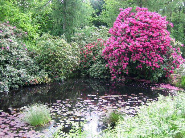 Photo could not load
SY9297 : Pond in Highwood Gardens, Drax Estate
John Lamper
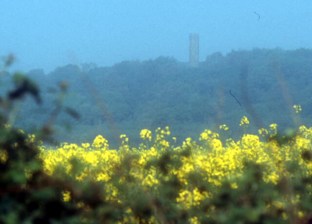 Photo could not load
SY9297 : Tower in High Wood
Patrick GUEULLE
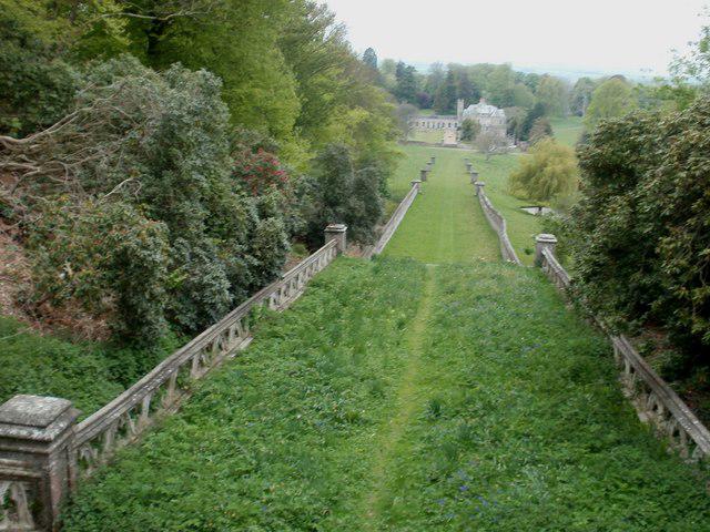 Photo could not load
SY9297 : Charborough Park, tower approach
Mike Faherty
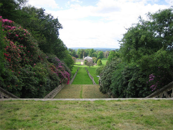 Photo could not load
SY9297 : Charborough House
John Lamper
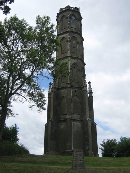 Photo could not load
SY9297 : Charborough Tower
John Lamper
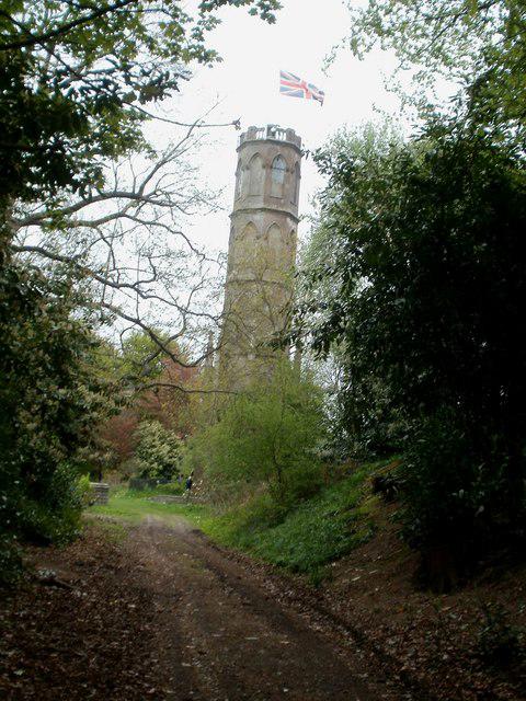 Photo could not load
SY9297 : Charborough Park, tower
Mike Faherty
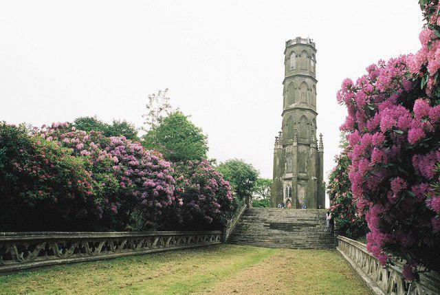 Photo could not load
SY9297 : Tower with undertones of one-upmanship
Chris Downer
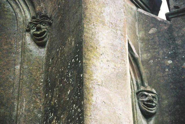 Photo could not load
SY9297 : Charborough Park tower: gargoyles close-up
Chris Downer
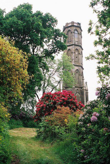 Photo could not load
SY9297 : Charborough Park: tower surrounded by colour
Chris Downer
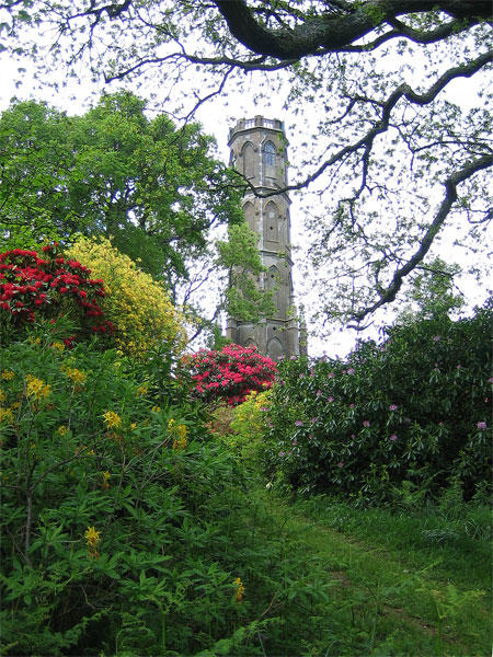 Photo could not load
SY9297 : Highwood Gardens, Drax Estate
John Lamper
Hill facts and local notes
Classifications
Elevation
101m
331 ft
Prominence
50m
Coordinates
50.7770, -2.1021
SY929975
OS Map
195
Explorer: 118S
At the Summit
The summit features a prominent tower built in the early 19th century, reminiscent of a fairytale castle. There is also a small grassy knoll for a picnic, if you fancy a spot of lunch after the climb.
Terrain & Geology
Charborough Tower is built from local sandstone, which is notably softer than granite and regularly weathers to create distinct shapes over time. The surrounding landscape is primarily composed of fertile clay and limestone, supporting lush vegetation.
Views & Scenery
From the top, one can see the rolling hills of Dorset and a glimpse of the distant Purbeck Hills.
History & Heritage
Name Origin
Charborough derives from the Old English 'Cearoburg', meaning 'fortified place where the cherry trees grow'.
Historical Significance
The tower was built as a follie and stands as a testament to 19th century romantic architecture, a symbol of love rather than defence.
Getting There & Facilities
Parking
There is a small car park at Charborough Park, approximately 500 metres from the base of the tower.
Public Transport
The nearest bus stop is in the village of Charborough, which is about a 20-minute walk away.
Nearby Facilities
There are no facilities directly at the tower, but Wareham nearby offers cafes, shops, and public toilets.
Safety Information
Known Hazards
- Watch out for uneven ground and the occasional cow who may think they own the place!
General Safety Tips
- Check weather conditions before setting out
- Carry appropriate clothing and equipment
- Let someone know your planned route
- Take a map, compass, and GPS device
- Carry emergency supplies: food, water, first aid kit, torch
Hills
Some common questions about the hills answered
Are there group walks up Charborough Tower?
Many walkers use Walkmates to join or organise walks with others. You can check for group walks around Charborough Tower through the maps
Are there other walkers around Charborough Tower?
Activity varies by location and time, but Walkmates lets you see whether others have shared walks or shown interest in this area. Find other people through the walking friends search walking friends for Charborough Tower search or of course create your own walk for Charborough Tower
Can I organise a walk to Charborough Tower?
Yes. If there aren’t any walks listed already, you can create a walk and make it available for others to join.
If you're signed up to Walkmates, you can create a walk to Charborough Tower.
How do I find a walk up this hill?
There are often multiple ways to walk this hill, depending on experience and route preference. Walkmates helps you explore walks and routes that others have shared.
Can I suggest a new route up Charborough Tower?
Yes. You can suggest or create routes to share with others. Walkmates focuses on the social side of walking, so routes are used to help people organise walks and explore areas together, rather than as detailed navigation tools or route libraries.
Other uses really appreciate knowledgeable walkers sharing their routes. Share your favourite route to Charborough Tower here
The is an error or something incorrect about this hill. How do I let you know?
We always strive to keep the information on Walkmates as accurate as possible. If you find an error, please let us know through the contact form and we'll aim to correct it as quickly as possible
Community Discussion
Comments
Location
View the hill's mapped position and surrounding paths.
Grid reference: SY929975
View on OpenStreetMapOpens a map in a new tab, centred on the hill.
Nearby Hills
Glastonbury Tor
158m
Worcestershire Beacon
425m
Dunkery Beacon
520m
Titterstone Clee Hill
533m
Cribyn
794m
No comments yet. Be the first.