

Caus Castle
Good walks are even better shared.
SJ3307 : Caus Castle
P Gaskell Photo source
Overview
Caus Castle
Overview
Welcome to Caus Castle, a hidden gem in the Shropshire Hills that may not be a towering giant like some of its neighbours, but it holds its own with charm and history. Standing at a modest 286 meters, it might just be the perfect hill for a leisurely afternoon hike.
Geology
The castle is constructed primarily of limestone, a rock type formed from ancient seabed sediments. This gives the area a unique character and provides some spectacular natural features to explore. Remember, every rock has a story, just like every hiker has a ‘how I conquered the hill’ tale!
Routes
One of the popular routes is the Caus Castle Circular Walk, a delightful 5.5 km hike ideal for those who fancy a bit of exercise without breaking a sweat. The paths wind through beautiful woodlands and fields, assuring plenty of scenic vistas along the way.
Summit Features
Upon reaching the summit, hikers will find themselves greeted by the ruins of the old castle, which gives a glimpse into the area's storied past. There’s also a quaint cairn, perfect for the obligatory summit photo – don't forget to strike a pose!
Terrain Type
The terrain is a mix of rocky outcrops and grassy areas, making it suitable for most hikers provided they wear appropriate footwear. Just think of it as nature's way of helping you find your footing… or lose it if you're not careful!
Views
The summit offers stunning views, especially towards the Long Mynd and the Wrekin. Spring and Autumn are the best times to appreciate the beauty of this landscape, with spring blooms and autumn foliage adding to the spectacular vista.
Hazards
While the hike is relatively safe, do watch out for slippery patches, especially after rain. Just because you're looking for a bit of excitement doesn’t mean you want to take a tumble!
Nearby Summits
Don’t forget to explore nearby summits like Ragleth Hill and the Clee Hills if you fancy some additional hiking challenges!
Access
Caus Castle is accessible from a small car park in the village. Be sure to arrive early on weekends, as spaces tend to fill up fast! The nearest public transport stop is about a km away in Caus, with good connections from Shrewsbury.
Facilities
While facilities in Caus are limited, head to Shrewsbury for a plethora of options – be it a warm drink post-hike or a well-deserved slice of cake.
History
The name 'Caus' trace its origins to the Welsh word 'castell', hinting at its historical significance. The remnants of the castle walls whisper tales of yesteryears when knights roamed the land.
In conclusion, Caus Castle is a delightful spot that blends history, stunning scenery, and a welcoming atmosphere that beckons hikers to explore. What more could you ask for in a day out?
Happy hiking!
Explore routes near Caus Castle
Walks starting near this hill. Open a route to check its map, distance and full itinerary.
Welshpool to Sweeps Bridge: Montgomery Canal and Belan Locks
View route
Shrewsbury Walk with Men Walking & Talking
View route
Lightspout Waterfall via Carding Mill Valley Circular
View route
Carding Mill Valley and The Long Mynd walk
View route
Route planning notes
These notes describe possible approaches. Check a route's map and access information when planning your walk.
Caus Castle Circular Walk
A loop trail ascending through verdant woodlands and open fields, enabling panoramic views of the surrounding countryside.
Make a day of it, together
Find someone to share the walk with, or organise a day out along a route you like.
Photo Gallery
View all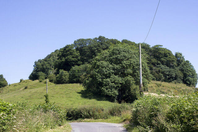 Photo could not load
SJ3307 : Caus Castle
P Gaskell
Hill facts and local notes
Classifications
Elevation
234m
766 ft
Prominence
53m
Coordinates
52.6637, -2.9816
SJ337077
OS Map
126
Explorer: 216
At the Summit
The summit is adorned with a fragmentary stone structure, reminiscent of the castle's former glory, along with a subtle cairn made by countless adventurous feet.
Terrain & Geology
Caus Castle is predominantly composed of limestone, providing an interesting layer of geology that has withstood the test of time – much like your old hiking boots.
Views & Scenery
On a clear day, you can see the Long Mynd and the iconic Wrekin in the distance, making for a pleasing view as you catch your breath.
History & Heritage
Name Origin
Caus is derived from the Welsh word 'castell', meaning castle, indicating its historic significance as a site of fortification.
Historical Significance
The site was once a prominent medieval castle, and its ruins are steeped in tales of valiant knights and local legends.
Getting There & Facilities
Parking
There is a small car park near the village of Caus, with space for about 10 vehicles. Please arrive early to secure a spot during weekends.
Public Transport
The nearest bus stop is in the village of Caus, approximately 1 km away. Services from Shrewsbury operate regularly.
Nearby Facilities
There are limited facilities in Caus itself, but Shrewsbury offers numerous cafes, restaurants, and toilet facilities.
Safety Information
Known Hazards
- Check for wet and slippery conditions after rain, especially on the rocky pathways.
General Safety Tips
- Check weather conditions before setting out
- Carry appropriate clothing and equipment
- Let someone know your planned route
- Take a map, compass, and GPS device
- Carry emergency supplies: food, water, first aid kit, torch
Hills
Some common questions about the hills answered
Are there group walks up Caus Castle?
Many walkers use Walkmates to join or organise walks with others. You can check for group walks around Caus Castle through the maps
Are there other walkers around Caus Castle?
Activity varies by location and time, but Walkmates lets you see whether others have shared walks or shown interest in this area. Find other people through the walking friends search walking friends for Caus Castle search or of course create your own walk for Caus Castle
Can I organise a walk to Caus Castle?
Yes. If there aren’t any walks listed already, you can create a walk and make it available for others to join.
If you're signed up to Walkmates, you can create a walk to Caus Castle.
How do I find a walk up this hill?
There are often multiple ways to walk this hill, depending on experience and route preference. Walkmates helps you explore walks and routes that others have shared.
Can I suggest a new route up Caus Castle?
Yes. You can suggest or create routes to share with others. Walkmates focuses on the social side of walking, so routes are used to help people organise walks and explore areas together, rather than as detailed navigation tools or route libraries.
Other uses really appreciate knowledgeable walkers sharing their routes. Share your favourite route to Caus Castle here
The is an error or something incorrect about this hill. How do I let you know?
We always strive to keep the information on Walkmates as accurate as possible. If you find an error, please let us know through the contact form and we'll aim to correct it as quickly as possible
Community Discussion
Comments
Location
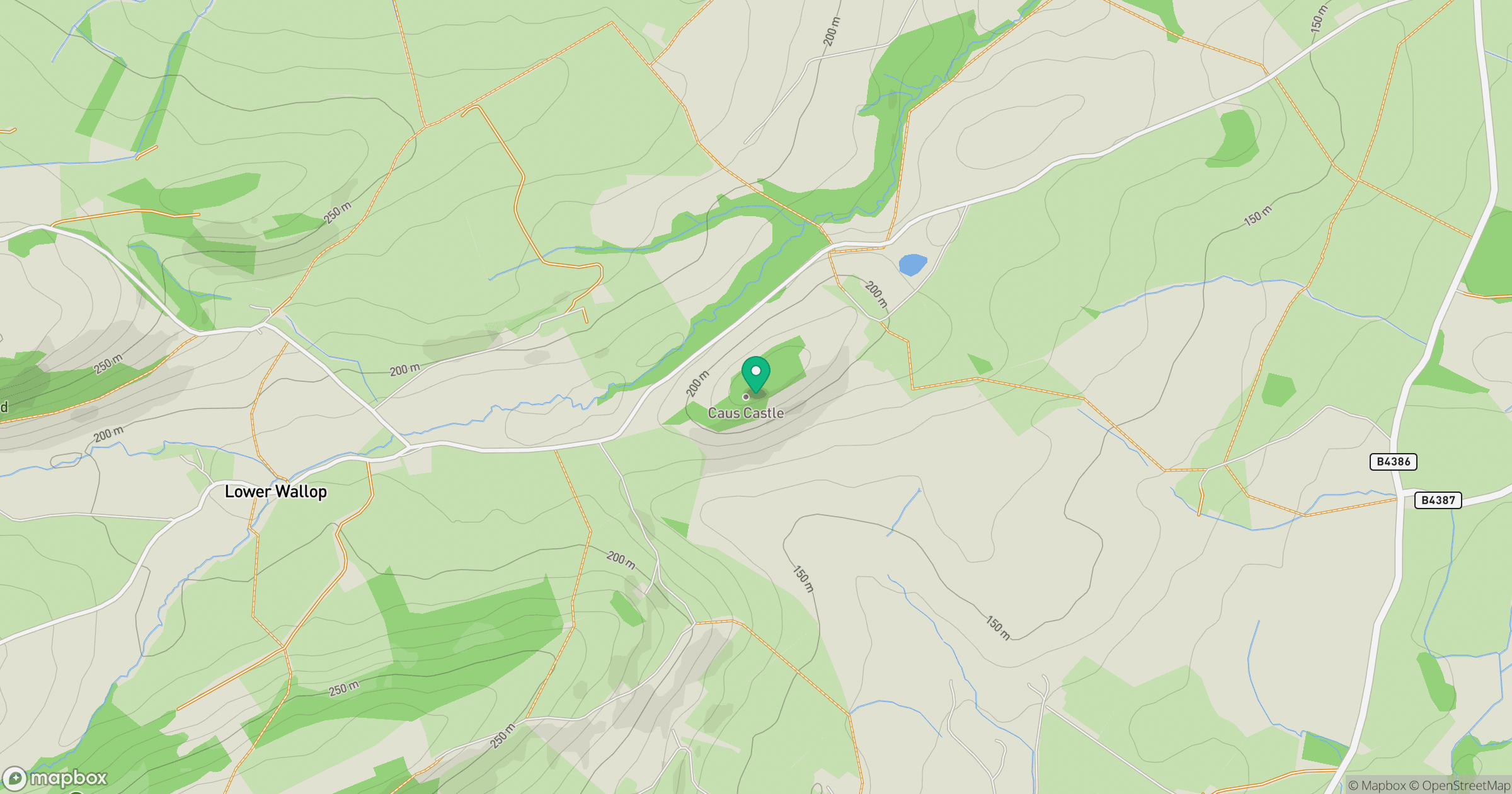
Grid reference: SJ337077
View on OpenStreetMapOpens a map in a new tab, centred on the hill.
Nearby Hills
Stiperstones
537m
Long Mynd - Pole Bank
517m

The Wrekin
407m
Cadair Berwyn
832m
Titterstone Clee Hill
533m
No comments yet. Be the first.