

Carreg Goch
Good walks are even better shared.
SN8116 : Storm brewing on Mynydd Du
Alan Hughes Photo source
Overview
Introduction
Carreg Goch is a charming Marilyn located in the stunning Brecon Beacons National Park. Rising to an elevation of 270 meters, it may not be the tallest peak in the area, but it certainly offers plenty of scenic beauty and a satisfying hiking experience.
Geology
This mountain boasts striking Old Red Sandstone formations, revealing the area's geological history. The rich red hues are as eye-catching as a fox in a henhouse, giving it an unmistakable character.
Routes
The most popular route begins at Cwm Clydach, where you can meander through lush greenery before making your way up to the summit. Expect a moderate hike that takes around 2.5 hours. Don't forget to bring your camera – you might find it hard to resist stopping to snap a picture every few steps!
Summit Features
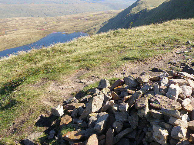
At the top, you'll find a prominent rock outcrop and a stone cairn, which serves as a perfect backdrop for that all-important summit selfie. Make sure you take a moment to enjoy the views before continuing your adventure!
Terrain
The terrain varies from grassy slopes to rocky outcrops, interspersed with some boggy areas. It's recommended to wear sturdy boots to keep your feet comfortable and dry.
Views
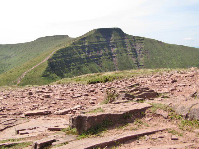
The vistas from Carreg Goch are nothing short of breathtaking. On a good day, you can gaze out at the towering peaks of Pen y Fan and Corn Du, as well as Talybont Reservoir shimmering in the distance. Spring is the best time to visit for clear views and vibrant colours.
Hazards
Like a cat on a hot tin roof, the weather in the Brecon Beacons can be unpredictable. Always check forecasts before setting out and be prepared for sudden changes in conditions. Loose stones and muddy patches can make the ascent a tad trickier, so tread carefully!
Access
Parking is readily available at Cwm Clydach, just a short distance from Libanus, where you might even find a quaint café to refuel after your hike. For those relying on public transport, there are buses available from Brecon to Libanus.
Facilities
While you won't find toilets or shops at the summit, Libanus has a small café and public restrooms, providing a welcome stop before or after your hike.
History
The translation of Carreg Goch is 'Red Rock,' a fitting name reflecting the striking sandstone that forms the mountain. This area has long been a part of local folklore, making it a rich tapestry of natural beauty and legends waiting to be explored.
Conclusion
In summary, Carreg Goch offers a delightful hiking experience in the Brecon Beacons, complete with stunning views, geological wonders, and plenty of opportunities for adventure. What more could you want?
Happy hiking, and remember – take only photographs, leave only footprints!
Explore routes near Carreg Goch
Walks starting near this hill. Open a route to check its map, distance and full itinerary.
Aircraft Crash Site - Wellington Bomber and Vampire Jet (Black Mountain range)
View route
Usk Reservoir: Glasfynydd Forest and Dam Circuit
View route
Pen y Fan via Corn Du from Storey Arms
View route
Swansea Canal: Coed Gwilym Park to Pontardawe Aqueduct
View route
Route planning notes
These notes describe possible approaches. Check a route's map and access information when planning your walk.
Cwm Clydach to Carreg Goch
A scenic walk leading up through Cwm Clydach, with stunning views as you ascend.
Make a day of it, together
Find someone to share the walk with, or organise a day out along a route you like.
Photo Gallery
View all Photo could not load
SN8116 : Storm brewing on Mynydd Du
Alan Hughes
 Photo could not load
SN8116 : Crash site of Wellington MF509
Gareth James
 Photo could not load
SN8116 : Crash site of Wellington MF509
Gareth James
 Photo could not load
SN8116 : Crash site of Wellington MF509
Gareth James
 Photo could not load
SN8116 : Crash site of Wellington MF509
Gareth James
 Photo could not load
SN8116 : Crash site of Wellington MF509
Gareth James
 Photo could not load
SN8116 : Summit of Carreg Goch
Nigel Davies
 Photo could not load
SN8116 : View SE from Carreg Goch
Gareth James
 Photo could not load
SN8116 : Crash site of Wellington MF509
Gareth James

SN8117 : Small pool on Carreg Goch
Gareth James
Hill facts and local notes
Classifications
Elevation
558m
1,832 ft
Prominence
68m
Coordinates
51.8394, -3.7158
SN818170
OS Map
160
Explorer: OL12W
At the Summit
The summit features a large rock outcrop and a stone cairn, offering an excellent vantage point for taking in the surrounding landscapes.
Terrain & Geology
Carreg Goch is primarily composed of Old Red Sandstone, which gives the area its characteristic reddish hue. The rock formations are of great interest to geology enthusiasts, showcasing sedimentary layers that date back to the Devonian period.
Views & Scenery
From the summit, you can see the impressive peaks of the Brecon Beacons, including Pen y Fan and the picturesque Talybont Reservoir.
History & Heritage
Name Origin
The name 'Carreg Goch' translates to 'Red Rock' in Welsh, aptly describing its reddish sandstone.
Historical Significance
This area is steeped in local folklore and has been a point of interest for hikers and nature lovers for generations.
Getting There & Facilities
Parking
The nearest parking area is at the Cwm Clydach car park, located a short drive from the village of Libanus.
Public Transport
Local bus services run from Brecon to Libanus, with a 2.5 km walk to the car park.
Nearby Facilities
While there are no facilities directly on the mountain, nearby Libanus offers a small café and public toilets.
Safety Information
Known Hazards
- Beware of sudden weather changes, typical of mountainous areas. Loose rocks and slippery terrain can make footing precarious, especially after rain.
General Safety Tips
- Check weather conditions before setting out
- Carry appropriate clothing and equipment
- Let someone know your planned route
- Take a map, compass, and GPS device
- Carry emergency supplies: food, water, first aid kit, torch
Hills
Some common questions about the hills answered
Are there group walks up Carreg Goch?
Many walkers use Walkmates to join or organise walks with others. You can check for group walks around Carreg Goch through the maps
Are there other walkers around Carreg Goch?
Activity varies by location and time, but Walkmates lets you see whether others have shared walks or shown interest in this area. Find other people through the walking friends search walking friends for Carreg Goch search or of course create your own walk for Carreg Goch
Can I organise a walk to Carreg Goch?
Yes. If there aren’t any walks listed already, you can create a walk and make it available for others to join.
If you're signed up to Walkmates, you can create a walk to Carreg Goch.
How do I find a walk up this hill?
There are often multiple ways to walk this hill, depending on experience and route preference. Walkmates helps you explore walks and routes that others have shared.
Can I suggest a new route up Carreg Goch?
Yes. You can suggest or create routes to share with others. Walkmates focuses on the social side of walking, so routes are used to help people organise walks and explore areas together, rather than as detailed navigation tools or route libraries.
Other uses really appreciate knowledgeable walkers sharing their routes. Share your favourite route to Carreg Goch here
The is an error or something incorrect about this hill. How do I let you know?
We always strive to keep the information on Walkmates as accurate as possible. If you find an error, please let us know through the contact form and we'll aim to correct it as quickly as possible
Community Discussion
Comments
Location
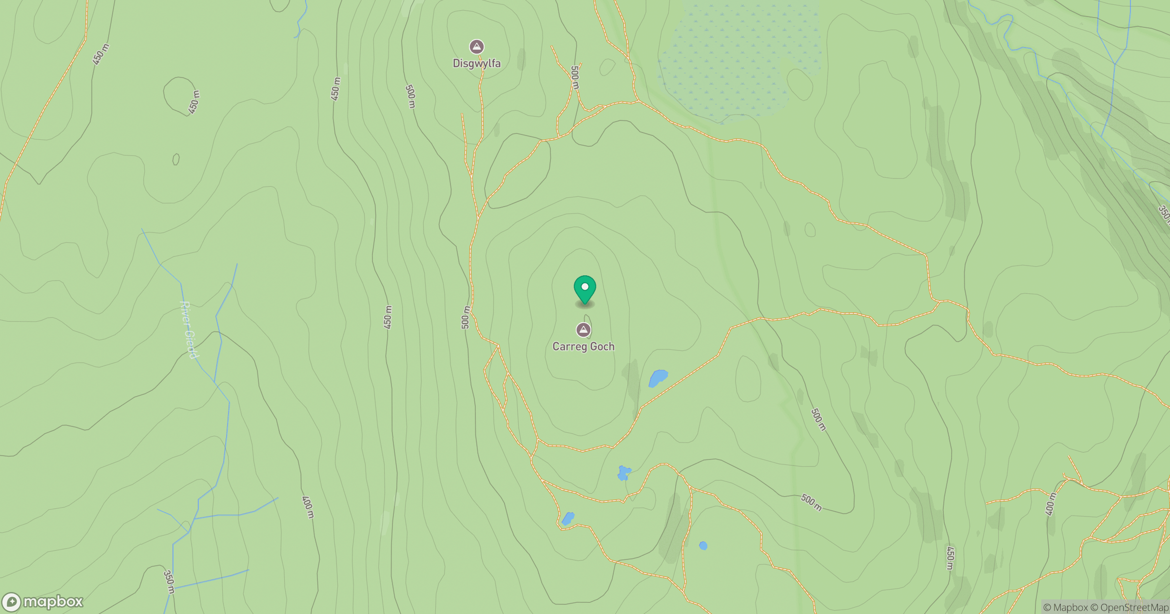
Grid reference: SN818170
View on OpenStreetMapOpens a map in a new tab, centred on the hill.
No comments yet. Be the first.