
Carn Mor
Good walks are even better shared.
Overview
Carn Mor
Nestled in the stunning Scottish Highlands, Carn Mor stands tall at an impressive elevation of 731 meters, inviting hikers to experience its breathtaking vistas and rich geological history. Known as a Munro, it promises a rewarding challenge for both seasoned trekkers and enthusiastic novices.
Geology
Carn Mor is composed primarily of granitic gneiss, which has weathered beautifully over millennia. This rock might be tough, but there's nothing tough about admiring its diverse formations and learning about its formation under intense heat and pressure deep within our planet.
Routes
The most popular approach is from An Fhaodhaig, a route that spans approximately 10.5 km and typically takes around 4.5 hours to complete. The trail is classified as moderate; keep an eye out for bogs that are stealthier than they sound, especially if you're fond of your hiking boots!
Summit Features
At the summit, you are welcomed by a mighty cairn that beckons for a photograph or two, offering gripping views of the Monadhliath mountains and Strathspey valley beyond. Whether it be a leisurely debate or an epic pose, the scene is nothing short of a postcard perfect moment.
Terrain Type
The terrain transitions from grassy slopes to rocky scrambles, with a charm of tricky bogs to engage even the most determined hiker. Careful footwork is advised to avoid any unforeseen splashes!
Views
The views from the top are a sight to behold. Spring and summer offer clearer vistas, while autumn will bathe the hills in a spectrum of warm hues. Don't forget your camera!
Hazards
Always factor in the unpredictable nature of Highland weather. Conditions can shift faster than you can say 'highland fling’, making it crucial to have an eye on the forecast before you set out. The rocky paths, while lovely, demand respect and a good boot!
Nearby Summits
If you fancy extending your horizons, nearby peaks include Carn an Fhidhleir at 717 meters and the taller Carn Sgulain at 788 meters. They make for a worthy country stroll.
Access
Parking
A quaint parking area nearly at the end of the road serves as the gateway to your adventure. Arrive in the early hours for the best chance of a spot.
Public Transport
Buses are available from Newtonmore, bringing you close to the trailhead. Check the schedules to align your start time with transport availability.
Nearest Town
Kingussie is the nearby village where you can gather supplies, enjoy a warm cuppa, and even find public toilets, so make sure to visit before heading out!
Facilities
While facilities on the mountain itself are non-existent, Kingussie is your friendly go-to for cafés and services to ensure your hiking expedition starts off on the right foot.
History
The name 'Carn Mor', meaning 'Big Cairn', is a tribute to the numerous stone piles that dot its slopes. It's a fabric of history within the glacial past of the region.
With all this in mind, Carn Mor stands not just as a mountain, but as a space where adventure beckons and nature thrives. And no matter if you’re a seasoned climber or a casual rambler, there’s always room for fun and exploration here. Happy hiking!
Explore routes near Carn Mor
Public walks starting within 80 km of this hill. Nearby does not mean a route reaches the summit; check its map and access before setting out.
Banavie to Glen Loy Aqueduct: Neptune’s Staircase Canal Towpath
View route
Ben Nevis via Mountain Path
View route
Loch Affric full circuit from River Affric
View route
Crinan Canal: Bellanoch and Dunardry towpath return
View route
Route planning notes
These notes describe possible approaches, not verified navigable routes or permission to cross land. Check current paths, local access rules and conditions before setting out.
From An Fhaodhaig
A popular route starting from the scenic glen of An Fhaodhaig that meanders through lush valleys and up to the summit.
Make a day of it, together
Find someone to share the walk with, or organise a day out along a route you like.
Hill facts and local notes
Classifications
Elevation
122m
400 ft
Prominence
117m
Coordinates
56.7778, -5.8836
NM628718
OS Map
40
Explorer: 390E
At the Summit
The summit features a prominent cairn that offers a perfect photo opportunity, along with stunning panoramic views of the surrounding area that are simply to die for – but please don't actually die trying to snap that selfie!
Terrain & Geology
Carn Mor is primarily composed of granitic gneiss, a rock that’s as tough as old boots and formed through intense pressure and heat deep within the Earth. This resilient rock has endured eons of weathering, making it a splendid sight for geology geeks.
Views & Scenery
From the summit, you can gaze upon the majestic peaks of the Monadhliath mountains and the scenic Strathspey valley, making it a feast for the eyes.
History & Heritage
Name Origin
The name 'Carn Mor' translates to 'Big Cairn', a fitting title for this notable summit lined with its stone markers.
Historical Significance
Carn Mor has long stood as a proud participant in the glacial history of the Highlands, once blanketed in ice, a story etched into its very rock.
Getting There & Facilities
Check current local access restrictions, parking rules and transport timetables before travelling. These notes do not confirm public access to the summit.
Parking
There is a small parking area at the end of the road near An Fhaodhaig, suitable for a few cars. Arrive early during peak seasons to snag a spot!
Public Transport
The nearest public transport access is from Newtonmore, where you can catch a bus that gets you close to the beginning of the hiking route.
Nearby Facilities
While there are no facilities directly on the mountain, Kingussie offers cafes and public toilets. Make sure to refuel before your adventure!
Safety Information
Known Hazards
- Be aware of sudden weather changes, especially in winter. Loose rocks and boggy terrain can also present challenges, so watch your step!
General Safety Tips
- Check weather conditions before setting out
- Carry appropriate clothing and equipment
- Let someone know your planned route
- Take a map, compass, and GPS device
- Carry emergency supplies: food, water, first aid kit, torch
Hills
Some common questions about the hills answered
Are there group walks up Carn Mor?
Many walkers use Walkmates to join or organise walks with others. You can check for group walks around Carn Mor through the maps
Are there other walkers around Carn Mor?
Activity varies by location and time, but Walkmates lets you see whether others have shared walks or shown interest in this area. Find other people through the walking friends search walking friends for Carn Mor search or of course create your own walk for Carn Mor
Can I organise a walk to Carn Mor?
Yes. If there aren’t any walks listed already, you can create a walk and make it available for others to join.
If you're signed up to Walkmates, you can create a walk to Carn Mor.
How do I find a walk up this hill?
There are often multiple ways to walk this hill, depending on experience and route preference. Walkmates helps you explore walks and routes that others have shared.
Can I suggest a new route up Carn Mor?
Yes. You can suggest or create routes to share with others. Walkmates focuses on the social side of walking, so routes are used to help people organise walks and explore areas together, rather than as detailed navigation tools or route libraries.
Other uses really appreciate knowledgeable walkers sharing their routes. Share your favourite route to Carn Mor here
The is an error or something incorrect about this hill. How do I let you know?
We always strive to keep the information on Walkmates as accurate as possible. If you find an error, please let us know through the contact form and we'll aim to correct it as quickly as possible
Community Discussion
Comments
Location
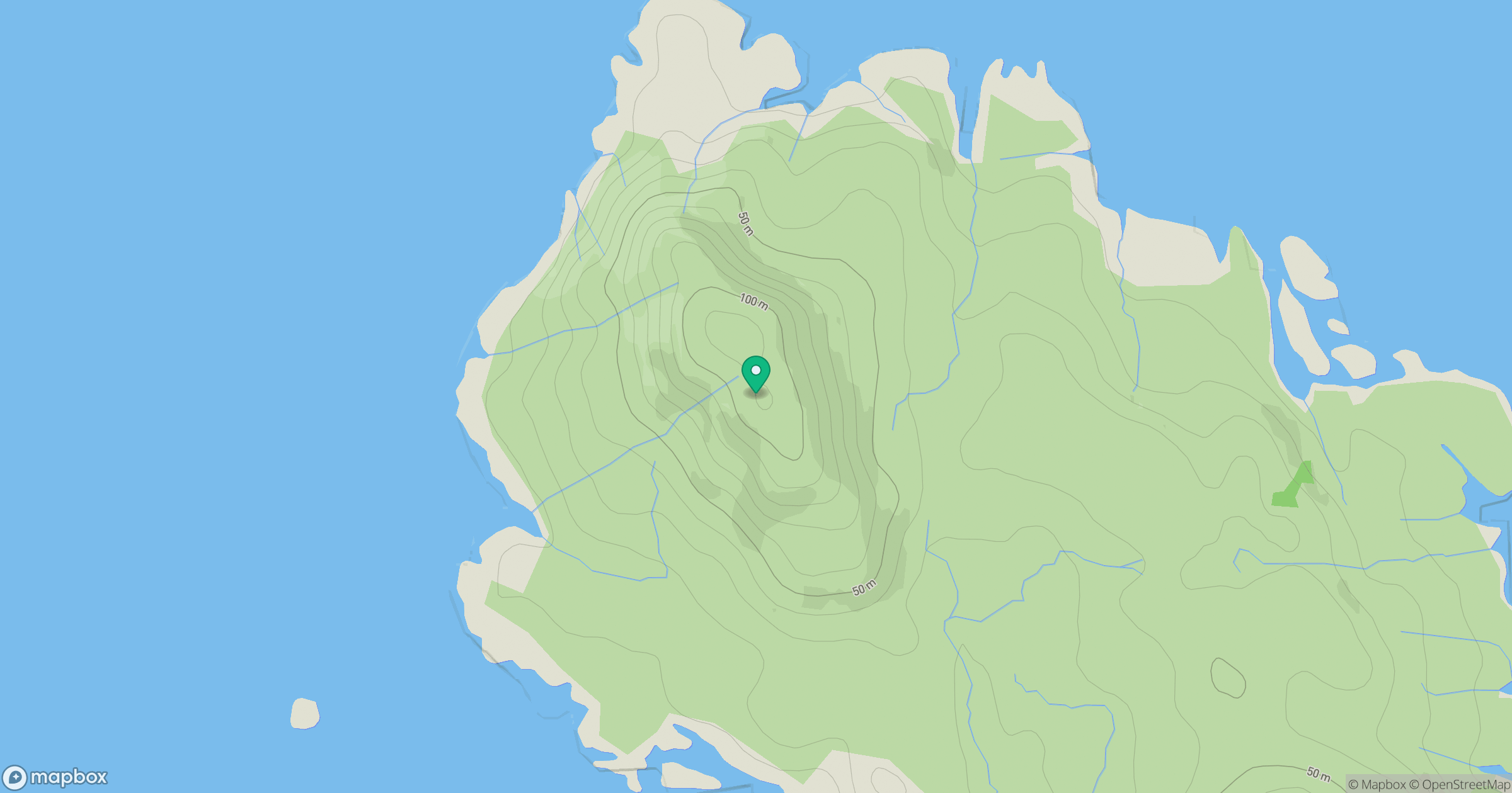
Grid reference: NM628718
View on OpenStreetMapOpens a map in a new tab, centred on the hill.
Hills within 30 km
Straight-line distance, not a walking route or confirmation of access.
No comments yet. Be the first.