
Beinn Bhuidhe
Good walks are even better shared.
Overview
Beinn Bhuidhe
Welcome to Beinn Bhuidhe, a glorious icon in the Arrochar Alps. Standing tall at 948 meters, this Munro offers both a challenge and a chance to bask in the awe of the Scottish Highlands.
Geology
Beinn Bhuidhe is notable for its Old Red Sandstone composition. This vibrant rock type not only gives the mountain its colour but also tells a story of our planet’s ancient history, dating back to the Devonian period. So every time you trip over a stone on your hike, just remember, it has been around longer than you!
Hiking Routes
The Beinn Bhuidhe Circuit is the route of choice for many climbers, encompassing a satisfying 15 km journey filled with stunning scenery. Expect to spend about 5 hours on this challenging trek, where the paths take you through beautiful heather and past picturesque loch views.
Summit Features
The summit is crowned with a prominent cairn—perfect for group photos, or as a setting for whipping out your sandwiches after a grueling climb. Remember: a share of your snack can go a long way to ensuring future climbing buddies!
Terrain
The terrain has a formidable mix of rocky outcrops and grassy slopes, though you might find a few muddy sections if the rain hasn’t been shy. Proper footwear recommended, unless you fancy a mud bath!
Views
Upon reaching the summit, the sweeping vistas will take your breath away—provided you have any left after the climb! Highlights include Loch Fyne and the jagged peaks of Ben Vorlich and Stob Binnein in the distance.
Best Seasons
For the best views (and to avoid being drenched), aim for late spring or early autumn. Of course, a wee bit of mist adds to the Highland charm—but do dress warmly, just in case!
Hazards
Hikers should be wary of loose rocks and rapidly changing weather conditions. Pack your common sense along with your snacks, as it can come in handy.
Access
For those driving, you’ll find parking at Inverchapel. It’s a popular spot, so arriving bright and early guarantees you a space. Public transport isn’t a hiker’s best friend in this region, but you can catch a bus to Lochgoilhead and then make your way from there—just be prepared for a long walk!
Nearby Facilities
While Beinn Bhuidhe is a rugged beauty without facilities, the nearby village of Arrochar has a few cafes, shops, and public toilets. Grab a cuppa before or after your hike!
History
The name Beinn Bhuidhe, meaning 'Yellow Mountain', hints at the beautiful blooms that grace its slopes, especially in spring. This mountain has captured the hearts of many a climber and lover of the great outdoors.
In summary, Beinn Bhuidhe stands not just as a challenge to conquer, but as a slice of Scottish history, scenery, and spirit. So lace up those boots, and may your hike be filled with adventure!
Explore routes near Beinn Bhuidhe
Public walks starting within 80 km of this hill. Nearby does not mean a route reaches the summit; check its map and access before setting out.
Banavie to Glen Loy Aqueduct: Neptune’s Staircase Canal Towpath
View route
Ben Nevis via Mountain Path
View route
Crinan Canal: Bellanoch and Dunardry towpath return
View route
Route planning notes
These notes describe possible approaches, not verified navigable routes or permission to cross land. Check current paths, local access rules and conditions before setting out.
Beinn Bhuidhe Circuit
A popular circular route starting from the end of the road at Inverchapel, taking you along paths through heather and past stunning loch views.
Make a day of it, together
Find someone to share the walk with, or organise a day out along a route you like.
Hill facts and local notes
Classifications
Elevation
282m
925 ft
Prominence
111m
Coordinates
56.6967, -5.9706
NM570631
OS Map
47
Explorer: 390W
At the Summit
The summit is marked by a substantial stone cairn, which is a welcoming site for tired hikers. It offers ample space for a well-deserved picnic with breathtaking views.
Terrain & Geology
The mountain is primarily composed of Old Red Sandstone, characterised by its reddish hue. This geological feature provides a stunning backdrop and speaks to the mountain's age, having formed during the Devonian period.
Views & Scenery
From the summit, you can see Loch Fyne, the Cowal Peninsula, and the peaks of the adjacent Arrochar Alps including Ben Vorlich and Stob Binnein.
History & Heritage
Name Origin
Beinn Bhuidhe translates to 'Yellow Mountain', possibly referring to the colours of the heather that cover its slopes in bloom.
Historical Significance
The mountain has long been a favoured spot for walkers and climbers, representing the rugged beauty of the Scottish Highlands.
Getting There & Facilities
Check current local access restrictions, parking rules and transport timetables before travelling. These notes do not confirm public access to the summit.
Parking
Parking is available at the end of the road near Inverchapel, with room for several cars. Arrive early to secure a space!
Public Transport
Public transport options are limited; however, you can take a bus to Lochgoilhead and hike from there, although it's a fair distance.
Nearby Facilities
There are no facilities directly on the mountain, but Arrochar offers various cafes and shops for pre- and post-hike needs. Public toilets can be found in the village.
Safety Information
Known Hazards
- Loose rocks, particularly on steeper sections, as well as changes in weather that can reduce visibility quickly.
General Safety Tips
- Check weather conditions before setting out
- Carry appropriate clothing and equipment
- Let someone know your planned route
- Take a map, compass, and GPS device
- Carry emergency supplies: food, water, first aid kit, torch
Hills
Some common questions about the hills answered
Are there group walks up Beinn Bhuidhe?
Many walkers use Walkmates to join or organise walks with others. You can check for group walks around Beinn Bhuidhe through the maps
Are there other walkers around Beinn Bhuidhe?
Activity varies by location and time, but Walkmates lets you see whether others have shared walks or shown interest in this area. Find other people through the walking friends search walking friends for Beinn Bhuidhe search or of course create your own walk for Beinn Bhuidhe
Can I organise a walk to Beinn Bhuidhe?
Yes. If there aren’t any walks listed already, you can create a walk and make it available for others to join.
If you're signed up to Walkmates, you can create a walk to Beinn Bhuidhe.
How do I find a walk up this hill?
There are often multiple ways to walk this hill, depending on experience and route preference. Walkmates helps you explore walks and routes that others have shared.
Can I suggest a new route up Beinn Bhuidhe?
Yes. You can suggest or create routes to share with others. Walkmates focuses on the social side of walking, so routes are used to help people organise walks and explore areas together, rather than as detailed navigation tools or route libraries.
Other uses really appreciate knowledgeable walkers sharing their routes. Share your favourite route to Beinn Bhuidhe here
The is an error or something incorrect about this hill. How do I let you know?
We always strive to keep the information on Walkmates as accurate as possible. If you find an error, please let us know through the contact form and we'll aim to correct it as quickly as possible
Community Discussion
Comments
Location
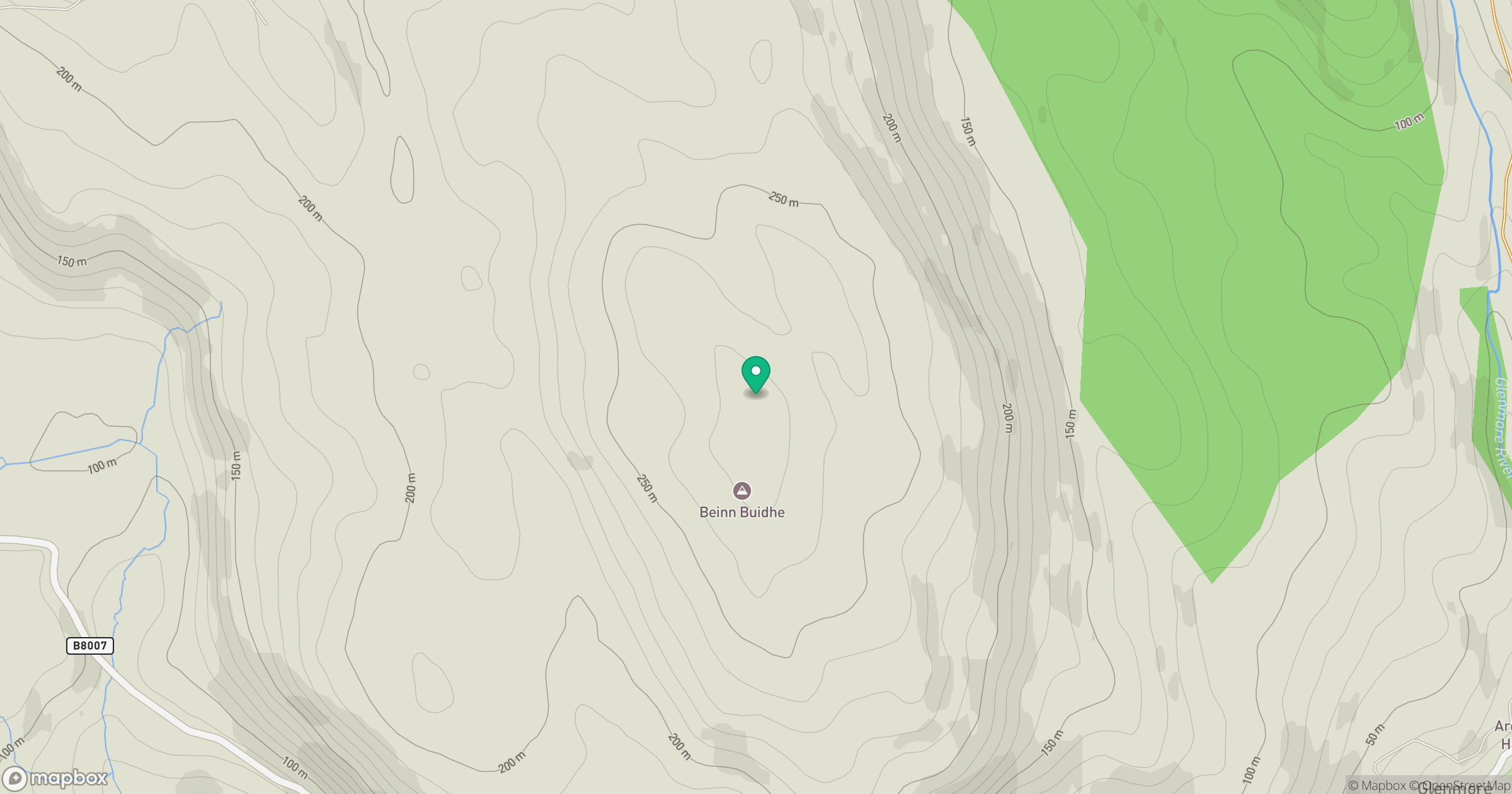
Grid reference: NM570631
View on OpenStreetMapOpens a map in a new tab, centred on the hill.
Hills within 30 km
Straight-line distance, not a walking route or confirmation of access.
Beinn Mheadhoin
739m
Ben Hiant
528m
Beinn nan Losgann
315m
Cruachan Charna
170m
Beinn an Leathaid
401m
No comments yet. Be the first.