

Beinn nan Losgann
Good walks are even better shared.
Overview
Beinn nan Losgann: A Hidden Gem in the Highlands
Nestled in the heart of the Scottish Highlands, Beinn nan Losgann is a Marilyn that promises adventure for both seasoned hikers and weekend warriors. At 770 meters, it might not be the tallest mountain, but don’t let its height fool you – this beauty offers stunning vistas and a chance to escape into nature.
Geology
The very bones of Beinn nan Losgann are steeped in history, formed from schists and granite that have stood the test of time. The rugged landscape is a testimony to glacial erosion, and if you’re lucky, you might even spot a rock or two that looks like it has been artistically arranged by nature itself.
Routes
For those looking to conquer Beinn nan Losgann, the North Ridge Route is a popular choice. This moderate climb is about 6.2 km long and typically takes around 3.5 hours. The path is well defined, so you won’t have to worry about playing hide and seek with the trail. Alternatively, the South-East Approach offers a 7.5 km route that takes about 4 hours. It’s scenic, featuring lush heather and grasslands before you tackle the rocky ascent.
Summit Features
Reaching the summit is a rewarding experience. You’ll find a modest cairn and some rocky outcrops offering the perfect spot to pause for breath (and a well-deserved snack). Don’t forget to capture the moment – the views here could make even the most stoic soul crack a smile!
Views
On a clear day, the summit of Beinn nan Losgann provides breathtaking 360-degree views. The rolling hills and distant valleys are a sight to behold, and you might even spot the Isle of Mull in the distance. Late spring to early autumn is the ideal time to visit, particularly in the early morning or late afternoon when the skies show off their best hues.
Hazards
As with any Highland adventure, be prepared for variable weather. The charm of a quick rain shower can be exhilarating, but it may also transform paths into slippery slopes. Keep an eye on the horizon and always respect nature’s unpredictability.
Nearby Summits
If you fancy an extended adventure, Beinn nan Losgann is in good company with nearby peaks like Beinn a'Chroin (942 meters) and Beinn Fhada (936 meters). These companions add to your exploration options, just in case one summit isn’t enough to satisfy your wanderlust!
Access
Getting to Beinn nan Losgann is relatively straightforward. The nearest parking can be found in the quaint village of Ardgour, and for those reliant on public transportation, bus services from Fort William provide easy access to this outdoor gem. Fort William itself is a bustling hub, offering all the amenities a hiker could need.
Conclusion
Beinn nan Losgann is an absolute must for anyone seeking a taste of the Highlands. With its rich geology, stunning views, and nearby options for further exploration, it caters to a wide range of hikers. So lace up those boots and get ready for a day filled with fresh air, breathtaking landscapes, and possibly a few friendly geese on your journey!
Happy hiking!
Explore routes near Beinn nan Losgann
Public walks starting within 80 km of this hill. Nearby does not mean a route reaches the summit; check its map and access before setting out.
Banavie to Glen Loy Aqueduct: Neptune’s Staircase Canal Towpath
View route
Ben Nevis via Mountain Path
View route
Crinan Canal: Bellanoch and Dunardry towpath return
View route
Route planning notes
These notes describe possible approaches, not verified navigable routes or permission to cross land. Check current paths, local access rules and conditions before setting out.
North Ridge Route
A relatively straightforward ascent via the northern ridge, providing excellent views as you climb towards the summit.
South-East Approach
This route starts from the southeast and offers a more scenic path through heather and grasslands before the rocky ascent.
Make a day of it, together
Find someone to share the walk with, or organise a day out along a route you like.
Photo Gallery
View all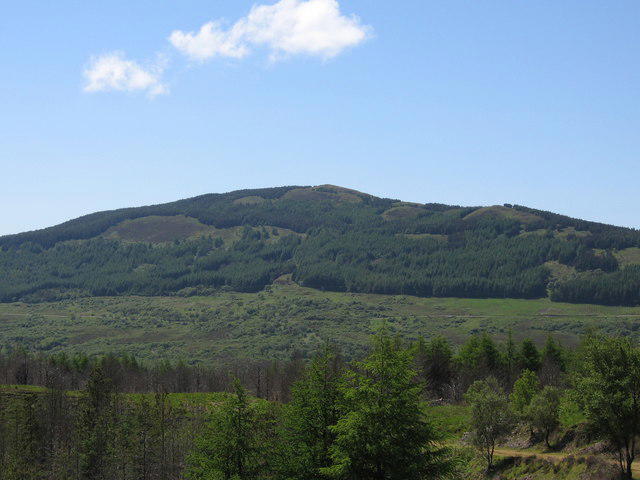 Photo could not load
NM5365 : Beinn nan Losgann
Keith Duncan
Hill facts and local notes
Classifications
Elevation
315m
1,033 ft
Prominence
111m
Coordinates
56.7156, -6.0312
NM534654
OS Map
47
Explorer: 390W
At the Summit
The summit features a small cairn and rocky outcrops, perfect for a photo opportunity and a well-earned snack.
Terrain & Geology
Beinn nan Losgann is primarily composed of ancient schists and granite, offering a geological history that dates back hundreds of millions of years. These rocks have been sculpted by glacial activity, giving the mountain its rugged appearance.
Views & Scenery
From the summit, you can enjoy panoramic views of the surrounding mountains and the stunning coastline of the West Highlands, including the distant silhouette of the Isle of Mull.
History & Heritage
Name Origin
Beinn nan Losgann translates to 'Mountain of the Geese' in Gaelic, likely referring to the countryside's wildlife.
Historical Significance
This mountain is a popular destination for hillwalkers and is celebrated in local folklore.
Getting There & Facilities
Check current local access restrictions, parking rules and transport timetables before travelling. These notes do not confirm public access to the summit.
Parking
There is parking available at the nearby village of Ardgour, approximately 2 km from the trailhead.
Public Transport
Bus services run from Fort William to the nearby village of Ardgour, making it accessible for those without a car.
Nearby Facilities
Basic facilities can be found in Ardgour, including a small shop and café. Public toilets are available at Fort William.
Safety Information
Known Hazards
- Variable weather conditions can lead to sudden changes in visibility. Beware of slippery rocks and marshy areas, especially after rain.
General Safety Tips
- Check weather conditions before setting out
- Carry appropriate clothing and equipment
- Let someone know your planned route
- Take a map, compass, and GPS device
- Carry emergency supplies: food, water, first aid kit, torch
Hills
Some common questions about the hills answered
Are there group walks up Beinn nan Losgann?
Many walkers use Walkmates to join or organise walks with others. You can check for group walks around Beinn nan Losgann through the maps
Are there other walkers around Beinn nan Losgann?
Activity varies by location and time, but Walkmates lets you see whether others have shared walks or shown interest in this area. Find other people through the walking friends search walking friends for Beinn nan Losgann search or of course create your own walk for Beinn nan Losgann
Can I organise a walk to Beinn nan Losgann?
Yes. If there aren’t any walks listed already, you can create a walk and make it available for others to join.
If you're signed up to Walkmates, you can create a walk to Beinn nan Losgann.
How do I find a walk up this hill?
There are often multiple ways to walk this hill, depending on experience and route preference. Walkmates helps you explore walks and routes that others have shared.
Can I suggest a new route up Beinn nan Losgann?
Yes. You can suggest or create routes to share with others. Walkmates focuses on the social side of walking, so routes are used to help people organise walks and explore areas together, rather than as detailed navigation tools or route libraries.
Other uses really appreciate knowledgeable walkers sharing their routes. Share your favourite route to Beinn nan Losgann here
The is an error or something incorrect about this hill. How do I let you know?
We always strive to keep the information on Walkmates as accurate as possible. If you find an error, please let us know through the contact form and we'll aim to correct it as quickly as possible
Community Discussion
Comments
Location
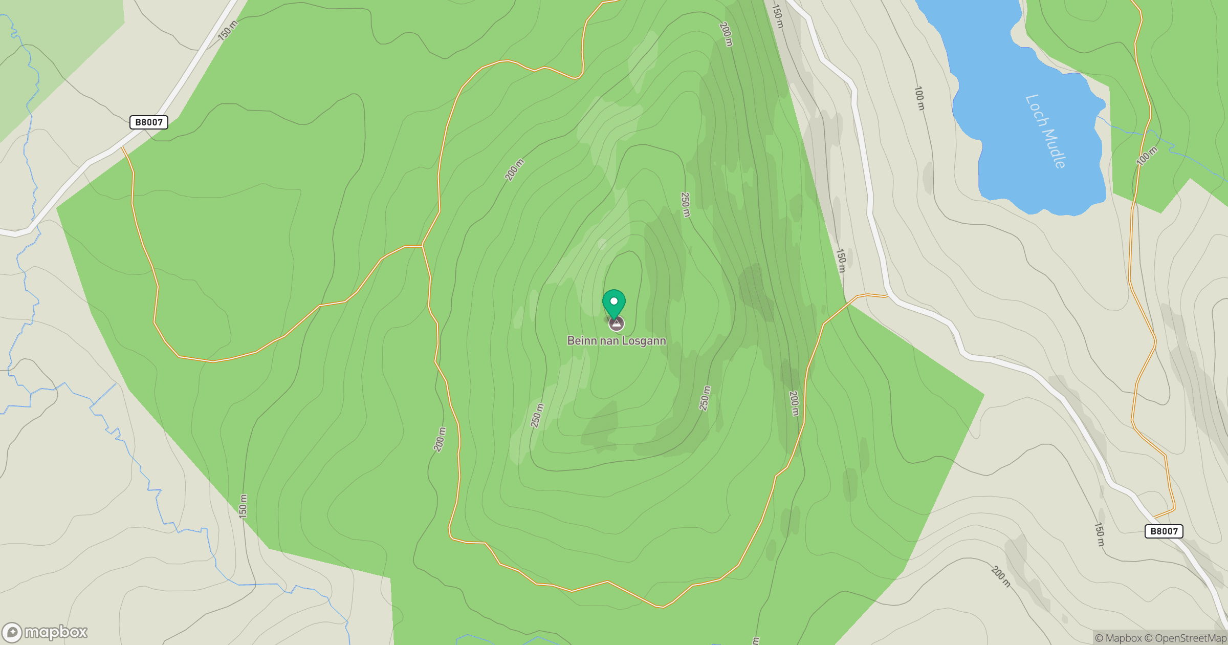
Grid reference: NM534654
View on OpenStreetMapOpens a map in a new tab, centred on the hill.
Hills within 30 km
Straight-line distance, not a walking route or confirmation of access.
No comments yet. Be the first.