
Carn Liath
Good walks are even better shared.
Overview
Overview
Carn Liath is one of Scotland’s cherished Munros, sitting aloof at 1046 meters, giving hikers a hearty climb and rewarding them with breathtaking views. Affectionately dubbed ‘Grey Hill’, it invites adventurers to explore its rugged flanks.
Geology
The hill is primarily formed of quartzite and schist, showcasing the dramatic geological past that shaped the Highlands. This provides not only a challenge but also a lesson in the Earth's history as hikers traverse its rugged paths.
Routes
- North East Ridge:
Starting at a small parking area near the A9, this moderate trail meanders up heather-covered slopes. Expect to see some wildlife if you’re quiet enough! - Southwest Route:
This less busy route offers peace and quieter reflections, perfect for those who enjoy a walk in solitude—just watch out for the odd sheep or two!
Summit Features
Reaching the summit, you will be greeted by a large and impressive cairn—perfect for those celebratory summit selfies. Occasionally, and depending on the weather, a trig point may also make an appearance!
Views
From the top, the panoramic vistas are nothing short of spectacular, encapsulating the grandeur of the Cairngorms and the enchanting glens below. Best enjoyed in late spring or early autumn for clear skies and scenic beauty.
Hazards
While ascending Carn Liath is a joy, it’s essential to be cautious of steep sections and suddenly changing weather. Remember, there’s nothing worse than being caught in a Highland downpour dressed for summer!
Access
Nearest parking is available at the Spittal of Glenshee, ideal for starting your adventure, but keep in mind it’s limited. The closest realistic public transport route may leave you waiting like a true scout.
Facilities
Once you return from your expedition, head back to Blairgowrie for a well-earned snack! Toilets are conveniently found at the Spittal of Glenshee too.
History
Known as 'Carn Liath' or 'Grey Hill', it carries a legacy of climbing culture. This Munro stands not just as a peak but as a beacon of Scotland's wild heart.
So there you have it—now grab your boots, pack your sense of adventure, and make the journey to Carn Liath!
Explore routes near Carn Liath
Walks starting near this hill. Open a route to check its map, distance and full itinerary.
Fort Augustus to Kytra Lock: Caledonian Canal Towpath
View route
Banavie to Glen Loy Aqueduct: Neptune’s Staircase Canal Towpath
View route
Ben Nevis via Mountain Path
View route
Glen Affric: Coire Loch Woodland Trail
View route
Route planning notes
These notes describe possible approaches. Check a route's map and access information when planning your walk.
North East Ridge
Starting from the small parking area near the A9, this path winds through heather and offers a fine ascent up the northeast ridge to the summit.
Southwest Route
A less trodden path traversing from the south, providing a quieter approach and stunning views of the surrounding glens.
Make a day of it, together
Find someone to share the walk with, or organise a day out along a route you like.
Hill facts and local notes
Classifications
Elevation
1,006m
3,301 ft
Prominence
87m
Coordinates
56.9788, -4.5153
NN472903
OS Map
34
Explorer: OL55 401
At the Summit
The summit is crowned by a substantial cairn, providing a quintessential sight for all Munro baggers. On a clear day, you might even spot a trig point if you're lucky.
Terrain & Geology
Carn Liath is primarily composed of quartzite and schist, providing a rugged terrain that showcases the geological history of the region etched over millions of years.
Views & Scenery
Panoramic views of the surrounding Cairngorms and Deeside, including the nearby peaks of Braeriach and Cairn Toul.
History & Heritage
Name Origin
The name 'Carn Liath' translates to 'Grey Hill' in Scottish Gaelic, reflecting its stony summit.
Historical Significance
Carn Liath is a popular destination among climbers and hikers, noted for its challenging ascents and beautiful landscapes, contributing to Scotland's rich hiking culture.
Getting There & Facilities
Parking
There is limited parking available at the Spittal of Glenshee car park (NN 410 916), approximately 10 km from the foot of the mountain.
Public Transport
The nearest bus service is from Blairgowrie to Spittal of Glenshee; however, service frequency can be sparse, so check schedules in advance.
Nearby Facilities
There are no facilities directly on the mountain. However, Blairgowrie offers cafes and shops, and there are public toilets available in Spittal of Glenshee.
Safety Information
Known Hazards
- Steep gradients on the way up, potential for slips in wet conditions, and sudden weather changes typical of the Scottish Highlands.
General Safety Tips
- Check weather conditions before setting out
- Carry appropriate clothing and equipment
- Let someone know your planned route
- Take a map, compass, and GPS device
- Carry emergency supplies: food, water, first aid kit, torch
Hills
Some common questions about the hills answered
Are there group walks up Carn Liath?
Many walkers use Walkmates to join or organise walks with others. You can check for group walks around Carn Liath through the maps
Are there other walkers around Carn Liath?
Activity varies by location and time, but Walkmates lets you see whether others have shared walks or shown interest in this area. Find other people through the walking friends search walking friends for Carn Liath search or of course create your own walk for Carn Liath
Can I organise a walk to Carn Liath?
Yes. If there aren’t any walks listed already, you can create a walk and make it available for others to join.
If you're signed up to Walkmates, you can create a walk to Carn Liath.
How do I find a walk up this hill?
There are often multiple ways to walk this hill, depending on experience and route preference. Walkmates helps you explore walks and routes that others have shared.
Can I suggest a new route up Carn Liath?
Yes. You can suggest or create routes to share with others. Walkmates focuses on the social side of walking, so routes are used to help people organise walks and explore areas together, rather than as detailed navigation tools or route libraries.
Other uses really appreciate knowledgeable walkers sharing their routes. Share your favourite route to Carn Liath here
The is an error or something incorrect about this hill. How do I let you know?
We always strive to keep the information on Walkmates as accurate as possible. If you find an error, please let us know through the contact form and we'll aim to correct it as quickly as possible
Community Discussion
Comments
Location
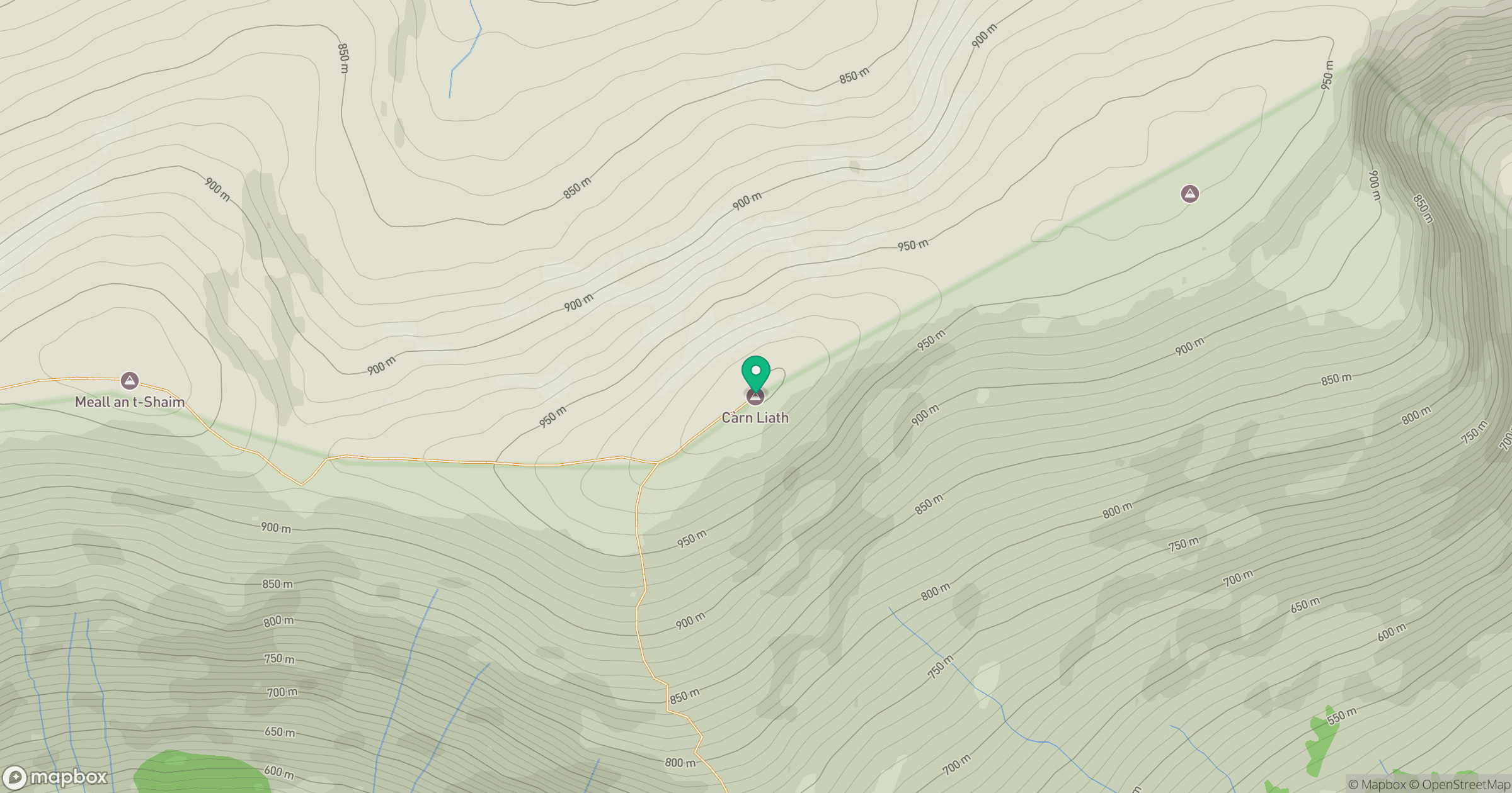
Grid reference: NN472903
View on OpenStreetMapOpens a map in a new tab, centred on the hill.
No comments yet. Be the first.