
Carn Dearg
Good walks are even better shared.
Overview
Carn Dearg: The Red Hill
Nestled in the heart of the Scottish Highlands, Carn Dearg stands proudly at 1025 meters. This Munro not only offers an exhilarating climb but also pays homage to the vibrant red granite that forms its rocky terrain.
Geology
As a mountain composed of granite, Carn Dearg showcases some fascinating geological history. The granite rock, shaped by ancient glaciers, tells tales of both erosion and the relentless forces of nature. It’s a rock star in the geology world—definitely one to bring along on hikes!
Routes
There are a couple of popular routes that hikers typically take to conquer Carn Dearg:
Cycle or Foot from the A82: This route is well-loved for its scenic beauty, which includes glens and sweeping vistas along the way. Expect around 15 kilometers of moderate hiking that takes roughly 6 hours to complete.
North Ridge Route: For those looking for a more direct and challenging ascent, the north ridge is the way to go. With a distance of about 7 kilometers and a hiking time of 3 hours, it's perfect for adventure seekers! Just remember to pack your determination.
Summit Features
Upon reaching the summit, you’ll be greeted by a prominent cairn, perfect for photo ops. There's also a small rocky outcrop that offers a nice spot for a snack—just hold on to your sandwiches in the wind!
Terrain Type
The terrain varies from rocky paths to grassy patches. It's essential to keep an eye out for the occasional boggy spot, particularly after a rainy day. A good pair of boots will serve you well here.
Views
From the top, the views are nothing short of spectacular! You can spot Ben Nevis to the south and feast your eyes on the stunning Lochaber landscape. Late spring and early autumn are the best times to enjoy these unparalleled vistas, making it a feast for the eyes (and a bit of a workout for the legs).
Hazards
While hiking Carn Dearg, be cautious of potential rockfall in certain areas, especially during wet weather. Ensure you're appropriately equipped and know your limits—your knees will thank you later!
Nearby Summits
Nearby summits include:
- Ben Nevis (1345 meters): Scotland's highest peak, always a crowd-pleaser.
- Stob Bàn (999 meters): A fine companion to your Carn Dearg adventure.
Access
The nearest parking is just off the A82 at a car park close to Fort William. If you're relying on public transport, fear not! Regular bus services from Fort William run to nearby villages with convenient trailhead connections.
Facilities
If you need to refuel, Fort William has a plethora of cafes and restaurants, along with public toilets to refresh yourself before or after the climb.
History
The name 'Carn Dearg' literally means 'Red Hill' in Gaelic, reflecting the enchanting red hue of the mountain’s rock formation at certain times of the day. Historically, this mountain holds significance for local climbers and is cherished in the Scottish outdoor community as a classic Munro.
In conclusion, whether you’re a seasoned hiker or just looking to stretch your legs, Carn Dearg offers an unforgettable experience that will leave you reminiscing for days!
Explore routes near Carn Dearg
Walks starting near this hill. Open a route to check its map, distance and full itinerary.
Fort Augustus to Kytra Lock: Caledonian Canal Towpath
View route
Banavie to Glen Loy Aqueduct: Neptune’s Staircase Canal Towpath
View route
Ben Nevis via Mountain Path
View route
Glen Affric: Coire Loch Woodland Trail
View route
Route planning notes
These notes describe possible approaches. Check a route's map and access information when planning your walk.
Cycle or Foot from the A82
Starting from the A82, this popular route leads through scenic glens and offers panoramic vistas as you ascend.
North Ridge Route
A direct ascent via the north ridge that rewards hikers with breathtaking views and a sense of achievement.
Make a day of it, together
Find someone to share the walk with, or organise a day out along a route you like.
Hill facts and local notes
Classifications
Elevation
834m
2,738 ft
Prominence
251m
Coordinates
56.9598, -4.7233
NN345887
OS Map
34 41
Explorer: 400
At the Summit
The summit features a prominent cairn, which is a favourite spot for taking selfies. There's also a small rocky outcrop that serves as a delightful picnic spot if you don’t mind a little wind!
Terrain & Geology
Carn Dearg is primarily composed of granite, which is a hallmark of the region's glacial history. The rugged rocks tell tales of ancient tectonic movements and erosion by glaciers that once blanketed this landscape.
Views & Scenery
From the summit, you can see the majestic Ben Nevis to the south, the vast expanse of Lochaber, and the distant peaks of the Mamores.
History & Heritage
Name Origin
The name 'Carn Dearg' translates to 'Red Hill' in Gaelic, alluding to the reddish hue of the rock in certain lights.
Historical Significance
Carn Dearg is a popular destination among climbers and an integral part of the Scottish walking tradition.
Getting There & Facilities
Parking
Parking is available at the car park near the A82, just off the road to Fort William.
Public Transport
Regular bus services run from Fort William to nearby villages with connections to the main trailheads.
Nearby Facilities
Fort William offers a range of facilities including cafes, restaurants, and public toilets.
Safety Information
Known Hazards
- Rockfall in certain areas, particularly in wet weather. Care should be taken when navigating the rocky sections.
General Safety Tips
- Check weather conditions before setting out
- Carry appropriate clothing and equipment
- Let someone know your planned route
- Take a map, compass, and GPS device
- Carry emergency supplies: food, water, first aid kit, torch
Hills
Some common questions about the hills answered
Are there group walks up Carn Dearg?
Many walkers use Walkmates to join or organise walks with others. You can check for group walks around Carn Dearg through the maps
Are there other walkers around Carn Dearg?
Activity varies by location and time, but Walkmates lets you see whether others have shared walks or shown interest in this area. Find other people through the walking friends search walking friends for Carn Dearg search or of course create your own walk for Carn Dearg
Can I organise a walk to Carn Dearg?
Yes. If there aren’t any walks listed already, you can create a walk and make it available for others to join.
If you're signed up to Walkmates, you can create a walk to Carn Dearg.
How do I find a walk up this hill?
There are often multiple ways to walk this hill, depending on experience and route preference. Walkmates helps you explore walks and routes that others have shared.
Can I suggest a new route up Carn Dearg?
Yes. You can suggest or create routes to share with others. Walkmates focuses on the social side of walking, so routes are used to help people organise walks and explore areas together, rather than as detailed navigation tools or route libraries.
Other uses really appreciate knowledgeable walkers sharing their routes. Share your favourite route to Carn Dearg here
The is an error or something incorrect about this hill. How do I let you know?
We always strive to keep the information on Walkmates as accurate as possible. If you find an error, please let us know through the contact form and we'll aim to correct it as quickly as possible
Community Discussion
Comments
Location
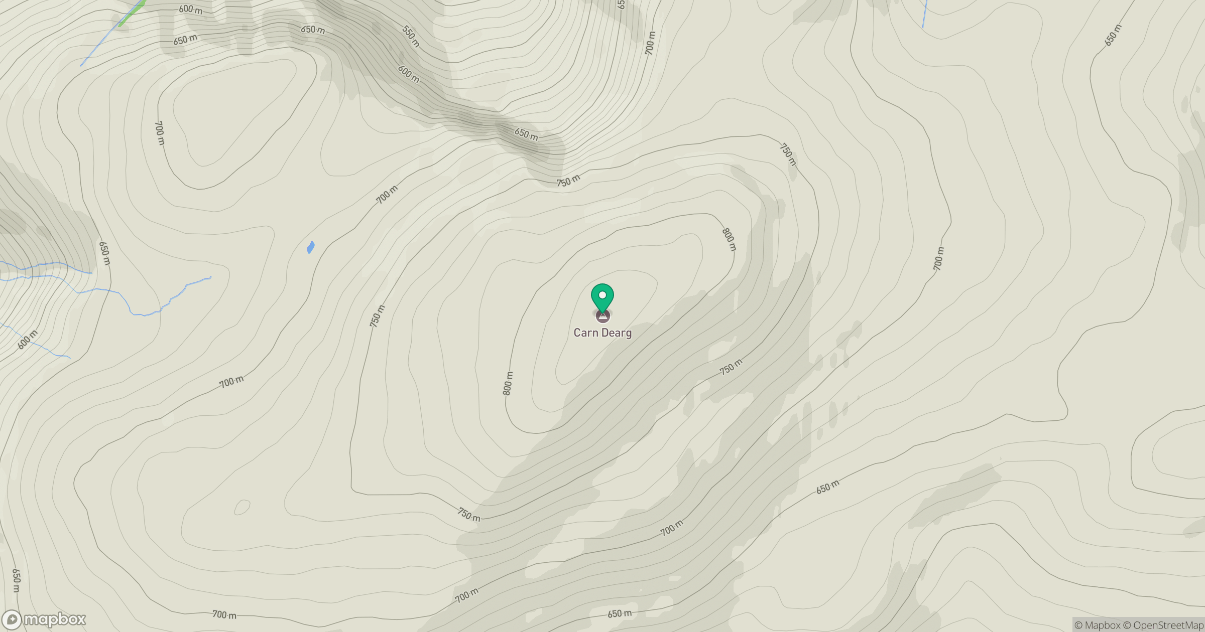
Grid reference: NN345887
View on OpenStreetMapOpens a map in a new tab, centred on the hill.
Nearby Hills
Creag Meagaidh
1,128m
Stob Choire Claurigh
1,177m
Stob Ban
977m
Aonach Mor
1,220m
Aonach Beag
1,234m
No comments yet. Be the first.