
Cnoc an Tubait
Good walks are even better shared.
Overview
Cnoc an Tubait
Introduction
Cnoc an Tubait, a Marilyn at 454 meters, is a lovely hill situated in the Scottish Highlands. Its moderate ascent is a perfect outing for families and seasoned hikers alike, with views that will make any selfie look like a postcard.
Geology
The geology here is dominated by ancient schist and gneiss. If those rock types had a Tinder profile, they’d definitely be looking for someone who appreciates rugged beauty and long walks on the mountains! These formations tell a story of intense geological processes that have occurred over eons.
Hiking Routes
The most popular route is the Sgurr na Gillean approach. It spans around 6.5 kilometers and takes approximately 2.5 hours to complete, making it achievable without needing to set off at the crack of dawn. It’s moderate in difficulty, so lace up those boots and enjoy the journey!
Summit Features
Upon reaching the summit, you'll find a stone cairn where you can not only take a well-earned break but also challenge your friend to try and spot the distant Skye hills – a fun way to keep the spirits high!
Terrain
Expect rocky paths with patches of heather and grass, interspersed with some boggier sections. It’s the Highlands, after all – a little muck adds to the fun!
Views
The views from the top are truly remarkable. You can gaze at the majestic Black Cuillin peaks and the shimmering waters of Loch Slapin. Both rewarding sights that are worth the climb!
Hazards
As with any Highland trek, be cautious of slippery rocks, particularly after rain. The weather can change quicker than a squirrel on a caffeine rush, so stay aware of your surroundings.
Access
Nearest Parking
Look for a small car park at NH320928, close to the start of your journey. Arrive early to nab yourself a spot, or you might end up parking several villages away!
Public Transport
Broadford is the nearest stop for buses running through the Highlands, and from there, it's just a short trek to the parking area.
Nearest Town
Broadford is the closest town, where you can stock up on snacks, drinks, and maybe even a wee souvenir!
Facilities
Cafes and restaurants abound in Broadford. Make sure to refuel with some local delicacies before or after your hike.
History
The name Cnoc an Tubait roughly translates to 'Hill of the Tubers'. It’s a reference to the area's agricultural past. So yes, this hill has seen a lot more than just hikers!
Conclusion
Whether you're hiking solo or with friends, Cnoc an Tubait is a delightful destination in the Scottish Highlands, with its charming terrain, stunning views, and rich history ready to be uncovered. Happy hiking!
Explore routes near Cnoc an Tubait
Public walks starting within 80 km of this hill. Nearby does not mean a route reaches the summit; check its map and access before setting out.
Loch Migdale from Torroy: Spinningdale pinewood and loch shore walk
View route
Ben Klibreck
View route
Beinn Eighe Lancaster Wreckage at Coire Mhic Fhearchair
View route
Fairy Lochs Liberator Wreckage Circuit
View route
Route planning notes
These notes describe possible approaches, not verified navigable routes or permission to cross land. Check current paths, local access rules and conditions before setting out.
Sgurr na Gillean approach
This route offers a gradual ascent with picturesque views, perfect for a leisurely hike.
Make a day of it, together
Find someone to share the walk with, or organise a day out along a route you like.
Hill facts and local notes
Classifications
Elevation
423m
1,388 ft
Prominence
100m
Coordinates
57.9012, -4.8280
NH325937
OS Map
20
Explorer: 440S
At the Summit
The summit features a small stone cairn, which has been known to play host to the occasional curious raven. On clear days, you might even catch sight of the distant Skye hills.
Terrain & Geology
The area primarily consists of rugged schist and gneiss formations, characteristic of the Scottish Highlands. The mountain's steep slopes and crags offer a glimpse into the geological processes that shaped this stunning region over millennia.
Views & Scenery
From the summit, you can enjoy sweeping views of the surrounding mountains and glens, including the rugged contours of the Black Cuillin and the clear waters of Loch Slapin.
History & Heritage
Name Origin
Cnoc an Tubait translates to 'Hill of the Tubers' in Gaelic, a nod to the area's agricultural history.
Historical Significance
The mountain holds cultural significance for locals, who often recount tales of ancient clans that roamed these hills.
Getting There & Facilities
Check current local access restrictions, parking rules and transport timetables before travelling. These notes do not confirm public access to the summit.
Parking
There is a small car park near the start of the Sgurr na Gillean approach, located at NH320928. It's a great spot to leave your car, but arrive early to secure a space.
Public Transport
Buses run from Broadford to various locations in the Highlands. The nearest bus stop is located in Broadford, about 10 km from the parking area.
Nearby Facilities
Broadford has cafes, restaurants, and public toilets available for hikers to refresh before or after their adventure.
Safety Information
Known Hazards
- Be cautious of slippery rocks, especially after rain. Additionally, visibility can change rapidly, so take care not to wander off the beaten track.
General Safety Tips
- Check weather conditions before setting out
- Carry appropriate clothing and equipment
- Let someone know your planned route
- Take a map, compass, and GPS device
- Carry emergency supplies: food, water, first aid kit, torch
Hills
Some common questions about the hills answered
Are there group walks up Cnoc an Tubait?
Many walkers use Walkmates to join or organise walks with others. You can check for group walks around Cnoc an Tubait through the maps
Are there other walkers around Cnoc an Tubait?
Activity varies by location and time, but Walkmates lets you see whether others have shared walks or shown interest in this area. Find other people through the walking friends search walking friends for Cnoc an Tubait search or of course create your own walk for Cnoc an Tubait
Can I organise a walk to Cnoc an Tubait?
Yes. If there aren’t any walks listed already, you can create a walk and make it available for others to join.
If you're signed up to Walkmates, you can create a walk to Cnoc an Tubait.
How do I find a walk up this hill?
There are often multiple ways to walk this hill, depending on experience and route preference. Walkmates helps you explore walks and routes that others have shared.
Can I suggest a new route up Cnoc an Tubait?
Yes. You can suggest or create routes to share with others. Walkmates focuses on the social side of walking, so routes are used to help people organise walks and explore areas together, rather than as detailed navigation tools or route libraries.
Other uses really appreciate knowledgeable walkers sharing their routes. Share your favourite route to Cnoc an Tubait here
The is an error or something incorrect about this hill. How do I let you know?
We always strive to keep the information on Walkmates as accurate as possible. If you find an error, please let us know through the contact form and we'll aim to correct it as quickly as possible
Community Discussion
Comments
Location
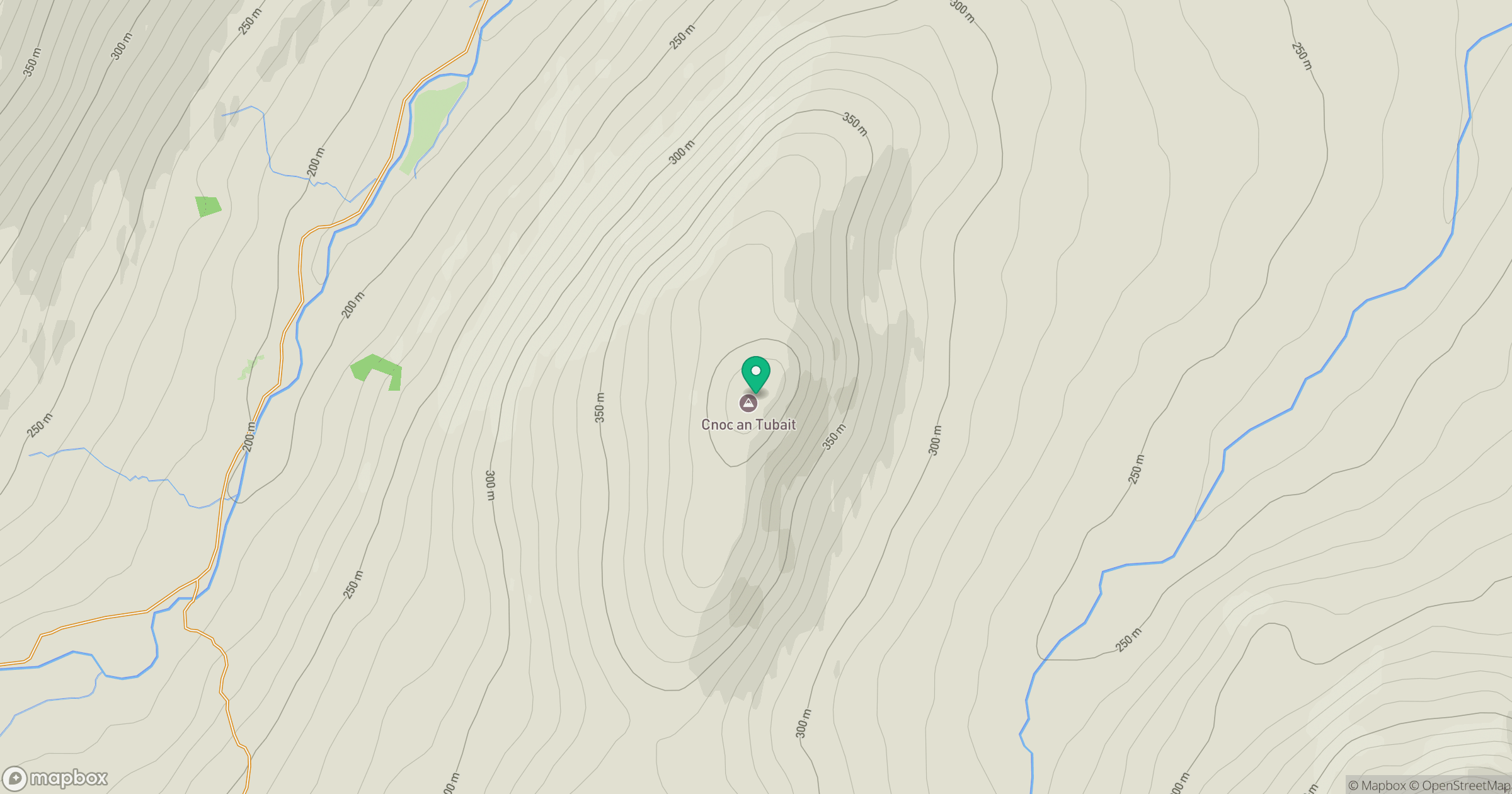
Grid reference: NH325937
View on OpenStreetMapOpens a map in a new tab, centred on the hill.
Hills within 30 km
Straight-line distance, not a walking route or confirmation of access.
No comments yet. Be the first.