

Carn a' Chnuic
Good walks are even better shared.
Overview
Carn a' Chnuic
Nestled within the stunning Scottish Highlands, Carn a' Chnuic stands tall at 712 meters. Known for its rugged granite peaks and picturesque scenery, this Munro is a formidable yet delightful challenge for hikers of varying experience levels.
Geology
The mountain's granite roots date back to the late Paleozoic era and have been sculpted by millennia of glacial activity. The result is a visually stunning landscape dotted with unique rock forms and lush greenery. So, if you're into rocks, you might say this mountain rocks!
Route
The Eastward Approach from Glen Gairn is a favourite among local hikers. This moderate route runs for about 12.5 km and generally takes around 5 hours to complete, depending on how many selfies you take at amazing views. It starts in the serene Glen Gairn, leading through a lush forest before challenging your lungs a bit on the ascent.
Summit Features
At the summit, you’ll find a prominent cairn and trig point. It’s an excellent spot for a well-deserved snack break! You might even overhear a flock of sheep chatting about their day.
Terrain
The terrain varies from rocky outcrops to soft, grassy slopes, interspersed with the occasional bog. Make sure your boots are up for the adventure, or you may find yourself stylishly covered in mud.
Views
From the top, the views are nothing short of spectacular. On a clear day, the panorama includes the Cairngorms, rolling hills of Aberdeenshire, and even the distant North Sea. For the best displays, aim for spring or early autumn—nature has a flair for the dramatic!
Hazards
While the mountain invites many to explore, be mindful of sudden weather changes and tricky terrain. A watertight jacket, sturdy boots, and a good supply of snacks are essential. Nothing ruins a hike like being underprepared and hangry!
Access
Parking is available at the end of the Glen Gairn road, which allows several cars. Public transport can drop you off in Ballater, a charming town where you can grab snacks and supplies.
Facilities
Though you won't find facilities right on the mountain, Ballater offers everything from local shops to cafes. Ideal for a little pre-hike refuelling!
History
The name Carn a' Chnuic translates loosely to 'Hill of the Little Knoll,' a modest title for a mountain of such breathtaking stature. This area is rich with history, featuring ancient paths and remnants of Neolithic settlements—perfect for those who appreciate the archaeology of our outdoor wonders.
In summary, Carn a' Chnuic is not just a hike; it's an experience that combines nature, history, and breathtaking views that will stick with you long after you've returned home. Just remember to have your camera ready, for Instagram won't update itself!
Happy hiking!
Explore routes near Carn a' Chnuic
Public walks starting within 80 km of this hill. Nearby does not mean a route reaches the summit; check its map and access before setting out.
Rothiemurchus: Beaver Trail and Lochan Mor
View route
Aviemore: Loch an Eilein and the Croft Track from Rothiemurchus
View route
Aberlour to Carron Bridge: Speyside Way riverside return
View route
Cairngorms night walk and stargazing (event meeting)
View route
Route planning notes
These notes describe possible approaches, not verified navigable routes or permission to cross land. Check current paths, local access rules and conditions before setting out.
Eastward Approach from Glen Gairn
A popular route starting from Glen Gairn, this trail meanders through lovely forestry before ascending steep terrain, rewarding hikers with panoramic views.
Make a day of it, together
Find someone to share the walk with, or organise a day out along a route you like.
Photo Gallery
View all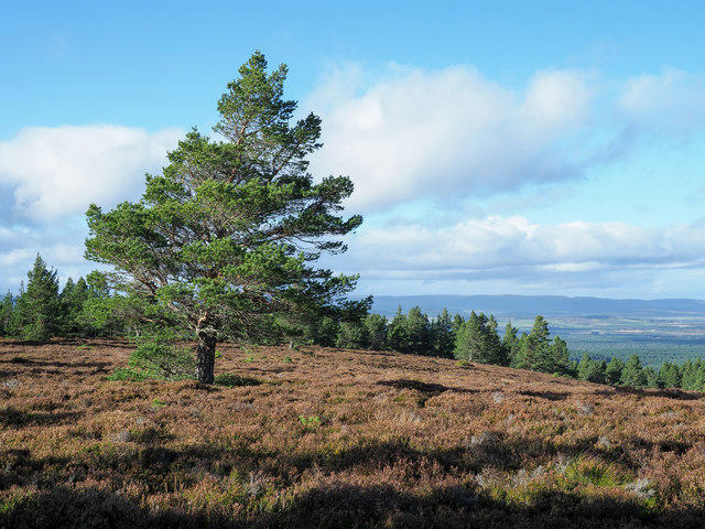 Photo could not load
NJ0314 : Scots pine near to summit of Carn a' Chnuic
Trevor Littlewood
Hill facts and local notes
Classifications
Elevation
506m
1,660 ft
Prominence
120m
Coordinates
57.2105, -3.5923
NJ039144
OS Map
36
Explorer: OL57N OL58N 403N 404N
At the Summit
The summit boasts a sizeable cairn and a trig point, where if you listen closely, you might just hear the whispers of history and a few sheep gossiping.
Terrain & Geology
Carn a' Chnuic is primarily composed of granite, dating back to the late Paleozoic era. The landscape is shaped by glacial activity, leaving behind rugged hills and deep valleys that are both beautiful and a bit cheeky in their complexity.
Views & Scenery
From the summit, you can see the breathtaking expanse of the Cairngorms, the rolling hills of Aberdeenshire, and on a clear day, the distant silhouette of the North Sea.
History & Heritage
Name Origin
The name 'Carn a' Chnuic' translates to 'Hill of the Little Knoll' in Gaelic, which might seem humble for such an impressive mountain.
Historical Significance
The area is rich in historical significance, with ancient paths and remnants of Neolithic settlements nearby, making it both a physical and cultural journey through time.
Getting There & Facilities
Check current local access restrictions, parking rules and transport timetables before travelling. These notes do not confirm public access to the summit.
Parking
The nearest parking is available at the end of the Glen Gairn road, providing ample space for several vehicles, but get there early—it's popular!
Public Transport
Bus services operate from nearby towns with the nearest stop several kilometres away; hence, a sturdy pair of legs will be necessary.
Nearby Facilities
While there are no facilities directly on the mountain, nearby Ballater offers cafes, local shops, and public toilets—a hiker's dream before scaling peaks.
Safety Information
Known Hazards
- Sudden weather changes, rough terrain, and potentially slippery slopes in wet conditions. Be sure to have appropriate gear and enough snacks to fuel an army.
General Safety Tips
- Check weather conditions before setting out
- Carry appropriate clothing and equipment
- Let someone know your planned route
- Take a map, compass, and GPS device
- Carry emergency supplies: food, water, first aid kit, torch
Hills
Some common questions about the hills answered
Are there group walks up Carn a' Chnuic?
Many walkers use Walkmates to join or organise walks with others. You can check for group walks around Carn a' Chnuic through the maps
Are there other walkers around Carn a' Chnuic?
Activity varies by location and time, but Walkmates lets you see whether others have shared walks or shown interest in this area. Find other people through the walking friends search walking friends for Carn a' Chnuic search or of course create your own walk for Carn a' Chnuic
Can I organise a walk to Carn a' Chnuic?
Yes. If there aren’t any walks listed already, you can create a walk and make it available for others to join.
If you're signed up to Walkmates, you can create a walk to Carn a' Chnuic.
How do I find a walk up this hill?
There are often multiple ways to walk this hill, depending on experience and route preference. Walkmates helps you explore walks and routes that others have shared.
Can I suggest a new route up Carn a' Chnuic?
Yes. You can suggest or create routes to share with others. Walkmates focuses on the social side of walking, so routes are used to help people organise walks and explore areas together, rather than as detailed navigation tools or route libraries.
Other uses really appreciate knowledgeable walkers sharing their routes. Share your favourite route to Carn a' Chnuic here
The is an error or something incorrect about this hill. How do I let you know?
We always strive to keep the information on Walkmates as accurate as possible. If you find an error, please let us know through the contact form and we'll aim to correct it as quickly as possible
Community Discussion
Comments
Location
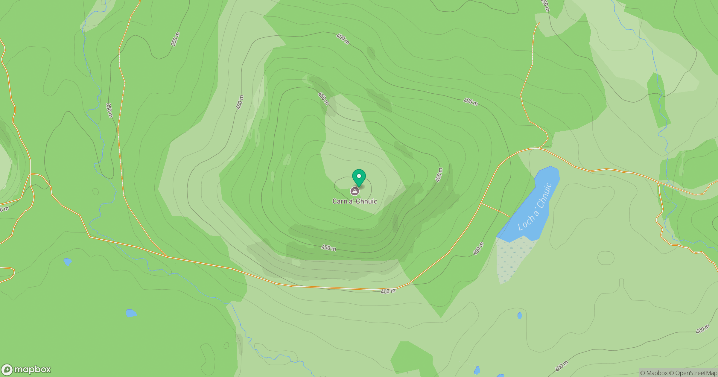
Grid reference: NJ039144
View on OpenStreetMapOpens a map in a new tab, centred on the hill.
Hills within 30 km
Straight-line distance, not a walking route or confirmation of access.
Bynack More
1,090m
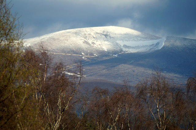
Cairn Gorm
1,245m
Beinn Mheadhoin
1,183m
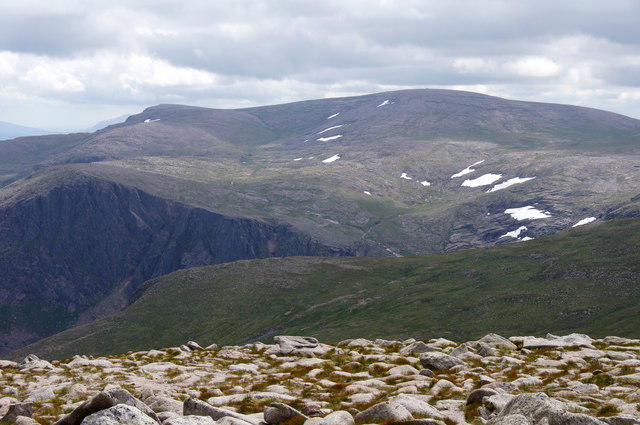
Ben Macdui [Beinn Macduibh]
1,309m
Braeriach
1,296m
No comments yet. Be the first.