
Beinn Mheadhoin
Good walks are even better shared.
Overview
Beinn Mheadhoin
Beinn Mheadhoin stands proudly at 1,182 meters, making it one of the prominent Munros in the Cairngorms National Park. With its rugged terrain and stunning viewpoints, it’s a favourite among hikers looking for a taste of Scottish wilderness.
Geology
Beinn Mheadhoin is primarily constructed of granite, a resilient rock that forms much of the Highlands. The landscape bears the marks of glacial activity, presenting captivating rock formations that tell a story of the earth's past.
Routes
The most common route up Beinn Mheadhoin begins at Derry Lodge. This moderate trek is approximately 12 kilometres round trip, taking roughly 5 hours to complete. The path meanders through beautiful scenery, giving you glimpses of the wildlife and stunning vistas on your ascent.
Summit Features
As you reach the top, you will be greeted by a sizeable stone cairn, just in case you’d like to leave your mark or a snack for the local birds. The views from the summit are breathtaking, with the expansive grey skies contrasting against the rocky landscape.
Views
From the summit, adventurers can enjoy views of Loch Avon and the surrounding mountains, including Ben Macdui, the second-highest peak in Scotland. For the best experience, aim to visit during late spring or summer, when the scenery is at its peak.
Hazards
While the charm of Beinn Mheadhoin is undeniable, hikers should be mindful of rapidly changing weather conditions. The rocky trails can become quite slippery, especially after rain.
Nearby Summits
If you’re feeling ambitious, consider tackling nearby peaks like Ben Macdui or Cairn Gorm while you’re in the area. Each offers its own unique challenges and views.
Access
Derry Lodge car park provides the nearest access point for your hike. Be prepared for potential parking shortages during busy periods; it’s often a case of first come, first served!
Facilities
Make sure you stock up on supplies in Aviemore before you head out; there’s nothing quite like a well-deserved slice of cake after a long hike. The town offers a range of amenities to ensure you have everything you need.
Conclusion
In summary, Beinn Mheadhoin is not just a peak; it’s an adventure waiting to happen, filled with stunning landscapes and memories to be made. Whether you’re a seasoned climber or a newcomer, this Munro welcomes you to explore its beauty. Just remember to take plenty of water and, if all else fails, a good sense of humour.
Explore routes near Beinn Mheadhoin
Walks starting near this hill. Open a route to check its map, distance and full itinerary.
Rothiemurchus: Beaver Trail and Lochan Mor
View route
Aviemore: Loch an Eilein and the Croft Track from Rothiemurchus
View route
Cairngorms night walk and stargazing (event meeting)
View route
Cairngorms night walk and stargazing (event meeting)
View route
Route planning notes
These notes describe possible approaches. Check a route's map and access information when planning your walk.
Derry Lodge Approach via Glen Derry
This popular route begins at the Linn of Dee car park (NO063898) and follows the track to Derry Lodge. From there, head north into Glen Derry before ascending Beinn Mheadhoin via the Coire Etchachan path. The route offers stunning views of the Cairngorms and prominent tors near the summit.
Cairngorm Traverse via Loch Avon
Starting from the Cairngorm Ski Centre (NH989060), this route takes walkers over the Cairngorm plateau, descending to Loch Avon. From there, ascend Beinn Mheadhoin’s summit plateau. This route offers dramatic scenery but requires good navigation skills, especially in poor weather.
Ben Macdui and Beinn Mheadhoin Circuit
This longer circuit combines two Munros: Ben Macdui and Beinn Mheadhoin. Starting from the Linn of Dee car park (NO063898), head via Glen Lui to Derry Lodge, then ascend Ben Macdui. From Ben Macdui, descend east to cross the plateau to Beinn Mheadhoin. Return via Glen Derry.
Loch Etchachan Direct Ascent
Begin at the Linn of Dee car park (NO063898) and follow the track through Glen Lui to Derry Lodge. From here, head towards Loch Etchachan, then make a direct ascent to Beinn Mheadhoin. This route is direct but requires stamina.
Beinn Mheadhoin via Lairig an Laoigh
This route starts from the Linn of Dee car park (NO063898) and takes walkers north through the Lairig an Laoigh pass, offering a more gradual ascent to the summit of Beinn Mheadhoin. The route provides a gentler gradient but is still lengthy.
Make a day of it, together
Find someone to share the walk with, or organise a day out along a route you like.
Hill facts and local notes
Classifications
Elevation
1,183m
3,881 ft
Prominence
254m
Coordinates
57.0959, -3.6115
NJ024016
OS Map
36
Explorer: OL57S 403S
At the Summit
The summit is adorned with a distinctive stone cairn and offers a trig point for those keen on GPS locations. On a clear day, the views will have you thinking you’ve reached the roof of Scotland!
Terrain & Geology
Primarily composed of granite, Beinn Mheadhoin features striking rock formations and notable glacial erosion patterns. The mountain showcases a classic example of the Cairngorm geology, shaped by the forces of ice over millennia.
Views & Scenery
Stunning vistas of Loch Avon, the Cairngorm plateau, and surrounding peaks including Ben Macdui. You may even spot some daredevil climbers tackling nearby cliffs.
History & Heritage
Name Origin
The name Beinn Mheadhoin translates to 'the mountain of the middle' in Gaelic, indicative of its position within the local landscape.
Historical Significance
Beinn Mheadhoin is part of the Cairngorms, which have been central to Scotland’s cultural and natural heritage, providing habitats for wildlife and inspiration for numerous folklore tales.
Getting There & Facilities
Parking
Derry Lodge car park, which is located off the A944; note that it can fill up quickly during peak season.
Public Transport
The nearest public transport connections are available in Aviemore, where you can catch local buses to Derry Lodge on certain days.
Nearby Facilities
There are no facilities directly on the mountain. However, Aviemore offers a variety of cafes, restaurants, and shops to stock up on snacks and gear before you tackle Beinn Mheadhoin.
Safety Information
Known Hazards
- Sudden weather changes are common; prepare for anything from sunshine to snow. Slippery rocks, especially in damp conditions, so tread carefully, or you may end up in a rather ungraceful slide!
General Safety Tips
- Check weather conditions before setting out
- Carry appropriate clothing and equipment
- Let someone know your planned route
- Take a map, compass, and GPS device
- Carry emergency supplies: food, water, first aid kit, torch
Hills
Some common questions about the hills answered
Are there group walks up Beinn Mheadhoin?
Many walkers use Walkmates to join or organise walks with others. You can check for group walks around Beinn Mheadhoin through the maps
Are there other walkers around Beinn Mheadhoin?
Activity varies by location and time, but Walkmates lets you see whether others have shared walks or shown interest in this area. Find other people through the walking friends search walking friends for Beinn Mheadhoin search or of course create your own walk for Beinn Mheadhoin
Can I organise a walk to Beinn Mheadhoin?
Yes. If there aren’t any walks listed already, you can create a walk and make it available for others to join.
If you're signed up to Walkmates, you can create a walk to Beinn Mheadhoin.
How do I find a walk up this hill?
There are often multiple ways to walk this hill, depending on experience and route preference. Walkmates helps you explore walks and routes that others have shared.
Can I suggest a new route up Beinn Mheadhoin?
Yes. You can suggest or create routes to share with others. Walkmates focuses on the social side of walking, so routes are used to help people organise walks and explore areas together, rather than as detailed navigation tools or route libraries.
Other uses really appreciate knowledgeable walkers sharing their routes. Share your favourite route to Beinn Mheadhoin here
The is an error or something incorrect about this hill. How do I let you know?
We always strive to keep the information on Walkmates as accurate as possible. If you find an error, please let us know through the contact form and we'll aim to correct it as quickly as possible
Community Discussion
Comments
Location
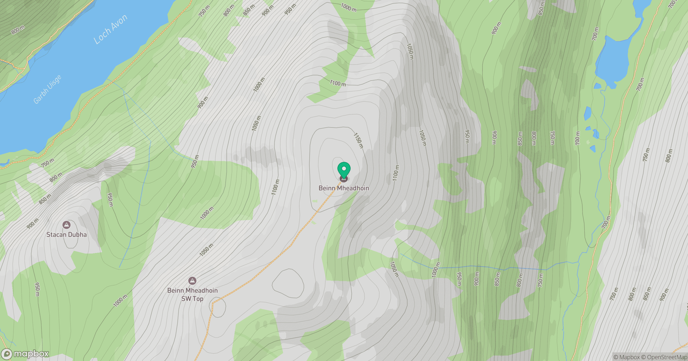
Grid reference: NJ024016
View on OpenStreetMapOpens a map in a new tab, centred on the hill.
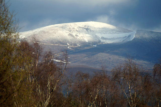
![Ben Macdui [Beinn Macduibh]](https://cdn.walkmates.com/gallery-images/e60cf32aeb394c3282fcdd14a63368f0.jpg)
No comments yet. Be the first.