

Bryn Euryn
Good walks are even better shared.
SH8379 : Bryn Euryn
Ian Capper Photo source
Overview
Bryn Euryn
Nestled within the stunning terrain of Conwy County, Bryn Euryn stands proudly with an elevation of 410 meters, offering walkers a delightful mixture of easy trails and rewarding scenery. Described as a 'Marilyn', a classification for hills with a prominence of 150 meters or more, it provides a fitting challenge even for those new to hiking.
Geology
The intriguing geology of Bryn Euryn, primarily limestone, has crafted a landscape of karst formations. The rugged rocks and limestone pavement found throughout the area serve as perfect reminders of the natural forces that shaped this extraordinary environment. Feel free to channel your inner geologist as you explore!
Popular Routes
Upper Colwyn Bay Route
A straightforward 4.5 km trail, suitable for families and casual walkers, starts in Upper Colwyn Bay. The route meanders through lush woodlands before steadily leading to the summit. It typically takes about 1.5 hours and can definitely allow for the inclusion of many photographic stops!
Llandudno Junction Approach
For those seeking a bit more of a leg stretch, the Llandudno Junction Route offers a moderate 6 km walk. With beautiful views from the start, it challenges you to earn your views a bit more, taking about 2 hours to reach the top.
Summit Features
Reaching the top, hikers will be greeted by a large stone cairn marking the official summit. The 360-degree panoramic views are nothing short of awe-inspiring; from the shimmering Conwy Bay to the solitude of the Snowdonia peaks, there’s plentiful stunning visuals for any keen photographer!
Terrain Type
The terrain is a friendly mix of grassy slopes and rocky outcrops, which ensures that the journey is accessible without excessive strain. Just keep your footing on the occasional loose gravel!
Views
The highlights of Bryn Euryn are undoubtedly the picturesque views. Not only can you see across Conwy Bay, but on particularly clear days, you may even spot the Isle of Man – though the odds of spotting it might be improved with a telescope! The best seasons for these views tend to be Spring and Autumn, with their crisp clearer skies showcasing the beauty of the region.
Hazards
As stunning as Bryn Euryn is, it’s worth noting that weather can be unpredictable. One moment the sun may be shining and the next, clouds may roll in like a bad house guest. Additionally, the paths can become slippery after rain, so sturdy footwear is recommended.
Nearby Summits
To extend your hiking adventures, nearby summits such as Penmaenhead and Conwy Mountain are only a stone's throw away and provide additional routes to explore.
Access and Facilities
Parking is available on Bryn Euryn Road, offering easy access to trails. Upper Colwyn Bay is a bustling little town with cafes, shops, and public toilets to refresh after your outdoor escapades!
History
The name 'Bryn Euryn' translates to 'Hill of Euryn' and is steeped in local legend, often tied to ancient Welsh chieftains and folklore. Its significance is captured in many stories passed down through generations, adding a touch of mystique to your hiking stories.
So, lace up your hiking boots and enjoy all that Bryn Euryn has to offer! There are many sights to see, experiences to have, and plenty of fresh air to enjoy. Who knows, you might even bump into a mountain goat or two – just remember they don't take kindly to being followed too closely!
Explore routes near Bryn Euryn
Walks starting near this hill. Open a route to check its map, distance and full itinerary.
Llyn Crafnant: Lakeside Circuit from the NRW Car Park
View route
Dyserth to Prestatyn: old railway walkway return
View route
Alwen Reservoir: full waymarked lakeside circuit
View route
Snowdon Pyg Track returning by Miner's Track
View route
Route planning notes
These notes describe possible approaches. Check a route's map and access information when planning your walk.
Upper Colwyn Bay Route
A popular trail starting from Upper Colwyn Bay leading through woodlands before ascending to the summit. Ideal for families and leisurely walks.
Llandudno Junction Approach
A slightly more challenging route that offers great views right from the start. Head up from Llandudno Junction, it rewards with panoramic views from the summit.
Make a day of it, together
Find someone to share the walk with, or organise a day out along a route you like.
Photo Gallery
View all Photo could not load
SH8379 : Bryn Euryn
Ian Capper
 Photo could not load
SH8379 : Limestone outcrop
Jonathan Wilkins
 Photo could not load
SH8379 : Geograph members on Bryn Euryn
DS Pugh
 Photo could not load
SH8379 : From Bryn Euryn towards Penrhyn
Alan Hughes
 Photo could not load
SH8379 : View from Bryn Euryn – 4
Alan Murray-Rust
 Photo could not load
SH8379 : View from Bryn Euryn – 5
Alan Murray-Rust
 Photo could not load
SH8379 : Summit: Bryn Euryn
Jim Smillie
 Photo could not load
SH8379 : Trig Point, Bryn Euryn
Chris Andrews
 Photo could not load
SH8379 : View from Bryn Euryn – 3
Alan Murray-Rust

SH8379 : Natural rock garden, Bryn Euryn
Alan Murray-Rust
Hill facts and local notes
Classifications
Elevation
131m
430 ft
Prominence
119m
Coordinates
53.3027, -3.7539
SH832798
OS Map
116
Explorer: OL17E
At the Summit
The summit is crowned with a large stone cairn and offers a breathtaking 360-degree view covering the coast, mountains, and surrounding countryside.
Terrain & Geology
The mountain is primarily composed of limestone formations, resulting in a unique karst landscape. The underlying geology also leads to the formation of interesting ridges and outcrops which can be explored.
Views & Scenery
From the summit, hikers can see the expansive Conwy Bay, the distant peaks of Snowdonia, and on clear days, even the Isle of Man!
History & Heritage
Name Origin
The name 'Bryn Euryn' translates to 'Hill of Euryn', where 'Euryn' may refer to an ancient Welsh chieftain.
Historical Significance
It holds historical significance due to its presence in local folklore and as a site of ancient settlements.
Getting There & Facilities
Parking
There is parking available at the end of Bryn Euryn Road, providing access to several trailheads.
Public Transport
Buses run regularly from Llandudno to Upper Colwyn Bay, making it fairly easy to access the starting points.
Nearby Facilities
There are several cafes and shops in Upper Colwyn Bay where you can grab a bite before or after your hike, and public toilets are available in the town as well.
Safety Information
Known Hazards
- Be aware of sudden weather changes common in the area, as well as slippery paths after rain.
General Safety Tips
- Check weather conditions before setting out
- Carry appropriate clothing and equipment
- Let someone know your planned route
- Take a map, compass, and GPS device
- Carry emergency supplies: food, water, first aid kit, torch
Hills
Some common questions about the hills answered
Are there group walks up Bryn Euryn?
Many walkers use Walkmates to join or organise walks with others. You can check for group walks around Bryn Euryn through the maps
Are there other walkers around Bryn Euryn?
Activity varies by location and time, but Walkmates lets you see whether others have shared walks or shown interest in this area. Find other people through the walking friends search walking friends for Bryn Euryn search or of course create your own walk for Bryn Euryn
Can I organise a walk to Bryn Euryn?
Yes. If there aren’t any walks listed already, you can create a walk and make it available for others to join.
If you're signed up to Walkmates, you can create a walk to Bryn Euryn.
How do I find a walk up this hill?
There are often multiple ways to walk this hill, depending on experience and route preference. Walkmates helps you explore walks and routes that others have shared.
Can I suggest a new route up Bryn Euryn?
Yes. You can suggest or create routes to share with others. Walkmates focuses on the social side of walking, so routes are used to help people organise walks and explore areas together, rather than as detailed navigation tools or route libraries.
Other uses really appreciate knowledgeable walkers sharing their routes. Share your favourite route to Bryn Euryn here
The is an error or something incorrect about this hill. How do I let you know?
We always strive to keep the information on Walkmates as accurate as possible. If you find an error, please let us know through the contact form and we'll aim to correct it as quickly as possible
Community Discussion
Comments
Location
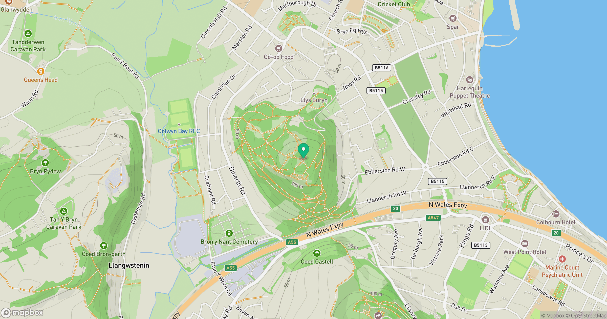
Grid reference: SH832798
View on OpenStreetMapOpens a map in a new tab, centred on the hill.
Nearby Hills
Great Orme [Y Gogarth]
207m
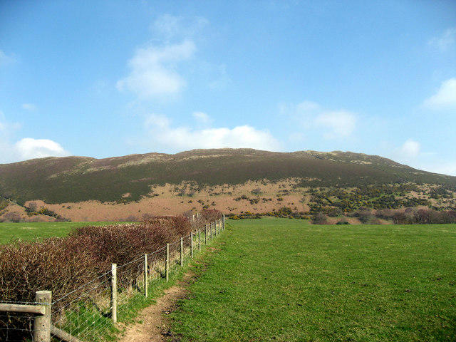
Mynydd Tryfan
402m
Carnedd Llewelyn
1,062m
Carnedd Dafydd
1,044m
Moel Siabod
872m
No comments yet. Be the first.