

Brimham Rocks
Good walks are even better shared.
SE2065 : Trig point, Brimham Rock
Philip Halling Photo source
Overview
Brimham Rocks is a 301 m gritstone-tor hill in Nidderdale, North Yorkshire, within a National Trust rock landscape. Visitor paths and moorland circuits explore its formations. The summit tor is separate from the nearby trig-bearing tor.
Brimham Rocks
Brimham Rocks is a 301 m hill within the National Trust’s gritstone landscape in Nidderdale, North Yorkshire. Its exact summit is a rock tor at SE 20594 65064. The trig-bearing tor about 15 m northeast is approximately 10 cm lower, according to the Database of British and Irish Hills.
Walking and the summit
Visitor paths offer views of the rocks without requiring a climb onto them. The routes below explore the rock landscape and do not describe a climb onto the summit tor. Rock climbing requires suitable skills and equipment.
The National Trust gives 2.08 km and 1 hour for the full return visitor circuit. It runs through the main rocks, past Brimham House, the Dancing Bear and Idol Rock, then returns beside Middle Crags. It includes rough paths, steps and drops and is unsuitable for wheelchairs, mobility scooters or prams.
A separate accessible out-and-back follows the main track and surfaced paths through the rocks. Gradients and mixed terrain still need consideration; consult the estate’s access information. The wider boundary circuit is 5.6 km, with a published time of 1.5–2 hours for the whole loop. It crosses rough, boggy moorland and returns past Druid’s Cave Farm. Follow current waymarkers and the signed bog diversion.
Geology and history
The tors are formed from Lower Brimham Grit, a Carboniferous sandstone deposited by river channels. Differences in the rock’s cementation and later weathering produced the varied shapes; freeze-thaw probably helped sculpt the tors. The eighteenth-century idea that Druids built the formations is a historical belief. Brimham House was built for visitors in 1792, and the National Trust acquired the site in October 1970.
Safety and conservation
There are sudden drops, steep slopes and slippery rocks. Supervise children closely and avoid climbing in wet conditions. Check National Trust notices and the BMC Regional Access Database for local climbing restrictions, including nesting birds. The protected rocks and moorland need care: do not damage the stone, keep dogs on short leads and do not use fires or barbecues.
Visiting
Use the main National Trust car park and check current charges and opening times. Parking is limited; keep surrounding roads and private tracks clear. A refreshment kiosk, toilets and visitor centre are available subject to opening times.
Bus 24 serves Summerbridge, with an onward road walk. Seasonal DalesBus 825 serves the entrance on its published summer Sundays and bank holiday Mondays; its advertised 2026 season ends on 18 October. Check current services and the return journey before travelling.
Explore routes near Brimham Rocks
Walks starting near this hill. Open a route to check its map, distance and full itinerary.
Fountains Abbey and Studley Royal Circular
View route
Studley Royal Deer Park and Rough Bridge
View route
Nidderdale Greenway: Ripley to Bilton Lane
View route
Ripon Walk with Men Walking & Talking
View route
Route planning notes
These notes describe possible approaches. Check a route's map and access information when planning your walk.
Brimham Rocks visitor circuit
From the main National Trust car park, follow the path through the rocks past Surprise View to Brimham House. Continue past the Dancing Bear and Idol Rock, then follow the moorland edge towards the Gorilla and return beside Middle Crags to the car park. National Trust figures for the complete return circuit are 2.08 km and 1 hour. This landscape walk does not include a summit-tor climb. Expect rough, narrow paths, steps and steep drops; this full circuit is unsuitable for wheelchairs, mobility scooters and prams.
Brimham Rocks boundary circuit
A full loop from the main car park via the Nidderdale Way, South Moor and North Moor, returning on farm tracks past Druid’s Cave Farm. National Trust distance: 5.6 km; allow its published 1.5–2 hours. Follow red waymarkers and the signed bog diversion. Includes ruts, stiles and road crossings; South Moor can be extremely boggy in winter. This circuit explores the wider moorland and woodland landscape.
Accessible main-rocks out-and-back
From the main car park, use the main vehicle track and the surfaced path branching through the rocks; return the same way. Use the National Trust visitor map and choose a turnaround that suits your access needs. Gradients and mixed surfaces can be strenuous for manual wheelchair users; watch for site vehicles. Pre-book a mobility scooter with the estate if needed. This route views the rock formations from the visitor paths.
Make a day of it, together
Find someone to share the walk with, or organise a day out along a route you like.
Photo Gallery
View all Photo could not load
SE2065 : Trig point, Brimham Rock
Philip Halling
 Photo could not load
SE2065 : Brimham House
David Dixon
 Photo could not load
SE2065 : Brimham House
DS Pugh
 Photo could not load
SE2065 : Trig Point, Brimham Rocks
Mark Anderson
 Photo could not load
SE2065 : Brimham Rocks near Summerbridge (5)
Stephen Richards
 Photo could not load
SE2065 : Brimham Rocks Flush Bracket
David Rogers
 Photo could not load
SE2065 : The 'Druid's writing desk', Brimham Rocks
Tim Heaton
 Photo could not load
SE2065 : Brimham Rocks: 'The Dancing Bear'
Michael Garlick
 Photo could not load
SE2065 : Trig point at Brimham Rocks
Bill Boaden

SE2065 : Brimham Rocks Triangulation Pillar
David Dixon
Hill facts and local notes
Classifications
Elevation
301m
988 ft
Prominence
46m
Coordinates
54.0811, -1.6867
SE205650
OS Map
99
Explorer: 298
At the Summit
The summit is the rock tor at SE 20594 65064. DoBIH records the trig-bearing tor about 15 m northeast, at SE 20604 65072, as approximately 10 cm lower. The walks listed here explore the surrounding rock landscape and do not describe an ascent of the summit tor.
Terrain & Geology
The tors are carved from Lower Brimham Grit, a coarse Carboniferous sandstone with cross-bedding formed in fast-flowing river channels. Differences in cementation and subsequent weathering produced the irregular shapes; freeze-thaw probably helped shape the tors. The rocks are natural formations.
Views & Scenery
Established viewpoints offer views over Nidderdale and the surrounding moorland. The visitor circuit also passes the Dancing Bear and Idol Rock. Keep clear of the steep drops.
History & Heritage
Name Origin
Recorded as Birnebeam in the Domesday Book. The National Trust notes that this early name suggests a wooded place.
Historical Significance
Brimham Rocks attracted eighteenth-century visitors, some of whom wrongly attributed the natural formations to Druids. Brimham House was built for visitors in 1792. The National Trust acquired Brimham Rocks in October 1970.
Getting There & Facilities
Parking
Use the main National Trust car park, HG3 4DW. Parking is limited; do not obstruct nearby roads or private tracks. Check current tariffs and closing times. Enter the vehicle registration at the machines; National Trust members must also validate their free parking.
Public Transport
Bus 24 between Harrogate and Pateley Bridge stops at Summerbridge, with a 1.5-mile one-way walk via Hartwith Bank and Brimham Rocks Road. Seasonal DalesBus 825 serves the entrance on summer Sundays and bank holiday Mondays; its published 2026 season ends 18 October. Check current timetables and the return journey.
Nearby Facilities
Refreshment kiosk, picnic benches, toilets including an accessible toilet, and a visitor centre with a second-hand bookshop. Toilets are about 550 m from the car park. Check opening times. The bookshop has no level access; mobility scooters can be pre-booked with the estate.
Safety Information
Known Hazards
- Sudden drops and steep slopes among the tors; supervise children closely
- Rocks and paths become slippery when wet; avoid wet-weather climbing
- Climbing requires appropriate skill and equipment and is separate from the visitor walks
- Rutted and boggy moorland, stiles and road crossings on the boundary circuit
- Site vehicles use the main access track
- Protect the rocks and moorland: keep dogs on short leads; no fires, barbecues or gas burners
Seasonal Hazards
South Moor on the boundary circuit can be extremely boggy in winter; follow the signed diversion and avoid impassable ground. Respect temporary climbing closures for nesting birds and check National Trust notices and the BMC access database before a climbing visit.
General Safety Tips
- Check weather conditions before setting out
- Carry appropriate clothing and equipment
- Let someone know your planned route
- Take a map, compass, and GPS device
- Carry emergency supplies: food, water, first aid kit, torch
Hills
Some common questions about the hills answered
Are there group walks up Brimham Rocks?
Many walkers use Walkmates to join or organise walks with others. You can check for group walks around Brimham Rocks through the maps
Are there other walkers around Brimham Rocks?
Activity varies by location and time, but Walkmates lets you see whether others have shared walks or shown interest in this area. Find other people through the walking friends search walking friends for Brimham Rocks search or of course create your own walk for Brimham Rocks
Can I organise a walk to Brimham Rocks?
Yes. If there aren’t any walks listed already, you can create a walk and make it available for others to join.
If you're signed up to Walkmates, you can create a walk to Brimham Rocks.
How do I find a walk up this hill?
There are often multiple ways to walk this hill, depending on experience and route preference. Walkmates helps you explore walks and routes that others have shared.
Can I suggest a new route up Brimham Rocks?
Yes. You can suggest or create routes to share with others. Walkmates focuses on the social side of walking, so routes are used to help people organise walks and explore areas together, rather than as detailed navigation tools or route libraries.
Other uses really appreciate knowledgeable walkers sharing their routes. Share your favourite route to Brimham Rocks here
The is an error or something incorrect about this hill. How do I let you know?
We always strive to keep the information on Walkmates as accurate as possible. If you find an error, please let us know through the contact form and we'll aim to correct it as quickly as possible
Community Discussion
Comments
Location
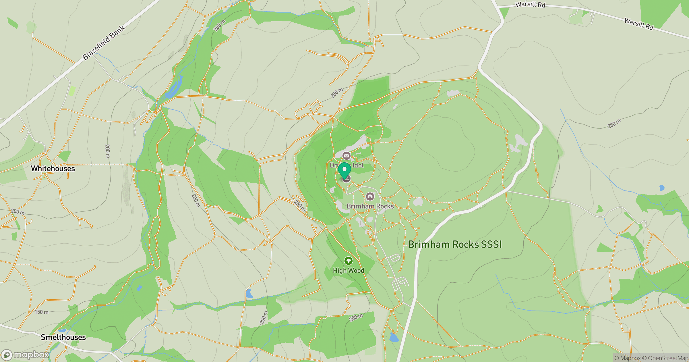
Grid reference: SE205650
View on OpenStreetMapOpens a map in a new tab, centred on the hill.
Nearby Hills
Rombalds Moor [Ilkley Moor]
402m
Buckden Pike
702m
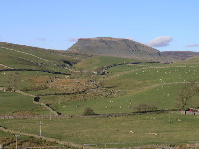
Pen-y-ghent
694m
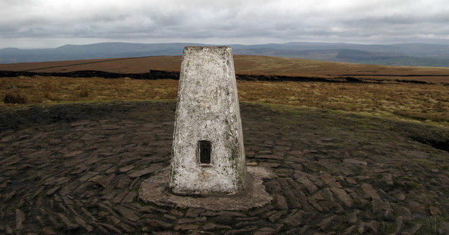
Pendle Hill
557m
Nine Standards Rigg
662m
No comments yet. Be the first.