
Box Hill
Good walks are even better shared.
Overview
Box Hill is a North Downs hill near Dorking, with chalk grassland, woodland and views over the Mole valley. Its catalogued high point is 224 m at TQ204517, east of the main National Trust visitor area. The famous Salomons Memorial viewpoint is a separate western location. Choose from short hilltop circuits, steep walks to the River Mole and longer estate hikes; the popular viewpoint walks are not verified routes to the exact catalogue summit.
Box Hill, Surrey
Box Hill brings chalk downland, woodland and the Mole valley together on the North Downs near Dorking. Choose the walk for the outing you want: a short viewpoint circuit, a descent to the river or a much more demanding loop through the estate. The National Trust’s walking guide links the marked options.
The summit and the famous viewpoint
The catalogue summit is 224 m at TQ204517, described by the Database of British and Irish Hills as a mound southwest of a water tower. It lies east of the main National Trust visitor area. The well-known Salomons Memorial viewpoint is a different place, beside the western visitor facilities. The summit should not be described as a trig point or given the viewpoint’s location. DoBIH; Salomons viewpoint location.
For the classic view, head to Salomons Memorial: the outlook crosses the Weald towards the South Downs in clear conditions. Box Hill itself belongs to the North Downs. If visiting the catalogued high point is your goal, plan that separately using a current map and confirmed public access; the estate walks below are not verified summit-bagging routes. National Trust viewpoint and route guide.
Five walks to compare
Distances, durations and grades below are the National Trust’s published figures for the named full circuits, not measurements of the old Walkmates route descriptions.
- Stepping Stones walk: 3.2 km, about 1½ hours, Moderate. A steep descent to the River Mole and an uphill return. The official route offers a footbridge alternative to the stepping stones.
- Juniper Top circular: 6.4 km, about 2 hours, Moderate. Woodland, the open top and a return through Juniper Bottom, with several steep stretches.
- The Box Hill Hike: 12.8 km, 4–6 hours, Challenging. A substantial estate circuit with repeated climbs, deep valleys and many steps.
- Hilltop stroll: 1.6 km, about 30 minutes, Easy. A short viewpoint-and-fort circuit. Roots and slopes mean the grade is not a promise of step-free access.
- Happy Valley circular: 4.32 km, about 1½ hours, Moderate. Broadwood’s Tower, a stepped descent into the valley and a return via the North Downs Way and viewpoint.
Underfoot and through the seasons
White chalk and flint underpin this landscape; thin chalk soils support the box trees that gave the hill its name. RGS landscape trail. The wider Mole Gap to Reigate Escarpment conservation area protects important box scrub, yew woodland and orchid-rich grassland. Keep to appropriate paths and leave plants undisturbed. JNCC site account.
The Juniper Top woods offer spring bluebells, while open grassland and woodland give different scenery through the year. Juniper Top trail. Chalk, mud, steps and exposed roots can be slippery after rain. Take care beside steep drops. Never cross the river on submerged or unsafe stones; check local notices and turn back if a safe crossing is unavailable.
Getting there and taking a break
The main National Trust car park and visitor facilities are up on the hill, not at its base. The visitor-centre trail start is TQ178513; the former TQ201512 parking reference did not identify it. Official trail start. Box Hill & Westhumble station is below the hill, so allow for a real uphill approach. The small Stepping Stones car park beside the A24 is a separate starting point. Parking charges and restrictions apply; use the current visitor information for travel, facilities and opening arrangements.
There are a café, servery and toilets near the main car park. Check the access guide for your chosen route: the wider hill includes steep and uneven ground. Keep dogs controlled around grazing animals, and do not light fires or barbecues.
A longstanding place for a day out
Box Hill’s popularity predates modern hiking: visitors came from Epsom in the seventeenth century, and railways later brought large numbers of day-trippers. The hill also provides the setting for a key scene in Jane Austen’s Emma. Dorking Local History Group. Near the western viewpoint, the late-Victorian fort can be viewed from outside. National Trust hilltop stroll.
Leith Hill and Holmbury Hill are other Surrey walking destinations, rather than small additions to these short Box Hill loops.
Editorial sources checked: 15 October 2026. Summit figures: DoBIH v18.6, hill 18385; source record revision 6 February 2022. Route and visitor information: National Trust. Geology and name: RGS; habitat context: JNCC; local history: Dorking Local History Group.
Explore routes near Box Hill
Walks starting near this hill. Open a route to check its map, distance and full itinerary.
Box Hill - Stepping Stones Circuit
View route
Reigate Hill B-17 Crash Site and Colley Hill
View route
Prospects of Polesden from Denbies Hillside
View route
Leith Hill: woodland circuit from Starveall Corner
View route
Route planning notes
These notes describe possible approaches. Check a route's map and access information when planning your walk.
Box Hill Stepping Stones walk (National Trust)
From the National Trust visitor centre, visit Salomons viewpoint, descend steeply to the River Mole and return via Burford Meadow, Burford Spur and the fort. Use the bridge alternative if the stepping stones are unsuitable and the bridge is open. The loop finishes back at the visitor centre.
Box Hill Juniper Top circular walk (National Trust)
Start at the National Trust visitor centre and follow the marked circuit via Salomons viewpoint, woodland and Juniper Top, returning up Juniper Bottom (Happy Valley). Expect uneven paths and several steep sections; spring bluebells are a highlight. Follow the official trail markers back to the visitor area.
The Box Hill Hike (National Trust)
A demanding estate circuit from the Shepherd’s Hut, taking in Lodge Hill, wooded valleys and the Mickleham area. Repeated steep climbs, descents and steps make this a full outing; the National Trust advises 4–6 hours. Carry suitable footwear, clothing, water and food. Follow the official map back to the visitor area.
A hilltop stroll at Box Hill (National Trust)
A short circuit from the National Trust visitor centre through Salomons viewpoint, Burford Spur and the outside of Box Hill Fort. The published grade is Easy, but roots, slopes and slippery ground still need care; it is not a guarantee of step-free access. Return to the visitor centre beside the fort.
Box Hill Happy Valley circular walk (National Trust)
From the visitor-centre area, follow the official route to Broadwood’s Tower, descend steep steps into Happy Valley and climb back towards the road. Return by the North Downs Way and Salomons viewpoint. Allow for uneven terrain and road crossings. Finish at the café and visitor area.
Make a day of it, together
Find someone to share the walk with, or organise a day out along a route you like.
Hill facts and local notes
Classifications
Elevation
224m
735 ft
Prominence
53m
Coordinates
51.2518, -0.2761
TQ204517
OS Map
187
Explorer: 146
At the Summit
The 224 m catalogue high point is a mound southwest of a water tower at TQ204517, east of the main National Trust visitor area. Salomons Memorial is the famous western viewpoint, not this summit. The catalogue does not identify a summit trig point.
Terrain & Geology
Box Hill forms part of the North Downs chalk escarpment. Its chalk accumulated from marine remains during the Cretaceous; flint also occurs in the landscape. Thin chalk soils help shape its grassland and box-and-yew woodland.
Views & Scenery
Salomons Memorial is the principal visitor viewpoint, looking over the Weald towards the South Downs in clear weather. The 224 m catalogue high point lies farther east; do not assume it has the same panorama.
Best Seasons
Spring bluebells feature along the Juniper Top woodland route. Open downland, woodland and the long view from Salomons Memorial offer different scenery through the year; visibility depends on weather.
History & Heritage
Name Origin
Named for the box trees that grow on the chalk slopes.
Historical Significance
Box Hill has attracted day-trippers for centuries and features in a key scene in Jane Austen’s Emma. Railways expanded visitor access in the nineteenth century. Leopold Salomons gave land here to the National Trust in 1914; the nearby late-Victorian fort belongs to the London defence landscape.
Getting There & Facilities
Parking
For the National Trust viewpoint walks, use the main or east hilltop car parks near the visitor facilities; the official visitor-centre trail start is TQ178513. These are above the valley, not at the base or at the 224 m catalogue summit. The small Stepping Stones car park off the A24 is a separate lower start. Check current charges, restrictions and notices with the National Trust; avoid parking on verges or obstructing access.
Public Transport
Box Hill & Westhumble station is below the hill; walking to the National Trust visitor area involves a steep climb. Dorking and Dorking Deepdene are other rail approaches. Check current train and bus services and the National Trust travel guidance before setting out; station-to-trail distances vary with the chosen route.
Nearby Facilities
Café, servery and toilets by the main National Trust car park, plus picnic space and designated accessible parking. Facilities are in the western visitor area, not at the 224 m high point. Check opening times and the route-specific access guide.
Safety Information
Known Hazards
- Slippery chalk, mud, steps and exposed roots, especially after rain
- Steep slopes and drops on escarpment paths
- River crossing hazards: avoid submerged or unsafe stepping stones and follow local notices
- Traffic at road crossings and beside the A24; use designated pedestrian routes
- Grazing livestock: keep dogs under control and follow local signs
Seasonal Hazards
Wet or wintry weather can make chalk paths, roots and steps slippery. High river levels can make stepping stones unsafe; use an open, safe bridge alternative or turn back. Do not light fires or barbecues.
General Safety Tips
- Check weather conditions before setting out
- Carry appropriate clothing and equipment
- Let someone know your planned route
- Take a map, compass, and GPS device
- Carry emergency supplies: food, water, first aid kit, torch
Hills
Some common questions about the hills answered
Are there group walks up Box Hill?
Many walkers use Walkmates to join or organise walks with others. You can check for group walks around Box Hill through the maps
Are there other walkers around Box Hill?
Activity varies by location and time, but Walkmates lets you see whether others have shared walks or shown interest in this area. Find other people through the walking friends search walking friends for Box Hill search or of course create your own walk for Box Hill
Can I organise a walk to Box Hill?
Yes. If there aren’t any walks listed already, you can create a walk and make it available for others to join.
If you're signed up to Walkmates, you can create a walk to Box Hill.
How do I find a walk up this hill?
There are often multiple ways to walk this hill, depending on experience and route preference. Walkmates helps you explore walks and routes that others have shared.
Can I suggest a new route up Box Hill?
Yes. You can suggest or create routes to share with others. Walkmates focuses on the social side of walking, so routes are used to help people organise walks and explore areas together, rather than as detailed navigation tools or route libraries.
Other uses really appreciate knowledgeable walkers sharing their routes. Share your favourite route to Box Hill here
The is an error or something incorrect about this hill. How do I let you know?
We always strive to keep the information on Walkmates as accurate as possible. If you find an error, please let us know through the contact form and we'll aim to correct it as quickly as possible
Community Discussion
Comments
Location
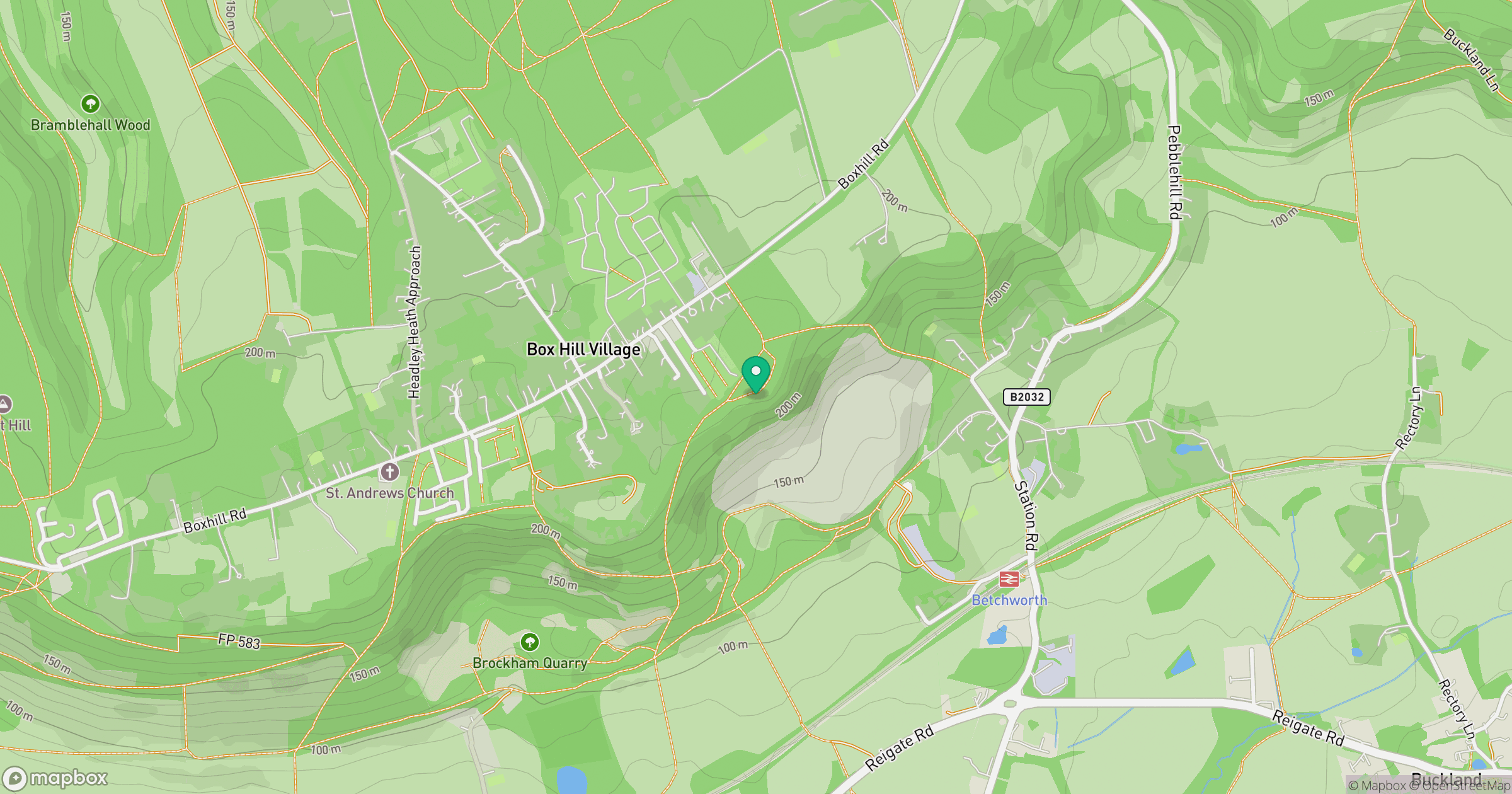
Grid reference: TQ204517
View on OpenStreetMapOpens a map in a new tab, centred on the hill.
Nearby Hills
Leith Hill
294m
Ditchling Beacon
248m
Worcestershire Beacon
425m
Glastonbury Tor
158m
The Roaches
505m
No comments yet. Be the first.