

White Top of Culreoch
Good walks are even better shared.
NX6063 : White Top of Culreoch
Richard Webb Photo source
Explore routes near White Top of Culreoch
Walks starting near this hill. Open a route to check its map, distance and full itinerary.
Threave Nature Reserve River Dee Circuit
View route
Kirkcudbright Harbour to Barrhill Woods Circuit
View route
Kirroughtree Little Bruntis Lochs and Woodland Trail
View route
Castle Douglas Carlingwark Loch and Lover’s Walk Circuit
View route
Route planning notes
These notes describe possible approaches. Check a route's map and access information when planning your walk.
Culreoch Farm Path
A scenic and well-marked trail starting from Culreoch Farm, this route meanders through picturesque pastures and ascends steadily to the summit, with opportunities to look back at the stunning countryside.
Make a day of it, together
Find someone to share the walk with, or organise a day out along a route you like.
Photo Gallery
View all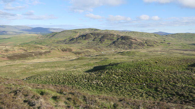 Photo could not load
NX6063 : White Top of Culreoch
Richard Webb
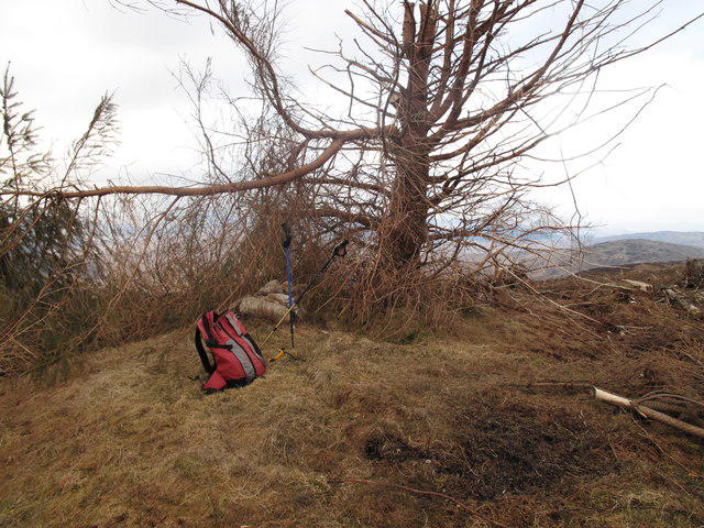 Photo could not load
NX6063 : White Top of Culreoch
Rude Health
Hill facts and local notes
Classifications
Elevation
344m
1,129 ft
Prominence
158m
Coordinates
54.9454, -4.1864
NX600633
OS Map
83
Explorer: 319
At the Summit
The summit is adorned with a prominent cairn, standing like a proud sentinel over the sprawling landscape. Those who reach the top are rewarded with a sense of accomplishment that even a bag of crisps can't match.
Terrain & Geology
The mountain is primarily composed of volcanic rock, offering a glimpse into the ancient geological activities that shaped this region. The rocky outcrops and boulder fields are a testament to the harsh weathering processes it has endured over centuries.
Views & Scenery
On a clear day, you can see the array of hills and valleys of the Southern Uplands, with the impressive Galloway Hills to the north and glimpses of the rolling landscapes of Ayrshire to the south.
History & Heritage
Name Origin
The name 'Culreoch' comes from the Gaelic 'Cuil Ruadh', meaning 'Red Corner', possibly referring to the reddish-stained rocks found in the region.
Historical Significance
This area holds historical significance, steeped in ancient tales and local folklore, drawing hikers who wish to immerse themselves in both the beauty of the landscape and its stories.
Getting There & Facilities
Parking
Culreoch Farm serves as the nearest parking location with basic facilities. It's a great spot to start your adventure once you have strapped on your best walking shoes.
Public Transport
Public transport options are limited; however, you can reach Dalmellington by bus and arrange a taxi to the farm if you’re not up for a good old-fashioned hike to the starting point.
Nearby Facilities
There are no facilities directly on the mountain, but Dalmellington has cafes and shops for those in need of a coffee or a toilet break.
Safety Information
Known Hazards
- Beware of sudden weather changes; the winds can whip up quite a storm. Also, the terrain can be slippery when wet, so it's advisable to choose your foot placements with care.
General Safety Tips
- Check weather conditions before setting out
- Carry appropriate clothing and equipment
- Let someone know your planned route
- Take a map, compass, and GPS device
- Carry emergency supplies: food, water, first aid kit, torch
Hills
Some common questions about the hills answered
Are there group walks up White Top of Culreoch?
Many walkers use Walkmates to join or organise walks with others. You can check for group walks around White Top of Culreoch through the maps
Are there other walkers around White Top of Culreoch?
Activity varies by location and time, but Walkmates lets you see whether others have shared walks or shown interest in this area. Find other people through the walking friends search walking friends for White Top of Culreoch search or of course create your own walk for White Top of Culreoch
Can I organise a walk to White Top of Culreoch?
Yes. If there aren’t any walks listed already, you can create a walk and make it available for others to join.
If you're signed up to Walkmates, you can create a walk to White Top of Culreoch.
How do I find a walk up this hill?
There are often multiple ways to walk this hill, depending on experience and route preference. Walkmates helps you explore walks and routes that others have shared.
Can I suggest a new route up White Top of Culreoch?
Yes. You can suggest or create routes to share with others. Walkmates focuses on the social side of walking, so routes are used to help people organise walks and explore areas together, rather than as detailed navigation tools or route libraries.
Other uses really appreciate knowledgeable walkers sharing their routes. Share your favourite route to White Top of Culreoch here
The is an error or something incorrect about this hill. How do I let you know?
We always strive to keep the information on Walkmates as accurate as possible. If you find an error, please let us know through the contact form and we'll aim to correct it as quickly as possible
Community Discussion
Comments
Location
View the hill's mapped position and surrounding paths.
Grid reference: NX600633
View on OpenStreetMapOpens a map in a new tab, centred on the hill.

No comments yet. Be the first.