
Binnein Mor
Good walks are even better shared.
Overview
Binnein Mor
Overview
Nestled firmly in the heart of the Scottish Highlands, Binnein Mor stands tall at 1130 meters. It is a Munro, first ascended by eager climbers thirsty for adventure. Like a grand old dame, she watches over the spectacular landscape that surrounds her.
Geology
Binnein Mor's geology is a mix of sandstone and conglomerate rocks, forming a robust base for the steep climbs and craggy outcrops that characterize this mountain. The schist that can be spotted in some areas adds to the rugged charm of the landscape. Geological formations like this are not built in a day—nature has taken its sweet time, and while you might try to race her to the top, remember: it’s about the journey, not just the summit!
Routes
The North Face Route is a direct approach that challenges even the seasoned hiker. It spans approximately 12 kilometres and often takes around 6 hours to complete, making it a good workout. For those preferring a gentler climb, the West Ridge Route offers stunning scenery without the heart-racing elevation. At about 10 kilometres and 5 hours, it's a moderate trek that allows you to soak in the beauty without gasping for breath.
Summit Features
At the pinnacle, there’s a substantial stone cairn where tired climbers can take stock and enjoy the views. If the highland winds are blowing, you might just think that cairn is waving back at you!
Terrain Type
Expect a rocky ascent that can get steep, with boggy patches in places where the moisture clings to the earth a little too eagerly. It's a great idea to wear sturdy boots—unless you fancy swimming through the mud!
Views
The summit presents a breathtaking tableau of the surrounding highland peaks, particularly the mighty Ben Nevis. Excellent visibility in spring and autumn means you can enjoy the dramatic landscape without the cloak of clouds obscuring your view.
Hazards
Remember, every rose has its thorns. The terrain can be exceptionally steep and rocky. The weather can be as fickle as a cat in water, so it’s wise to be prepared.
Access
To reach Binnein Mor, you can park at the eastern trailhead car park that's well signposted from the A82 road. Public transport is a bit sparse, but Fort William is a stone's throw away, offering a range of facilities for weary hikers.
Facilities
While the mountain itself is bereft of facilities, Fort William generously offers cafes, restaurants, and conveniences to prepare you for the adventure ahead.
History
The name 'Binnein Mor' or 'the big peak' perfectly encapsulates its towering presence. It holds significance in the hearts of climbers and adventurers who have made it part of their tales.
In conclusion, whether you're a seasoned peak-bagger or a newcomer with a sense of adventure, Binnein Mor promises a memorable day out in the sublime Scottish Highlands. So lace up those boots, pack that lunch, and don't forget your camera—you'll want to remember this one!
Explore routes near Binnein Mor
Walks starting near this hill. Open a route to check its map, distance and full itinerary.
Ben Nevis via Mountain Path
View route
Banavie to Glen Loy Aqueduct: Neptune’s Staircase Canal Towpath
View route
Fort Augustus to Kytra Lock: Caledonian Canal Towpath
View route
Killin: Falls of Dochart, Finlarig and Moirlanich Longhouse
View route
Route planning notes
These notes describe possible approaches. Check a route's map and access information when planning your walk.
North Face Route
A scenic and direct route starting from the eastern approach, taking in stunning views and challenging terrain. Ideal for those looking for a proper Highland adventure.
West Ridge Route
A less popular but equally rewarding route that meanders through picturesque glens and offers a more gradual ascent.
Make a day of it, together
Find someone to share the walk with, or organise a day out along a route you like.
Hill facts and local notes
Classifications
Elevation
1,130m
3,707 ft
Prominence
759m
Coordinates
56.7544, -4.9258
NN212663
OS Map
41
Explorer: 392
At the Summit
The summit of Binnein Mor features a distinct stone cairn and a stunning panoramic view, looking out over the Ben Nevis range and the surrounding glens. Watch out for the resident birds eyeing your lunch!
Terrain & Geology
Binnein Mor is predominantly composed of sandstone and conglomerate, with some schist present, forming a rugged landscape typical of the western Highlands. The geology contributes to the stunning cliffs and steep slopes that characterize this Munro.
Views & Scenery
From the summit, you can see the majestic Ben Nevis, the grey heights of the Mamores, and many of the nearby lochs glistening in the sunlight.
History & Heritage
Name Origin
The name 'Binnein Mor' translates from Gaelic as 'the big peak', which is pretty spot on, don't you think?
Historical Significance
The mountain is part of the rich heritage of the Scottish Highlands, attracting climbers and walkers for generations.
Getting There & Facilities
Parking
The nearest parking is at the car park located at the eastern trailhead, accessible via the A82 road.
Public Transport
There are limited public transport options, but regular bus services run between Fort William and the surrounding areas. Plan ahead!
Nearby Facilities
There are no facilities directly on the mountain, but Fort William offers numerous cafes, restaurants, and public toilets.
Safety Information
Known Hazards
- Steep and loose rocky terrain, especially on the ascents and descents. Weather can change rapidly, so be prepared for high winds and possible precipitation.
General Safety Tips
- Check weather conditions before setting out
- Carry appropriate clothing and equipment
- Let someone know your planned route
- Take a map, compass, and GPS device
- Carry emergency supplies: food, water, first aid kit, torch
Hills
Some common questions about the hills answered
Are there group walks up Binnein Mor?
Many walkers use Walkmates to join or organise walks with others. You can check for group walks around Binnein Mor through the maps
Are there other walkers around Binnein Mor?
Activity varies by location and time, but Walkmates lets you see whether others have shared walks or shown interest in this area. Find other people through the walking friends search walking friends for Binnein Mor search or of course create your own walk for Binnein Mor
Can I organise a walk to Binnein Mor?
Yes. If there aren’t any walks listed already, you can create a walk and make it available for others to join.
If you're signed up to Walkmates, you can create a walk to Binnein Mor.
How do I find a walk up this hill?
There are often multiple ways to walk this hill, depending on experience and route preference. Walkmates helps you explore walks and routes that others have shared.
Can I suggest a new route up Binnein Mor?
Yes. You can suggest or create routes to share with others. Walkmates focuses on the social side of walking, so routes are used to help people organise walks and explore areas together, rather than as detailed navigation tools or route libraries.
Other uses really appreciate knowledgeable walkers sharing their routes. Share your favourite route to Binnein Mor here
The is an error or something incorrect about this hill. How do I let you know?
We always strive to keep the information on Walkmates as accurate as possible. If you find an error, please let us know through the contact form and we'll aim to correct it as quickly as possible
Community Discussion
Comments
Location
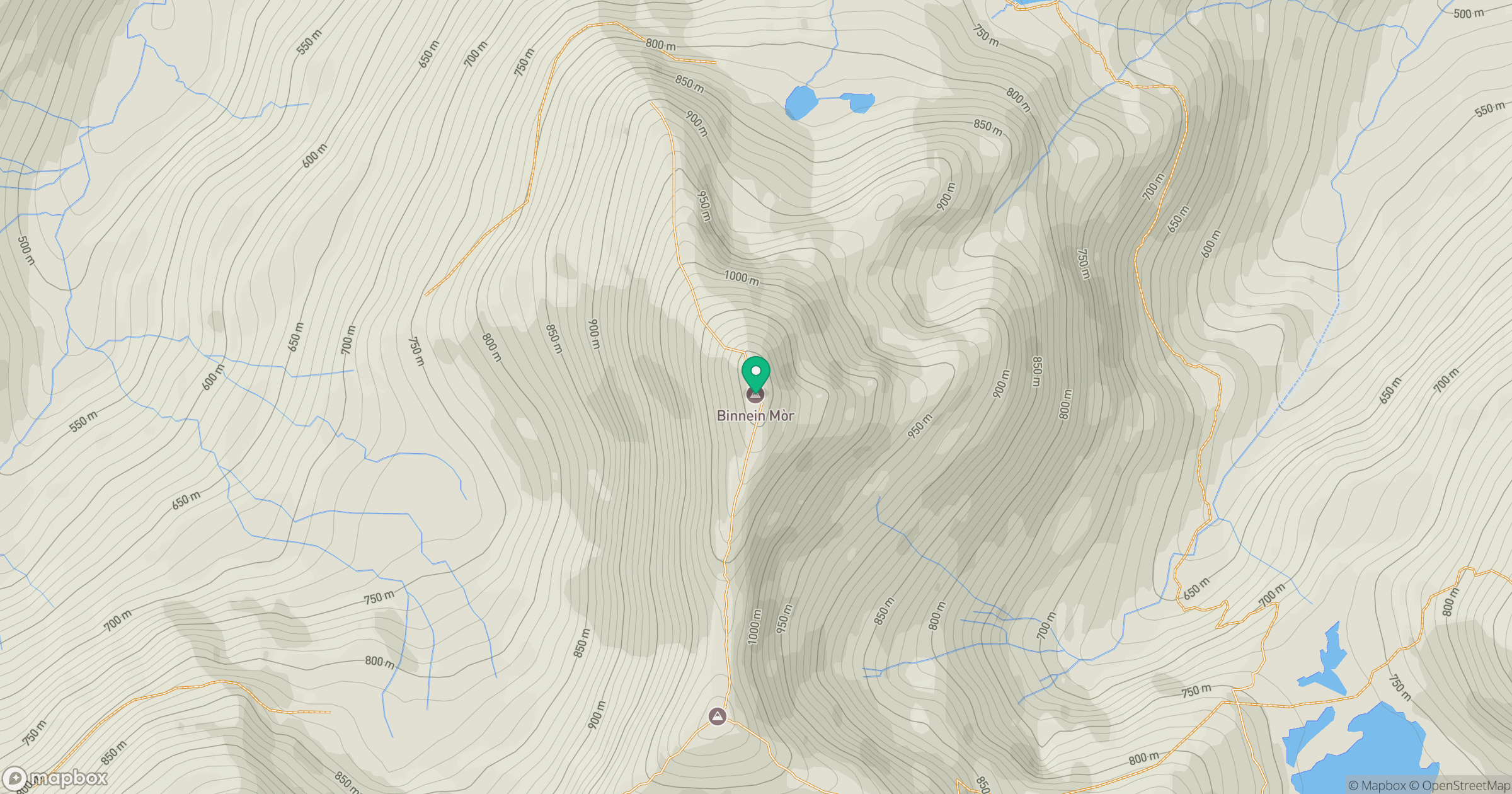
Grid reference: NN212663
View on OpenStreetMapOpens a map in a new tab, centred on the hill.
No comments yet. Be the first.