

Creag an t-Sithein
Good walks are even better shared.
Overview
Creag an t-Sithein: A Hidden Gem in the Highlands
Nestled among the majestic peaks of the Scottish Highlands, Creag an t-Sithein is a treat for both novice hikers and seasoned trekkers alike. Standing at an impressive 450 meters, this Hewitt offers a rewarding ascent with views that are bound to make even the most stoic adventurer crack a smile.
Geology
The granite of Creag an t-Sithein provides a sturdy base, with striking contrasts to the schist and gneiss that dominate the surrounding hills. Walking on this ancient bedrock lets you feel the history underfoot, but mind the occasional loose stone that may have a mind of its own.
Routes
The most popular route is from Inversnaid, a picturesque starting point just a stone's throw away from Loch Lomond. The path winds through verdant woodlands, beckoning you to explore deeper into the Highland wilderness before leading to the rocky summit. This route generally takes around 2.5 hours, providing a good blend of challenge without being overly taxing.
Summit Features
As you reach the top, you’ll be greeted by a charming stone cairn—a traditional sign of reaching the pinnacle—along with stunning views that stretch across the horizon. Ensure your camera is at the ready!
Terrain
While the ascent is generally manageable, expect a mix of rocky outcrops and the occasional boggy patch; good footwear is your best friend here. The terrain provides varying conditions, promising a rich experience with nature.
Views
From the summit, behold the expansive vistas over Loch Lomond and beyond to the towering silhouette of Ben Lomond. There’s a reason they say the best views are often reserved for those who venture off the beaten path!
Hazards
Not everything is sunny skies, however. The rocky nature of the climb can be slippery, especially in wet weather, so it’s advisable to tread carefully. And remember, the Scottish weather is as unpredictable as a cat on a hot tin roof!
Access
You can conveniently park at the Inversnaid car park, which is a short, scenic drive from the A82. With limited public transport options available, it is recommended to plan ahead, especially if you fancy a pint after your hike in the nearest village.
Facilities
Facilities in the nearby village of Inversnaid are modest, with a café perfect for recharging post-hike. Don't forget to visit the toilet before you head off, unless you're hoping to take an unscheduled detour!
Conclusion
Creag an t-Sithein is a splendid micro-adventure waiting to be had, where history, culture, and stunning natural beauty converge. Whether it's a leisurely day hike or part of a grander exploration of the Highlands, this hill is sure to capture your heart.
Happy hiking!
Explore routes near Creag an t-Sithein
Public walks starting within 80 km of this hill. Nearby does not mean a route reaches the summit; check its map and access before setting out.
Glen Banvie Trail with the Bruar viewpoint
View route
Aberfeldy: Glassie Woodland and River Tay Circular
View route
Unled club outing: Glenesk (coach departure)
View route
Unled club outing: Xmas Walk - Bankfoot - Dunkeld (coach departure)
View route
Route planning notes
These notes describe possible approaches, not verified navigable routes or permission to cross land. Check current paths, local access rules and conditions before setting out.
Access Route from Inversnaid
A scenic hike starting from Inversnaid, winding through lush woodlands before ascending onto the rocky outcrops of Creag an t-Sithein.
Make a day of it, together
Find someone to share the walk with, or organise a day out along a route you like.
Photo Gallery
View all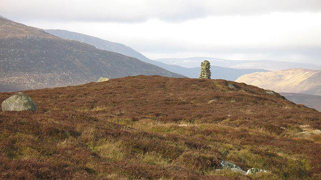 Photo could not load
NO0365 : Stone man on Creag an t-Sìthein
Richard Webb
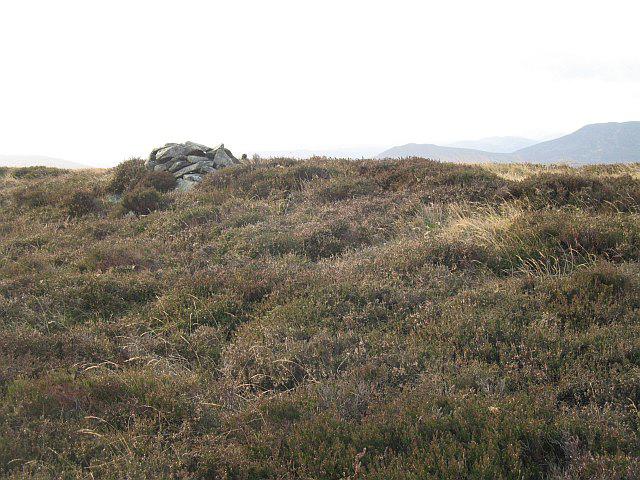 Photo could not load
NO0365 : Summit, Creag an t-Sìthein
Richard Webb
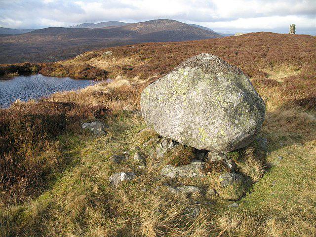 Photo could not load
NO0365 : Erratic, Creag an t-Sìthein
Richard Webb
Hill facts and local notes
Classifications
Elevation
634m
2,081 ft
Prominence
148m
Coordinates
56.7740, -3.5858
NO031658
OS Map
43
Explorer: OL52S 387S
At the Summit
The summit features a small stone cairn and offers a breathtaking panoramic view of the surrounding roll of the Highlands, perfect for a selfie or two!
Terrain & Geology
Creag an t-Sithein is primarily composed of granitic rock, providing a solid and reliable footing for hikers. The surrounding hills showcase a fascinating variety of schist and gneiss, reflecting the ancient geological processes that shaped this landscape.
Views & Scenery
Views of Loch Lomond, Ben Lomond, and the towering peaks of the Trossachs National Park are visible from the summit.
History & Heritage
Name Origin
The name 'Creag an t-Sithein' translates to 'rock of the fairy hill', reflecting its significance in local folklore.
Historical Significance
The area is rich in myths, particularly those related to the faeries said to inhabit the hills around Loch Lomond.
Getting There & Facilities
Check current local access restrictions, parking rules and transport timetables before travelling. These notes do not confirm public access to the summit.
Parking
Inversnaid car park, which has space for approximately 20 vehicles and is located just off the A82. A small charge may apply.
Public Transport
The nearest train station is at Balloch, from where you can catch a bus (No. 309) to Inversnaid.
Nearby Facilities
There are limited facilities in Inversnaid, including a small café and public toilets, but best to stock up on supplies beforehand.
Safety Information
Known Hazards
- Rocky terrain can be slippery, especially in wet conditions. Watch for loose stones, and keep an eye out for sudden weather changes.
General Safety Tips
- Check weather conditions before setting out
- Carry appropriate clothing and equipment
- Let someone know your planned route
- Take a map, compass, and GPS device
- Carry emergency supplies: food, water, first aid kit, torch
Hills
Some common questions about the hills answered
Are there group walks up Creag an t-Sithein?
Many walkers use Walkmates to join or organise walks with others. You can check for group walks around Creag an t-Sithein through the maps
Are there other walkers around Creag an t-Sithein?
Activity varies by location and time, but Walkmates lets you see whether others have shared walks or shown interest in this area. Find other people through the walking friends search walking friends for Creag an t-Sithein search or of course create your own walk for Creag an t-Sithein
Can I organise a walk to Creag an t-Sithein?
Yes. If there aren’t any walks listed already, you can create a walk and make it available for others to join.
If you're signed up to Walkmates, you can create a walk to Creag an t-Sithein.
How do I find a walk up this hill?
There are often multiple ways to walk this hill, depending on experience and route preference. Walkmates helps you explore walks and routes that others have shared.
Can I suggest a new route up Creag an t-Sithein?
Yes. You can suggest or create routes to share with others. Walkmates focuses on the social side of walking, so routes are used to help people organise walks and explore areas together, rather than as detailed navigation tools or route libraries.
Other uses really appreciate knowledgeable walkers sharing their routes. Share your favourite route to Creag an t-Sithein here
The is an error or something incorrect about this hill. How do I let you know?
We always strive to keep the information on Walkmates as accurate as possible. If you find an error, please let us know through the contact form and we'll aim to correct it as quickly as possible
Community Discussion
Comments
Location
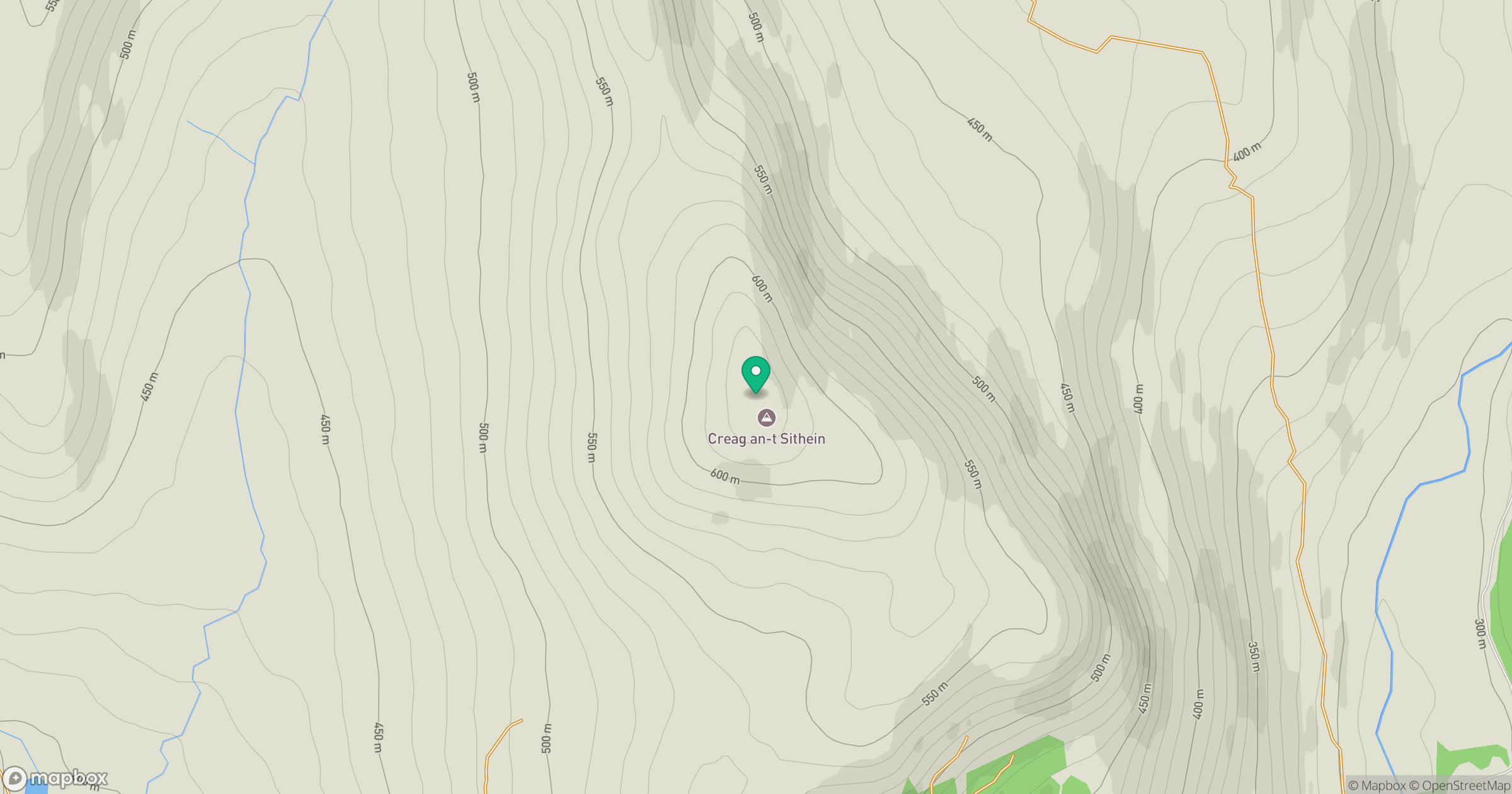
Grid reference: NO031658
View on OpenStreetMapOpens a map in a new tab, centred on the hill.
Hills within 30 km
Straight-line distance, not a walking route or confirmation of access.
Beinn a' Ghlo - Carn nan Gabhar
1,122m
Beinn a' Ghlo - Braigh Coire Chruinn-bhalgain
1,070m
Beinn a' Ghlo - Carn Liath
976m
Lochnagar - Cac Carn Beag
1,156m
Driesh
948m
No comments yet. Be the first.