

Beinn Talaidh
Good walks are even better shared.
NM6234 : Ben More from Beinn Talaidh
Reed Sadler Photo source
Overview
Beinn Talaidh
Overview
Beinn Talaidh, standing proud at 774 meters, is a noticeable hill in the Scottish Highlands, specifically the Inner Hebrides. Known for its stunning vistas and variety of wildlife, it's an excellent destination for hikers and outdoor enthusiasts alike.
Geology
The mountain is formed from schist and gneiss, revealing the ages of geological transformation that have sculpted the area. The rocky outcrops along the ascent make for interesting navigation while providing a scenic backdrop.
Routes
From the A846
This route is a direct ascent from the A846, offering a moderate challenge and an exhilarating sense of achievement at the top. At approximately 6.5 km, it's manageable in about 3.5 hours. Bring along a sandwich, because you'll want to bask in the views at the summit!
Summit Features
Upon reaching the summit, you'll be greeted by a well-constructed cairn, a sturdy reminder of paths trodden before you. The views from here are nothing short of spectacular, giving you a perfect place to sip a cuppa and contemplate life’s mysteries.
Terrain Type
Expect a variety of terrains ranging from rocky outcrops to grassy hillsides, with a sprinkling of boggy patches to keep you on your toes. Good hiking boots are essential!
Views
The panorama at Beinn Talaidh is one that leaves a lasting impression. Notable sights include the islands of Mull and Iona, contrasting harmoniously with the deep blue of the surrounding waters. The best time for these views is during the spring and summer months when visibility is at its peak.
Hazards
As with many Highland hikes, be cautious of the boggy areas. Also, the famous Scottish weather can shift with little warning, so it's wise to pack a waterproof jacket just in case it decides to rain its socks off!
Nearby Summits
- Ben More (966 meters)
- Ben Cruchan (816 meters)
These neighbouring peaks offer additional adventures and are well worth a visit.
Access
For those driving, you'll find parking at a small lay-by on the A846 at NM628348, where you can prepare for your hike.
Public transport options are a wee bit limited, with bus services from Bunessan during the tourist season. It’s advisable to plan accordingly.
Facilities
Although the mountain itself has no facilities, don’t fret! Bunessan is just a short drive away and has a shop for those last-minute ice cream cravings and a lovely café to refuel.
History
The name Beinn Talaidh hints at its rich past and relationship with the Gaelic language. Its cultural significance is deeply rooted in the scenic beauty that has inspired countless poets and artists over the years.
Conclusion
For those looking to stretch their legs and indulge in nature’s beauty, Beinn Talaidh offers a welcoming adventure. Just remember: take lots of photographs as the views might just leave you speechless!
Explore routes near Beinn Talaidh
Walks starting near this hill. Open a route to check its map, distance and full itinerary.
Crinan Canal: Bellanoch and Dunardry towpath return
View route
Ben Nevis via Mountain Path
View route
Banavie to Glen Loy Aqueduct: Neptune’s Staircase Canal Towpath
View route
Beinn Ime from Succoth
View route
Route planning notes
These notes describe possible approaches. Check a route's map and access information when planning your walk.
From the A846
A direct ascent from the road provides an excellent route that showcases diverse terrain and breathtaking scenery.
Make a day of it, together
Find someone to share the walk with, or organise a day out along a route you like.
Photo Gallery
View all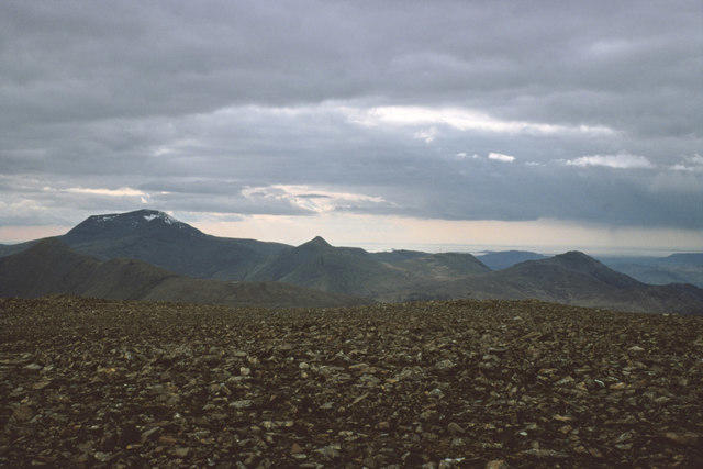 Photo could not load
NM6234 : Ben More from Beinn Talaidh
Reed Sadler
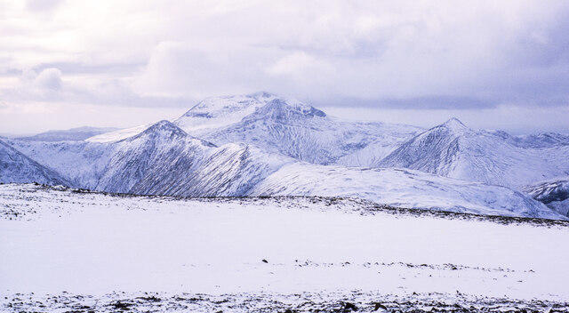 Photo could not load
NM6234 : Snow cover at summit of Beinn Talaidh
Trevor Littlewood
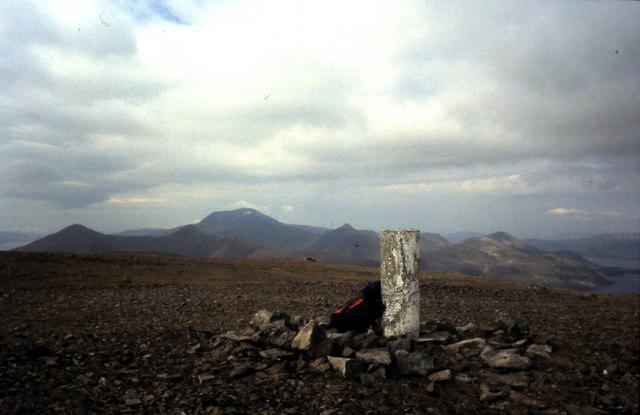 Photo could not load
NM6234 : Summit Plateau Beinn Talaidh
ronnie leask
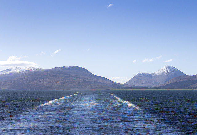 Photo could not load
NM6234 : View towards Ben Talaidh
William Starkey
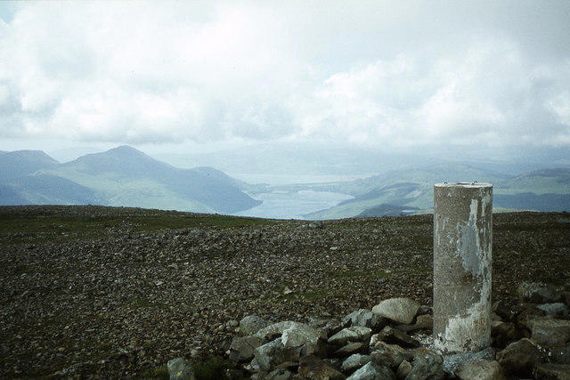 Photo could not load
NM6234 : Trig point on Beinn Talaidh with view towards Loch Ba
Colin Park
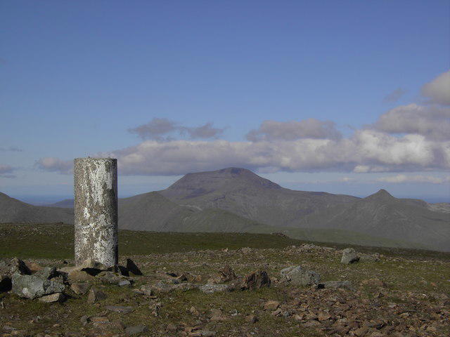 Photo could not load
NM6234 : Beinn Talaidh Summit
Colin Kinnear
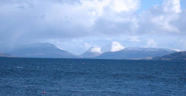 Photo could not load
NM6234 : Distant view of Beinn Talaidh
Gordon Hatton
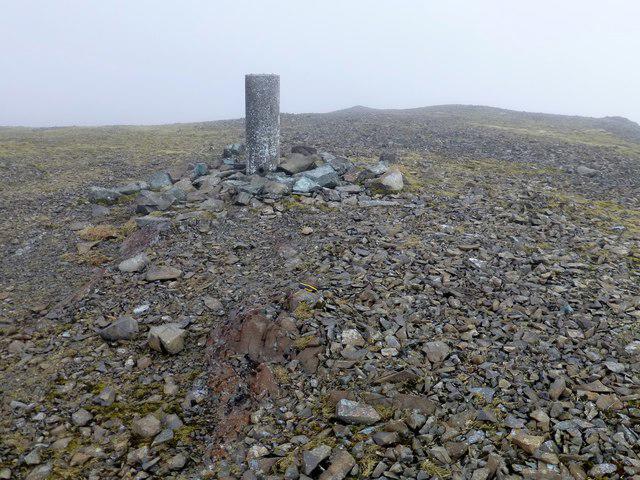 Photo could not load
NM6234 : Beinn Talaidh
Rude Health
Hill facts and local notes
Classifications
Elevation
762m
2,499 ft
Prominence
430m
Coordinates
56.4446, -5.8543
NM625347
OS Map
49
Explorer: 375E
At the Summit
The summit features a prominent cairn that provides a perfect spot for a well-deserved snack and stunning panoramic views of the surrounding landscapes.
Terrain & Geology
Beinn Talaidh is primarily composed of schist and gneiss, with spectacular outcrops visible on the ascent. The rugged geology contributes to the striking landscape typical of the Highland region.
Views & Scenery
From the summit, hikers can enjoy views of the nearby islands of Mull and Iona, as well as the rugged coastline of the Inner Hebrides.
History & Heritage
Name Origin
The name Beinn Talaidh may derive from the Gaelic 'Beinn' meaning 'mountain' and 'Talaidh' could refer to a particular feature or characteristic of the hill.
Historical Significance
Beinn Talaidh is part of the scenic landscape that has inspired many poets and artists, adding to the rich cultural heritage of the region.
Getting There & Facilities
Parking
There is a small lay-by along the A846 at NM628348, providing convenient parking for hikers. It's advisable to arrive early as spaces can fill up quickly.
Public Transport
The nearest bus service operates from the village of Bunessan to the lay-by during tourist season, but services are limited.
Nearby Facilities
There are no facilities directly on the mountain, but Bunessan has a shop and café for pre and post-hike refreshments.
Safety Information
Known Hazards
- Wet and boggy sections can be a tripping hazard. Watch out for sudden weather changes, which can reduce visibility.
General Safety Tips
- Check weather conditions before setting out
- Carry appropriate clothing and equipment
- Let someone know your planned route
- Take a map, compass, and GPS device
- Carry emergency supplies: food, water, first aid kit, torch
Hills
Some common questions about the hills answered
Are there group walks up Beinn Talaidh?
Many walkers use Walkmates to join or organise walks with others. You can check for group walks around Beinn Talaidh through the maps
Are there other walkers around Beinn Talaidh?
Activity varies by location and time, but Walkmates lets you see whether others have shared walks or shown interest in this area. Find other people through the walking friends search walking friends for Beinn Talaidh search or of course create your own walk for Beinn Talaidh
Can I organise a walk to Beinn Talaidh?
Yes. If there aren’t any walks listed already, you can create a walk and make it available for others to join.
If you're signed up to Walkmates, you can create a walk to Beinn Talaidh.
How do I find a walk up this hill?
There are often multiple ways to walk this hill, depending on experience and route preference. Walkmates helps you explore walks and routes that others have shared.
Can I suggest a new route up Beinn Talaidh?
Yes. You can suggest or create routes to share with others. Walkmates focuses on the social side of walking, so routes are used to help people organise walks and explore areas together, rather than as detailed navigation tools or route libraries.
Other uses really appreciate knowledgeable walkers sharing their routes. Share your favourite route to Beinn Talaidh here
The is an error or something incorrect about this hill. How do I let you know?
We always strive to keep the information on Walkmates as accurate as possible. If you find an error, please let us know through the contact form and we'll aim to correct it as quickly as possible
Community Discussion
Comments
Location
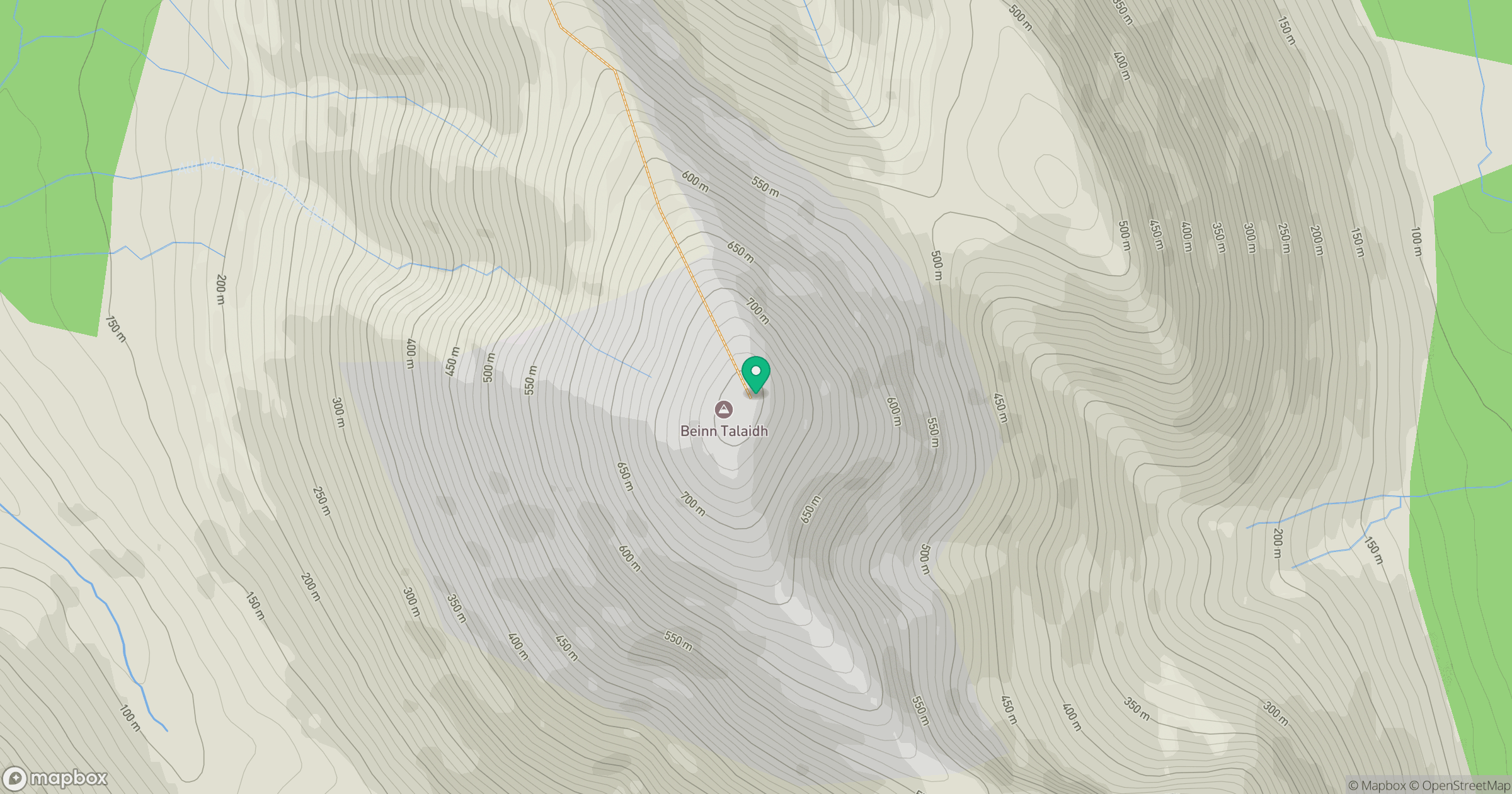
Grid reference: NM625347
View on OpenStreetMapOpens a map in a new tab, centred on the hill.
No comments yet. Be the first.