

Beinn na Cille
Good walks are even better shared.
NM8554 : Fogbow and Brocken spectre, Beinn na Cille
Jim Barton Photo source
Overview
Beinn na Cille
Overview
Beinn na Cille is a delightful Marilyn located in the stunning Scottish Highlands. Standing at 674 meters and showcasing a prominent prominence of 184 meters, this mountain offers an exhilarating challenge wrapped in breathtaking views.
Geology
The geological makeup of Beinn na Cille is primarily of schists and gneisses. These ancient rocks tell the tale of geological tumult, having formed during the Caledonian orogeny. As a result, you're not just hiking; you're walking through history! Be sure to take a glance at the rock formations, which serve as a reminder of the powerful forces that shaped them over millennia.
Routes
The most favoured route begins from the North West Ridge. This moderate ascent covers a distance of 6.5 km and typically takes about 3.5 hours to complete. As you ascend, keep your eyes peeled for lovely vistas unfolding before you. Who knew hiking could come with such great views?
Summit Features
At the summit, you will find a sturdy cairn, perhaps built by prior adventurers hoping to leave their mark. It’s a fantastic spot to catch your breath and enjoy a picnic while soaking in the panorama. Just be mindful of the steep edges if you’re planning to do a jig.
Terrain Type
Expect a rocky terrain with patches of grass and heath. This varied landscape makes each step a new experience, so make sure to wear sturdy footwear.
Views
From the summit, you can feast your eyes on the shimmering waters of Loch Nedd, the rugged coast of the Isle of Skye, and the majestic peaks of Harris in the distance. Late spring and early autumn are the best seasons for these views, as the weather is generally kinder and the pesky midges are less prevalent.
Hazards
Don't let the beauty distract you entirely; rocky terrain can be slippery when wet, and Highland weather can be as temperamental as a cat in a bathtub. Always check the forecast and be prepared for a surprise downpour!
Nearby Summits
You are never alone in the Highlands! Nearby mountains include Beinn Tharsuin and Beinn a'Chlaidheimh, both worth exploring if you have the time to spare.
Access
The nearest parking can be found at NM848535. Pack your patience; it’s a limited spot, so early birds are often the lucky ones. If you’re relying on public transport, buses operate from Acharacle to nearby locations, but a car is the most convenient way to access the trailhead.
Facilities
While there are no facilities on the mountain itself, you can find a small shop and public toilets in Acharacle. Swing by the local café for a warming hot drink after your adventure; you'll certainly deserve it!
History
The name Beinn na Cille translates to 'Hill of the Cell,' hinting at its historical significance as a site for early Christian gatherings. Reflecting on this history as you hike can add an extra layer of depth to your experience.
In summary, Beinn na Cille offers a well-rounded package for the hiker looking for both adventure and enlightenment. So lace up those boots and get trekking!
Explore routes near Beinn na Cille
Walks starting near this hill. Open a route to check its map, distance and full itinerary.
Ben Nevis via Mountain Path
View route
Banavie to Glen Loy Aqueduct: Neptune’s Staircase Canal Towpath
View route
Crinan Canal: Bellanoch and Dunardry towpath return
View route
Beinn Ime from Succoth
View route
Route planning notes
These notes describe possible approaches. Check a route's map and access information when planning your walk.
North West Ridge
An engaging ascent that brings adventurers up through rocky terrain with stunning views developing along the way.
Make a day of it, together
Find someone to share the walk with, or organise a day out along a route you like.
Photo Gallery
View all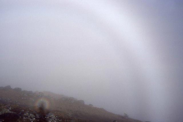 Photo could not load
NM8554 : Fogbow and Brocken spectre, Beinn na Cille
Jim Barton
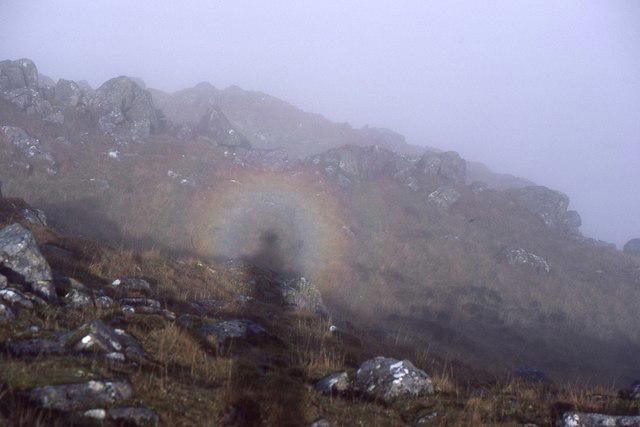 Photo could not load
NM8554 : Brocken spectre, Beinn na Cille
Jim Barton
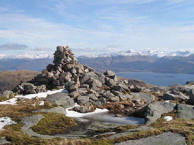 Photo could not load
NM8554 : Cairn, Beinn na Cille
Richard Webb
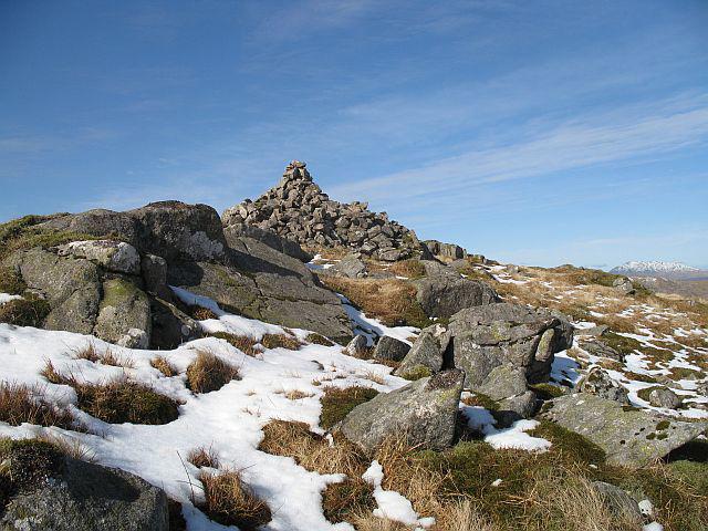 Photo could not load
NM8554 : Cairn, Beinn na Cille
Richard Webb
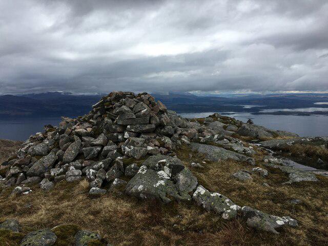 Photo could not load
NM8554 : Cairn on Beinn na Cille
Steven Brown
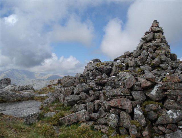 Photo could not load
NM8554 : Summit of Beinn na Cille
Tony Kinghorn
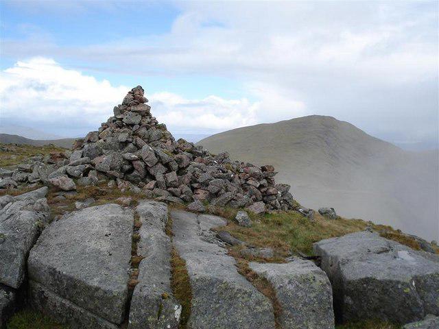 Photo could not load
NM8554 : Summit Cairn, Beinn na Cille
Tony Kinghorn
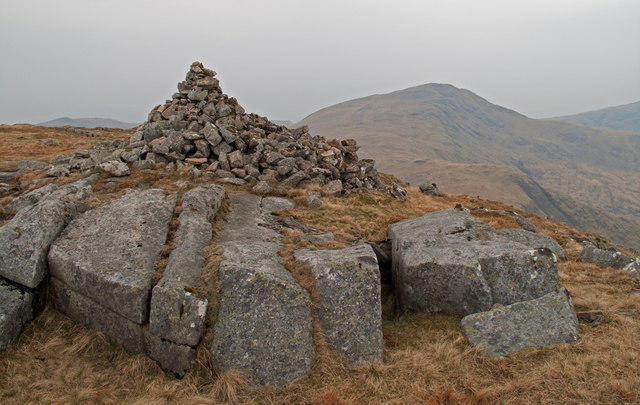 Photo could not load
NM8554 : Summit area and cairn of Beinn na Cille
Trevor Littlewood
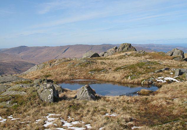 Photo could not load
NM8554 : Beinn na Cille
Richard Webb
Hill facts and local notes
Classifications
Elevation
652m
2,139 ft
Prominence
193m
Coordinates
56.6305, -5.5005
NM853542
OS Map
49
Explorer: 376 383E
At the Summit
The summit features a prominent cairn and a lovely flat area ideal for a well-deserved breather and a scenic picnic. Be cautious, though; the edges can be steep!
Terrain & Geology
Beinn na Cille primarily consists of rugged schists and gneisses, characteristically formed during the Caledonian orogeny. The rock formations illustrate a fascinating geological history shaped by glaciation, making it a great spot for geological enthusiasts.
Views & Scenery
Spectacular views of Loch Nedd, the rugged coastline of the Isle of Skye, and the distant peaks of the Harris mountains.
History & Heritage
Name Origin
Beinn na Cille translates to 'Hill of the Cell' in Scots Gaelic, reflecting its historical significance as a site with early Christian connections.
Historical Significance
This mountain holds cultural significance as a place of pilgrimage, where spiritual seekers would gather, adding a mystical quality to your hike.
Getting There & Facilities
Parking
There is a small parking area at NM848535, approximately 2 km from the start of the trail. Spaces are limited, so arrive early.
Public Transport
The nearest public transport options can be found in the village of Acharacle, where buses run to nearby locations. However, a vehicle is recommended for accessing the trailhead.
Nearby Facilities
Acharacle offers basic amenities including a small shop and public toilets. For something to warm your soul, pop into the local café for a steaming cuppa.
Safety Information
Known Hazards
- Rocky terrain can be slippery when wet, and visibility can drop rapidly in fog. Be prepared for sudden weather changes typical of the Highlands.
General Safety Tips
- Check weather conditions before setting out
- Carry appropriate clothing and equipment
- Let someone know your planned route
- Take a map, compass, and GPS device
- Carry emergency supplies: food, water, first aid kit, torch
Hills
Some common questions about the hills answered
Are there group walks up Beinn na Cille?
Many walkers use Walkmates to join or organise walks with others. You can check for group walks around Beinn na Cille through the maps
Are there other walkers around Beinn na Cille?
Activity varies by location and time, but Walkmates lets you see whether others have shared walks or shown interest in this area. Find other people through the walking friends search walking friends for Beinn na Cille search or of course create your own walk for Beinn na Cille
Can I organise a walk to Beinn na Cille?
Yes. If there aren’t any walks listed already, you can create a walk and make it available for others to join.
If you're signed up to Walkmates, you can create a walk to Beinn na Cille.
How do I find a walk up this hill?
There are often multiple ways to walk this hill, depending on experience and route preference. Walkmates helps you explore walks and routes that others have shared.
Can I suggest a new route up Beinn na Cille?
Yes. You can suggest or create routes to share with others. Walkmates focuses on the social side of walking, so routes are used to help people organise walks and explore areas together, rather than as detailed navigation tools or route libraries.
Other uses really appreciate knowledgeable walkers sharing their routes. Share your favourite route to Beinn na Cille here
The is an error or something incorrect about this hill. How do I let you know?
We always strive to keep the information on Walkmates as accurate as possible. If you find an error, please let us know through the contact form and we'll aim to correct it as quickly as possible
Community Discussion
Comments
Location
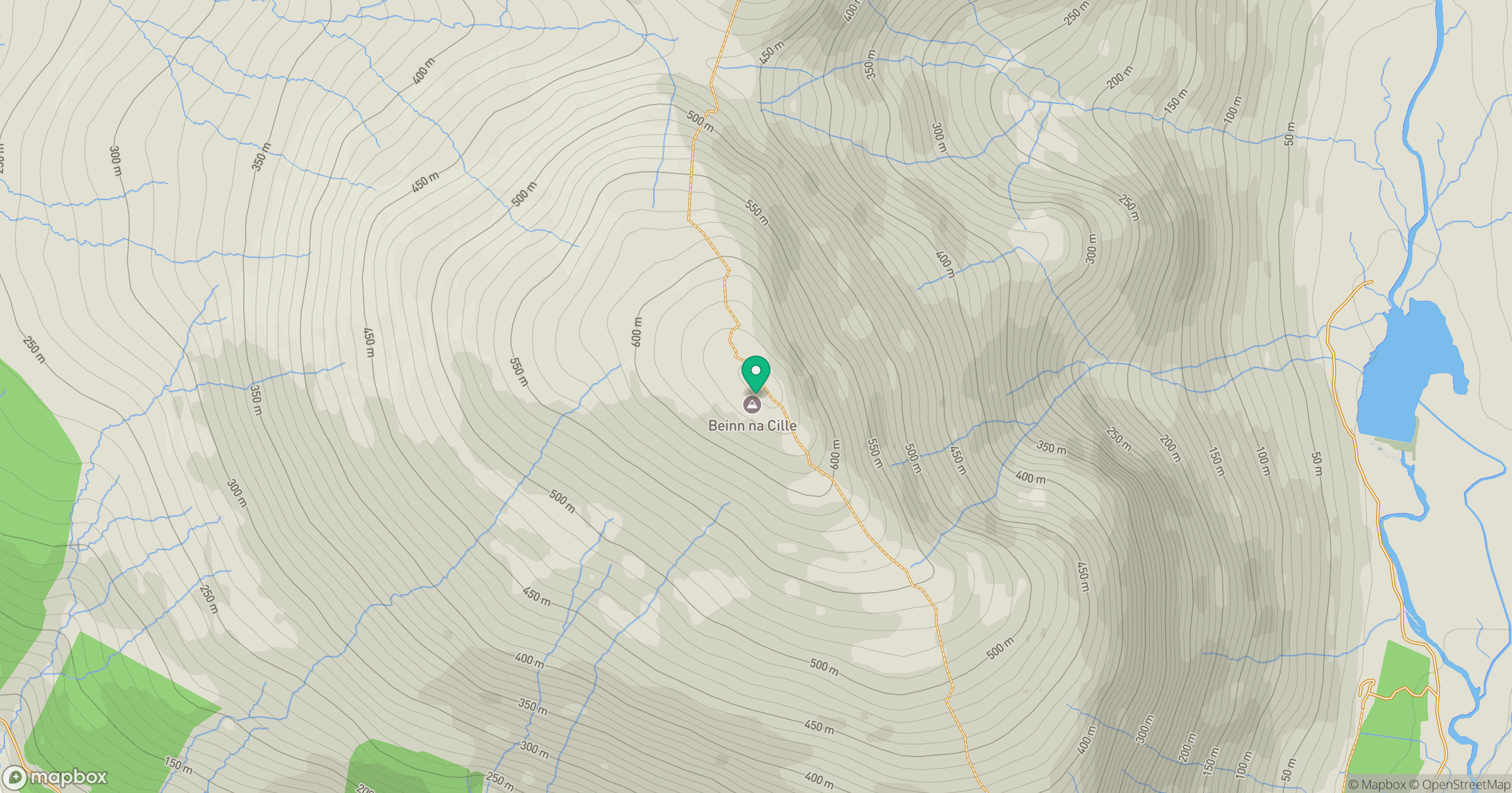
Grid reference: NM853542
View on OpenStreetMapOpens a map in a new tab, centred on the hill.
No comments yet. Be the first.