

Beinn Eibhinn
Good walks are even better shared.
NN4573 : Coire a Charra Mhòir
Adam Ward Photo source
Overview
Beinn Eibhinn
Beinn Eibhinn, one of the crown jewels of the Scottish Highlands, stands tall at 1165 meters. This Munro not only offers a test for seasoned hikers but also rewards them with astonishing views and the thrill of outdoor adventure.
Geology
The mountain’s formidable landscape is a testament to its hard metamorphic rock, predominantly schist. Its rugged terrain and steep cliffs are a result of ancient geological processes and the sculpting power of glaciers that once blanketed the area. Rocks here might just be as old as your great-grandparents, possibly older!
Routes
One popular route is the East Ridge Route that begins from the Glen Roy visitors’ centre. This moderate path spans approximately 10 km and generally takes around 4 hours to ascend. It's a well-trodden track, perfect for both avid hikers and those with a slightly less enthusiastic approach to exercise.
Summit Features
Upon reaching the summit, adventurers are greeted by a large stone cairn and panoramic views that will make even the most dedicated Instagrammer swoon. Dust off your camera, as the backdrop of Lochaber, the Grey Corries, and, occasionally, the impressive Nevis Range will be too good to resist!
Terrain
Expect a rocky trek adorned with grassy patches, combined with the occasional boggy area that reminds you you're still in the Highlands. Proper footwear is essential unless you fancy an impromptu mud bath.
Views
Don't forget to take time at the summit to bask in the scenery—on a clear day, the sights are utterly magnificent! The best seasons for stunning views are late spring through autumn, so plan accordingly.
Hazards
Keep in mind the rocky terrain can test your physical limits, particularly in wet conditions. Make sure to securely attach those hiking boots to your feet and mind the loose stones along the way.
Access
Parking at the Glen Roy visitor centre is your best bet, but be mindful that spaces can fill up quicker than a kettle boils. Public transport options include local bus services from Fort William to nearby villages, so check the scheduling for seamless travel.
Facilities
While at the mountain, don’t expect any hospitality services, but fear not; you can find a delightful café at Spean Bridge to fuel up before your adventure. Restrooms are thoughtfully available at the visitor centre to avoid any awkward situations.
History
The mountain’s name translates to 'rough hill' in Gaelic, a poetic nod to its ruggedness. Local traditions and folk stories abound, making Beinn Eibhinn a site of significant cultural value to the Highlands.
Whether challenging yourself or simply soaking in the natural beauty of the Scottish Highlands, Beinn Eibhinn promises an unforgettable experience that will leave you with stories to tell and memories to treasure.
Happy hiking!
Explore routes near Beinn Eibhinn
Walks starting near this hill. Open a route to check its map, distance and full itinerary.
Coire Ardair lochan from Aberarder and back
View route
Ben Nevis via Mountain Path
View route
Banavie to Glen Loy Aqueduct: Neptune’s Staircase Canal Towpath
View route
Fort Augustus to Kytra Lock: Caledonian Canal Towpath
View route
Route planning notes
These notes describe possible approaches. Check a route's map and access information when planning your walk.
East Ridge Route
A popular and well-trodden path that starts from the visitors' centre at Glen Roy, leading up the east ridge to the summit. It offers stunning views along the ascent.
Make a day of it, together
Find someone to share the walk with, or organise a day out along a route you like.
Photo Gallery
View all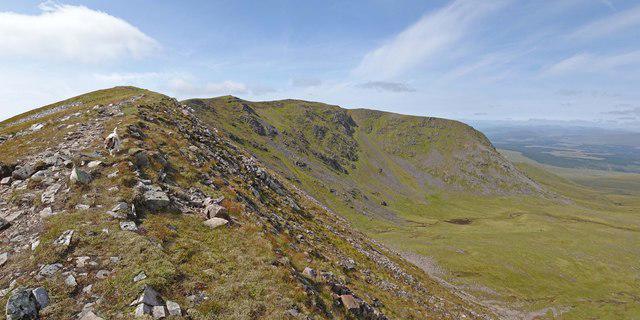 Photo could not load
NN4573 : Coire a Charra Mhòir
Adam Ward
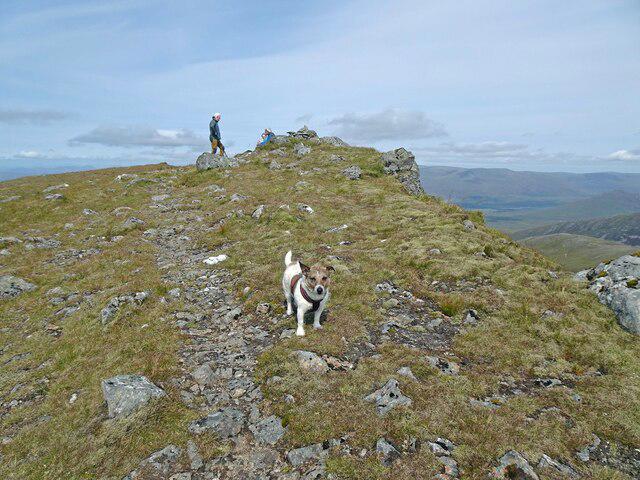 Photo could not load
NN4473 : Leaving the Delightful Hill
Adam Ward
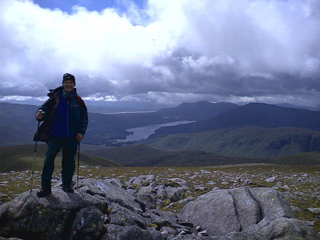 Photo could not load
NN4473 : Willie on summit of Beinn Eibhinn with Loch Ossian in view.
Willie Milne
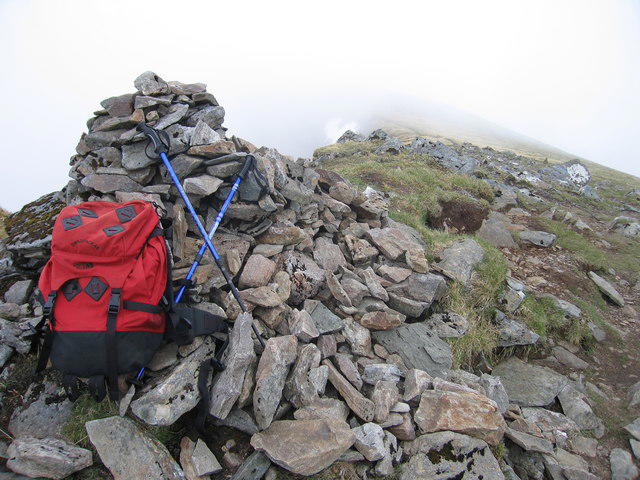 Photo could not load
NN4473 : West Cairn On Beinn Eibhinn
Rude Health
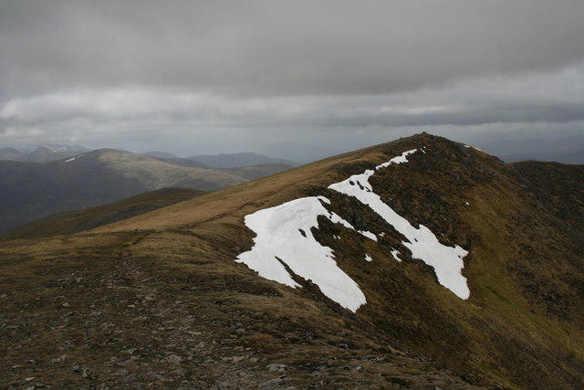 Photo could not load
NN4473 : Summit ridge, Beinn Eibhinn
Nic Bullivant
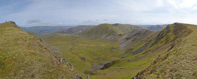 Photo could not load
NN4473 : Twin Summits of Beinn Eibhinn
Adam Ward
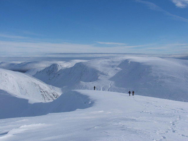 Photo could not load
NN4473 : Summit ridge of Beinn Eibhinn
Chris Peck
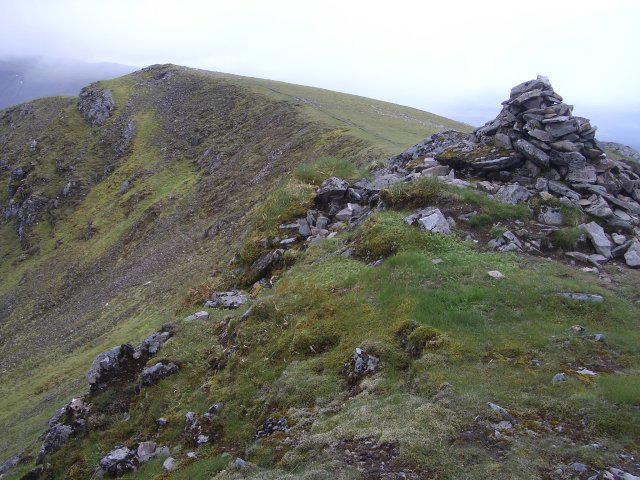 Photo could not load
NN4473 : Twin summits of Beinn Eibhinn
Callum Black
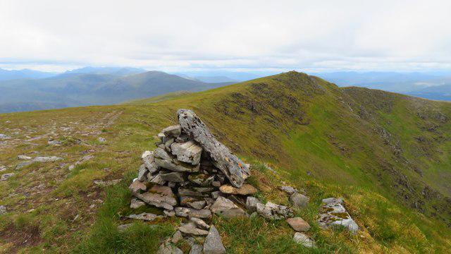 Photo could not load
NN4473 : Cairn on Beinn Eibhinn (SE summit)
Colin Park
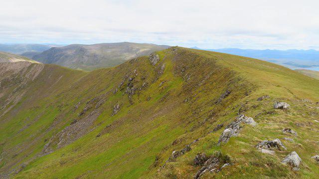 Photo could not load
NN4473 : On Beinn Eibhinn (NW summit) - view to (SE summit)
Colin Park
Hill facts and local notes
Classifications
Elevation
1,103m
3,620 ft
Prominence
127m
Coordinates
56.8253, -4.5421
NN449733
OS Map
42
Explorer: OL50 393
At the Summit
The summit features a large stone cairn that provides a perfect spot for photographs and a well-deserved rest. The views from the top are simply breath-taking—don't forget your camera!
Terrain & Geology
Beinn Eibhinn is primarily composed of hard metamorphic rock, predominantly schist, which contributes to its rugged terrain and steep cliffs. The geology tells a tale of ancient geological activity shaped by glaciation.
Views & Scenery
From the summit, you can see Lochaber, the Grey Corries, and the sprawling beauty of the surrounding glens. On a clear day, the Nevis Range also makes a striking appearance.
History & Heritage
Name Origin
The name 'Eibhinn' is derived from Gaelic, meaning 'rough hill', which is fitting given its character.
Historical Significance
Beinn Eibhinn is steeped in local lore and is often regarded as a mystical place by the locals, featuring in various folktales.
Getting There & Facilities
Parking
Parking available at the Glen Roy visitor centre. It's a popular spot, so arrive early to secure a space.
Public Transport
Buses run from Fort William to nearby villages. Be sure to check the local timetable for the latest information.
Nearby Facilities
There are no facilities on the mountain itself, but enjoy a good cuppa at the nearby café in Spean Bridge before your hike. Toilets are available at the visitor centre.
Safety Information
Known Hazards
- The rocky terrain can be treacherous, especially in wet conditions. Keep an eye out for loose stones and avoid the slopes during icy weather.
General Safety Tips
- Check weather conditions before setting out
- Carry appropriate clothing and equipment
- Let someone know your planned route
- Take a map, compass, and GPS device
- Carry emergency supplies: food, water, first aid kit, torch
Hills
Some common questions about the hills answered
Are there group walks up Beinn Eibhinn?
Many walkers use Walkmates to join or organise walks with others. You can check for group walks around Beinn Eibhinn through the maps
Are there other walkers around Beinn Eibhinn?
Activity varies by location and time, but Walkmates lets you see whether others have shared walks or shown interest in this area. Find other people through the walking friends search walking friends for Beinn Eibhinn search or of course create your own walk for Beinn Eibhinn
Can I organise a walk to Beinn Eibhinn?
Yes. If there aren’t any walks listed already, you can create a walk and make it available for others to join.
If you're signed up to Walkmates, you can create a walk to Beinn Eibhinn.
How do I find a walk up this hill?
There are often multiple ways to walk this hill, depending on experience and route preference. Walkmates helps you explore walks and routes that others have shared.
Can I suggest a new route up Beinn Eibhinn?
Yes. You can suggest or create routes to share with others. Walkmates focuses on the social side of walking, so routes are used to help people organise walks and explore areas together, rather than as detailed navigation tools or route libraries.
Other uses really appreciate knowledgeable walkers sharing their routes. Share your favourite route to Beinn Eibhinn here
The is an error or something incorrect about this hill. How do I let you know?
We always strive to keep the information on Walkmates as accurate as possible. If you find an error, please let us know through the contact form and we'll aim to correct it as quickly as possible
Community Discussion
Comments
Location
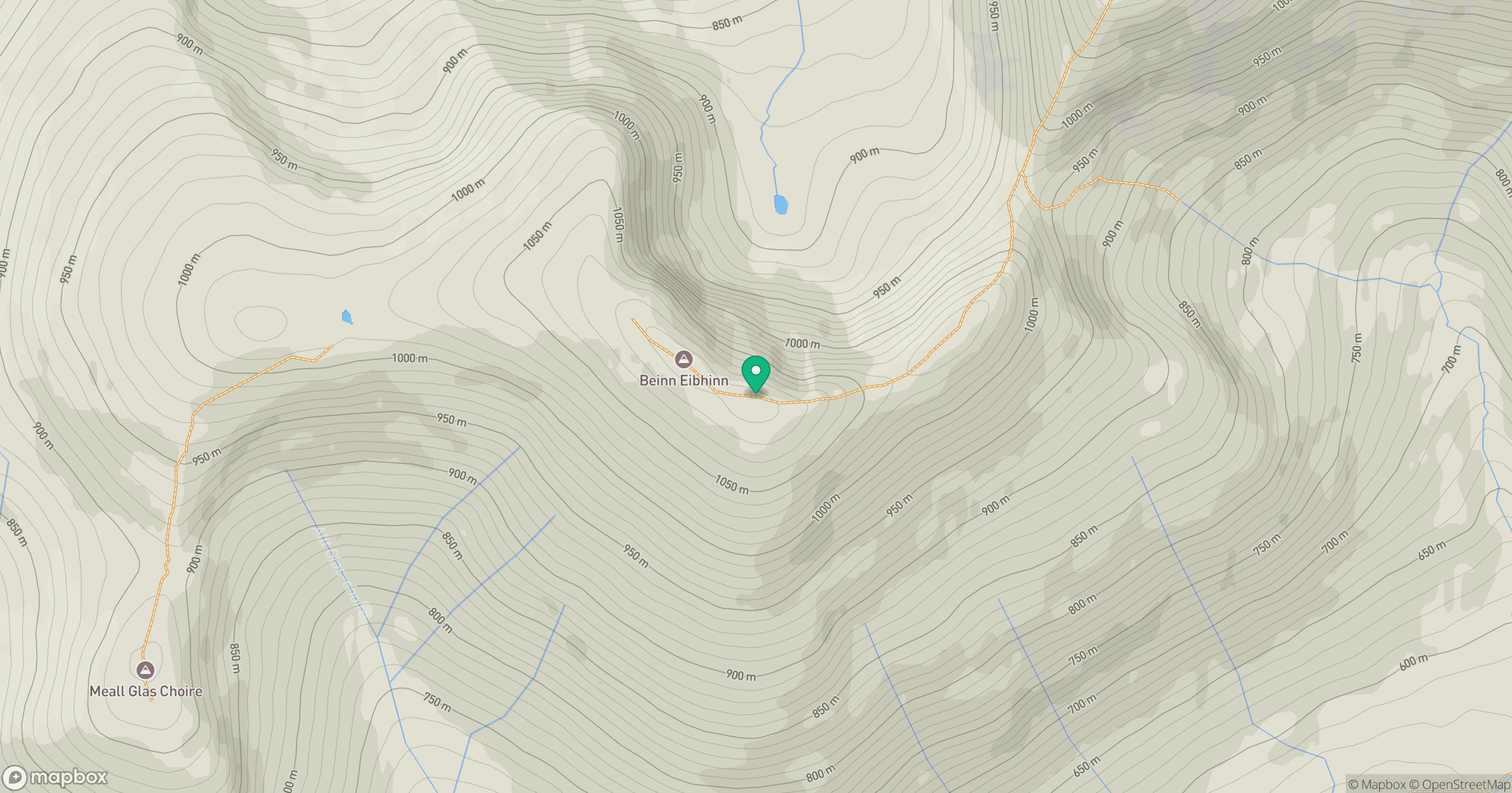
Grid reference: NN449733
View on OpenStreetMapOpens a map in a new tab, centred on the hill.
Nearby Hills
Ben Alder
1,148m
Creag Meagaidh
1,128m
Stob Ban
977m
Stob Choire Claurigh
1,177m
Beinn Mheadhoin
541m
No comments yet. Be the first.