
Beinn Bheag
Good walks are even better shared.
Overview
Beinn Bheag
Nestled in the picturesque Scottish Highlands, Beinn Bheag is a hidden gem that offers both tranquillity and breathtaking views for those willing to put in the effort. Standing at an elevation of 777 meters, this Marilyn may not be the tallest peak in the area, but it’s certainly no slouch when it comes to beauty!
Geology
Beinn Bheag is primarily composed of ancient metamorphic gneisses and schists, typical of the North West Highlands. These remarkable rocks have been shaped by geologic forces over millennia, presenting curious hikers with stunning weathered features and a chance to ponder Earth's history — no geology degree required, but it certainly wouldn't hurt.
Routes
East Glen Affric Route
This moderately steep route begins at the East Glen Affric car park and takes you through lush woodlands before unveiling the open slopes of Beinn Bheag. At around 6.5 km long, expect to spend about three hours on this scenic ascent, soaking in all the sights and maybe catching your breath along the way.
Summit Features
Once you reach the summit, a distinctive stone cairn greets you. It's an excellent spot for a well-deserved breather, not to mention a perfect backdrop for that classic summit photo to show off to your friends!
Terrain
The terrain is a delightful mix of grassy slopes interspersed with rocky outcrops, and if you're lucky — or perhaps unlucky, depending on your boots' anti-bog technology — you might navigate a few boggy patches. But hey, what’s a bit of mud among friends?
Views
From the summit, the panoramic views include the majestic peaks like Carn Eige and the serene lochs dotting the landscape below. The best time to visit for photography aficionados is late spring or early autumn when the light is simply magical.
Hazards
Keep in mind that the Highlands aren't known for their predictable weather. As such, be prepared for sudden changes that can turn your sunny day into a not-so-fun adventure. The rocky terrain can also be slippery when wet, so sturdy boots are a must. Don’t worry; your feet will thank you later!
Nearby Summits
Beinn Bheag stands proudly alongside its more renowned companions, such as Carn Eige and Mullach Fraoch-Choire. A day out here could easily inspire plans for more Highland explorations!
Access
Getting to Beinn Bheag is half the fun! Park up at the East Glen Affric car park (NH106005), which offers ample space for vehicles. Although public transport is a bit scarce, the local bus from Drumnadrochit can drop you off in Cannich, just a stone's throw from the trailhead.
While you're in Cannich, consider popping into the local café for a quick snack or perhaps a hot cup of tea to fuel your adventure.
Facilities
In terms of facilities, while the mountain itself keeps things pretty wild, Cannich provides a café and toilets to ensure you’re not caught short!
History
The name 'Beinn Bheag' translates to 'Little Mountain' in Gaelic — don’t let its humble name fool you. It plays a significant role in local history and folklore, with ancient paths that have seen countless feet traverse its rugged beauty.
In summary, Beinn Bheag is a delightful hike imparted with history, geology, and stunning vistas. It’s a little mountain that offers a huge amount of joy. So lace up those boots; adventure awaits!
Explore routes near Beinn Bheag
Public walks starting within 80 km of this hill. Nearby does not mean a route reaches the summit; check its map and access before setting out.
Banavie to Glen Loy Aqueduct: Neptune’s Staircase Canal Towpath
View route
Loch Affric full circuit from River Affric
View route
Ben Nevis via Mountain Path
View route
Fort Augustus to Kytra Lock: Caledonian Canal Towpath
View route
Route planning notes
These notes describe possible approaches, not verified navigable routes or permission to cross land. Check current paths, local access rules and conditions before setting out.
East Glen Affric Route
A moderately steep ascent starting from the East Glen Affric, this route winds through scenic woodlands before breaking free onto the open slopes of Beinn Bheag.
Make a day of it, together
Find someone to share the walk with, or organise a day out along a route you like.
Hill facts and local notes
Classifications
Elevation
339m
1,112 ft
Prominence
125m
Coordinates
57.0569, -5.1689
NH079006
OS Map
33
Explorer: 399 414S
At the Summit
At the summit, hikers will find a distinct stone cairn marking the highest point, offering a perfect photo opportunity and a chance to catch their breath.
Terrain & Geology
Beinn Bheag is primarily composed of ancient metamorphic gneisses and schists, typical of the North West Highlands. The distinctive weathering patterns create fascinating rock formations, and fossil evidence from thousands of years ago tells the tale of a dynamic geological history.
Views & Scenery
From the summit, you can feast your eyes on stunning views of the surrounding peaks, including the impressive Carn Eige and the tranquil lochs below.
History & Heritage
Name Origin
The name 'Beinn Bheag' translates to 'Little Mountain' in Gaelic, a modest title for a peak that commands such impressive views.
Historical Significance
Locally, the mountain is part of the rich cultural landscape of the Highlands, often associated with traditional folklore and ancient paths used by past communities.
Getting There & Facilities
Check current local access restrictions, parking rules and transport timetables before travelling. These notes do not confirm public access to the summit.
Parking
Parking is available at the East Glen Affric car park, NH106005, which accommodates several vehicles and serves as a great starting point for this adventure.
Public Transport
Public transport options are limited; however, the nearest bus service operates from Drumnadrochit to Cannich, with a short walk to the trailhead.
Nearby Facilities
While there are no facilities directly on the mountain, you can find a café and toilets at nearby Cannich.
Safety Information
Known Hazards
- Be cautious of sudden weather changes, which are common in the Highlands. The rocky terrain can also be slippery when wet, so a sturdy pair of boots is recommended.
General Safety Tips
- Check weather conditions before setting out
- Carry appropriate clothing and equipment
- Let someone know your planned route
- Take a map, compass, and GPS device
- Carry emergency supplies: food, water, first aid kit, torch
Hills
Some common questions about the hills answered
Are there group walks up Beinn Bheag?
Many walkers use Walkmates to join or organise walks with others. You can check for group walks around Beinn Bheag through the maps
Are there other walkers around Beinn Bheag?
Activity varies by location and time, but Walkmates lets you see whether others have shared walks or shown interest in this area. Find other people through the walking friends search walking friends for Beinn Bheag search or of course create your own walk for Beinn Bheag
Can I organise a walk to Beinn Bheag?
Yes. If there aren’t any walks listed already, you can create a walk and make it available for others to join.
If you're signed up to Walkmates, you can create a walk to Beinn Bheag.
How do I find a walk up this hill?
There are often multiple ways to walk this hill, depending on experience and route preference. Walkmates helps you explore walks and routes that others have shared.
Can I suggest a new route up Beinn Bheag?
Yes. You can suggest or create routes to share with others. Walkmates focuses on the social side of walking, so routes are used to help people organise walks and explore areas together, rather than as detailed navigation tools or route libraries.
Other uses really appreciate knowledgeable walkers sharing their routes. Share your favourite route to Beinn Bheag here
The is an error or something incorrect about this hill. How do I let you know?
We always strive to keep the information on Walkmates as accurate as possible. If you find an error, please let us know through the contact form and we'll aim to correct it as quickly as possible
Community Discussion
Comments
Location
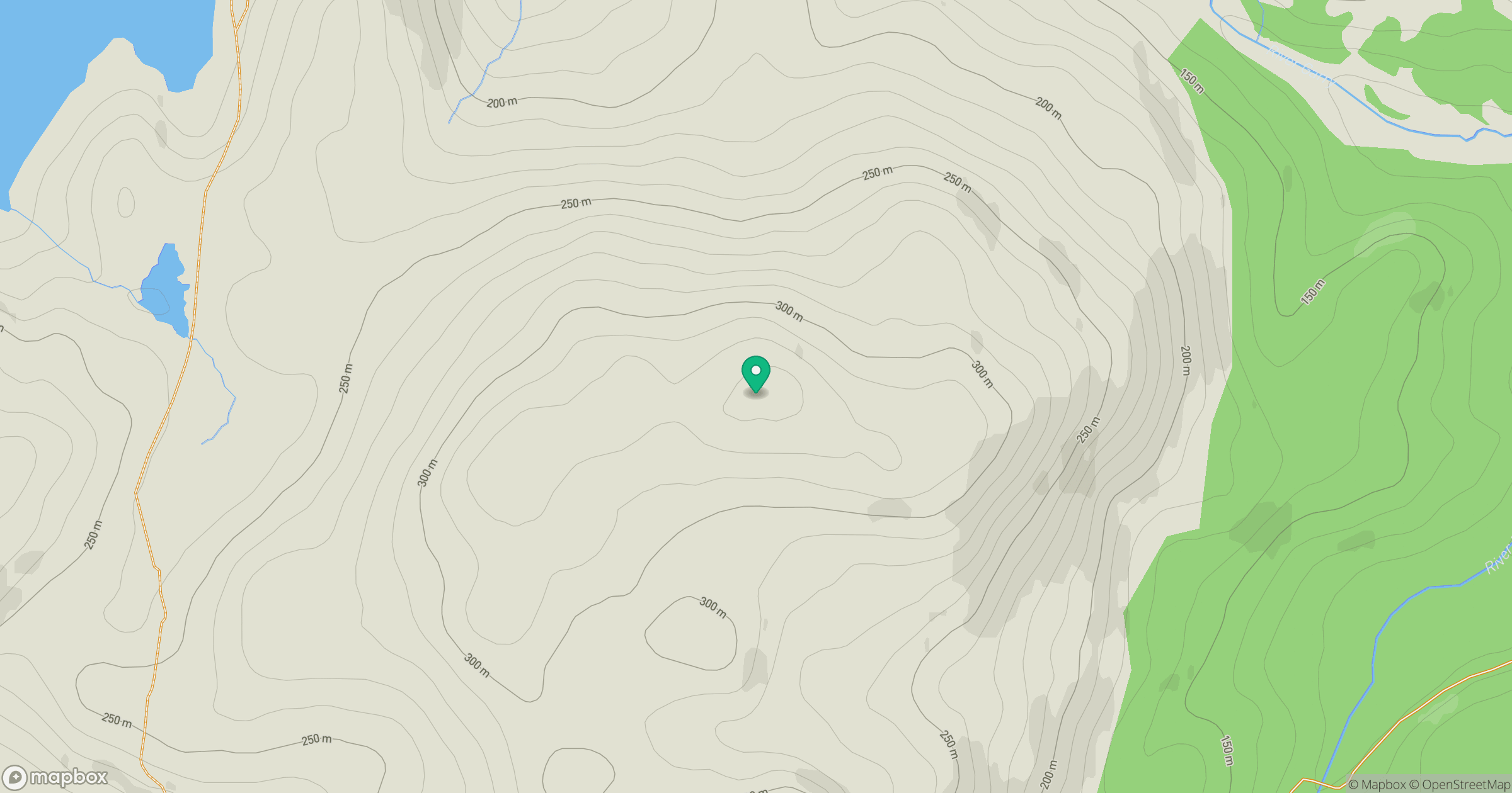
Grid reference: NH079006
View on OpenStreetMapOpens a map in a new tab, centred on the hill.
Hills within 30 km
Straight-line distance, not a walking route or confirmation of access.
Gleouraich
1,035m
Sgurr a' Mhaoraich
1,027m
Sgurr Fhuaran
1,069m
Mam Sodhail
1,179m
Carn Eighe
1,183m
No comments yet. Be the first.