
Beinn Aird da Loch
Good walks are even better shared.
Overview
Overview
Beinn Aird da Loch, standing tall at 511 meters, is a Marilyn in the Scottish Highlands, offering breathtaking views and a great workout. It’s often overlooked by those flocking to more popular peaks, but that only adds to its charm.
Geology
The rocky terrain is primarily composed of ancient metamorphic rocks, providing a sense of ruggedness that hikers will enjoy. If geology is your bag, you’ll find the schists and gneisses particularly fascinating—just don’t try to take any home!
Routes
West Highland Way Access
This route is perfect for those who are on the famous West Highland Way. As you walk through the management of the lush greenery, the ascent will gradually challenge you, but your sacrifices will be rewarded with stunning views of the surrounding landscape.
Short Ascent from Loch Awe
Got a free afternoon and a craving for a challenge? This short, steep route is a quick way to the top, offering rewards that will make your legs burn slightly less in retrospect.
Summit Features
The summit boasts a modest cairn—perfect for that Instagram shot with what can only be described as ‘epic’ backgrounds. Get your sandwiches ready!
Terrain
Expect a mix of ruggedness with grassy sections and a few boggy bits waiting to ambush the unsuspecting hiker. Good footwear is a must!
Views
Here’s the kicker—on a clear day, the views are absolutely spectacular! You can see Loch Awe and the iconic Ben Cruachan, ensuring that the journey is worth every step. Spring and autumn are the ideal seasons to take in the colours, where the landscape can turn into a patchwork of vibrant hues.
Hazards
Watch your step; slippery rocks and steep paths may try to conspire against you, especially after rain. Always check weather forecasts before heading out!
Access
Dalavich serves as your gateway to adventure. With public transport options available, you can leave your car behind and feel good about saving the planet while you hike!
Facilities
Don’t expect luxury in Dalavich! A small shop and a couple of food options are available to refuel before trekking, but pack your lunch just in case.
History
The name means ‘Hill of the Height by the Lake’, beautifully descriptive for a location that is built for adventure.
So pack your bags and don’t forget your sense of adventure! Beinn Aird da Loch awaits, more challenging than your last relationship but equally rewarding!
Explore routes near Beinn Aird da Loch
Public walks starting within 80 km of this hill. Nearby does not mean a route reaches the summit; check its map and access before setting out.
Ben Klibreck
View route
Loch Migdale from Torroy: Spinningdale pinewood and loch shore walk
View route
Fairy Lochs Liberator Wreckage Circuit
View route
Route planning notes
These notes describe possible approaches, not verified navigable routes or permission to cross land. Check current paths, local access rules and conditions before setting out.
West Highland Way Access
Starting from the West Highland Way, this trail takes you through lush forestry before climbing steadily towards the summit, offering beautiful views along the way.
Short Ascent from Loch Awe
A direct route from the shores of Loch Awe which is steep at times but relatively short, making it ideal for those with limited time but a desire for stunning vistas.
Make a day of it, together
Find someone to share the walk with, or organise a day out along a route you like.
Hill facts and local notes
Classifications
Elevation
533m
1,749 ft
Prominence
116m
Coordinates
58.2403, -4.9294
NC281316
OS Map
15
Explorer: 442E 445
At the Summit
The summit is marked by a small but well-constructed cairn, providing a great spot for a celebratory sandwich once you've summited.
Terrain & Geology
The mountain primarily consists of ancient metamorphic rocks, specifically schists and gneisses, providing a rugged terrain that is a testament to the geological forces shaping the Highlands over millions of years.
Views & Scenery
From the summit, you can see stunning panoramas of Loch Awe and Ben Cruachan, as well as the expansive landscapes of the surrounding Highlands.
History & Heritage
Name Origin
The name 'Beinn Aird da Loch' translates to 'Hill of the Height by the Lake', which is quite fitting considering its scenic surroundings.
Historical Significance
Part of the traditional lands of the Highlands, the area is rich in cultural history and offers a glimpse into Scotland's past.
Getting There & Facilities
Check current local access restrictions, parking rules and transport timetables before travelling. These notes do not confirm public access to the summit.
Parking
There is a small parking area near the West Highland Way trailhead at Dalavich, approximately 2 km from the start of the ascent.
Public Transport
Buses run from Oban to Dalavich, offering a convenient way to access the area without the need for a car.
Nearby Facilities
Basic facilities are available in Dalavich, including a small shop and places to grab a bite, but don’t expect a five-star experience!
Safety Information
Known Hazards
- Be mindful of slippery rocks, especially after rain. The steep paths can be challenging, and visibility can drop quickly in poor weather.
General Safety Tips
- Check weather conditions before setting out
- Carry appropriate clothing and equipment
- Let someone know your planned route
- Take a map, compass, and GPS device
- Carry emergency supplies: food, water, first aid kit, torch
Hills
Some common questions about the hills answered
Are there group walks up Beinn Aird da Loch?
Many walkers use Walkmates to join or organise walks with others. You can check for group walks around Beinn Aird da Loch through the maps
Are there other walkers around Beinn Aird da Loch?
Activity varies by location and time, but Walkmates lets you see whether others have shared walks or shown interest in this area. Find other people through the walking friends search walking friends for Beinn Aird da Loch search or of course create your own walk for Beinn Aird da Loch
Can I organise a walk to Beinn Aird da Loch?
Yes. If there aren’t any walks listed already, you can create a walk and make it available for others to join.
If you're signed up to Walkmates, you can create a walk to Beinn Aird da Loch.
How do I find a walk up this hill?
There are often multiple ways to walk this hill, depending on experience and route preference. Walkmates helps you explore walks and routes that others have shared.
Can I suggest a new route up Beinn Aird da Loch?
Yes. You can suggest or create routes to share with others. Walkmates focuses on the social side of walking, so routes are used to help people organise walks and explore areas together, rather than as detailed navigation tools or route libraries.
Other uses really appreciate knowledgeable walkers sharing their routes. Share your favourite route to Beinn Aird da Loch here
The is an error or something incorrect about this hill. How do I let you know?
We always strive to keep the information on Walkmates as accurate as possible. If you find an error, please let us know through the contact form and we'll aim to correct it as quickly as possible
Community Discussion
Comments
Location
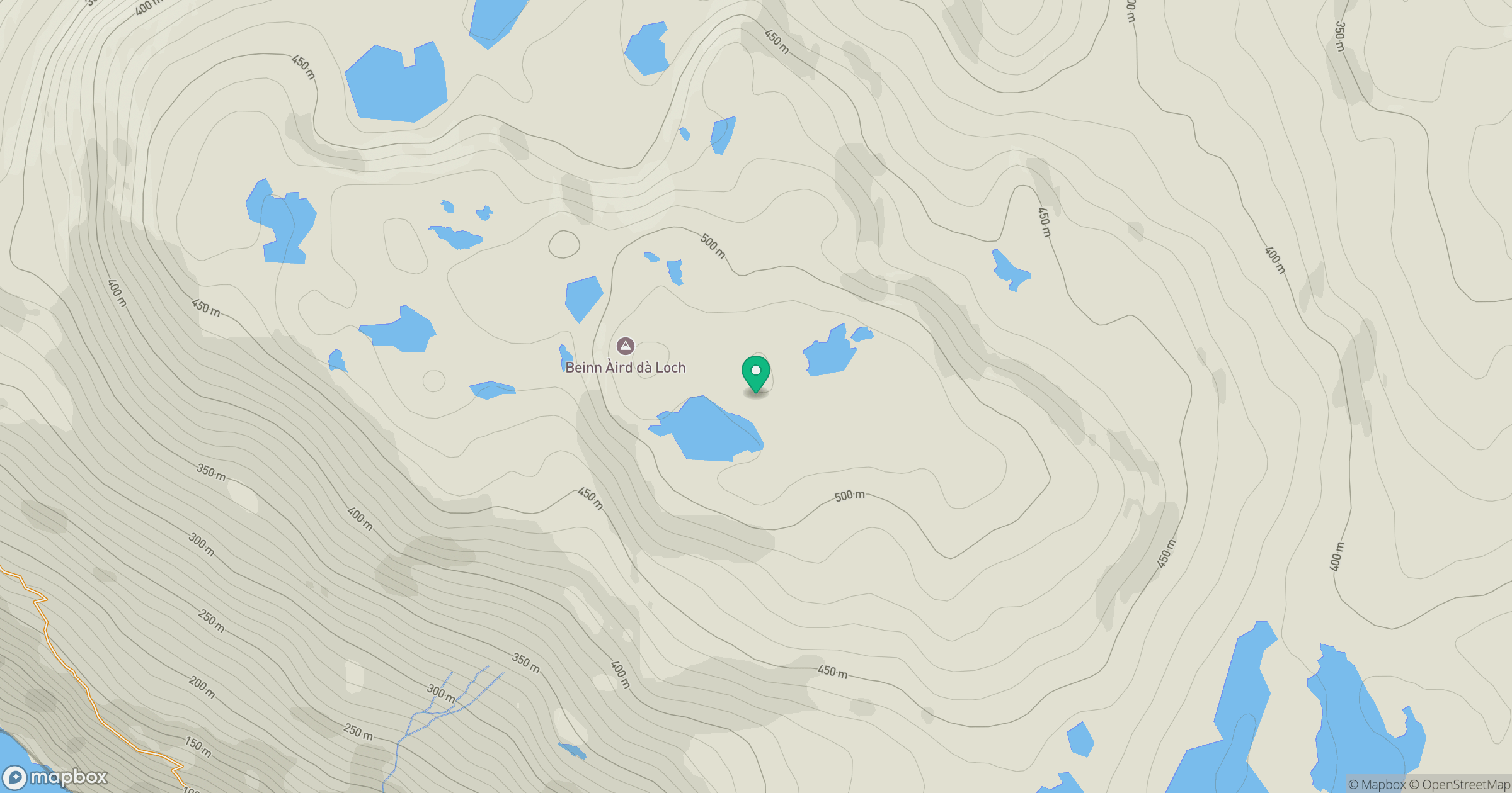
Grid reference: NC281316
View on OpenStreetMapOpens a map in a new tab, centred on the hill.
Hills within 30 km
Straight-line distance, not a walking route or confirmation of access.
Ben Stack
721m
Quinag - Sail Gharbh
809m
Ben More Assynt
999m
Quinag - Spidean Coinich
764m
Quinag - Sail Ghorm [Sail Gorm]
776m
No comments yet. Be the first.