
Beinn a' Chaorainn
Good walks are even better shared.
Overview
Beinn a' Chaorainn
Situated in the stunning Scottish Highlands, Beinn a' Chaorainn rises majestically to a height of 1001 meters, beckoning hikers with its promise of adventure and breathtaking views. Its prominent stone cairn at the summit is not just a resting place for weary travellers but also a fine spot for snapping those all-important Instagram photos, proving that yes, you did indeed conquer a Munro!
Geology
Beinn a' Chaorainn is a prime example of the Lewisian gneiss, which is one of the oldest rock formations in the UK. Exhibiting the characteristic ruggedness of the Highlands, the formations are a testament to Earth's geological history, having withstood the test of time, intense weathering, and perhaps a wee bit of Scottish stubbornness.
Routes
North Ridge Route
This popular and scenic route boasts 8 km of varied terrain, making it a delightful way to reach the summit. It typically takes around 5 hours to complete, but don't forget to pause and enjoy the views—after all, the fun is in the journey!
West Approach
For those seeking a bit more challenge, the West Approach spans about 10 km and may take around 6 hours. While it rewards hikers with spectacular sights, do keep an eye out for the boggy patches; nobody wants to end up with squelchy boots and soggy socks!
Summit Features
The summit features a hefty stone cairn that stands proudly against the sky, often playing host to tired yet triumphant hikers. It's a perfect spot to catch your breath and take in the surrounding panoramas.
Terrain
Beinn a' Chaorainn offers a mix of rocky, grassy, and boggy sections, so be prepared for a bit of everything. Don your best walking boots; your feet will thank you!
Views
The views from the top are simply marvellous! With the Cairngorms stretching out in front and Loch Ness sparkling in the distance, it’s easy to see why this mountain has become a favourite for outdoor enthusiasts. The best seasons to visit are spring and autumn, when the colours are vibrant and visibility is at its peak.
Hazards
Do keep an eye on changing weather conditions, as the Highlands can be unpredictable. Paths may become slippery after rain, and those boggy sections... well, let's just say they’re best approached with caution!
Nearby Summits
If your legs still have some life in them, consider tackling nearby Beinn a' Chlachair or Creag Pitridh for more stunning Highland experiences!
Access
Parking is available at a small area at the end of the public road near Fersit, but it fills up quickly during peak season. For those relying on public transport, check schedules carefully, as buses can be few and far between. The village of Fersit will provide some local charm and basic amenities, making it a quaint starting point for your adventure.
Facilities
Remember, you won’t find facilities on the mountain itself, so ensure you're stocked up on snacks and water before your ascent. The nearest cafes await you in Fersit or nearby Newtonmore after your potentially exhausting trek.
History
The etymology of Beinn a' Chaorainn translates elegantly to 'Mountain of the Rowan Tree', reminiscent of the rich flora that characterises the region. Historically, this mountain plays a key role in the culture and exploration of the Highlands, attracting many hikers eager to leave their mark.
In conclusion, Beinn a' Chaorainn is more than just another Munro; it's a gateway to the wild beauty and captivating history of the Scottish Highlands. So lace up those boots, grab your walking pole, and embark on an adventure that will surely tickle your hiking fancy.
Happy trekking!
Explore routes near Beinn a' Chaorainn
Walks starting near this hill. Open a route to check its map, distance and full itinerary.
Fort Augustus to Kytra Lock: Caledonian Canal Towpath
View route
Banavie to Glen Loy Aqueduct: Neptune’s Staircase Canal Towpath
View route
Ben Nevis via Mountain Path
View route
Glen Affric: Coire Loch Woodland Trail
View route
Route planning notes
These notes describe possible approaches. Check a route's map and access information when planning your walk.
North Ridge Route
A scenic and popular route that follows the north ridge, offering great views as you ascend.
West Approach
An alternative scenic approach leading to the summit, with some sections of boggy ground to navigate.
Make a day of it, together
Find someone to share the walk with, or organise a day out along a route you like.
Hill facts and local notes
Classifications
Elevation
1,049m
3,442 ft
Prominence
227m
Coordinates
56.9286, -4.6536
NN386850
OS Map
34 41
Explorer: OL55 400 401
At the Summit
The summit is marked by a stone cairn providing a lovely viewpoint for hikers to enjoy the surrounding vistas.
Terrain & Geology
Composed primarily of Lewisian gneiss, Beinn a' Chaorainn exhibits the ancient geological formations typical of the Scottish Highlands, dating back over 3 billion years. Its rugged terrain and rocky outcrops provide insight into the region's geological past.
Views & Scenery
From the summit, one can see the vast landscapes of the Cairngorms, and the glistening waters of Loch Ness on a clear day.
History & Heritage
Name Origin
The name 'Beinn a' Chaorainn' translates to 'Mountain of the Rowan Tree', reflecting the flora that once flourished in this area.
Historical Significance
The mountain has been a significant viewpoint for scouts and outdoor enthusiasts, contributing to the hiking culture in the Scottish Highlands.
Getting There & Facilities
Parking
There is a small parking area at the end of the public road near the village of Fersit, which can accommodate a few vehicles.
Public Transport
Buses run from nearby towns to Fersit, but schedule can be limited. It's advisable to check local timetables.
Nearby Facilities
There are no facilities on the mountain itself; amenities can be found in Fersit or the nearby town of Newtonmore, including cafes and public toilets.
Safety Information
Known Hazards
- Beware of sudden weather changes, especially in winter. Paths can be boggy after rains, and rocky sections may be slippery.
General Safety Tips
- Check weather conditions before setting out
- Carry appropriate clothing and equipment
- Let someone know your planned route
- Take a map, compass, and GPS device
- Carry emergency supplies: food, water, first aid kit, torch
Hills
Some common questions about the hills answered
Are there group walks up Beinn a' Chaorainn?
Many walkers use Walkmates to join or organise walks with others. You can check for group walks around Beinn a' Chaorainn through the maps
Are there other walkers around Beinn a' Chaorainn?
Activity varies by location and time, but Walkmates lets you see whether others have shared walks or shown interest in this area. Find other people through the walking friends search walking friends for Beinn a' Chaorainn search or of course create your own walk for Beinn a' Chaorainn
Can I organise a walk to Beinn a' Chaorainn?
Yes. If there aren’t any walks listed already, you can create a walk and make it available for others to join.
If you're signed up to Walkmates, you can create a walk to Beinn a' Chaorainn.
How do I find a walk up this hill?
There are often multiple ways to walk this hill, depending on experience and route preference. Walkmates helps you explore walks and routes that others have shared.
Can I suggest a new route up Beinn a' Chaorainn?
Yes. You can suggest or create routes to share with others. Walkmates focuses on the social side of walking, so routes are used to help people organise walks and explore areas together, rather than as detailed navigation tools or route libraries.
Other uses really appreciate knowledgeable walkers sharing their routes. Share your favourite route to Beinn a' Chaorainn here
The is an error or something incorrect about this hill. How do I let you know?
We always strive to keep the information on Walkmates as accurate as possible. If you find an error, please let us know through the contact form and we'll aim to correct it as quickly as possible
Community Discussion
Comments
Location
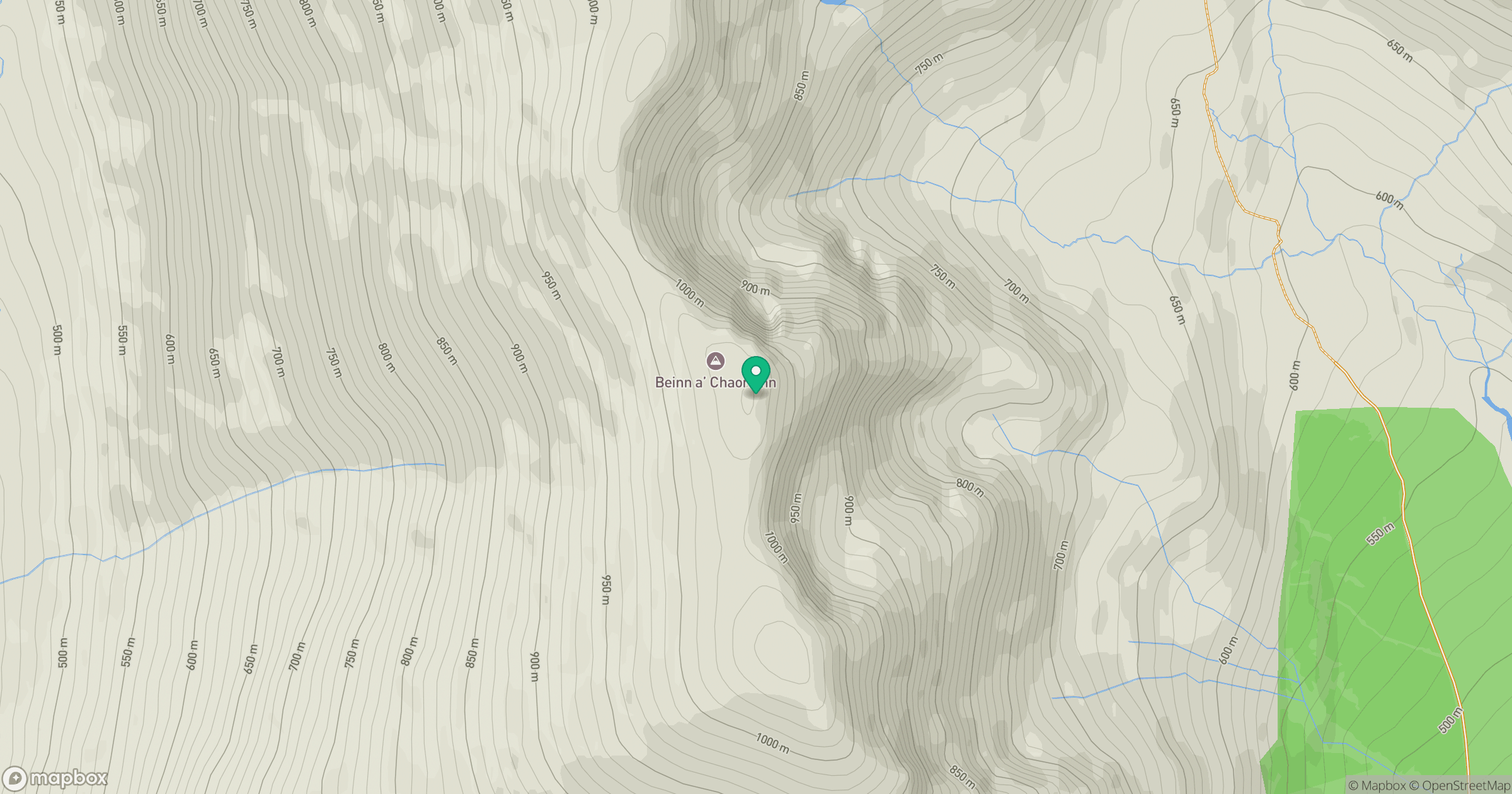
Grid reference: NN386850
View on OpenStreetMapOpens a map in a new tab, centred on the hill.
Nearby Hills
Creag Meagaidh
1,128m
Ben Alder
1,148m
Stob Ban
977m
Stob Choire Claurigh
1,177m
Beinn Mheadhoin
541m
No comments yet. Be the first.