
Beacon Hill
Good walks are even better shared.
Overview
Beacon Hill
Overview
Beacon Hill, perched proudly at an elevation of 239 meters, lies in the heart of the East Midlands. This Marilyn may not be the tallest peak around, but it certainly packs a punch with its stunning views and rich geological features.
Geology
This enchanting hill is primarily composed of Grey Sandstone, offering a mix of rocky crags and grassy slopes. The geology of Beacon Hill provides a fantastic adventure for geology enthusiasts and casual hikers alike, unveiling interesting rock formations along the way.
Routes
One popular route is the Beacon Hill Country Park Circular Trail, which spans approximately 5 km. This moderately challenging trail allows hikers to absorb the stunning surroundings while navigating the diverse terrain. Expect to spend about 1.5 hours soaking up all the sights.
Summit Features
Once you reach the summit, you’ll find a classic British trig point and a short stone cairn. It’s the perfect location to catch your breath – and perhaps capture that majestic selfie against the rolling hills in the background.
Terrain
The terrain is predominantly grassy, interspersed with rocky patches. It’s the perfect mix for those who love a little adventure but don't want to scramble like goats!
Views
The summit provides panoramic views over Leicestershire and Nottinghamshire. On clear days, you could even spot the edges of the National Forest. For the best viewing experience, consider visiting in spring or autumn when the skies are often clearer.
Hazards
While hiking, do take care on uneven ground. Your ankles will thank you if you watch your step! And if you do veer off course, be prepared for the delightful British tradition of mud puddles.
Access
Parking is conveniently located at Beacon Hill Country Park, with a small fee for a day’s parking—the best investment for a refreshing outdoor adventure. If you’re relying on public transport, there’s a bus stop in nearby Woodhouse Eaves, approximately a km away.
Facilities
You can find toilets and picnic areas throughout the park, plus a delightful café to refuel after a good hike.
History
The name Beacon Hill is not just for show; it marks the site where signals were historically sent. Historically significant, the area reveals traces of human activity from prehistoric times, making it not just a hill, but a tale of history.
So whether you're out for a brisk walk or aiming to conquer the views from the trig point, Beacon Hill is a delightful excursion just waiting for your hiking boots. Enjoy your adventure!
Explore routes near Beacon Hill
Walks starting near this hill. Open a route to check its map, distance and full itinerary.
Petworth Park: Capability Brown Hills and Lower Pond Circuit
View route
Hindhead Sailor's Stroll to Gibbet Hill
View route
Hinton Ampner: Dutton Estate Woodland and Downland Circuit
View route
Frensham Little Pond and Snowball Ridge Walk
View route
Route planning notes
These notes describe possible approaches. Check a route's map and access information when planning your walk.
Beacon Hill Country Park Circular Trail
A delightful circular walk that showcases the beauty of the park while taking in panoramic views from the summit.
Make a day of it, together
Find someone to share the walk with, or organise a day out along a route you like.
Hill facts and local notes
Classifications
Elevation
242m
794 ft
Prominence
95m
Coordinates
50.9591, -0.8520
SU807183
OS Map
197
Explorer: OL8 120
At the Summit
The summit features a prominent trig point and a small stone cairn, which offers a perfect spot for a summit selfie – just make sure to angle it for the best view!
Terrain & Geology
Beacon Hill is composed of sandstone, specifically the Grey Sandstone. The area features impressive rock formations, including crags that are a haven for climbing enthusiasts.
Views & Scenery
On a clear day, you can see Leicestershire and Nottinghamshire, along with other notable landmarks such as the National Forest.
History & Heritage
Name Origin
The name 'Beacon Hill' derives from its historical use as a signalling point, or beacon.
Historical Significance
The hill has significant cultural importance, with evidence of human activity dating back to prehistoric times.
Getting There & Facilities
Parking
Parking is available at Beacon Hill Country Park, with a small charge for all-day parking.
Public Transport
The nearest bus stop is located in the village of Woodhouse Eaves, approximately 1 km from the park entrance.
Nearby Facilities
There are toilets and picnic areas available in Beacon Hill Country Park, along with a café for refreshments.
Safety Information
Known Hazards
- Uneven ground in areas can be tricky, so watch your step; wandering off the beaten path may lead to a surprise mud bath!
General Safety Tips
- Check weather conditions before setting out
- Carry appropriate clothing and equipment
- Let someone know your planned route
- Take a map, compass, and GPS device
- Carry emergency supplies: food, water, first aid kit, torch
Hills
Some common questions about the hills answered
Are there group walks up Beacon Hill?
Many walkers use Walkmates to join or organise walks with others. You can check for group walks around Beacon Hill through the maps
Are there other walkers around Beacon Hill?
Activity varies by location and time, but Walkmates lets you see whether others have shared walks or shown interest in this area. Find other people through the walking friends search walking friends for Beacon Hill search or of course create your own walk for Beacon Hill
Can I organise a walk to Beacon Hill?
Yes. If there aren’t any walks listed already, you can create a walk and make it available for others to join.
If you're signed up to Walkmates, you can create a walk to Beacon Hill.
How do I find a walk up this hill?
There are often multiple ways to walk this hill, depending on experience and route preference. Walkmates helps you explore walks and routes that others have shared.
Can I suggest a new route up Beacon Hill?
Yes. You can suggest or create routes to share with others. Walkmates focuses on the social side of walking, so routes are used to help people organise walks and explore areas together, rather than as detailed navigation tools or route libraries.
Other uses really appreciate knowledgeable walkers sharing their routes. Share your favourite route to Beacon Hill here
The is an error or something incorrect about this hill. How do I let you know?
We always strive to keep the information on Walkmates as accurate as possible. If you find an error, please let us know through the contact form and we'll aim to correct it as quickly as possible
Community Discussion
Comments
Location
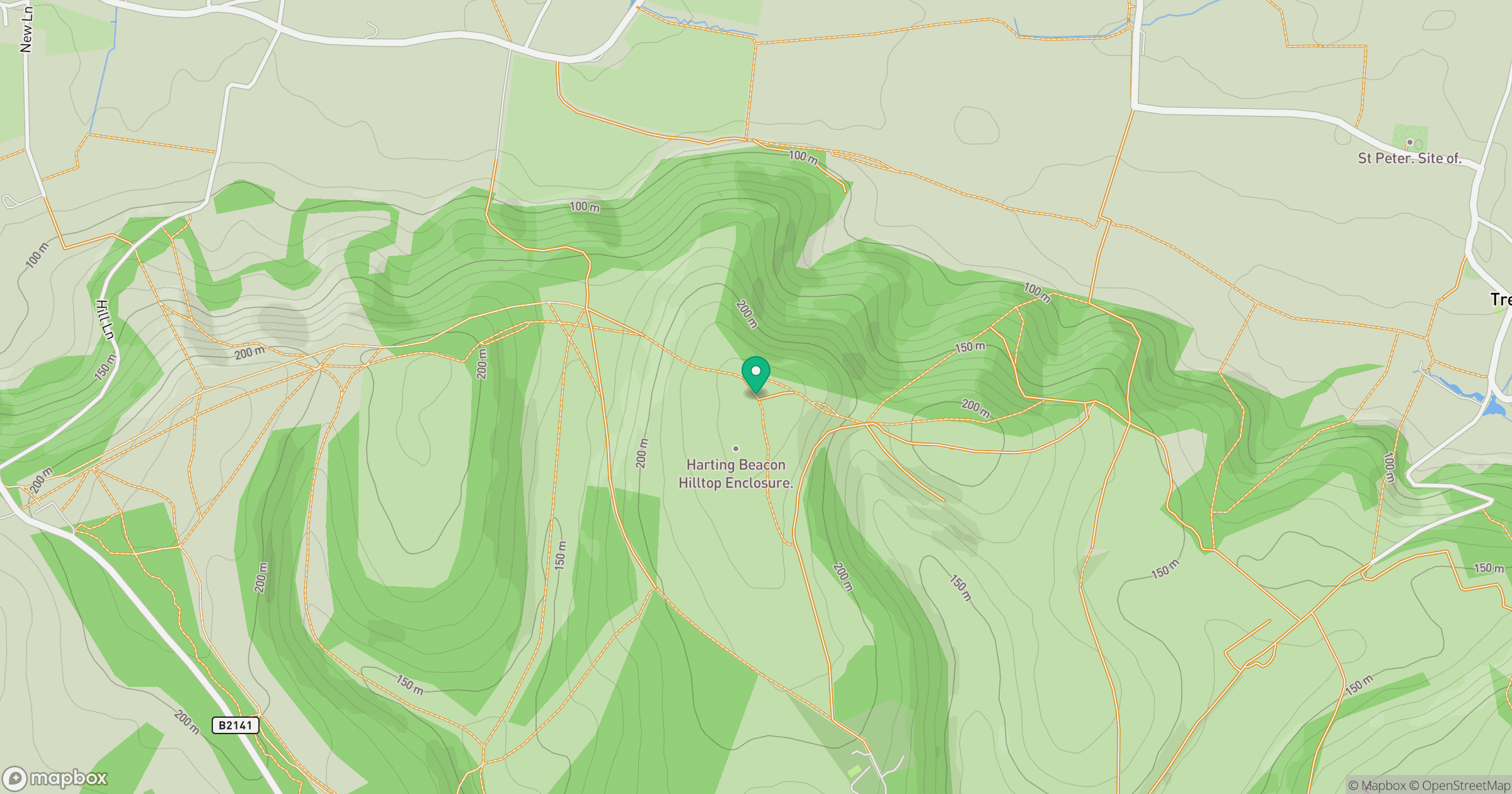
Grid reference: SU807183
View on OpenStreetMapOpens a map in a new tab, centred on the hill.
Nearby Hills
Leith Hill
294m
Ditchling Beacon
248m
Glastonbury Tor
158m
Worcestershire Beacon
425m
Titterstone Clee Hill
533m
No comments yet. Be the first.