

Banc y Celyn
Good walks are even better shared.
Overview
Banc y Celyn
Elevation: 573 meters
Region: Brecon Beacons
Classification: Marilyn
Geology
Banc y Celyn is primarily composed of sandstone, with some surrounding limestone formations providing a unique geological contrast in the area. These rock types contribute to a varied and beautiful landscape that hikers can truly appreciate.
Routes
One of the most popular routes is the Banc y Celyn Circular Walk. This scenic loop starts from the car park at SO047464 and encompasses rolling hills and stunning views, culminating at the summit of Banc y Celyn. It's approximately 8.5 km long and should take around 3.5 hours to complete at a moderate pace.
Summit Features
Reaching the summit, hikers will find a prominent trig point accompanied by a large stone cairn. It’s an ideal spot for photo ops and a well-deserved rest after the ascent.
Terrain Type
The terrain is predominantly grassy, with rocky sections that provide an interesting challenge, especially near the summit. Be prepared for some boggy spots after heavy rain—your boots will thank you later!
Views
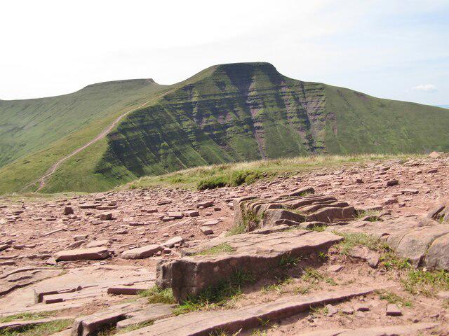
From the top, breathtaking views await. You can see the sweeping landscapes of the Brecon Beacons, including the distant silhouette of Pen y Fan and the beautiful Usk Valley. The best seasons to experience these views are spring and autumn, though winter can transform the area into a magical snowy wonderland.
Hazards
Keep an eye on the weather! Sudden changes can occur, so always check forecasts before heading out. Additionally, paths may become slippery after wet weather, so a bit of caution goes a long way.
Nearby Summits
A couple of nearby peaks worth exploring include Cribyn (795 meters) and the more famous Pen y Fan (886 meters). Both offer additional hiking opportunities and stunning vistas.
Access
The nearest parking is located at SO047464, which can accommodate several vehicles but fills up quickly on weekends. If you're planning to use public transport, the nearest bus stop is in Libanus, about 4 km away; just remember that services can be infrequent. The charming town of Brecon is the closest urban area, around 10 km to the north, where you can grab a bite or recharge before your hike.
Facilities
Facilities are scarce, so plan accordingly. Public toilets can be found in Brecon, but make sure to bring your own food and drink for the hike.
History
The name 'Banc y Celyn' translates to 'Hill of the Holly', referencing the flora that might have once dominated the area. This region is also steeped in local folklore, adding to the Brecon Beacons' rich cultural tapestry.
So pack your bags, lace up those hiking boots, and get ready to enjoy the great outdoors!
Explore routes near Banc y Celyn
Public walks starting within 80 km of this hill. Nearby does not mean a route reaches the summit; check its map and access before setting out.
Brecon Basin to Brynich Aqueduct: Canal Towpath Walk
View route
World Curlew Day Walk and Talk at Mynydd Illtud
View route
Elan Valley: Reservoir Trail to Pen y Garreg Dam
View route
Pen y Fan via Corn Du from Storey Arms
View route
Route planning notes
These notes describe possible approaches, not verified navigable routes or permission to cross land. Check current paths, local access rules and conditions before setting out.
Banc y Celyn Circular Walk
A scenic loop starting from the car park at SO047464, this route encompasses rolling hills and stunning views, culminating at the summit of Banc y Celyn.
Make a day of it, together
Find someone to share the walk with, or organise a day out along a route you like.
Photo Gallery
View all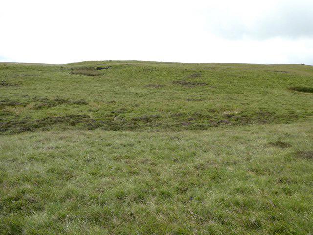 Photo could not load
SO0446 : Approaching the summit of Banc y Celyn
Jeremy Bolwell
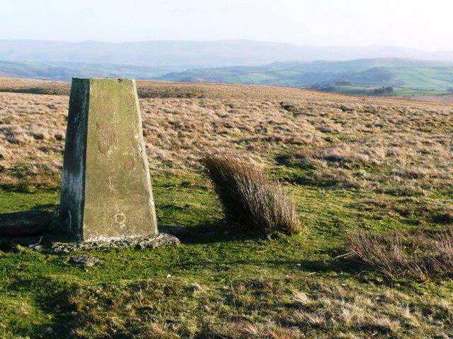 Photo could not load
SO0446 : Summit of Banc y Celyn
Graham Horn
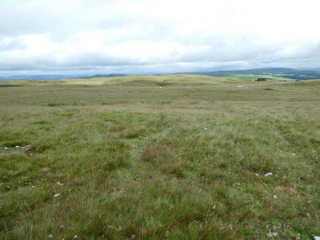 Photo could not load
SO0446 : View south-west from Banc y Celyn trig point
Jeremy Bolwell
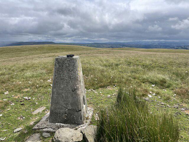 Photo could not load
SO0446 : Trig point on Banc y Celyn summit
Andrew Shannon
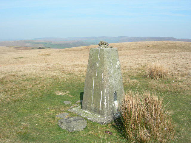 Photo could not load
SO0446 : Triangulation Pillar (S6530)
Adrian Dust
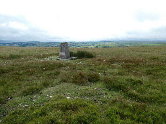 Photo could not load
SO0446 : Banc y Celyn
Jeremy Bolwell
Hill facts and local notes
Classifications
Elevation
472m
1,549 ft
Prominence
102m
Coordinates
52.1080, -3.3920
SO047464
OS Map
147
Explorer: 188
At the Summit
The summit features a prominent trig point and a large stone cairn, making it a picturesque spot for photos and a perfect place to take a breather after the ascent.
Terrain & Geology
Banc y Celyn is primarily composed of sandstone, with some surrounding limestone formations that provide a unique geological contrast in the area. These rock types contribute to the varied and beautiful landscape.
Views & Scenery
From the summit, you can see the sweeping views of the Brecon Beacons, as well as the distant silhouette of Pen y Fan and the beautiful Usk Valley.
History & Heritage
Name Origin
The name 'Banc y Celyn' translates to 'Hill of the Holly', highlighting the flora that might have once dominated the area.
Historical Significance
This area is steeped in local folklore, contributing to the rich cultural tapestry of the Brecon Beacons.
Getting There & Facilities
Check current local access restrictions, parking rules and transport timetables before travelling. These notes do not confirm public access to the summit.
Parking
There is a small parking area at SO047464 that accommodates several vehicles, but it can fill up quickly on weekends.
Public Transport
The nearest bus stop is located in the village of Libanus, approximately 4 km away. Plan ahead; services can be infrequent.
Nearby Facilities
Public toilets can be found in Brecon. Bring your own provisions as there are limited facilities nearby.
Safety Information
Known Hazards
- Beware of sudden weather changes; always check forecasts before setting out. Paths can be slippery after rain.
General Safety Tips
- Check weather conditions before setting out
- Carry appropriate clothing and equipment
- Let someone know your planned route
- Take a map, compass, and GPS device
- Carry emergency supplies: food, water, first aid kit, torch
Hills
Some common questions about the hills answered
Are there group walks up Banc y Celyn?
Many walkers use Walkmates to join or organise walks with others. You can check for group walks around Banc y Celyn through the maps
Are there other walkers around Banc y Celyn?
Activity varies by location and time, but Walkmates lets you see whether others have shared walks or shown interest in this area. Find other people through the walking friends search walking friends for Banc y Celyn search or of course create your own walk for Banc y Celyn
Can I organise a walk to Banc y Celyn?
Yes. If there aren’t any walks listed already, you can create a walk and make it available for others to join.
If you're signed up to Walkmates, you can create a walk to Banc y Celyn.
How do I find a walk up this hill?
There are often multiple ways to walk this hill, depending on experience and route preference. Walkmates helps you explore walks and routes that others have shared.
Can I suggest a new route up Banc y Celyn?
Yes. You can suggest or create routes to share with others. Walkmates focuses on the social side of walking, so routes are used to help people organise walks and explore areas together, rather than as detailed navigation tools or route libraries.
Other uses really appreciate knowledgeable walkers sharing their routes. Share your favourite route to Banc y Celyn here
The is an error or something incorrect about this hill. How do I let you know?
We always strive to keep the information on Walkmates as accurate as possible. If you find an error, please let us know through the contact form and we'll aim to correct it as quickly as possible
Community Discussion
Comments
Location
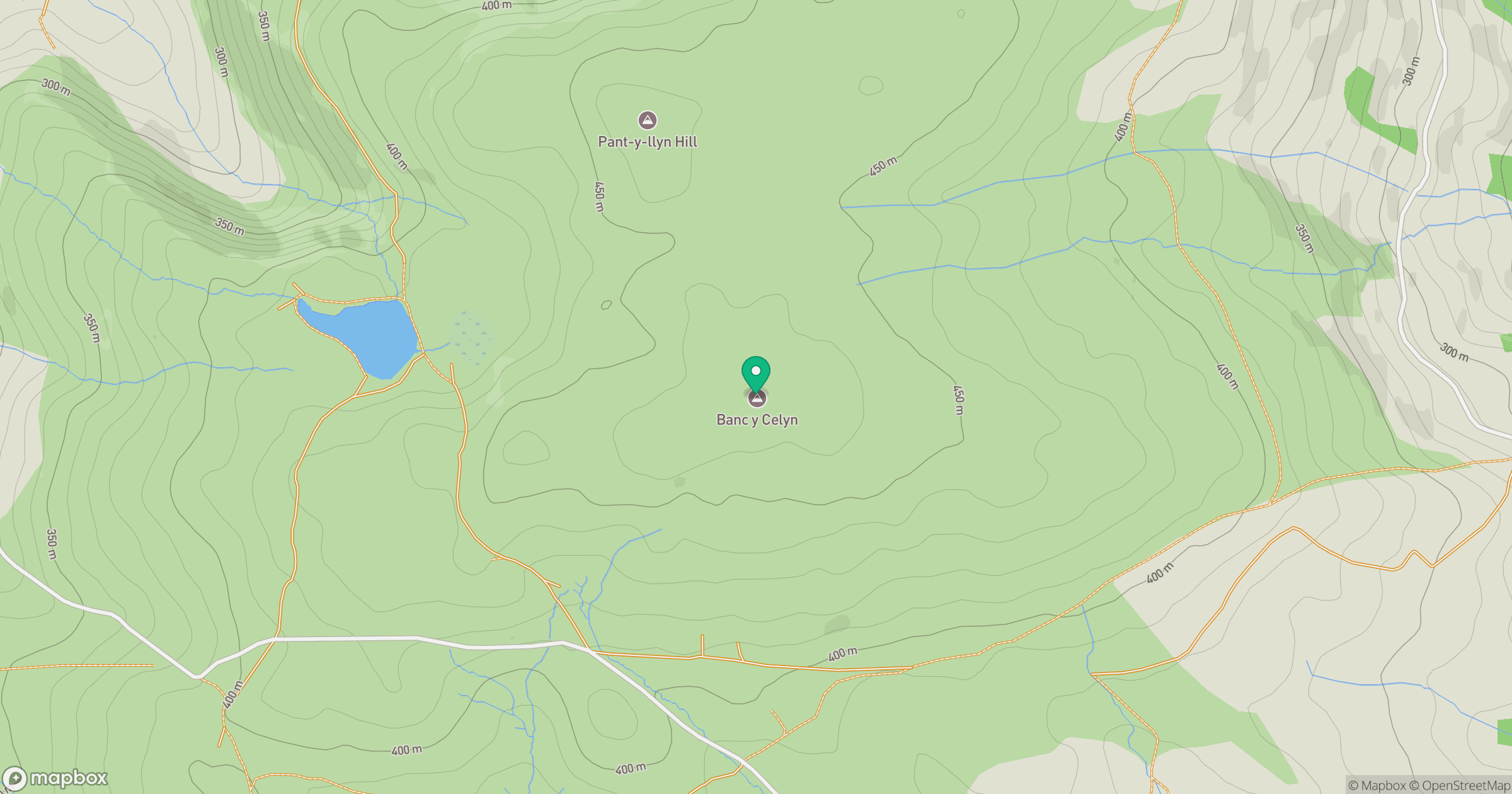
Grid reference: SO047464
View on OpenStreetMapOpens a map in a new tab, centred on the hill.
Hills within 30 km
Straight-line distance, not a walking route or confirmation of access.
No comments yet. Be the first.