
An t-Sleubhaich
Good walks are even better shared.
Overview
An t-Sleubhaich: A Highland Gem
Overview
Nestled in the captivating Scottish Highlands, An t-Sleubhaich stands proudly at 708 meters, offering adventurers a delightful quest through lush heather and rugged terrain. Its classification as a Hewitt and Marilyn certainly adds to its charm, attracting hikers eager to stamp another peak into their walking books.
Geology
The mountain boasts an intriguing geological composition, predominantly made up of Lewisian Gneiss and schist. These metamorphic rocks tell a story of ancient Earth’s history, shaped over billions of years. As you navigate its slopes, remember to look for fascinating rock formations that adorn the path.
Routes
The most popular route ascends from Beinn Dubh, a nearby hill. This moderate trek of 7.5 km takes approximately 3.5 hours, making it an ideal day hike. As you make your way to the summit, expect to encounter areas of challenging rock alongside stretches of tranquil heather.
Summit Features
Reaching the summit is rewarded with a sturdy stone cairn, perfect for posing with a backdrop of outstanding beauty. The panoramic views will leave you breathless—both from the spectacular sights and the climb!
Terrain Type
Expect varied terrain, including both rocky patches and soft heather-covered areas, with the occasional boggy spot to keep your feet guessing. Sturdy footwear is highly recommended to manage the dynamic landscape.
Views
From the peak, you’ll be treated to sweeping vistas of the majestic Ben Nevis and the shimmering waters of Loch Eil. For the best views, plan your hike during late spring to early autumn. However, don’t shy away from autumn; the colourful foliage can be a sight to behold!
Hazards
Scottish weather can be as fickle as a cat on a hot tin roof. Always be prepared for unexpected changes, especially in winter months. The rocky terrain might present some challenges, particularly during wet conditions.
Nearby Summits
Nearby, you’ll find Beinn Bhreac and Meall na Teanga, both of which offer additional hiking opportunities for those keen to explore further.
Access
Parking is available in the quaint village of Glenfinnan, making it easy to kick start your adventure. The area is accessible via the West Highland Railway, and the bustling town of Fort William is just a short distance away, brimming with amenities for post-hike recovery.
Facilities
Although facilities are limited in Glenfinnan, a lovely café and public toilets are worth mentioning. Don’t forget to grab a treat to refuel for your descent!
History
The name An t-Sleubhaich captures local folklore beautifully, hinting at tales of Jacobite adventures in the region. The history attached to this majestic peak adds an enchanting layer to your hike.
In summary, An t-Sleubhaich is an inviting challenge offering stunning views and a taste of Scottish heritage. So lace up your boots, grab your walking stick, and get ready for a Highland adventure!
Explore routes near An t-Sleubhaich
Public walks starting within 80 km of this hill. Nearby does not mean a route reaches the summit; check its map and access before setting out.
Banavie to Glen Loy Aqueduct: Neptune’s Staircase Canal Towpath
View route
Ben Nevis via Mountain Path
View route
Loch Affric full circuit from River Affric
View route
Fort Augustus to Kytra Lock: Caledonian Canal Towpath
View route
Route planning notes
These notes describe possible approaches, not verified navigable routes or permission to cross land. Check current paths, local access rules and conditions before setting out.
Hill of Beinn Dubh
Starting from the nearby hill of Beinn Dubh, this route meanders through beautiful heather-clad slopes and rocky outcrops before reaching the summit.
Make a day of it, together
Find someone to share the walk with, or organise a day out along a route you like.
Hill facts and local notes
Classifications
Elevation
533m
1,749 ft
Prominence
105m
Coordinates
56.8660, -5.4841
NM877803
OS Map
40
Explorer: 391 398E
At the Summit
At the summit, you'll find a traditional stone cairn and a breathtaking 360-degree view of the surrounding landscape. It's the perfect spot to catch your breath—or to catch a selfie with those stunning views.
Terrain & Geology
An t-Sleubhaich is primarily composed of metamorphic rocks typical of the region, with a fascinating history of geological processes shaping its rugged contours. The presence of Lewisian Gneiss and schist gives the mountain its characteristic rocky features.
Views & Scenery
From the summit, you can spot iconic features like the stunning Ben Nevis, the highest peak in the UK, and the shimmering waters of Loch Eil.
History & Heritage
Name Origin
An t-Sleubhaich translates to 'the Sluggish one' in Gaelic, a nod to the mountain's contoured silhouette.
Historical Significance
The mountain is steeped in local history, with legends of the Jacobite uprising adding to its mystique.
Getting There & Facilities
Check current local access restrictions, parking rules and transport timetables before travelling. These notes do not confirm public access to the summit.
Parking
Parking is available at the base near the village of Glenfinnan, with a small car park suitable for several vehicles.
Public Transport
Glenfinnan is served by the West Highland Railway, with a scenic train ride offering splendid views.
Nearby Facilities
There are limited facilities in Glenfinnan, but you can find a charming café and a public toilet. Keep your eyes peeled for some delightful local treats!
Safety Information
Known Hazards
- As with many Scottish mountains, be wary of sudden weather changes, particularly in winter months. The rocky terrain can become slippery.
General Safety Tips
- Check weather conditions before setting out
- Carry appropriate clothing and equipment
- Let someone know your planned route
- Take a map, compass, and GPS device
- Carry emergency supplies: food, water, first aid kit, torch
Hills
Some common questions about the hills answered
Are there group walks up An t-Sleubhaich?
Many walkers use Walkmates to join or organise walks with others. You can check for group walks around An t-Sleubhaich through the maps
Are there other walkers around An t-Sleubhaich?
Activity varies by location and time, but Walkmates lets you see whether others have shared walks or shown interest in this area. Find other people through the walking friends search walking friends for An t-Sleubhaich search or of course create your own walk for An t-Sleubhaich
Can I organise a walk to An t-Sleubhaich?
Yes. If there aren’t any walks listed already, you can create a walk and make it available for others to join.
If you're signed up to Walkmates, you can create a walk to An t-Sleubhaich.
How do I find a walk up this hill?
There are often multiple ways to walk this hill, depending on experience and route preference. Walkmates helps you explore walks and routes that others have shared.
Can I suggest a new route up An t-Sleubhaich?
Yes. You can suggest or create routes to share with others. Walkmates focuses on the social side of walking, so routes are used to help people organise walks and explore areas together, rather than as detailed navigation tools or route libraries.
Other uses really appreciate knowledgeable walkers sharing their routes. Share your favourite route to An t-Sleubhaich here
The is an error or something incorrect about this hill. How do I let you know?
We always strive to keep the information on Walkmates as accurate as possible. If you find an error, please let us know through the contact form and we'll aim to correct it as quickly as possible
Community Discussion
Comments
Location
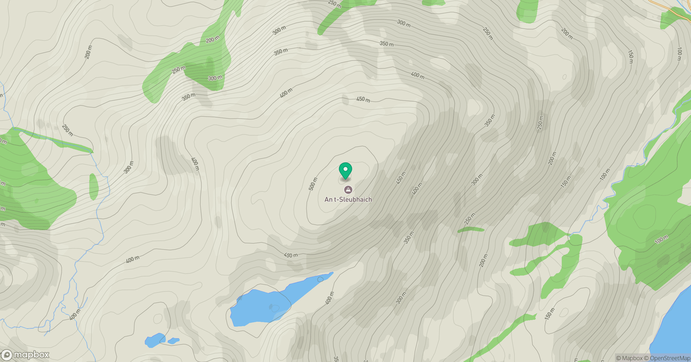
Grid reference: NM877803
View on OpenStreetMapOpens a map in a new tab, centred on the hill.
Hills within 30 km
Straight-line distance, not a walking route or confirmation of access.
An Caisteal
622m
Ladhar Bheinn
1,020m
Beinn Mheadhoin
739m
Sgurr a' Mhaoraich
1,027m
Gleouraich
1,035m
No comments yet. Be the first.