

Beinn Odhar Mhor
Good walks are even better shared.
Overview
Beinn Odhar Mhor: An Adventurer's Delight
Introduction
Beinn Odhar Mhor, a proud Munro standing at 875 meters, graces the Scottish Highlands with its impressive stature and rugged beauty. Known for its challenging ascents and rewarding vistas, it's no wonder that this mountain has charmed hikers for generations.
Geology
The geology of Beinn Odhar Mhor is primarily characterized by granitic rocks. This creates the rugged landscape so familiar to the area, prominently featuring steep cliffs and scattered rocky outcrops that add character. Weathering of these rocks has produced various microhabitats, supporting diverse flora and fauna—look out for that rare plant hiding in a crevice!
Routes
The most common approach is via the Glen Etive Route, a 12 km trek that will have you sweating, swearing, and laughing as you conquer the ascent. For something a bit gentler, the Kilchurn Castle approach serves as a delightful alternative, perfect for families or those simply looking for a leisurely hike to soak in the views.
Summit Features
Upon reaching the summit, you'll be greeted by a rocky outcrop and a proud cairn that calls for your attention. Snap a photo for posterity—or social media validation—before descending. Just remember that it’s hard to capture the wind in your face, so enjoy the moment while it lasts.
Terrain
Be prepared for a varied terrain that includes rocky paths, grassy stretches, and the occasional bog. These boggy areas can really surprise you, so keep your footwork light—like you're stepping over a sleeping dragon!
Views
From the top, the views are nothing short of spectacular, with Loch Awe stretching below and the mighty Ben Cruachan sitting proud. The best seasons for these sweeping vistas are spring and autumn, when the atmosphere is clear and the colours are vibrant.
Hazards
As with any mountain, hazards lurk—particularly lose rocks and rapidly changing weather. Ensure you're adequately prepared, heed weather warnings, and absolutely do not step into the proverbial quicksand, unless you fancy a very muddy Instagram photo!
Access
Nearest parking is at the head of Glen Etive, which can fill up quickly on weekends. If you're hoping to ditch the car, there's limited public transport from Oban. Tyndrum is your closest town, well worth a stop for pre-hike snacks and toilet breaks.
Facilities
Facilities are minimal on the mountain itself. Make sure to use the amenities in Tyndrum where you can find everything from snacks to coffee, keeping your energy up and your spirits high.
History
In terms of history, Beinn Odhar Mhor’s name means ‘the Great Dun-coloured Mountain’. This name reflects its somewhat dramatic, forbidding presence in the Scottish landscape. It has a rich tapestry of tales woven into the very rock, celebrating its significance to adventurers long before us.
Conclusion
Beinn Odhar Mhor is not just a mountain; it’s a joyful journey waiting to be experienced. So lace up those boots, pack that adventurous spirit, and head out to discover what this stunning Highland gem has to offer. Safe travels, and may your ascent be filled with laughter and breathtaking sights!
Explore routes near Beinn Odhar Mhor
Public walks starting within 80 km of this hill. Nearby does not mean a route reaches the summit; check its map and access before setting out.
Banavie to Glen Loy Aqueduct: Neptune’s Staircase Canal Towpath
View route
Ben Nevis via Mountain Path
View route
Loch Affric full circuit from River Affric
View route
Fort Augustus to Kytra Lock: Caledonian Canal Towpath
View route
Route planning notes
These notes describe possible approaches, not verified navigable routes or permission to cross land. Check current paths, local access rules and conditions before setting out.
Glen Etive Route
This popular ascent begins at the head of Glen Etive, offering a steady climb through scenic valleys and moorlands before reaching the summit.
Kilchurn Castle Approach
Starting from Kilchurn Castle, this route meanders through lush landscapes, with the added bonus of stunning views of the castle itself.
Make a day of it, together
Find someone to share the walk with, or organise a day out along a route you like.
Photo Gallery
View all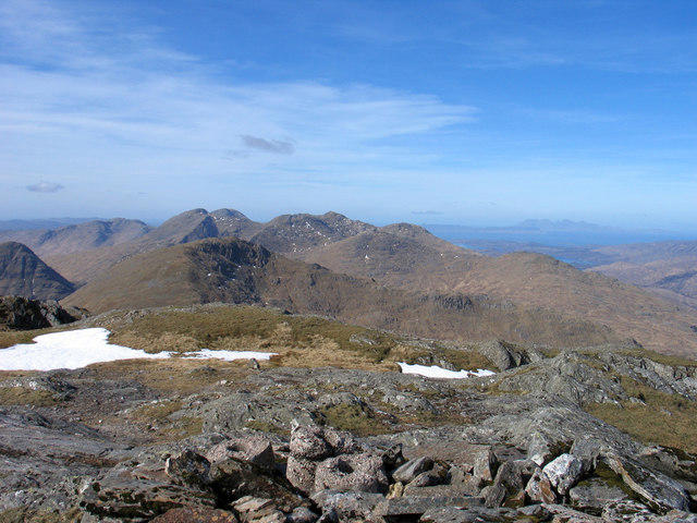 Photo could not load
NM8579 : Summit area of Beinn Odhar Mhòr
Trevor Littlewood
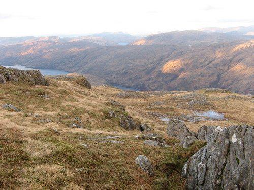 Photo could not load
NM8579 : Summit area of Beinn Odhar Mhor
trevor willis
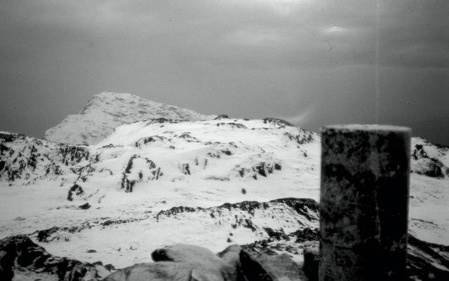 Photo could not load
NM8579 : Summit, Beinn Odhar Mhòr
Richard Webb
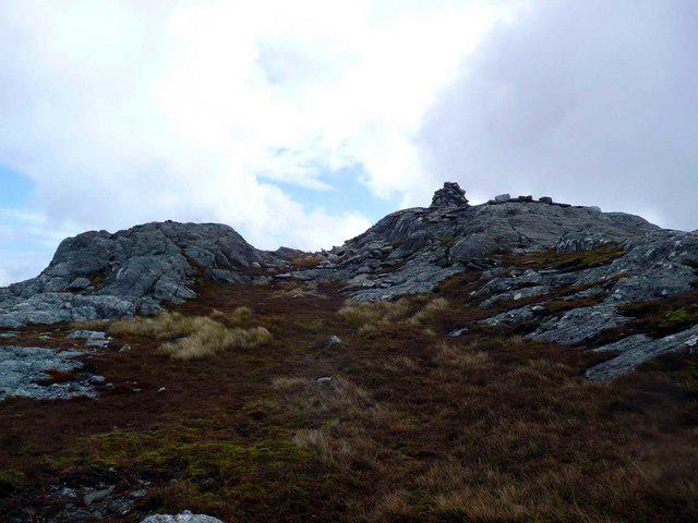 Photo could not load
NM8579 : Summit cairn on Beinn Odhar Mhor
Gordon Brown
Hill facts and local notes
Classifications
Elevation
870m
2,855 ft
Prominence
112m
Coordinates
56.8535, -5.5254
NM851791
OS Map
40
Explorer: 391 398E
At the Summit
The summit features a prominent rocky outcrop and a cairn, providing a perfect photo opportunity. Don’t forget to snap a shot—if you don’t post it on social media, did you even climb the mountain?
Terrain & Geology
Beinn Odhar Mhor is primarily composed of granitic rocks, leading to its rugged landscape. The weathering of these rocks contributes to the unique features of the mountain, including its steep cliffs and rocky outcrops.
Views & Scenery
From the summit, hikers can enjoy panoramic views of Loch Awe and the surrounding peaks such as Ben Cruachan and the rugged landscape of the Highlands.
History & Heritage
Name Origin
The name 'Beinn Odhar Mhor' translates from Gaelic as 'the Great Dun-coloured Mountain', likely referencing its rocky and often moody appearance.
Historical Significance
The area around Beinn Odhar Mhor is steeped in Scottish folklore, and the mountain itself has been a popular destination for mountaineers since the early 20th century.
Getting There & Facilities
Check current local access restrictions, parking rules and transport timetables before travelling. These notes do not confirm public access to the summit.
Parking
The nearest parking area is located at the head of Glen Etive, where there is a small parking lot suitable for about 8-10 cars. It's a popular starting point, so arriving early is advisable.
Public Transport
The nearest village, Dalness, is accessible via bus routes from Oban. However, public transport options may be limited, so plan accordingly.
Nearby Facilities
There are no facilities directly on the mountain. However, Tyndrum offers various cafes, shops, and public toilets to stock up on essentials before your trek.
Safety Information
Known Hazards
- Loosely packed rocks in some areas can pose a risk of slipping. Beware of changing weather conditions, which can turn from sunny to stormy in the blink of a Highland eye.
General Safety Tips
- Check weather conditions before setting out
- Carry appropriate clothing and equipment
- Let someone know your planned route
- Take a map, compass, and GPS device
- Carry emergency supplies: food, water, first aid kit, torch
Hills
Some common questions about the hills answered
Are there group walks up Beinn Odhar Mhor?
Many walkers use Walkmates to join or organise walks with others. You can check for group walks around Beinn Odhar Mhor through the maps
Are there other walkers around Beinn Odhar Mhor?
Activity varies by location and time, but Walkmates lets you see whether others have shared walks or shown interest in this area. Find other people through the walking friends search walking friends for Beinn Odhar Mhor search or of course create your own walk for Beinn Odhar Mhor
Can I organise a walk to Beinn Odhar Mhor?
Yes. If there aren’t any walks listed already, you can create a walk and make it available for others to join.
If you're signed up to Walkmates, you can create a walk to Beinn Odhar Mhor.
How do I find a walk up this hill?
There are often multiple ways to walk this hill, depending on experience and route preference. Walkmates helps you explore walks and routes that others have shared.
Can I suggest a new route up Beinn Odhar Mhor?
Yes. You can suggest or create routes to share with others. Walkmates focuses on the social side of walking, so routes are used to help people organise walks and explore areas together, rather than as detailed navigation tools or route libraries.
Other uses really appreciate knowledgeable walkers sharing their routes. Share your favourite route to Beinn Odhar Mhor here
The is an error or something incorrect about this hill. How do I let you know?
We always strive to keep the information on Walkmates as accurate as possible. If you find an error, please let us know through the contact form and we'll aim to correct it as quickly as possible
Community Discussion
Comments
Location
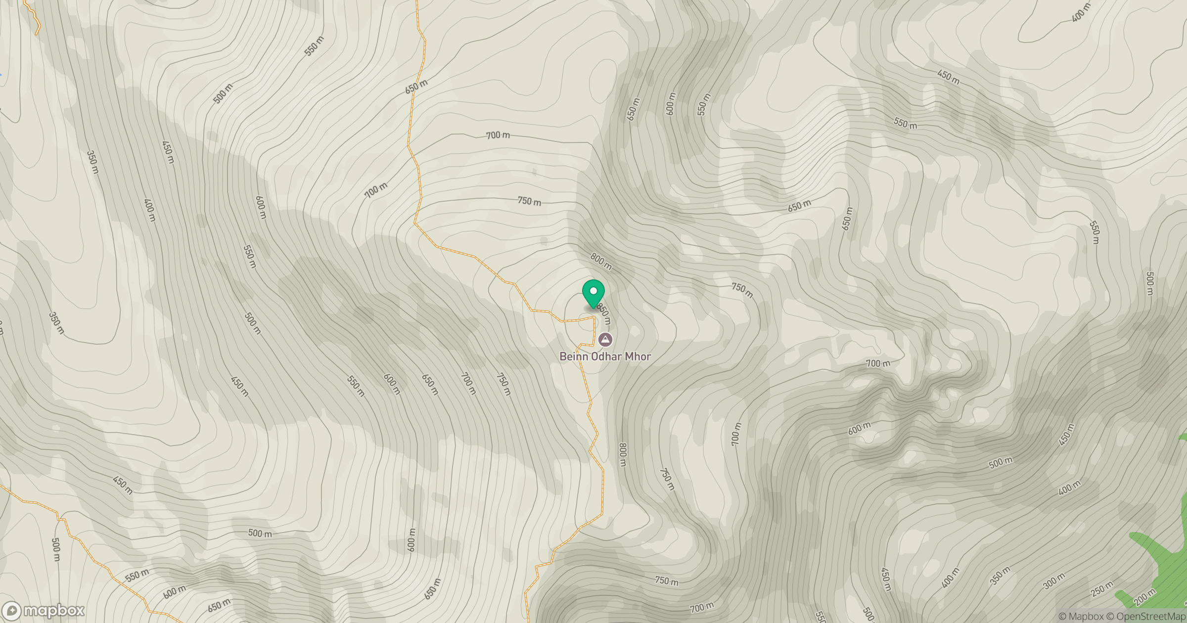
Grid reference: NM851791
View on OpenStreetMapOpens a map in a new tab, centred on the hill.
Hills within 30 km
Straight-line distance, not a walking route or confirmation of access.
Ladhar Bheinn
1,020m
An Caisteal
622m
Beinn Mheadhoin
739m
Beinn Odhar Bheag
883m
Sgurr a' Mhuidhe
562m
No comments yet. Be the first.