

Sgurr a' Mhuidhe
Good walks are even better shared.
Overview
Sgurr a' Mhuidhe: The Peak of the Moss
If you're looking for the kind of mountain that will make you feel alive, look no further than Sgurr a' Mhuidhe. This Munro offers an exhilarating challenge for both novice hikers and seasoned climbers alike.
Geology
Sgurr a' Mhuidhe is a fine example of the captivating geological history of the Scottish Highlands. Composed mainly of metamorphic schists and gneisses, this mountain showcases nature's artistry, shaped over millennia by relentless glaciers. Just think: while you’re puffing up its slopes, you’re walking over rocks that have been around longer than your great-great-grandparents!
Routes
Southern Approach from the A861
This popular route is perfect for those who are gearing up to conquer their first Munro. With a distance of 12.5 km and a moderate difficulty rating, it takes about 5 hours to complete. You’ll wander through lovely heather moors and have an excellent chance to spot local wildlife along the way.
Northern Ridge
For the more adventurous souls, the Northern Ridge offers a challenging ascent that promises breathtaking views, especially along the crest. At 10 km with a 6-hour trek ahead, it’s not for the faint-hearted, but the spectacular vistas are worth every sweat-drenched moment!
Summit Features
When you finally reach the summit, you'll be greeted by a classic stone cairn and possibly the best view you'll see all week (barring a visit to your grandmother's house, of course). On clear days, the Isle of Mull is a distant gem just begging for your camera's attention.
Terrain
The terrain is predominantly rocky, so sturdy footwear is a must! Don't forget to be prepared for some boggy patches; Scotland is renowned for its rather liberal approach to moisture!
Views
The views from Sgurr a' Mhuidhe are nothing short of breathtaking. You can see the stunning Ardnamurchan Peninsula, Ben Nevis to the north, and the sparkling waters of Loch Sunart. The best time for stunning vistas is late spring or early autumn when the scenery dazzles in vibrant seasonal colours.
Hazards
While this mountain is a walker’s paradise, it’s not without its hazards. Keep an eye out for slippery stones and remember, the weather can turn on a dime. Those steep drops are as dramatic as they sound!
Access
Parking is available at a small layby along the A861, just be sure to arrive early during peak times to avoid any disappointment. The nearest bus stop is in Strontian, roughly a 5 km walk to the trailhead.
Facilities
Strontian has a few local cafés and a convenience store where you can grab a bite before your ascent, but once on the mountain, facilities are non-existent.
History
The etymology behind Sgurr a' Mhuidhe means 'peak of the moss', a title indicating its lush surroundings. This mountain has stood for generations as a beloved landmark in local folklore, making it not just a hike but a journey into Scotland’s rich heritage.
In conclusion, no matter how you approach it, Sgurr a' Mhuidhe promises to be a fantastic experience. So pack your gear, lace up those hiking boots, and prepare for an adventure that you won't soon forget!
Explore routes near Sgurr a' Mhuidhe
Public walks starting within 80 km of this hill. Nearby does not mean a route reaches the summit; check its map and access before setting out.
Banavie to Glen Loy Aqueduct: Neptune’s Staircase Canal Towpath
View route
Ben Nevis via Mountain Path
View route
Loch Affric full circuit from River Affric
View route
Fort Augustus to Kytra Lock: Caledonian Canal Towpath
View route
Route planning notes
These notes describe possible approaches, not verified navigable routes or permission to cross land. Check current paths, local access rules and conditions before setting out.
Southern Approach from the A861
A well-trodden path offering a steady ascent through scenic glens and heather-clad hills, perfect for those looking to tackle their first Munro.
Northern Ridge
A more challenging and rewarding option for seasoned hikers, this route features a steep ascent and spectacular views, especially along the ridgeline.
Make a day of it, together
Find someone to share the walk with, or organise a day out along a route you like.
Photo Gallery
View all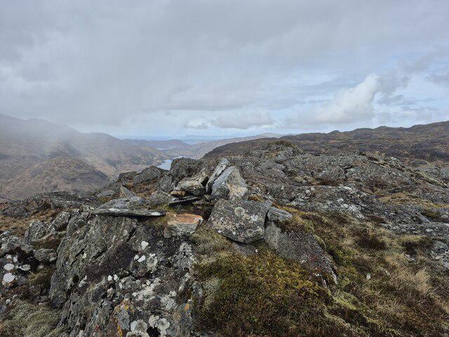 Photo could not load
NM8582 : Tiny cairn on Sgurr a' Mhuidhe
Steven Brown
Hill facts and local notes
Classifications
Elevation
562m
1,844 ft
Prominence
108m
Coordinates
56.8831, -5.5137
NM860823
OS Map
40
Explorer: 398E
At the Summit
The summit is marked by a classic stone cairn and offers panoramic views of the surrounding valleys and peaks. On a clear day, you might even spot the distant Isle of Mull!
Terrain & Geology
Sgurr a' Mhuidhe is primarily composed of metamorphic rocks, particularly schists and gneisses, indicative of the complex geological history of the Scottish Highlands. The rugged terrain has been shaped by glacial activity, creating the breathtaking cliffs and ridges that define this peak.
Views & Scenery
From the summit, hikers can enjoy spectacular vistas of the Ardnamurchan Peninsula, Ben Nevis to the north, and the shimmering waters of Loch Sunart.
History & Heritage
Name Origin
The name 'Sgurr a' Mhuidhe' is derived from Gaelic, translating to 'peak of the moss'.
Historical Significance
This mountain is steeped in local folklore and has been a cherished landmark for generations of hillwalkers and climbers.
Getting There & Facilities
Check current local access restrictions, parking rules and transport timetables before travelling. These notes do not confirm public access to the summit.
Parking
Parking is available at the small layby near the A861 road, with enough space for several cars. Arrive early during peak seasons to secure a spot.
Public Transport
The nearest bus stop is in Strontian, from where you can walk to the start of the route or arrange for a lift.
Nearby Facilities
Strontian offers a few local cafés and a convenience store; however, facilities on the mountain itself are non-existent, so plan accordingly.
Safety Information
Known Hazards
- Rocky terrain can be slippery, and weather conditions can change rapidly. Watch out for loose stones and be mindful of steep drops.
General Safety Tips
- Check weather conditions before setting out
- Carry appropriate clothing and equipment
- Let someone know your planned route
- Take a map, compass, and GPS device
- Carry emergency supplies: food, water, first aid kit, torch
Hills
Some common questions about the hills answered
Are there group walks up Sgurr a' Mhuidhe?
Many walkers use Walkmates to join or organise walks with others. You can check for group walks around Sgurr a' Mhuidhe through the maps
Are there other walkers around Sgurr a' Mhuidhe?
Activity varies by location and time, but Walkmates lets you see whether others have shared walks or shown interest in this area. Find other people through the walking friends search walking friends for Sgurr a' Mhuidhe search or of course create your own walk for Sgurr a' Mhuidhe
Can I organise a walk to Sgurr a' Mhuidhe?
Yes. If there aren’t any walks listed already, you can create a walk and make it available for others to join.
If you're signed up to Walkmates, you can create a walk to Sgurr a' Mhuidhe.
How do I find a walk up this hill?
There are often multiple ways to walk this hill, depending on experience and route preference. Walkmates helps you explore walks and routes that others have shared.
Can I suggest a new route up Sgurr a' Mhuidhe?
Yes. You can suggest or create routes to share with others. Walkmates focuses on the social side of walking, so routes are used to help people organise walks and explore areas together, rather than as detailed navigation tools or route libraries.
Other uses really appreciate knowledgeable walkers sharing their routes. Share your favourite route to Sgurr a' Mhuidhe here
The is an error or something incorrect about this hill. How do I let you know?
We always strive to keep the information on Walkmates as accurate as possible. If you find an error, please let us know through the contact form and we'll aim to correct it as quickly as possible
Community Discussion
Comments
Location
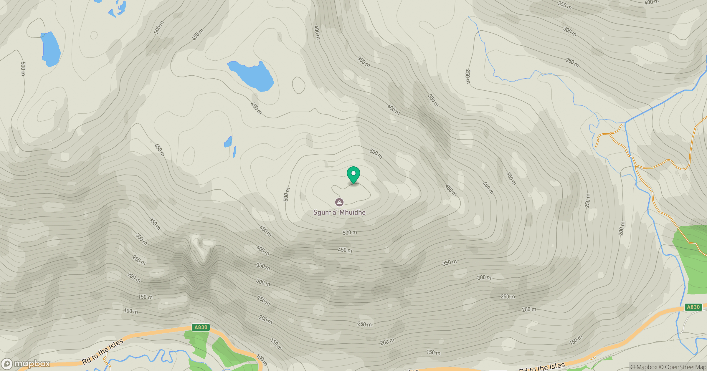
Grid reference: NM860823
View on OpenStreetMapOpens a map in a new tab, centred on the hill.
Hills within 30 km
Straight-line distance, not a walking route or confirmation of access.
No comments yet. Be the first.