

Y Foel Goch
Good walks are even better shared.
SH6758 : From Y Foel Goch to Glyder Fach
Richard Law Photo source
Overview
Y Foel Goch
Nestled in the heart of Snowdonia National Park, Y Foel Goch stands proudly at an elevation of 651 meters. This Marilyn offers not only a delightful climb for both seasoned hikers and novices alike but also breathtaking views that make every step worth it.
Geology
As you traverse its slopes, you'll notice the diverse geology of the region. Y Foel Goch is made up of ancient volcanic rock, dating back to the Ordovician period. The interesting sedimentary deposits tell a tale of a dramatic geologic history filled with tectonic shifts and volcanic activity.
Routes
One of the most popular hiking routes is the Bwlch y Ddeufaen Route. Spanning about 8 kilometers, it leads you through picturesque landscapes that epitomise the rugged beauty of North Wales. Expect to spend roughly 3.5 hours on this moderate trail. Alternatively, the Pantgwyn Route provides a more challenging experience with direct ascents, perfect for those looking to test their mettle!
Summit Features
At the summit, you'll discover a rocky outcrop adorned with a modest stone cairn, a perfect spot to rest and enjoy the views—and maybe add a stone of your own!
Terrain
The terrain varies from grassy slopes to craggy rocks, creating a delightful mix that keeps your hike exciting. Just be sure to keep your footing!
Views
The summit rewards your efforts with panoramic views of the surrounding Snowdonia landscape, including the majestic peaks of Snowdon itself. For the best views, consider hiking in spring when the heather is in bloom or in autumn when the trees are ablaze with colour.
Hazards
While the views are stunning, remember that the weather can be a fickle friend. Always check forecasts before setting out, and take care on the loose rocks along the way.
Access
For those driving, a small car park at Bwlch y Ddeufaen accommodates around ten vehicles. However, be prepared to arrive early, especially on weekends, as spots fill up quickly. The nearest public transport options are limited to a bus service from Conwy, which leaves you a bit of a trek before the adventure begins.
After your hike, Conwy offers a variety of cafes where you can grab a well-deserved cup of tea or cake, and don't forget the public toilets.
History
The etymology of Y Foel Goch translates to 'The Red Hill', perhaps referencing the unique hue of its rock and soil. This peak is not only a fantastic hiking destination but also enriches local folklore, adding a touch of historical significance to every step.
With its combination of natural beauty, accessible routes, and rich cultural history, Y Foel Goch is a must-visit for any outdoor enthusiast. Pack your hiking boots and prepare for a memorable adventure!
Explore routes near Y Foel Goch
Walks starting near this hill. Open a route to check its map, distance and full itinerary.
Snowdon Pyg Track returning by Miner's Track
View route
Llyn Crafnant: Lakeside Circuit from the NRW Car Park
View route
Beddgelert Forest: Derwen Circuit and Llyn Llywelyn
View route
Beddgelert Forest: Llyn Llywelyn Woodland Circuit
View route
Route planning notes
These notes describe possible approaches. Check a route's map and access information when planning your walk.
Bwlch y Ddeufaen Route
A scenic route that starts from Bwlch y Ddeufaen, leading you through beautiful hills and the tranquillity of the surrounding countryside before ascending to the summit.
Pantgwyn Route
An alternative route that offers a more challenging ascent directly from the nearby valley, perfect for those looking to break a sweat and enjoy stunning views.
Make a day of it, together
Find someone to share the walk with, or organise a day out along a route you like.
Photo Gallery
View all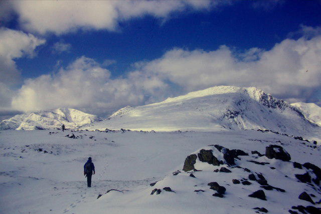 Photo could not load
SH6758 : From Y Foel Goch to Glyder Fach
Richard Law
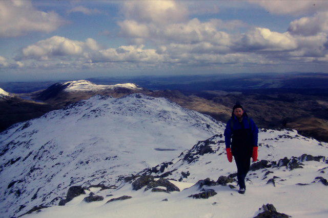 Photo could not load
SH6758 : Climbing towards Y Foel Goch
Richard Law
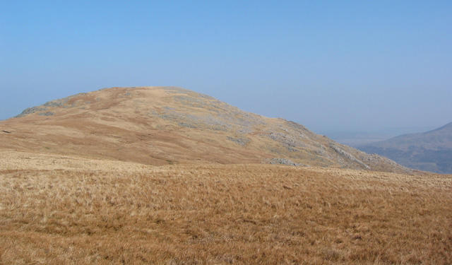 Photo could not load
SH6758 : Y Foel Goch summit
Espresso Addict
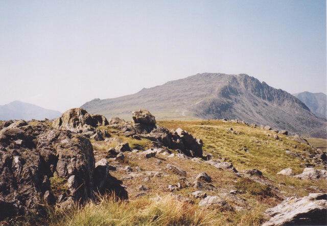 Photo could not load
SH6758 : Glacial erratics near the summit of Y Foel Goch
Eric Jones
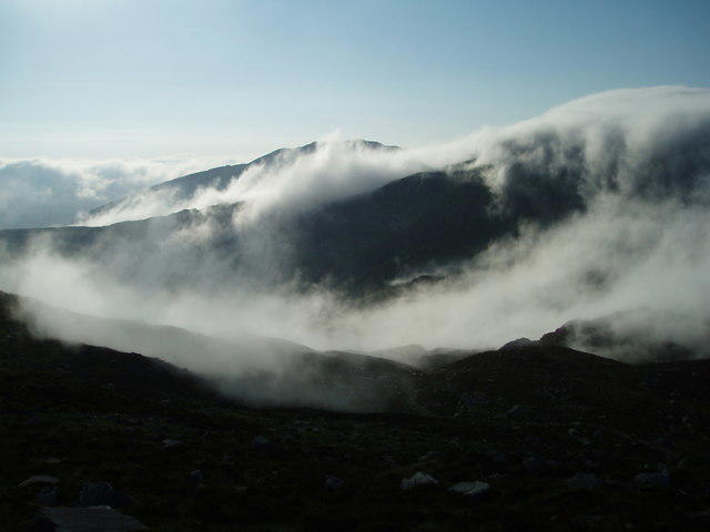 Photo could not load
SH6758 : View of Y Foel Goch
Chris Andrews
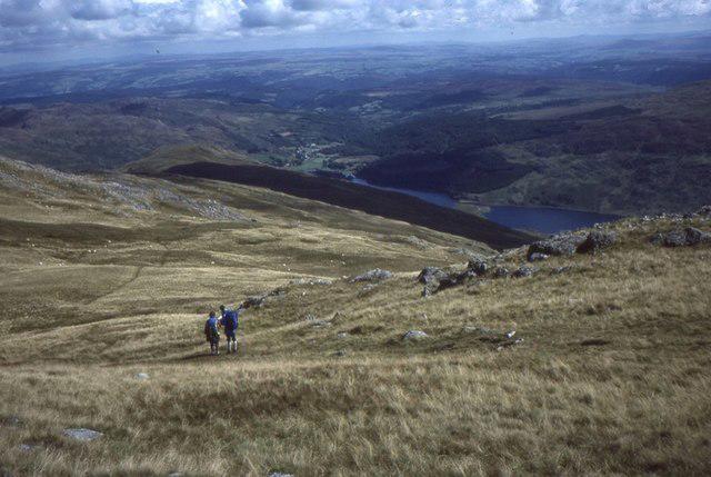 Photo could not load
SH6758 : Descent from Y Foel Goch
Richard Webb
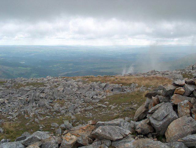 Photo could not load
SH6758 : The top of Y Foel Goch
Bill Boaden
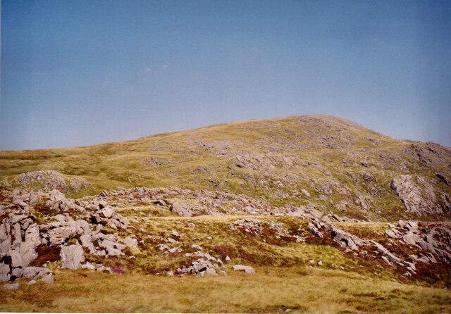 Photo could not load
SH6758 : View North towards the summit of Y Foel Goch
Eric Jones
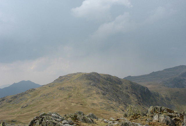 Photo could not load
SH6758 : Y Foel Goch from Gallt Yr Ogof
Eric Jones
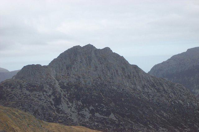
SH6758 : Eastern Face of Tryfan from Y Foel Goch Summit
Terry Hughes
Hill facts and local notes
Classifications
Elevation
805m
2,641 ft
Prominence
63m
Coordinates
53.1047, -3.9765
SH677582
OS Map
115
Explorer: OL17W
At the Summit
The summit features a prominent rocky outcrop with a small stone cairn, giving hikers a chance to leave their mark – or at least a few rocks for the next adventurer.
Terrain & Geology
Y Foel Goch is primarily composed of volcanic rock from the Ordovician period, with interesting sedimentary deposits that tell tales of ancient geological events, including tectonic shifts and volcanic eruptions.
Views & Scenery
From the summit, you’ll be treated to breathtaking views of the surrounding peaks including Snowdon and the rugged beauty of the Snowdonia range, with valleys stretching as far as the eye can see.
History & Heritage
Name Origin
The name 'Y Foel Goch' translates to 'The Red Hill', possibly referring to the distinctive colour of the soil or rock in certain light.
Historical Significance
This mountain not only offers a great hiking experience but is also steeped in local legend and folklore, making it a significant part of the cultural landscape.
Getting There & Facilities
Parking
There is a small parking area at Bwlch y Ddeufaen, which accommodates about ten cars. It can get busy on weekends, so arrive early.
Public Transport
The nearest public transport option is the bus service from Conwy. The nearest stop is several miles away, so be prepared for a bit of a walk.
Nearby Facilities
There are no facilities directly on the mountain, but plenty can be found in Conwy, including cafes for post-hike refreshment and public toilets.
Safety Information
Known Hazards
- Weather can be unpredictable; ensure you check forecasts before heading out. Loose rocks can also be a tripping hazard.
General Safety Tips
- Check weather conditions before setting out
- Carry appropriate clothing and equipment
- Let someone know your planned route
- Take a map, compass, and GPS device
- Carry emergency supplies: food, water, first aid kit, torch
Hills
Some common questions about the hills answered
Are there group walks up Y Foel Goch?
Many walkers use Walkmates to join or organise walks with others. You can check for group walks around Y Foel Goch through the maps
Are there other walkers around Y Foel Goch?
Activity varies by location and time, but Walkmates lets you see whether others have shared walks or shown interest in this area. Find other people through the walking friends search walking friends for Y Foel Goch search or of course create your own walk for Y Foel Goch
Can I organise a walk to Y Foel Goch?
Yes. If there aren’t any walks listed already, you can create a walk and make it available for others to join.
If you're signed up to Walkmates, you can create a walk to Y Foel Goch.
How do I find a walk up this hill?
There are often multiple ways to walk this hill, depending on experience and route preference. Walkmates helps you explore walks and routes that others have shared.
Can I suggest a new route up Y Foel Goch?
Yes. You can suggest or create routes to share with others. Walkmates focuses on the social side of walking, so routes are used to help people organise walks and explore areas together, rather than as detailed navigation tools or route libraries.
Other uses really appreciate knowledgeable walkers sharing their routes. Share your favourite route to Y Foel Goch here
The is an error or something incorrect about this hill. How do I let you know?
We always strive to keep the information on Walkmates as accurate as possible. If you find an error, please let us know through the contact form and we'll aim to correct it as quickly as possible
Community Discussion
Comments
Location
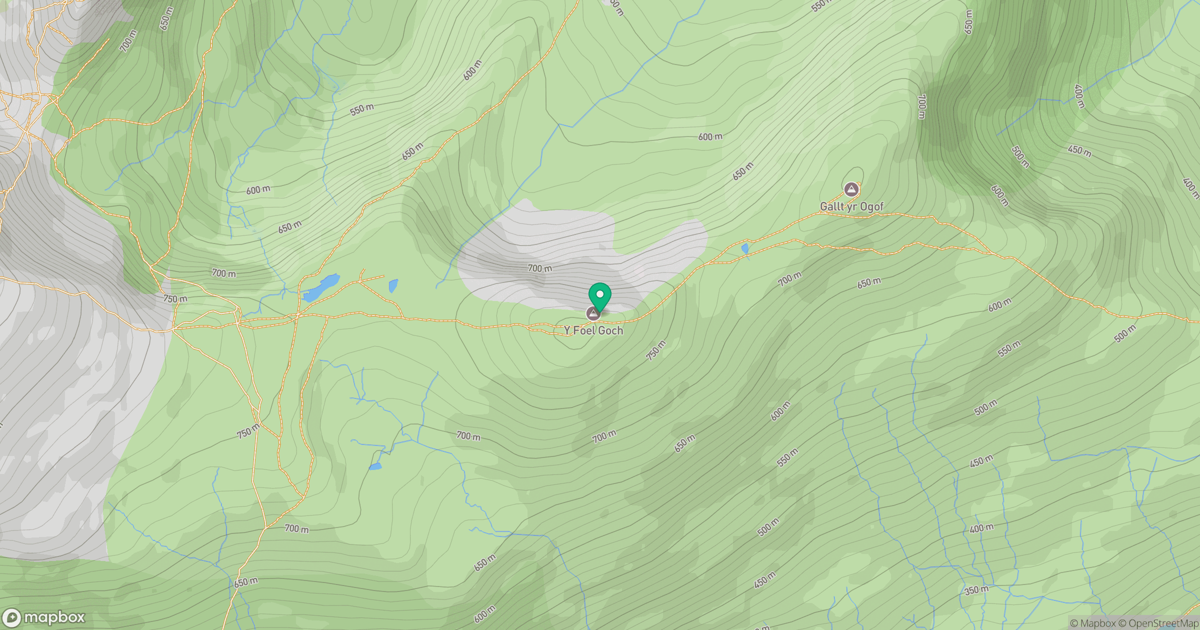
Grid reference: SH677582
View on OpenStreetMapOpens a map in a new tab, centred on the hill.
No comments yet. Be the first.