
Windmill Hill
Good walks are even better shared.
Overview
Windmill Hill
Nestled in the heart of the enchanting South Downs, Windmill Hill beckons hikers with its charm and scenic vistas. At an elevation of 190 meters, it may not be the highest peak, but as they say, good things come in small packages!
Geology
As you traverse the chalky terrain, keep an eye out for interesting fossil formations, remnants of ancient marine life that once inhabited this area. The gentle erosion has sculpted the slopes into their current soft profile, making it a perfect playground for geology enthusiasts.
Routes
The primary route up Windmill Hill starts in the delightful village of Alfriston. This circular walk takes about 2.5 hours and covers approximately 6.5 kilometers. What could be better than a jaunt through lush meadows? Just keep your eyes peeled for the local sheep, they can be quite the photobombers!
Summit Features
Reaching the summit, you'll be greeted by a stone cairn and a trig point that demands a celebratory photo! The panoramic views from here can easily make anyone feel on top of the world.
Views
The vistas at the summit are nothing short of spectacular. Gaze upon the Cuckmere Valley and the winding river, while the Seven Sisters cliffs make an appearance if you’re lucky. The colours of the landscape are beautifully vivid in spring and autumn, perfect for your social media album.
Hazards
While hiking Windmill Hill is generally safe, do be wary of sudden weather changes, which can bring fog in a flash. The trails can get muddy, so good hiking boots are essential.
Access
Getting to Windmill Hill is a breeze! Park your car in Alfriston, where a charming village awaits to welcome you. Public transport links are also reliable, so no need to be shy about using those buses.
Facilities
After your adventure, unwind in one of Alfriston’s cafes or pubs to refuel. Treat yourself to a warm cup of tea or a genuinely splendid slice of cake.
History
Windmill Hill, with its intriguing name, alludes to a bygone era of windmills, although none are found today. Historically, its position offered a lookout point for early inhabitants to spot invasions.
So what are you waiting for? Lace up those boots and step into the beauty of Windmill Hill. It doesn’t bite, I promise!
Explore routes near Windmill Hill
Walks starting near this hill. Open a route to check its map, distance and full itinerary.
Sturminster Newton, Cutt Mill and Stalbridge Lane
View route
Badbury Rings and The Oaks from Heron Drove, Dorset
View route
Warminster Walk with Men Walking & Talking
View route
Stourhead: Alfred's Tower, Park Hill Camp and Turner's Paddock
View route
Route planning notes
These notes describe possible approaches. Check a route's map and access information when planning your walk.
From Alfriston
A delightful circular route starting from Alfriston village, passing through lush meadows and ancient woodland before ascending to the summit of Windmill Hill.
Make a day of it, together
Find someone to share the walk with, or organise a day out along a route you like.
Hill facts and local notes
Classifications
Elevation
178m
584 ft
Prominence
35m
Coordinates
51.0084, -2.0514
ST964232
OS Map
184
Explorer: 118N
At the Summit
The summit is crowned with a stone cairn and offers a trig point, perfect for those who love to tick them off their list. On a clear day, you might even feel like you can see forever!
Terrain & Geology
Primarily composed of chalk, typical of the South Downs, Windmill Hill features the rolling hills and ancient fossils that are characteristic of this region. Erosion patterns have shaped its gentle slopes, making it a fascinating study for geologists and casual hikers alike.
Views & Scenery
From the summit, you can see the picturesque Cuckmere Valley, the River Cuckmere winding its way to the sea, and, on a clear day, the iconic Seven Sisters cliffs in the distance.
History & Heritage
Name Origin
The name 'Windmill Hill' likely derives from old Cornish or English roots referring to its historical association with windmills in the region, though no active windmills remain today.
Historical Significance
Windmill Hill has been a strategic point for centuries, offering views that were once crucial for spotting invading forces.
Getting There & Facilities
Parking
There is a small car park in Alfriston, with additional roadside parking available. Arrive early during peak seasons to ensure a spot!
Public Transport
Buses run regularly to Alfriston from nearby towns, and railway stations at Lewes and Eastbourne offer a scenic route via bus to the village.
Nearby Facilities
Alfriston boasts a couple of lovely cafes and pubs where you can enjoy a well-deserved pint or a slice of cake post-hike. Public toilets are also available in the village.
Safety Information
Known Hazards
- Be mindful of sudden changes in weather, which can cause visibility to drop quickly. The terrain can be slippery after rain, so wear appropriate footwear.
General Safety Tips
- Check weather conditions before setting out
- Carry appropriate clothing and equipment
- Let someone know your planned route
- Take a map, compass, and GPS device
- Carry emergency supplies: food, water, first aid kit, torch
Hills
Some common questions about the hills answered
Are there group walks up Windmill Hill?
Many walkers use Walkmates to join or organise walks with others. You can check for group walks around Windmill Hill through the maps
Are there other walkers around Windmill Hill?
Activity varies by location and time, but Walkmates lets you see whether others have shared walks or shown interest in this area. Find other people through the walking friends search walking friends for Windmill Hill search or of course create your own walk for Windmill Hill
Can I organise a walk to Windmill Hill?
Yes. If there aren’t any walks listed already, you can create a walk and make it available for others to join.
If you're signed up to Walkmates, you can create a walk to Windmill Hill.
How do I find a walk up this hill?
There are often multiple ways to walk this hill, depending on experience and route preference. Walkmates helps you explore walks and routes that others have shared.
Can I suggest a new route up Windmill Hill?
Yes. You can suggest or create routes to share with others. Walkmates focuses on the social side of walking, so routes are used to help people organise walks and explore areas together, rather than as detailed navigation tools or route libraries.
Other uses really appreciate knowledgeable walkers sharing their routes. Share your favourite route to Windmill Hill here
The is an error or something incorrect about this hill. How do I let you know?
We always strive to keep the information on Walkmates as accurate as possible. If you find an error, please let us know through the contact form and we'll aim to correct it as quickly as possible
Community Discussion
Comments
Location
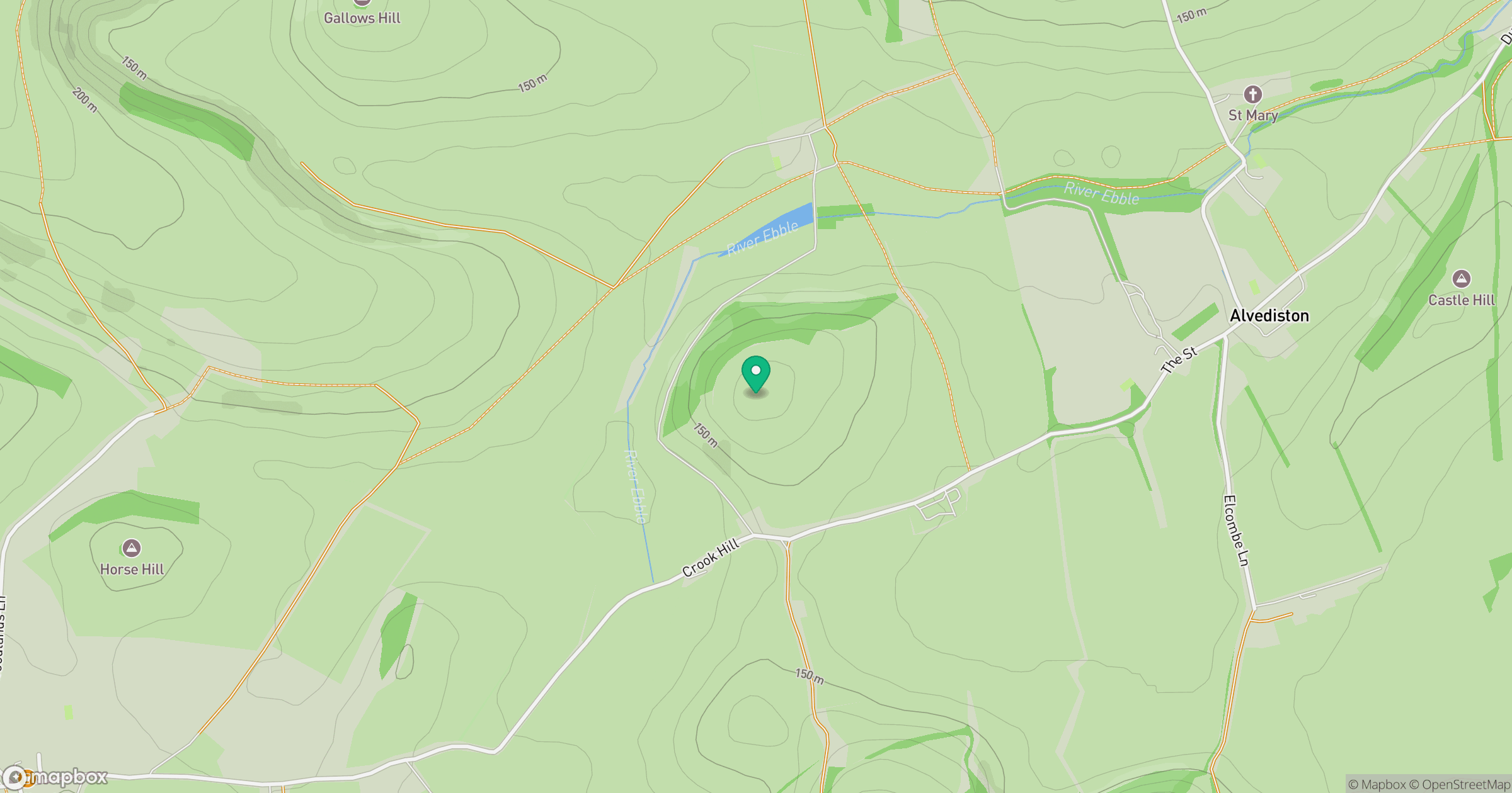
Grid reference: ST964232
View on OpenStreetMapOpens a map in a new tab, centred on the hill.
Nearby Hills
Glastonbury Tor
158m
Worcestershire Beacon
425m
Titterstone Clee Hill
533m

Dunkery Beacon
520m

Cribyn
794m
No comments yet. Be the first.