

Ysgyryd Fawr
Good walks are even better shared.
SO3318 : The summit of Ysgyryd Fawr
Jeremy Bolwell Photo source
Overview
Ysgyryd Fawr, also called the Skirrid or Holy Mountain, rises to 486.1 m above the countryside near Abergavenny. Woodland paths lead to an open ridge, a trig point and the remains of St Michael's Chapel. The steep climb rewards walkers with views towards Sugar Loaf, the Black Mountains and the Welsh borderlands.
The Skirrid above Abergavenny
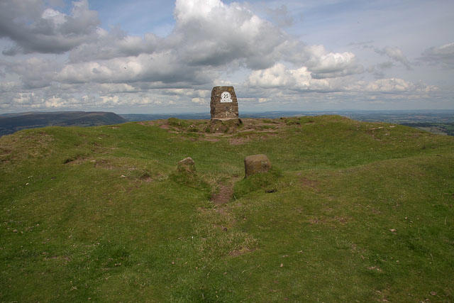
Ysgyryd Fawr, the Skirrid or Holy Mountain, stands at 486.1 m on the eastern edge of the Black Mountains. Its wooded lower slopes give way to an open ridge and a summit with a trig point and the remains of St Michael's Chapel. The recorded high point is a rock 3 m east of the trig point.
Choosing a route
Both options start and finish at the National Trust car park on the B4521, south of the hill, at SO328164.
- National Trust circuit: climb to the gate above the woods, turn left along the hillside path and round the northern end. A steep, waymarked climb on the eastern side reaches the summit. Return south along the ridge and descend through the woods to the car park. The National Trust lists 6.4 km and about 2 hours for its full trail.
- South ridge out and back: climb through the woodland and continue along the ridge beyond the first rise to the trig point. Retrace the same ridge and woodland path to the car park. This alternative is about 4.5 km. Allow time for the steep sections and summit stops.
Underfoot and in view
Woodland tracks and steps can be muddy; higher up, grass and stony paths lead onto an exposed ridge. Views take in Sugar Loaf, the Black Mountains and the Usk Valley, with the Malvern Hills and Bristol Channel visible in clear conditions. Spring bluebells are a highlight of the lower woodland.
Wear footwear with good grip and carry waterproofs, warm layers and a map. Wind, low cloud, snow or ice can make this short hill walk much more demanding. Stay on the paths and away from steep edges and landslip slopes. Keep dogs controlled, with a short lead around livestock.
Rock, landscape and history
The hill is built from Devonian Old Red Sandstone. Resistant sandstone above softer strata, followed by erosion and landslipping, produced its distinctive shape. The large cleft on the western side is a particularly striking landslip feature.
Ysgyryd is associated with shaking or shattering, and fawr means big or large. The medieval summit chapel remained a place of Roman Catholic worship after the Reformation. Local folklore links the cleft to the Crucifixion, helping explain the hill's Holy Mountain name.
Planning your visit
Check the car park signs for current charges and restrictions; overnight parking is prohibited. Abergavenny is the nearest town for refreshments, shops and toilets, and the main rail and bus gateway. Arrange the onward journey and the return before setting out. Bring food and water for the hill.
Nearby hills include Ysgyryd Fach (271 m), Sugar Loaf (596 m) and Blorenge (561 m). They make separate outings rather than extensions of either short route above.
Explore routes near Ysgyryd Fawr
Walks starting near this hill. Open a route to check its map, distance and full itinerary.
Clytha Estate: River Usk, Chapel Ruins and Castle Woods
View route
Goytre Wharf to Pentre Bridge: Mon and Brec Canal Walk
View route
A Very Merry Winter Walk ending with Cake & a Hot Drink!
View route
Forest of Dean Hicksters Way Woodland Circuit from Cannop
View route
Route planning notes
These notes describe possible approaches. Check a route's map and access information when planning your walk.
National Trust Skirrid circuit
Start and finish at the B4521 National Trust car park (SO328164). Climb through the woods to the gate in the stone wall, then turn left along the contouring path. Round the northern end and take the waymarked eastern-side path up to the trig point. Follow the ridge south to the waymark, then descend through the woodland to the same car park. The northern climb is steep.
South ridge out and back
From the B4521 National Trust car park (SO328164), take the uphill woodland path and steps to the gate at the upper edge of the trees. Continue onto the southern ridge, pass the first rise and follow the ridge north to the summit trig point. Return along the same ridge, through the gate and down the woodland path and entrance track to the car park. Take care on the muddy descent.
Make a day of it, together
Find someone to share the walk with, or organise a day out along a route you like.
Photo Gallery
View all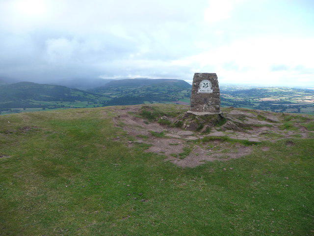 Photo could not load
SO3318 : The summit of Ysgyryd Fawr
Jeremy Bolwell
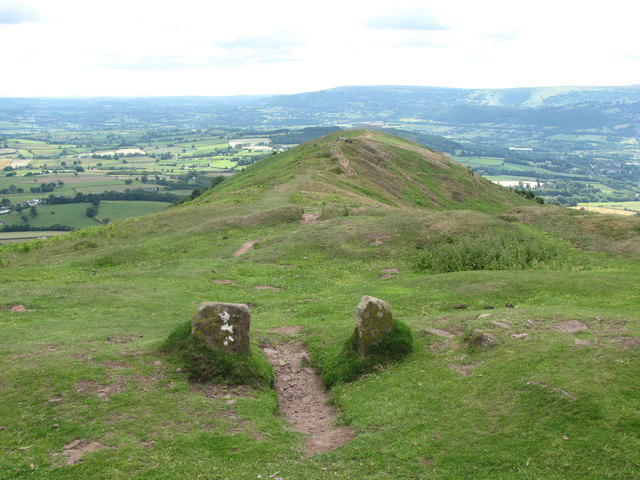 Photo could not load
SO3318 : Remains of the entrance to St Michael's Chapel
John Light
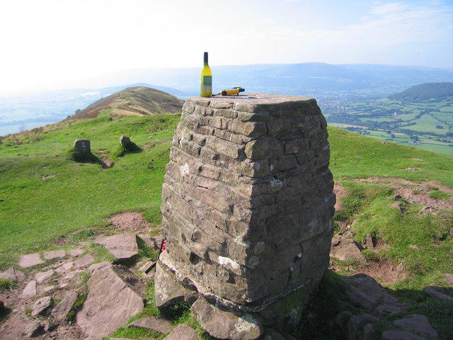 Photo could not load
SO3318 : Ysgyryd Fawr
Rude Health
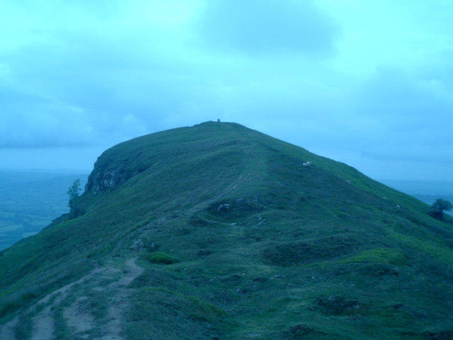 Photo could not load
SO3318 : The climb to Ysgyryd Fawr
Stewart Wilkinson
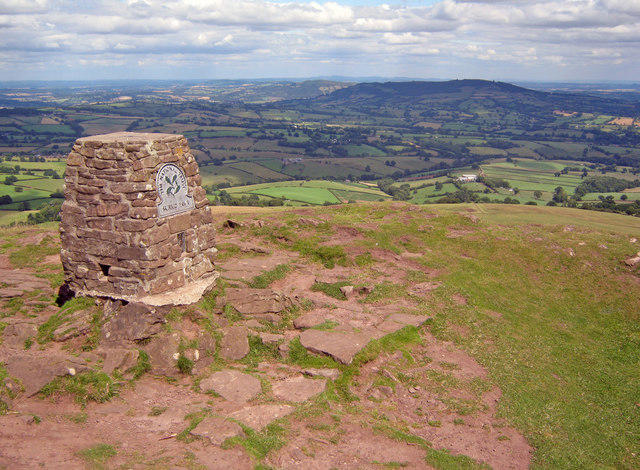 Photo could not load
SO3318 : Trig point on Ysgyryd Fawr
Trevor Rickard
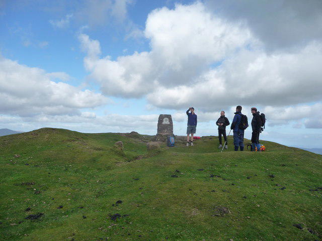 Photo could not load
SO3318 : At the summit of Ysgyryd Fawr
Jeremy Bolwell
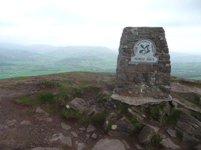 Photo could not load
SO3318 : The summit of Ysgyryd Fawr
Jeremy Bolwell
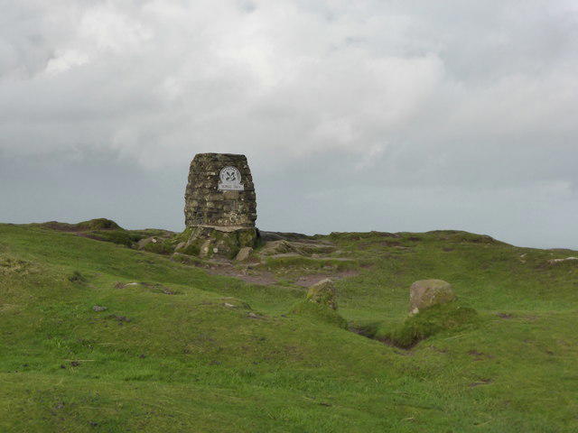 Photo could not load
SO3318 : Ysgyryd Fawr / Skirrid summit trig point
Jeremy Bolwell
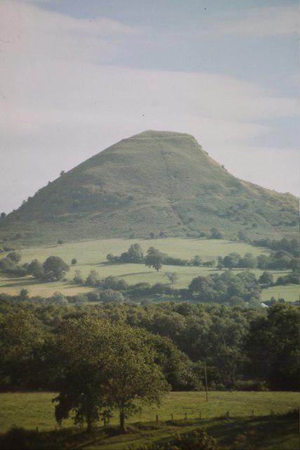 Photo could not load
SO3318 : Ysgyryd Fawr
Mark Anderson
SO3318 : Skirrid Fawr trig point
Hugh Venables
Hill facts and local notes
Classifications
Elevation
486m
1,595 ft
Prominence
342m
Coordinates
51.8591, -2.9726
SO331182
OS Map
161
Explorer: OL13S
At the Summit
A trig point and the remains of St Michael's Chapel occupy the summit area. The recorded highest point is a rock 3 m east of the trig point.
Terrain & Geology
Devonian Old Red Sandstone underlies the hill, with sandstone of the Senni succession above softer mudstone-rich strata. Landslips on the western flank, including a large rotational slip near the northern end, created the distinctive cleft profile. The landscape records sedimentary rock formation, erosion and slope movement.
Views & Scenery
The open ridge looks across Abergavenny and the Usk Valley towards Sugar Loaf and the Black Mountains. In clear conditions the wider panorama extends towards the Malvern Hills, Somerset and the Bristol Channel.
Best Seasons
Spring brings bluebells to the lower woodland. Changing woodland colours add interest later in the year; clear-weather views from the open ridge are rewarding in any season.
History & Heritage
Name Origin
Ysgyryd is associated with shaking, shattering or splitting, reflecting the hill's broken profile; fawr means big or large. Skirrid is the anglicised name. The cleft also features in local legends explaining the name Holy Mountain.
Historical Significance
The summit holds the remains of the medieval chapel of St Michael. It was a place of pilgrimage and was used by Roman Catholics during and after the Reformation, with worship recorded into the late 17th century. A local legend links the hill's cleft to the Crucifixion; this is folklore associated with its Holy Mountain name.
Getting There & Facilities
Parking
Use the National Trust Skirrid car park beside the B4521 (Old Ross Road), south of the hill, at SO328164, postcode NP7 8AP. Parking charges and restrictions apply; check the signs on arrival for current rates and member arrangements. Overnight parking is not permitted.
Public Transport
Abergavenny is the rail and bus gateway. The National Trust lists the railway station as 4 miles (6.4 km) and the bus station as 3 miles (4.8 km) from the trail start. Plan the onward journey and return in advance, using a taxi or a mapped walking route; check current transport services before travelling.
Nearby Facilities
The trail starts at a National Trust car park. Bring food and water, and use Abergavenny for toilets, shops and refreshments. Dogs should be kept under close control and on a short lead around livestock.
Safety Information
Known Hazards
- Steep ascents and descents, including woodland steps and the northern summit approach.
- Mud and wet stone can be slippery, especially on the descent.
- The open ridge is exposed to strong wind and poor visibility; keep clear of steep edges and landslip slopes.
Seasonal Hazards
Heavy rain can leave the woodland paths very muddy and slippery. Snow and ice make steep ground more serious, while low cloud can obscure the ridge. Check the forecast, carry suitable layers and navigation, and turn back if conditions exceed the group's ability.
General Safety Tips
- Check weather conditions before setting out
- Carry appropriate clothing and equipment
- Let someone know your planned route
- Take a map, compass, and GPS device
- Carry emergency supplies: food, water, first aid kit, torch
Hills
Some common questions about the hills answered
Are there group walks up Ysgyryd Fawr?
Many walkers use Walkmates to join or organise walks with others. You can check for group walks around Ysgyryd Fawr through the maps
Are there other walkers around Ysgyryd Fawr?
Activity varies by location and time, but Walkmates lets you see whether others have shared walks or shown interest in this area. Find other people through the walking friends search walking friends for Ysgyryd Fawr search or of course create your own walk for Ysgyryd Fawr
Can I organise a walk to Ysgyryd Fawr?
Yes. If there aren’t any walks listed already, you can create a walk and make it available for others to join.
If you're signed up to Walkmates, you can create a walk to Ysgyryd Fawr.
How do I find a walk up this hill?
There are often multiple ways to walk this hill, depending on experience and route preference. Walkmates helps you explore walks and routes that others have shared.
Can I suggest a new route up Ysgyryd Fawr?
Yes. You can suggest or create routes to share with others. Walkmates focuses on the social side of walking, so routes are used to help people organise walks and explore areas together, rather than as detailed navigation tools or route libraries.
Other uses really appreciate knowledgeable walkers sharing their routes. Share your favourite route to Ysgyryd Fawr here
The is an error or something incorrect about this hill. How do I let you know?
We always strive to keep the information on Walkmates as accurate as possible. If you find an error, please let us know through the contact form and we'll aim to correct it as quickly as possible
Community Discussion
Comments
Location
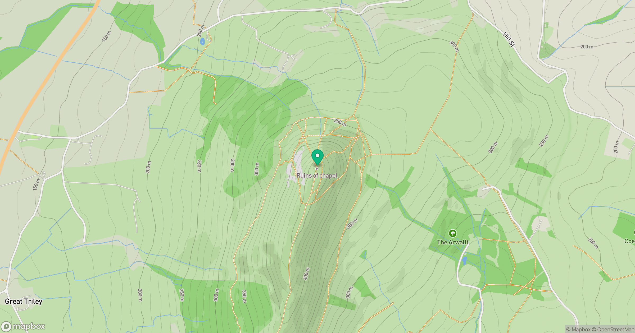
Grid reference: SO331182
View on OpenStreetMapOpens a map in a new tab, centred on the hill.

No comments yet. Be the first.