

Watson's Dodd
Good walks are even better shared.
NY3319 : Descending Watson's Dodd
Michael Graham Photo source
Overview
Watson's Dodd
Overview
Nestled in the Lake District, Watson's Dodd rises gracefully to an elevation of 609 meters. It is a well-loved Wainwright, often admired for its accessible routes and breathtaking views.
Geology
The mountain's intriguing geological composition consists mainly of volcanic rock, which provides not only a solid footing for your hike but also a fascinating insight into the Earth’s fiery past. A mix of ancient lava flows and sedimentary rock creates a unique terrain worth exploring.
Hiking Routes
One of the most popular routes is the Thirlmere Circular, stretching around 7 km. This moderate trek takes approximately 2.5 hours to complete, allowing ample time to admire the stunning vistas along the way. It offers a mix of grassy paths and rocky outcroppings, striking the perfect balance for various walking levels.
Summit Features
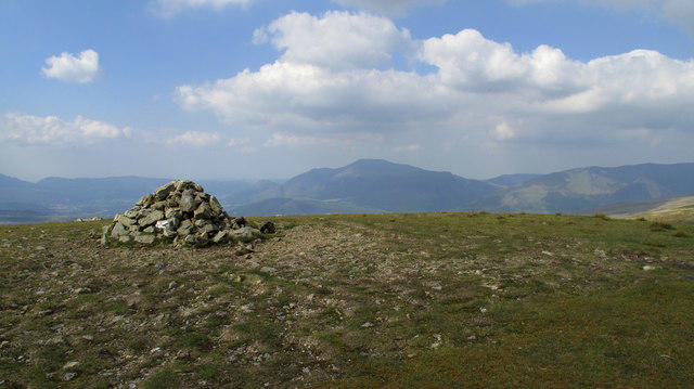
Reaching the summit, hikers are greeted with a distinguished cairn, acting as both a landmark and a perfect viewpoint for a celebratory snack or photo.
Terrain and Views
The terrain is predominantly grassy, peppered with rocky sections, making it a comfortable yet engaging climb. Upon reaching the summit, you will be enamoured by the panoramic views of not just Thirlmere, but also the majestic peaks of Helvellyn—one of the most celebrated mountains in the Lakes. The sight is enough to take your breath away, so be sure to pack your camera!
Hazards
As with all mountains, a few hazards exist. Beware of slippery rocks—especially if the sky has been overly generous with rainfall. Always keep an eye on the weather forecasts, as visibility can change in a heartbeat in these parts.
Nearby Summits
Adventure seekers can also explore nearby summits like Glaramara and High Seat, which are sure to provide additional challenges and views that could rival those from Watson's Dodd itself.
Access
Parking is straightforward at Thirlmere, and for those venturing without a vehicle, local buses frequently travel from Keswick to the foot of the mountain.
The closest town, Keswick, offers a warm welcome for hikers with its array of cafes, shops, and public amenities.
Facilities
After a long day of hiking, enjoy a rest in one of Keswick's bustling cafes where you can indulge in a slice of cake or a hearty meal. Rest assured, toilets are also conveniently located throughout the town.
History
The name 'Watson's Dodd' conjures images of local legends and historical figures, possibly reflecting a family or notable person from the past. Its recognition as a Wainwright highlights its significance amongst fellow adventurers, ensuring that it remains a favoured destination for both newcomers and seasoned hikers alike.
Conclusion
Whether you’re a seasoned hiker or a casual walker, Watson's Dodd promises a delightful day out in the heart of the Lake District. Remember, the journey isn't just about reaching the top—it's about enjoying the journey, making memories, and sharing a hearty laugh at your hiking companions’ expense!
Happy hiking!
Explore routes near Watson's Dodd
Walks starting near this hill. Open a route to check its map, distance and full itinerary.
Helvellyn via Striding Edge
View route
Striding Edge, Helvellyn and Catstye Cam
View route
Bannerdale Crags from Mungrisdale Wainwright
View route
Scafell Pike from Seathwaite via the Corridor Route
View route
Route planning notes
These notes describe possible approaches. Check a route's map and access information when planning your walk.
Thirlmere Circular
A popular route that offers stunning views of Thirlmere and surrounding fells.
Make a day of it, together
Find someone to share the walk with, or organise a day out along a route you like.
Photo Gallery
View all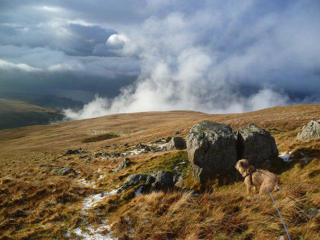 Photo could not load
NY3319 : Descending Watson's Dodd
Michael Graham
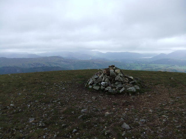 Photo could not load
NY3319 : Cairn, Watson's Dodd
David Brown
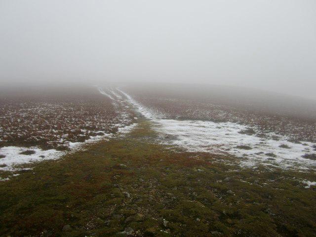 Photo could not load
NY3319 : Path towards Stybarrow Dodd
Graham Robson
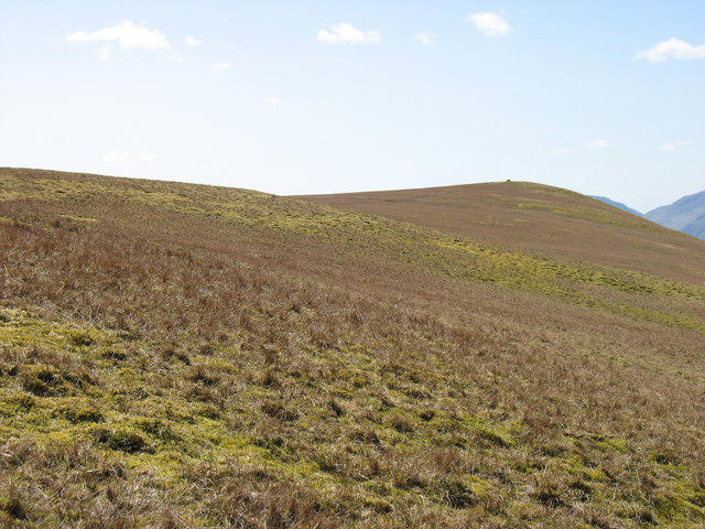 Photo could not load
NY3319 : Watson's Dodd from the north-east
David Purchase
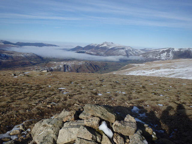 Photo could not load
NY3319 : On Watson's Dodd
Michael Graham
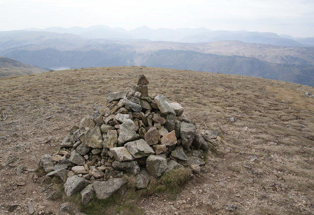 Photo could not load
NY3319 : The summit cairn on Watson's Dodd
Bill Boaden
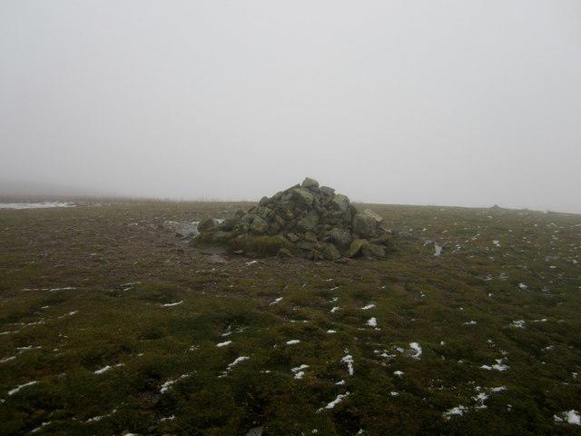 Photo could not load
NY3319 : Watson's Dodd summit
Graham Robson
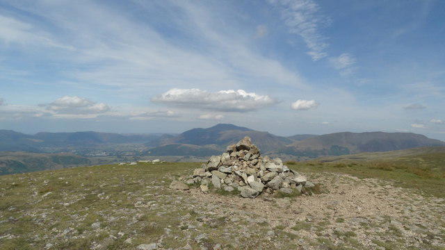 Photo could not load
NY3319 : On Watson's Dodd - view towards Skiddaw
Colin Park
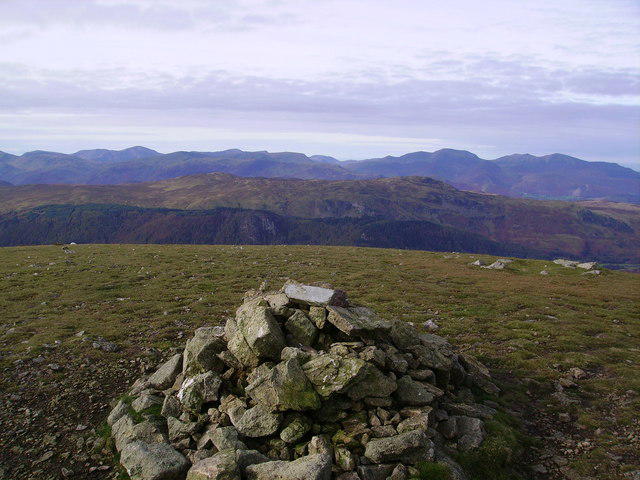 Photo could not load
NY3319 : Summit Cairn, Watson's Dodd
Michael Graham
NY3319 : Summit area of Watson's Dodd
Trevor Littlewood
Hill facts and local notes
Classifications
Elevation
789m
2,589 ft
Prominence
11m
Coordinates
54.5669, -3.0290
NY335195
OS Map
90
Explorer: OL5S
At the Summit
The summit features a prominent cairn, perfect for a photo op and boasting sweeping views.
Terrain & Geology
The mountain comprises volcanic rock primarily formed from ancient lava flows with a sprinkling of sedimentary rock, providing striking views and geological interest.
Views & Scenery
From the summit, you can see the stunning peaks of Helvellyn and the serene Thirlmere lake, as well as the lush valleys below.
History & Heritage
Name Origin
The name 'Watson's Dodd' refers to an old dialect word for a hill, with Watson possibly linked to a historical figure or local family.
Historical Significance
This mountain is part of the traditional Wainwright walks, making it a beloved spot for hikers and nature enthusiasts.
Getting There & Facilities
Parking
Parking is available at Thirlmere, which provides easy access to the trailhead.
Public Transport
Buses frequently run from Keswick to Thirlmere, making it accessible for those relying on public transport.
Nearby Facilities
The nearby town of Keswick features numerous cafes, shops, and public toilets, ensuring a comfortable visit.
Safety Information
Known Hazards
- While generally safe, be cautious of slippery rocks after rain and always check the weather forecast before your hike.
General Safety Tips
- Check weather conditions before setting out
- Carry appropriate clothing and equipment
- Let someone know your planned route
- Take a map, compass, and GPS device
- Carry emergency supplies: food, water, first aid kit, torch
Hills
Some common questions about the hills answered
Are there group walks up Watson's Dodd?
Many walkers use Walkmates to join or organise walks with others. You can check for group walks around Watson's Dodd through the maps
Are there other walkers around Watson's Dodd?
Activity varies by location and time, but Walkmates lets you see whether others have shared walks or shown interest in this area. Find other people through the walking friends search walking friends for Watson's Dodd search or of course create your own walk for Watson's Dodd
Can I organise a walk to Watson's Dodd?
Yes. If there aren’t any walks listed already, you can create a walk and make it available for others to join.
If you're signed up to Walkmates, you can create a walk to Watson's Dodd.
How do I find a walk up this hill?
There are often multiple ways to walk this hill, depending on experience and route preference. Walkmates helps you explore walks and routes that others have shared.
Can I suggest a new route up Watson's Dodd?
Yes. You can suggest or create routes to share with others. Walkmates focuses on the social side of walking, so routes are used to help people organise walks and explore areas together, rather than as detailed navigation tools or route libraries.
Other uses really appreciate knowledgeable walkers sharing their routes. Share your favourite route to Watson's Dodd here
The is an error or something incorrect about this hill. How do I let you know?
We always strive to keep the information on Walkmates as accurate as possible. If you find an error, please let us know through the contact form and we'll aim to correct it as quickly as possible
Community Discussion
Comments
Location
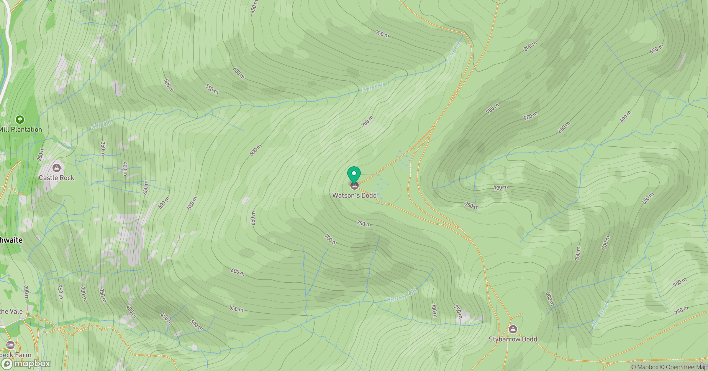
Grid reference: NY335195
View on OpenStreetMapOpens a map in a new tab, centred on the hill.


No comments yet. Be the first.