

Wandope
Good walks are even better shared.
NY1819 : Whiteless Edge with Wandope
Andy Parkes Photo source
Overview
Wandope: A Hiker's Delight
Introduction
Wandope is a stunning mountain located in the heart of the Lake District, a region known for its breathtaking landscapes and outdoor adventures. At an elevation of 771 metres, it might not be the tallest peak around, but don’t let its stature fool you. The views from the summit are simply marvellous!
Geology
Wandope is largely composed of volcanic rocks that date back millions of years. The andesite and tuff found here create a fascinating geological story that speaks to the Mountain’s fiery past. Next time you find yourself stuck at a social event, just casually mention the volcanic activity and you’ll have everyone's ears perked up!
Routes
The most straightforward and popular route to Wandope starts in the picturesque village of Braithwaite. This moderate hike covers a distance of approximately 8.5 km and can typically be completed in about 3.5 hours. Along the route, you’ll be treated to some truly breathtaking landscapes, so remember to take a few mental snapshots — or actual ones!
Terrain
Expect a mix of rocky paths interspersed with soft grassy sections. However, keep an eye out for those cheeky boggy spots that might just be waiting to surprise you. A sturdy pair of boots are your best friends here!
Views
The summit of Wandope rewards your efforts with panoramic views that are second to none. On a clear day, you’ll be able to see Skiddaw, Derwentwater, and the rolling hills beyond, not to mention the thrill of spotting a herd of sheep grazing far below. For the best views, try to visit in spring or autumn when the skies are clear and the landscape is a riot of colours.
Hazards
While Wandope isn’t known for being overly treacherous, it’s wise to be cautious. Wet rocks can be slippery, and the boggy patches can be deceiving. Keep your footing sure, and you’ll enjoy the trek without any unexpected dips!
Nearby Summits
If you’re feeling adventurous, combine your visit to Wandope with a climb to nearby peaks like Grisedale Pike (791 metres) or Hopegill Head (770 metres). Each offers varying views and challenges, so there’s plenty to keep you occupied!
Access
You’ll find parking available in Braithwaite, but don’t dawdle getting there or you might end up sharing your parking space with a sheep or two. Public transport is also a handy option, with regular bus services from Keswick getting you to the trailhead with ease.
Facilities
After your hike, treat yourself to a well-deserved break at one of Braithwaite's quaint cafes or pubs. Nothing quite like a slice of cake and a cuppa after a trek!
Conclusion
Wandope offers a delightful hiking experience for both seasoned walkers and those new to the hills. With its stunning vistas and warm local hospitality, it’s a must-visit on your Lake District itinerary. So lace up your boots, pack your sense of adventure, and head on up — the summit awaits!
Explore routes near Wandope
Walks starting near this hill. Open a route to check its map, distance and full itinerary.
Whinlatter dark skies walk
View route
Whinlatter dark skies walk
View route
Steeple, Scoat Fell and Haycock from Ennerdale
View route
Scafell Pike from Seathwaite via the Corridor Route
View route
Route planning notes
These notes describe possible approaches. Check a route's map and access information when planning your walk.
Wandope from Braithwaite
A popular route leading from the quaint village of Braithwaite through scenic valleys and up to the summit, providing hikers with stunning views along the way.
Make a day of it, together
Find someone to share the walk with, or organise a day out along a route you like.
Photo Gallery
View all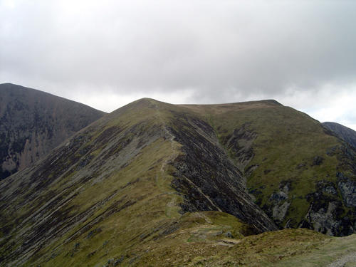 Photo could not load
NY1819 : Whiteless Edge with Wandope
Andy Parkes
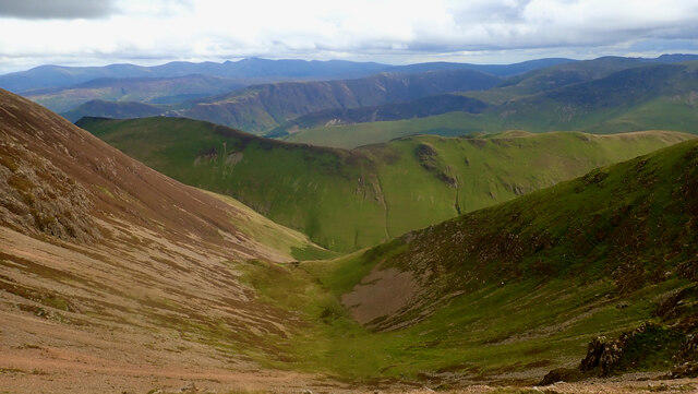 Photo could not load
NY1819 : Addamcombe Hole
Mick Garratt
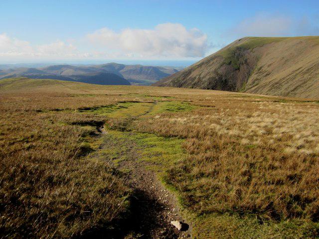 Photo could not load
NY1819 : Footpath across Wandhope Moss
Graham Robson
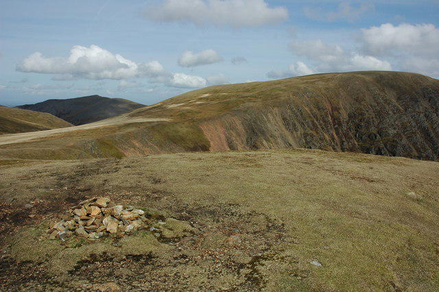 Photo could not load
NY1819 : View to the north from the summit of Wandope
Philip Halling
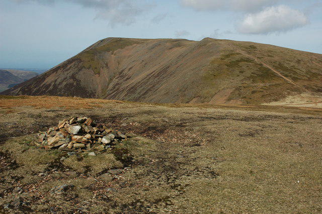 Photo could not load
NY1819 : Summit cairn on Wandope
Philip Halling
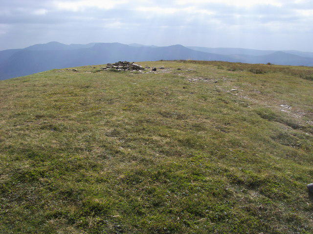 Photo could not load
NY1819 : Wandope Summit
Shaun Ferguson
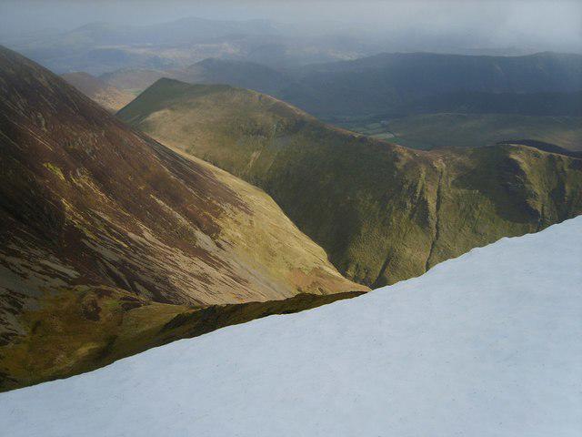 Photo could not load
NY1819 : Cornice on Wandope
Michael Graham
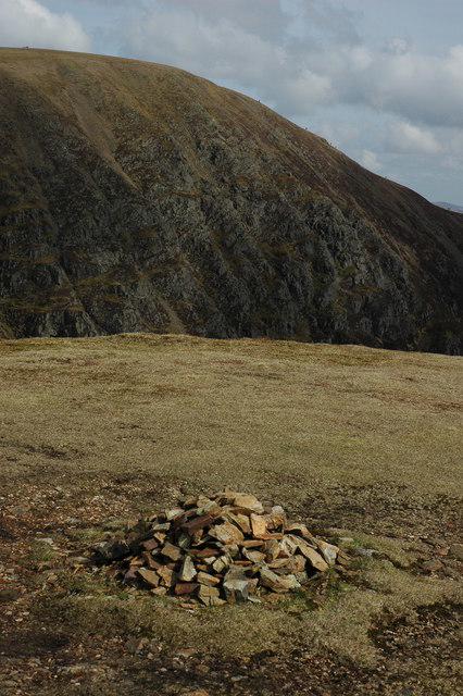 Photo could not load
NY1819 : Summit cairn on Wandope
Philip Halling
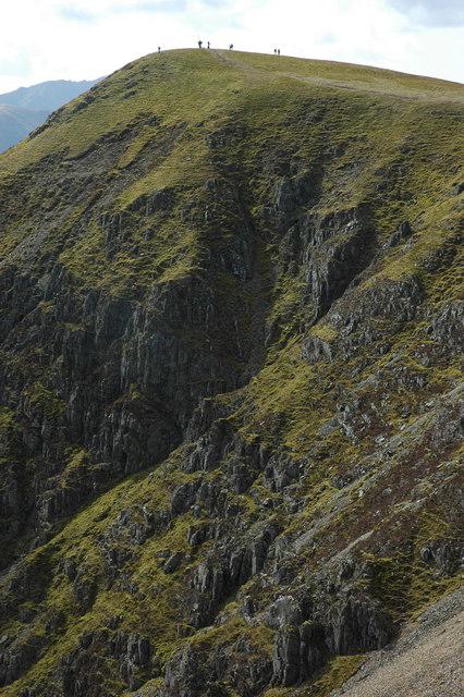 Photo could not load
NY1819 : Wandope
Philip Halling
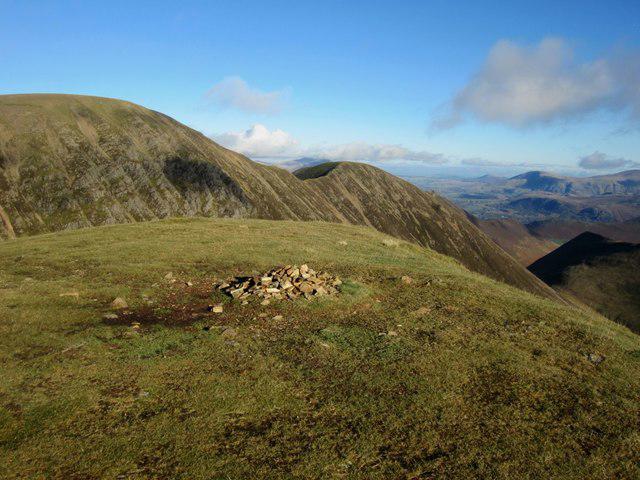
NY1819 : Wandhope summit cairn
Graham Robson
Hill facts and local notes
Classifications
Elevation
774m
2,539 ft
Prominence
30m
Coordinates
54.5663, -3.2571
NY188197
OS Map
89 90
Explorer: OL4S
At the Summit
The summit is marked by a stone cairn and offers a stunning panoramic view of the surrounding peaks and valleys, perfect for bragging to your mates back home about your exploits.
Terrain & Geology
The mountain is primarily composed of volcanic rocks, with notable outcrops of andesite and tuff. These rocks give Wandope its rugged charm, and if rocks could talk, they’d likely have quite the story to tell about ancient volcanic activity!
Views & Scenery
From the top, you can see Skiddaw, Derwentwater, and even the distant outline of the Scottish hills on a clear day.
History & Heritage
Name Origin
The name 'Wandope' is believed to derive from Old Norse, possibly meaning 'valley of the Wain (wagon)'.
Historical Significance
Wandope is part of the history of the Lake District, once a bustling area for local farmers and miners.
Getting There & Facilities
Parking
There is a small parking area in Braithwaite, but arrive early as it fills up quicker than you can say 'wobbly boots'.
Public Transport
Regular buses run from Keswick to Braithwaite, making it accessible without a car.
Nearby Facilities
Braithwaite offers a couple of charming cafes and pubs, perfect for a well-deserved pint after your hike.
Safety Information
Known Hazards
- Be cautious of slippery rocks, especially in wet conditions. There are also some boggy areas that can catch you off guard.
General Safety Tips
- Check weather conditions before setting out
- Carry appropriate clothing and equipment
- Let someone know your planned route
- Take a map, compass, and GPS device
- Carry emergency supplies: food, water, first aid kit, torch
Hills
Some common questions about the hills answered
Are there group walks up Wandope?
Many walkers use Walkmates to join or organise walks with others. You can check for group walks around Wandope through the maps
Are there other walkers around Wandope?
Activity varies by location and time, but Walkmates lets you see whether others have shared walks or shown interest in this area. Find other people through the walking friends search walking friends for Wandope search or of course create your own walk for Wandope
Can I organise a walk to Wandope?
Yes. If there aren’t any walks listed already, you can create a walk and make it available for others to join.
If you're signed up to Walkmates, you can create a walk to Wandope.
How do I find a walk up this hill?
There are often multiple ways to walk this hill, depending on experience and route preference. Walkmates helps you explore walks and routes that others have shared.
Can I suggest a new route up Wandope?
Yes. You can suggest or create routes to share with others. Walkmates focuses on the social side of walking, so routes are used to help people organise walks and explore areas together, rather than as detailed navigation tools or route libraries.
Other uses really appreciate knowledgeable walkers sharing their routes. Share your favourite route to Wandope here
The is an error or something incorrect about this hill. How do I let you know?
We always strive to keep the information on Walkmates as accurate as possible. If you find an error, please let us know through the contact form and we'll aim to correct it as quickly as possible
Community Discussion
Comments
Location
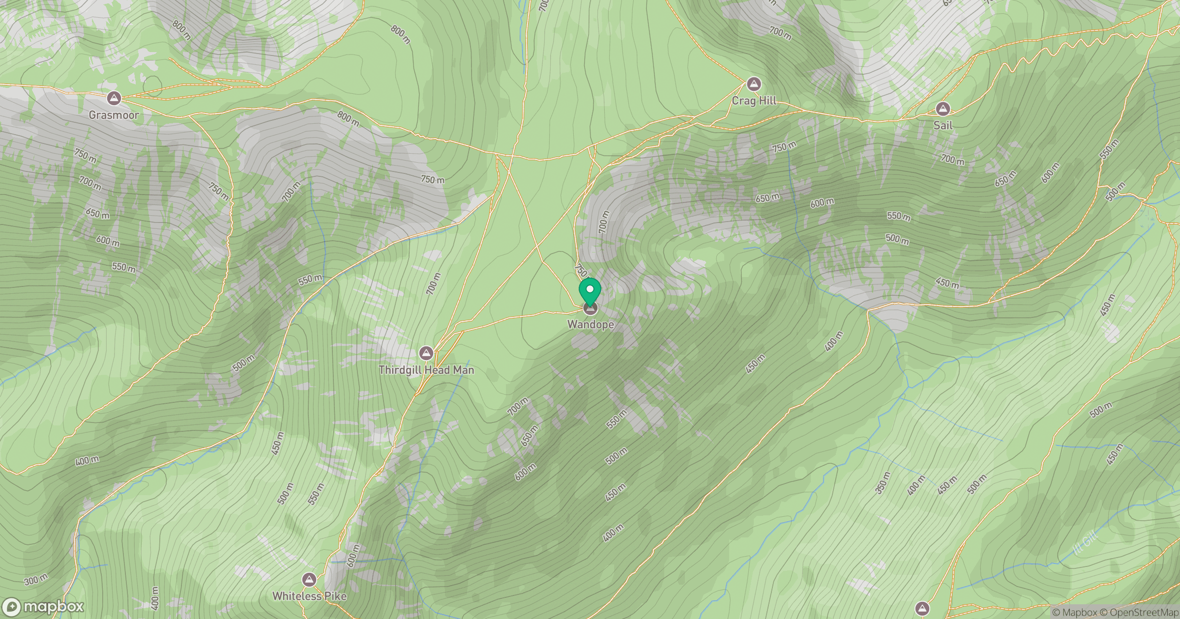
Grid reference: NY188197
View on OpenStreetMapOpens a map in a new tab, centred on the hill.
Nearby Hills
Crag Hill [Eel Crag]
839m
Grasmoor
852m
Grisedale Pike
790m
High Stile [Grey Crag - High Stile]
806m
Fleetwith Pike
649m
No comments yet. Be the first.