

Twmbarlwm
Good walks are even better shared.
ST2392 : Path to the summit of Twmbarlwm
Roger Cornfoot Photo source
Overview
Twmbarlwm is a 418.6 m hill above Risca and Cwmcarn in south-east Wales, known for its hilltop earthworks and views over the Severn Estuary. Its natural summit lies beside the trig point; the conspicuous eastern castle mound is artificial. Approaches include a steep return walk from Cwmcarn Visitor Centre and a shorter circuit from Mountain Road.
Twmbarlwm
Twmbarlwm rises to 418.6 m above Risca and Cwmcarn in south-east Wales. Its prominence is 49 m.
Summit
The natural high point is ground 12 m west-north-west of the trig at ST241926. The slightly higher castle mound roughly 200 m east is artificial. The visitor centre is a separate starting point in the valley.
Landscape and history
The hill is formed from Carboniferous sandstone. Its scheduled earthworks include an enclosure conventionally interpreted as an Iron Age hillfort and a probable medieval motte; excavation has not settled every phase or function. The local nickname is the Twmp.
Walking
The council’s Cwmcarn Visitor Centre return walk is 4 km, approximately two hours and strenuous. The Mountain Road ridge circuit is approximately 3.1 km; no fixed duration is given here. Both route notes include the return. Use an up-to-date map and current site signs.
Access and facilities
The southern common car park is reached by Mountain Road from Risca. Cwmcarn has separate charged parking, toilets, information and a shop. Crosskeys station and Silver Street bus stops serve the visitor-centre approach. Raven’s Café currently advertises a limited drinks, cake and toast menu; check opening and service notices.
Safety and views
Steep descents can be slippery, and the open hill is exposed in wind or mist. Watch for Forest Drive traffic, avoid mountain-bike trails and respect livestock, gates and earthworks. Clear-weather views include Newport, Cwmbran, the Severn Estuary and the northern Welsh uplands.
Nearby hills
Nearby summits include Medart (388 m), Mynydd Machen (363.2 m) and Mynydd Maen / Mynydd Twyn-glas (473 m).
Explore routes near Twmbarlwm
Walks starting near this hill. Open a route to check its map, distance and full itinerary.
Newport Fourteen Locks to Risca: Monmouthshire Canal Return
View route
Goytre Wharf to Pentre Bridge: Mon and Brec Canal Walk
View route
Cardiff: Hailey Park to Blackweir Bridge on the Taff Trail
View route
Clytha Estate: River Usk, Chapel Ruins and Castle Woods
View route
Route planning notes
These notes describe possible approaches. Check a route's map and access information when planning your walk.
Twmbarlwm from Cwmcarn Visitor Centre (return)
Start and finish at Cwmcarn Visitor Centre (ST229936). Follow the lake-side approach and signed walking tracks uphill, crossing and briefly following the Forest Drive with care for traffic. From Pegwn y Bwlch climb the steep hillfort path. Visit the natural summit beside the trig and, separately, the eastern castle mound. Retrace the outward route to the visitor centre. The council leaflet gives about 270 m of climb for this 4 km return walk. Follow current walking signs and closures rather than mountain-bike trails.
Mountain Road and ridge circuit
From the common car park at the end of Mountain Road, follow the rocky track north through the livestock gate. At the crossroads continue uphill to the ridge, then turn left towards Twmbarlwm. Use the established path and steps for the mound; visit the enclosure and natural summit 12 m WNW of the trig. Return on the southern path to the bench, then follow the fence downhill to the same car park. This approximately 3.1 km circuit has a steep descent that can be slippery. Returning via the crossroads and northern track is longer and is not included in this distance.
Make a day of it, together
Find someone to share the walk with, or organise a day out along a route you like.
Photo Gallery
View all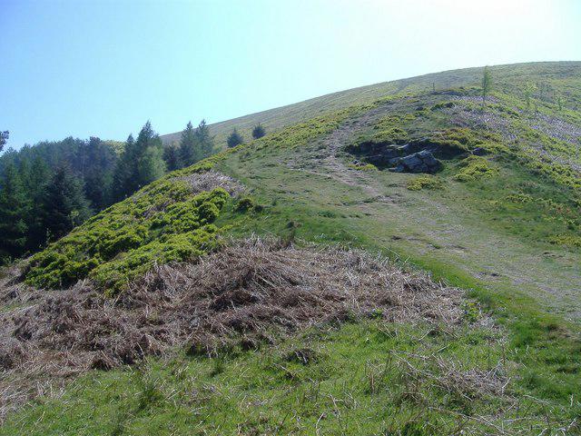 Photo could not load
ST2392 : Path to the summit of Twmbarlwm
Roger Cornfoot
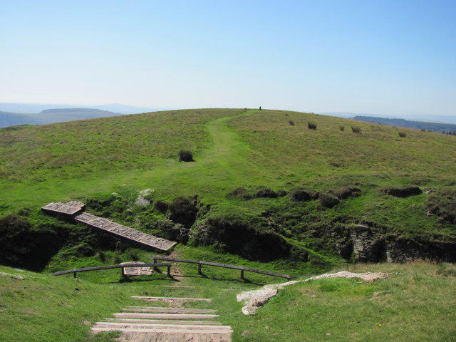 Photo could not load
ST2492 : View west from Twmbarlwm Motte
John Light
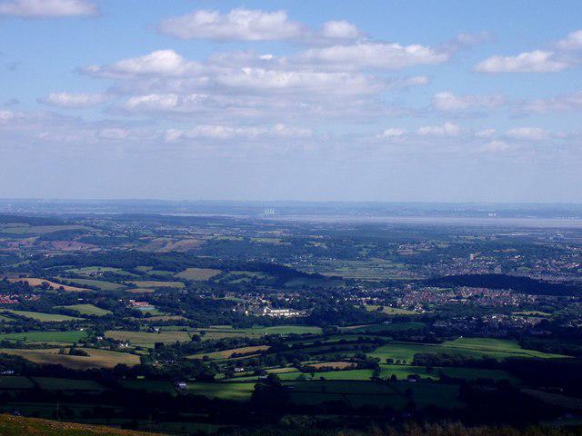 Photo could not load
ST2492 : View from Twmbarlwm summit
Rudi Winter
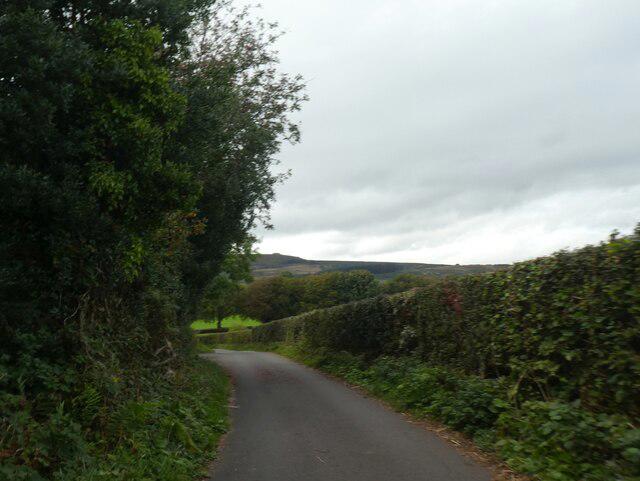 Photo could not load
ST2492 : Distant view of Twmbarlwm
David Smith
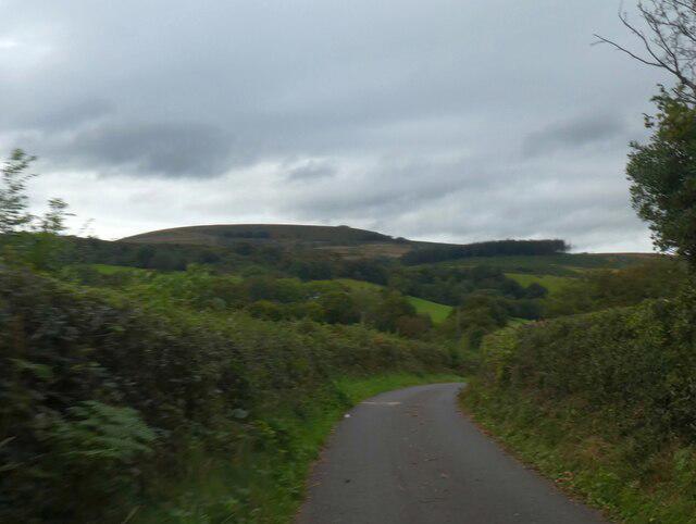 Photo could not load
ST2492 : The dome of Twmbarlwm
David Smith
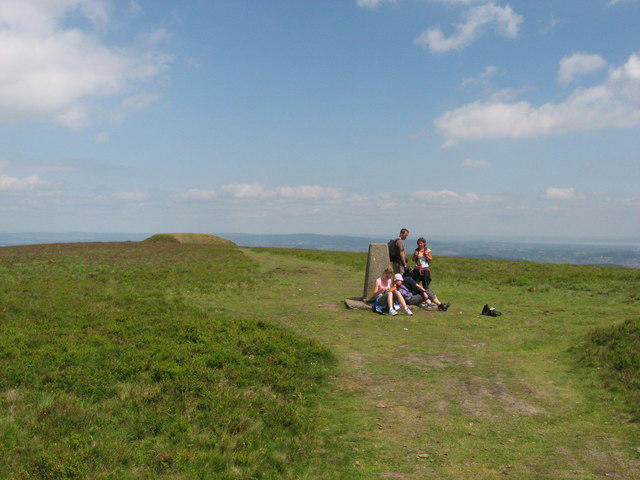 Photo could not load
ST2492 : Twmbarlwm trig point gathering
Gareth James
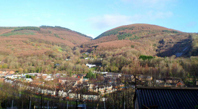 Photo could not load
ST2492 : Twmbarlwm viewed from Danygraig, Risca
Jaggery
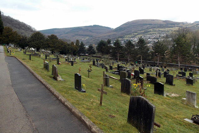 Photo could not load
ST2492 : A mountain view from a hillside cemetery, Risca
Jaggery
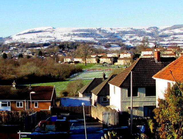 Photo could not load
ST2492 : Snowy Twmbarlwm viewed from Malpas, Newport
Jaggery
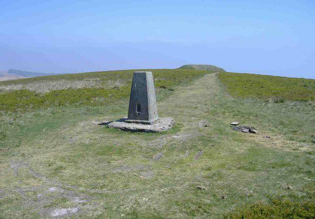
ST2492 : Trig point, Twmbarlwm
Roger Cornfoot
Hill facts and local notes
Classifications
Elevation
419m
1,373 ft
Prominence
49m
Coordinates
51.6272, -3.0967
ST241926
OS Map
171
Explorer: 152
At the Summit
The natural summit is ground 12 m west-north-west of the trig point at ST241926. The castle mound about 200 m east, at ST24386 92666, is slightly higher but artificial. The trig, natural high point, probable prehistoric cairn and castle mound are distinct features within the hilltop earthworks.
Terrain & Geology
Carboniferous sandstone underlies Twmbarlwm. Geological and archaeological surveys identify Hughes Beds or Hughes Member sandstone within the Pennant sandstone succession, deposited in ancient river and floodplain environments.
Views & Scenery
In clear weather the hilltop overlooks Newport, Cwmbran and the Severn Estuary, with views towards Cardiff Bay and the Bannau Brycheiniog (Brecon Beacons).
History & Heritage
Name Origin
The hill is known locally as the Twmp, a nickname referring to its conspicuous mound.
Historical Significance
Twmbarlwm is a scheduled monument (MM044). Its bank-and-ditch enclosure is conventionally interpreted as an Iron Age hillfort, while the eastern mound is probably a medieval motte. Investigations in 2021 and 2022 also examined a probable prehistoric funerary cairn. The site’s full sequence and the precise date and purpose of the mound remain uncertain. The 2018 fire prompted further archaeological and conservation work.
Getting There & Facilities
Parking
For the southern approach use the common car park at the end of Mountain Road above Risca. The approach is a narrow single-track lane with passing places; drive slowly. Cwmcarn Visitor Centre (ST229936) has a separate pay car park for the forest approach. The operator listed £1 for two hours or £3 all day when checked on 17 October 2026. Forest Drive vehicle admission and opening hours are separate. There is no vehicle through-route between the Cwmcarn and Risca sides; check current parking and access notices.
Public Transport
Crosskeys railway station is the nearest station to Cwmcarn Visitor Centre, described by the operator as about a 15-minute walk away. The convenient bus stops are Silver Street on Twyncarn Road, Pontywaun, on the entrance road. Check current services and return times with Transport for Wales or Traveline Cymru; this access is for the visitor-centre route.
Nearby Facilities
Cwmcarn Visitor Centre provides toilets, visitor information and a shop. Raven’s Café has a specific notice limiting service to hot drinks, cakes, toast and teacakes until further notice, checked 17 October 2026. Check opening hours before relying on these facilities. Bring food and water for the hill, especially when starting from Mountain Road.
Safety Information
Known Hazards
- Steep grass, stone paths and steps can be slippery when wet, especially on the southern descent.
- The open hilltop is exposed to wind and poor visibility. Carry suitable clothing and navigation.
- The Cwmcarn approach crosses and briefly follows the Forest Drive. Watch for vehicles and keep to walking routes around mountain-bike trails.
- Keep clear of steep earthwork edges and ditches; use established paths to avoid damaging the scheduled monument.
- Grazing livestock may be present. Keep dogs under close control and close gates.
- Follow current forestry diversions and closures. Check Natural Resources Wales and Cwmcarn Forest visitor notices before setting out.
General Safety Tips
- Check weather conditions before setting out
- Carry appropriate clothing and equipment
- Let someone know your planned route
- Take a map, compass, and GPS device
- Carry emergency supplies: food, water, first aid kit, torch
Hills
Some common questions about the hills answered
Are there group walks up Twmbarlwm?
Many walkers use Walkmates to join or organise walks with others. You can check for group walks around Twmbarlwm through the maps
Are there other walkers around Twmbarlwm?
Activity varies by location and time, but Walkmates lets you see whether others have shared walks or shown interest in this area. Find other people through the walking friends search walking friends for Twmbarlwm search or of course create your own walk for Twmbarlwm
Can I organise a walk to Twmbarlwm?
Yes. If there aren’t any walks listed already, you can create a walk and make it available for others to join.
If you're signed up to Walkmates, you can create a walk to Twmbarlwm.
How do I find a walk up this hill?
There are often multiple ways to walk this hill, depending on experience and route preference. Walkmates helps you explore walks and routes that others have shared.
Can I suggest a new route up Twmbarlwm?
Yes. You can suggest or create routes to share with others. Walkmates focuses on the social side of walking, so routes are used to help people organise walks and explore areas together, rather than as detailed navigation tools or route libraries.
Other uses really appreciate knowledgeable walkers sharing their routes. Share your favourite route to Twmbarlwm here
The is an error or something incorrect about this hill. How do I let you know?
We always strive to keep the information on Walkmates as accurate as possible. If you find an error, please let us know through the contact form and we'll aim to correct it as quickly as possible
Community Discussion
Comments
Location
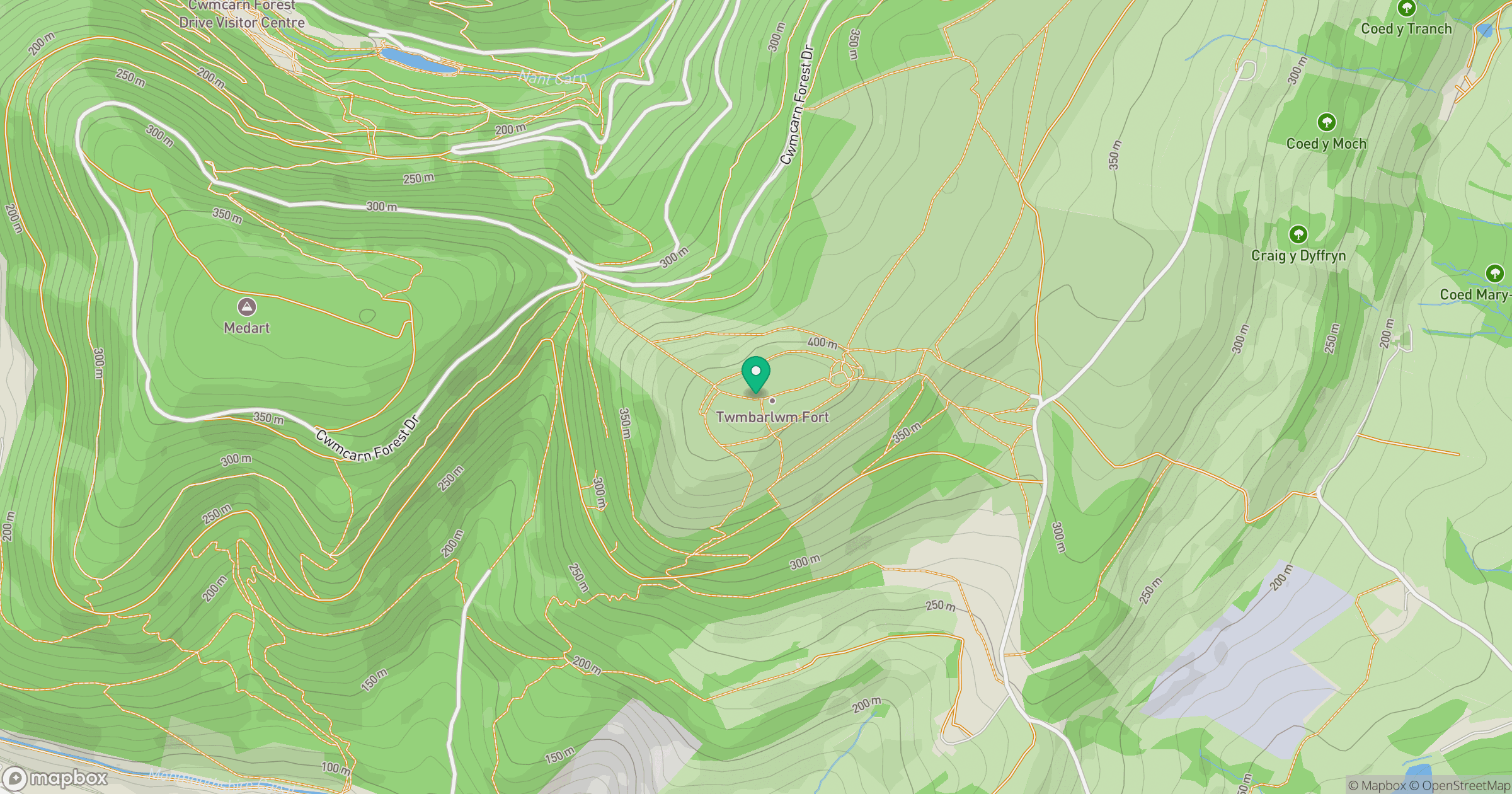
Grid reference: ST241926
View on OpenStreetMapOpens a map in a new tab, centred on the hill.

No comments yet. Be the first.