
Tal y Fan
Good walks are even better shared.
Overview
Tal y Fan (610 m) is an outlying Carneddau mountain in Conwy, above Rowen and the North Wales coast. The rocky summit lies beside a trig point. Walks from Rowen or the Bwlch y Ddeufaen mountain car park cross open upland and rough rock, with wide views towards Anglesey and the Conwy Valley.
Tal y Fan
Summit and setting
Tal y Fan is a 610 m mountain in the Carneddau, Conwy. DoBIH records 189.6 m of prominence. Its highest point is a rock 3 m southwest of the trig point, 0.35 m above the pillar base. Foel Lwyd, 600.2 m, is the neighbouring summit to the west.
Two complete circuits
- From Rowen (SH759719), the Walking in Snowdonia circuit passes Caer Bach, climbs Tal y Fan and descends from the col below Foel Lwyd to the road back to Rowen: 7 km, 510 m height gain and about 3 hours. Its optional Foel Lwyd extension is a longer itinerary, not included in these figures.
- From the mountain car park at the end of the surfaced Bwlch y Ddeufaen lane, the AA circuit walks to the pass, climbs Foel Lwyd and Tal y Fan, then returns via Caer Bach, Cae Coch and the lane: 8.1 km, 300 m ascent and 3 hours.
Access and safety
Tal y Fan is serious hill walking. Its upper paths cross rough rock, boggy ground and short scrambles; the Cae Coch approach includes a tricky downward step. Stiles and ladder stiles are part of the routes. Low cloud can make route-finding difficult. Take mountain clothing, boots, food, water and navigation equipment, and check the forecast. Snow and ice require suitable winter skills and equipment.
For Rowen, follow local parking signs and keep village and farm access clear. The high-start circuit uses the surfaced lane through Cae Coch. Do not drive the Roman Road above Rowen or continue beyond the youth hostel. Keep dogs on leads around sheep.
Landscape and heritage
BGS identifies Ordovician basalt lava, pillow breccia and volcanic fragmental rocks with mudstone layers. Clear-weather views extend towards Anglesey, the Menai Strait, the Great Orme and the Conwy Valley. Caer Bach hillfort, Maen y Bardd burial chamber and the old road through Bwlch y Ddeufaen reveal a landscape used long before modern recreational walking. Eryri National Park identifies that Roman road as a link between Caerhun and Caernarfon.
Explore routes near Tal y Fan
Walks starting near this hill. Open a route to check its map, distance and full itinerary.
Llyn Crafnant: Lakeside Circuit from the NRW Car Park
View route
Carnedd Circular from Ogwen Valley
View route
Snowdon Pyg Track returning by Miner's Track
View route
Beddgelert Forest: Derwen Circuit and Llyn Llywelyn
View route
Route planning notes
These notes describe possible approaches. Check a route's map and access information when planning your walk.
Rowen and Caer Bach circuit
Start and finish in Rowen (SH759719). Climb the lane towards the hostel, then take the right of way past Caer Bach and head west to the summit wall. Follow the wall to Tal y Fan, continue to the col below Foel Lwyd, then descend the right of way to the minor road and return to Rowen. The 7 km circuit excludes the optional Foel Lwyd extension.
Bwlch y Ddeufaen and Foel Lwyd circuit
Start at the mountain car park at the end of the tarmac Bwlch y Ddeufaen lane. Walk the old road to the pass, then climb beside the wall over Foel Lwyd to Tal y Fan. Descend east towards Caer Bach, take the pasture track beneath Cae Coch and follow the surfaced lane back to the same car park. Expect rocky mountain paths and stiles.
Make a day of it, together
Find someone to share the walk with, or organise a day out along a route you like.
Hill facts and local notes
Classifications
Elevation
610m
2,001 ft
Prominence
190m
Coordinates
53.2356, -3.9052
SH729726
OS Map
115
Explorer: 017E
At the Summit
The highest point is a rock 3 m southwest of the trig point, measured 0.35 m above the pillar base. The summit is rocky and lies beside a stone wall.
Terrain & Geology
The Ordovician Tal y Fan Volcanic Formation includes basalt lava, pillow breccia, hyaloclastite and basaltic tuff, with mudstone layers. These volcanic rocks account for the rocky upland; the summit is not a limestone-pavement or karst landscape.
Views & Scenery
In clear weather the summit overlooks the Carneddau, Anglesey and the Menai Strait, the Great Orme, Conwy Castle and the Conwy Valley.
History & Heritage
Historical Significance
The surrounding uplands preserve prehistoric monuments including Caer Bach hillfort and Maen y Bardd burial chamber. The Roman road through Bwlch y Ddeufaen linked Caerhun with Caernarfon.
Getting There & Facilities
Parking
For Rowen, the community website recommends roadside parking opposite the flagpole (LL32 8YA); keep access clear and observe local signs. The Memorial Hall car park is shared and can become congested. For the high-start circuit use the mountain car park at the end of the surfaced Bwlch y Ddeufaen lane, reached via Llanbedr y Cennin and Cae Coch. The lane is narrow. Do not drive the Roman Road from Rowen or beyond the hostel; hostel parking is for its guests.
Public Transport
Selected Llew Jones service 19 journeys serve Rowen from Conwy and Llanrwst. Check the operator timetable and return connections before setting off; not every trip visits Rowen. Llanfairfechan has a railway station for longer northern approaches, with additional walking to the upland trailhead.
Nearby Facilities
No facilities are provided on the mountain. Tŷ Gwyn in Rowen is a refreshment option; check opening hours. The Rowen community page lists the public toilets as closed, while another guide says they are available, so check locally before relying on them. Carry food and water.
Safety Information
Known Hazards
- Rough rocky steps and short scrambles occur near the summit; the Cae Coch approach includes an awkward short downward scramble. Wet rock can be slippery.
- Boggy ground and multiple paths make navigation harder, especially in cloud. Carry a map and compass and know how to use them.
- The Roman Road above Rowen is unsuitable for motor vehicles. Do not try to drive beyond Rowen Youth Hostel; use the appropriate surfaced access lane for the mountain car park.
- This is sheep-grazing country: keep dogs on leads and use stiles or gates without damaging walls.
Seasonal Hazards
Snow or ice makes the rocky summit steps more serious and requires suitable winter skills and equipment. The narrow access road to Bwlch y Ddeufaen is not recommended when snow-covered.
General Safety Tips
- Check weather conditions before setting out
- Carry appropriate clothing and equipment
- Let someone know your planned route
- Take a map, compass, and GPS device
- Carry emergency supplies: food, water, first aid kit, torch
Hills
Some common questions about the hills answered
Are there group walks up Tal y Fan?
Many walkers use Walkmates to join or organise walks with others. You can check for group walks around Tal y Fan through the maps
Are there other walkers around Tal y Fan?
Activity varies by location and time, but Walkmates lets you see whether others have shared walks or shown interest in this area. Find other people through the walking friends search walking friends for Tal y Fan search or of course create your own walk for Tal y Fan
Can I organise a walk to Tal y Fan?
Yes. If there aren’t any walks listed already, you can create a walk and make it available for others to join.
If you're signed up to Walkmates, you can create a walk to Tal y Fan.
How do I find a walk up this hill?
There are often multiple ways to walk this hill, depending on experience and route preference. Walkmates helps you explore walks and routes that others have shared.
Can I suggest a new route up Tal y Fan?
Yes. You can suggest or create routes to share with others. Walkmates focuses on the social side of walking, so routes are used to help people organise walks and explore areas together, rather than as detailed navigation tools or route libraries.
Other uses really appreciate knowledgeable walkers sharing their routes. Share your favourite route to Tal y Fan here
The is an error or something incorrect about this hill. How do I let you know?
We always strive to keep the information on Walkmates as accurate as possible. If you find an error, please let us know through the contact form and we'll aim to correct it as quickly as possible
Community Discussion
Comments
Location
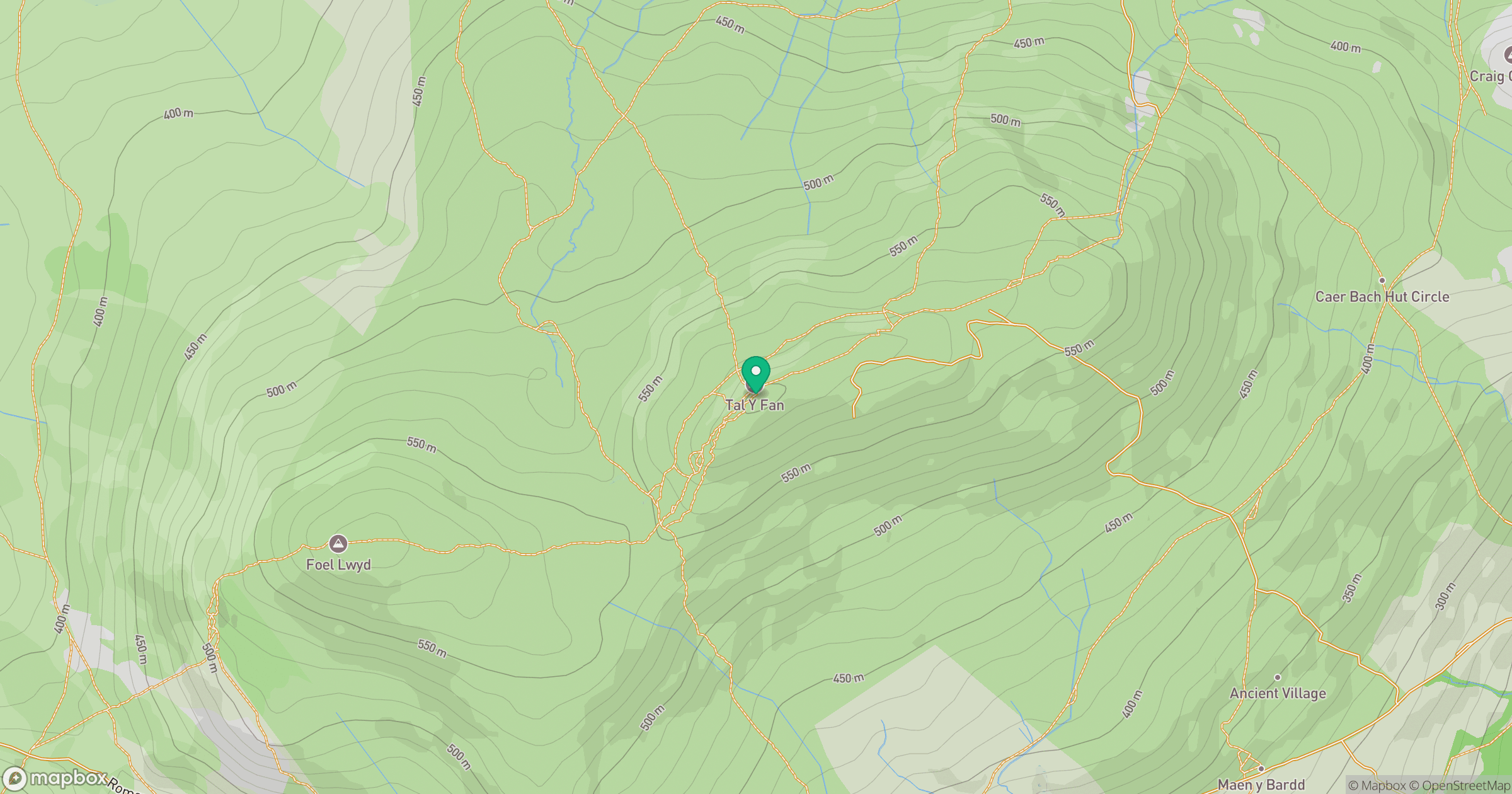
Grid reference: SH729726
View on OpenStreetMapOpens a map in a new tab, centred on the hill.
Nearby Hills
Carnedd Llewelyn
1,062m
Great Orme [Y Gogarth]
207m
Carnedd Dafydd
1,044m
Tryfan
918m
Moel Siabod
872m
No comments yet. Be the first.