

Stob Coire an Laoigh
Good walks are even better shared.
NN2472 : Stob Coire an Laoigh
Richard Webb Photo source
Overview
Stob Coire an Laoigh
Stob Coire an Laoigh, a Munro standing proud at 1115 meters, is a gem of the Scottish Highlands.
Geology
This magnificent mountain is predominantly made of granite and schist, aligning well with the traditional Highland geological formations. The landscape tells a story shaped by ancient glaciers, leaving behind valleys that inspire awe and perhaps a sense of envy at their magnificent beauty.
Routes
Glen Roy Route
- Distance: 10 km
- Estimated Time: 4.5 hours
- Difficulty: Moderate
This well-trodden path begins at Glen Roy and offers a fantastic introduction to the splendor of the Highlands. The steady incline rewards hikers with marvelous views along the way—don't forget to pack your camera, or risk endless Instagram envy.
Coire an Laoigh Route
- Distance: 8 km
- Estimated Time: 3.5 hours
- Difficulty: Challenging
For those looking for a bit more of a thrill, this route through Coire an Laoigh is a perfect choice. Expect some challenging sections, but the satisfaction of standing atop this iconic peak makes it all worthwhile.
Summit Features
Upon reaching the summit, hikers are greeted by a prominent stone cairn and panoramic views that will make you feel like you've stepped into a postcard. Expect to see some of the finest landscapes the Highlands have to offer!
Terrain Type
The terrain is a delightful mix of rocky patches and grassy slopes, though be mindful of the boggy parts—your boots may need a spa day after your adventure!
Views
Highlights
Looking out from Stob Coire an Laoigh, you can marvel at the vast vistas including the peaks of Ben Nevis and the enchanting Mamores range. It’s a view that demands a moment of respect— or at least a good selfie!
Best Seasons
The best time to soak in these views is during the spring and early summer when the heather is in glorious bloom. Late summer may also offer clear skies, but the heather is where it’s at!
Hazards
Be prepared for the unpredictable Scottish weather, which can change at the drop of a hat. Ensure your footwear can handle loose rocks, as some slopes can be a bit slippery or steep.
Nearby Summits
Stob Coire an Laoigh is not alone in its majesty. Nearby, you’ll find:
- Stob Coire Soilleir (1000 meters)
- Ben Nevis (1345 meters)
Access
Nearest Parking
The Glen Roy car park is the best starting point, so arrive early—preferably before the sun makes an appearance!
Public Transport
Buses between Fort William and Glen Roy run fairly regularly, so you’ve got options if driving isn't in your plan.
Nearest Town
Fort William has everything you need before your hike and will provide comfort after your adventures.
Facilities
Prepare yourself—Fort William boasts a variety of cafes, restaurants, and public toilets. Fuel up and hydrate; your legs will thank you!
History
Name Meaning
The name Stob Coire an Laoigh means 'The peak of the corrie of the calf', which is a nod to the local wildlife that has roamed this area.
Significance
This mountain is not just a climb; it's a vibrant part of Highland culture and offers a fantastic opportunity to connect with nature in all its splendor.
Now that you're armed with the essential knowledge, gear up and get ready to conquer Stob Coire an Laoigh!
Explore routes near Stob Coire an Laoigh
Walks starting near this hill. Open a route to check its map, distance and full itinerary.
Ben Nevis via Mountain Path
View route
Banavie to Glen Loy Aqueduct: Neptune’s Staircase Canal Towpath
View route
Fort Augustus to Kytra Lock: Caledonian Canal Towpath
View route
Killin: Falls of Dochart, Finlarig and Moirlanich Longhouse
View route
Route planning notes
These notes describe possible approaches. Check a route's map and access information when planning your walk.
Glen Roy Route
A popular ascent starting from Glen Roy that offers a steady climb with stunning views of the surrounding hills.
Coire an Laoigh Route
This route takes you up through Coire an Laoigh, with plenty of opportunities to admire local wildlife along the way.
Make a day of it, together
Find someone to share the walk with, or organise a day out along a route you like.
Photo Gallery
View all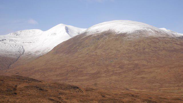 Photo could not load
NN2472 : Stob Coire an Laoigh
Richard Webb
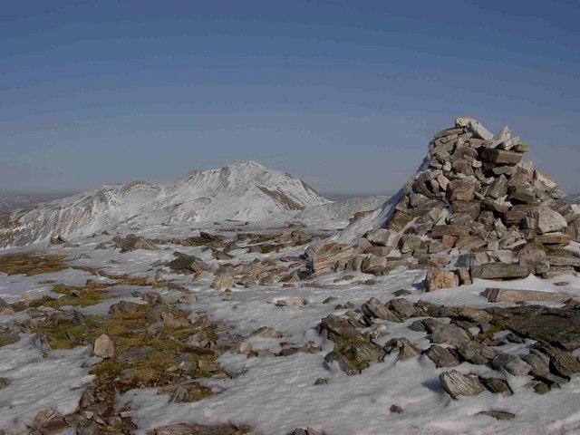 Photo could not load
NN2472 : Snow and Ice on Stob Coire an Laoigh, 1116m
charlie kennedy
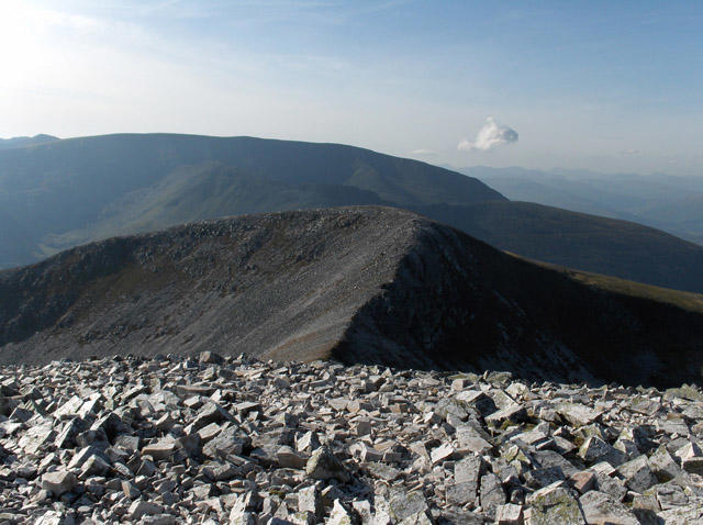 Photo could not load
NN2372 : Stob Coire an Laoigh
Andrew Smith
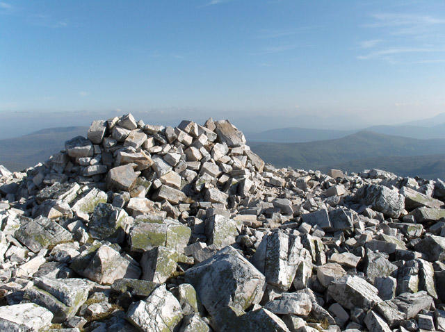 Photo could not load
NN2372 : Stob Coire an Laoigh
Andrew Smith
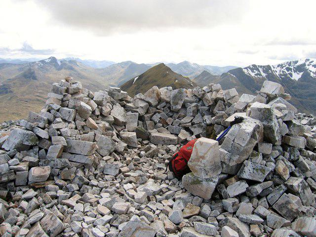 Photo could not load
NN2372 : Stob Coire an Laoigh
Rude Health
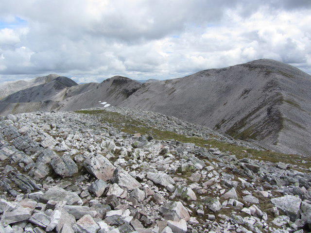 Photo could not load
NN2372 : On Stob Coire Easain with view to Stob Coire an Laoig
Colin Park
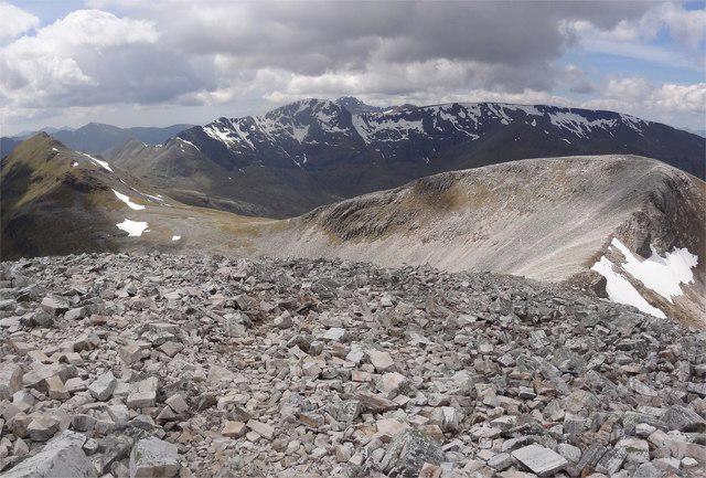 Photo could not load
NN2372 : Westward Bound
Adam Ward
Hill facts and local notes
Classifications
Elevation
1,116m
3,661 ft
Prominence
74m
Coordinates
56.8109, -4.8849
NN239725
OS Map
41
Explorer: 392
At the Summit
The summit features a large cairn and offers breathtaking panoramic views of the surrounding peaks and glens.
Terrain & Geology
Stob Coire an Laoigh is primarily composed of granite and schist, which are characteristic of the Highland geology. Its rugged landscape has been shaped by glacial activity, leaving behind deep valleys and steep ridges.
Views & Scenery
From the summit, you can see the majestic Ben Nevis, the Mamores, and the vast expanse of Lochaber.
History & Heritage
Name Origin
Stob Coire an Laoigh translates to 'The peak of the corrie of the calf'.
Historical Significance
The mountain is a key feature in the local landscape and is celebrated for its natural beauty and challenging climbs.
Getting There & Facilities
Parking
The nearest parking is available at the Glen Roy car park, which provides ample space for vehicles.
Public Transport
Regular bus services connect Fort William with Glen Roy. Check local schedules for the best options.
Nearby Facilities
Fort William has a range of facilities, including cafes, restaurants, and public toilets. Remember to stock up on snacks before hitting the trail!
Safety Information
Known Hazards
- Potential for rapidly changing weather conditions.
- Loose rocks and steep slopes, particularly on the ascent.
General Safety Tips
- Check weather conditions before setting out
- Carry appropriate clothing and equipment
- Let someone know your planned route
- Take a map, compass, and GPS device
- Carry emergency supplies: food, water, first aid kit, torch
Hills
Some common questions about the hills answered
Are there group walks up Stob Coire an Laoigh?
Many walkers use Walkmates to join or organise walks with others. You can check for group walks around Stob Coire an Laoigh through the maps
Are there other walkers around Stob Coire an Laoigh?
Activity varies by location and time, but Walkmates lets you see whether others have shared walks or shown interest in this area. Find other people through the walking friends search walking friends for Stob Coire an Laoigh search or of course create your own walk for Stob Coire an Laoigh
Can I organise a walk to Stob Coire an Laoigh?
Yes. If there aren’t any walks listed already, you can create a walk and make it available for others to join.
If you're signed up to Walkmates, you can create a walk to Stob Coire an Laoigh.
How do I find a walk up this hill?
There are often multiple ways to walk this hill, depending on experience and route preference. Walkmates helps you explore walks and routes that others have shared.
Can I suggest a new route up Stob Coire an Laoigh?
Yes. You can suggest or create routes to share with others. Walkmates focuses on the social side of walking, so routes are used to help people organise walks and explore areas together, rather than as detailed navigation tools or route libraries.
Other uses really appreciate knowledgeable walkers sharing their routes. Share your favourite route to Stob Coire an Laoigh here
The is an error or something incorrect about this hill. How do I let you know?
We always strive to keep the information on Walkmates as accurate as possible. If you find an error, please let us know through the contact form and we'll aim to correct it as quickly as possible
Community Discussion
Comments
Location
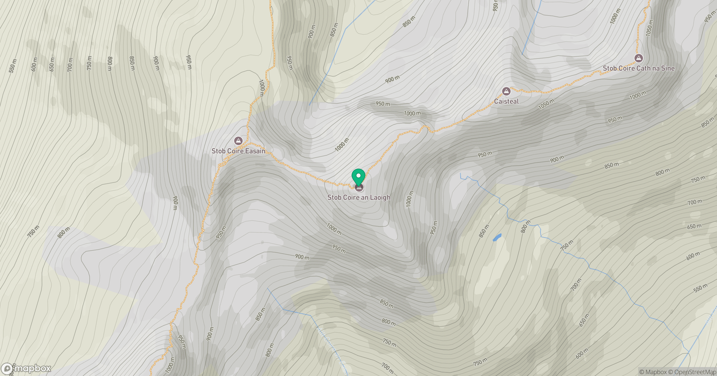
Grid reference: NN239725
View on OpenStreetMapOpens a map in a new tab, centred on the hill.
No comments yet. Be the first.