

Slievenagower
Good walks are even better shared.
Overview
Overview
Slievenagower, part of the stunning Mourne Mountains, stands proudly at an elevation of 641 meters. This Marilyn offers not just elevation but an incredible vista ripe for exploration.
Geology
The mountain is primarily granite, which gives it a sturdy backbone. Despite its relatively modest height, the various rocky outcrops offer a rugged appeal, creating an adventurous atmosphere for hikers.
Routes
Mourne Wall Route
This popular route is well-trodden, beginning from the Mourne Wall car park and winding its way alongside the famed Mourne Wall. At approximately 6.5 km, it takes around 3.5 hours to complete. While it’s not a walk in the park (pun intended!), the moderate difficulty makes it approachable for most.
Summit Features
Upon reaching the summit, you'll be greeted by a substantial cairn—a perfect backdrop for capturing that all-important summit photo.
Terrain
The terrain is a delightful mix of grassy slopes and rocky outcrops, with a healthy sprinkling of heather. It’s a typical site in the picturesque Mourne landscape and provides a great variety for those keen on hiking.
Views
The vistas from Slievenagower are simply spectacular. To the east, you’ll be met with the deep blues of the Irish Sea, while the wider Mourne range wraps around you, offering postcard-worthy views ideal for those snap-happy adventurers.
The best time to enjoy these views would be late spring to early autumn when the weather tends to be milder, and the heather puts on a splendid show.
Hazards
As with any mountain, certain hazards are best to keep in mind. Be cautious of loose rocks on steep sections, as well as the unpredictable Northern Irish weather—what's that they say? ‘If you don’t like the weather, wait fifteen minutes!’ It pays to be prepared.
Nearby Summits
Don’t forget about the other peaks nearby! Slieve Donard and Slieve Commedagh are excellent companions for your mountain adventures and don’t mind sharing the limelight.
Access
For hassle-free access, park at the Mourne Wall track near Newcastle. Trust us, Newcastle is also a hub of activity, so you won't be left high and dry after your hike. There are public transport links available from here being frequent for those who prefer not to drive.
Facilities
After descending, why not treat yourself to a well-deserved coffee or pint in one of Newcastle's many cafes or restaurants? Public toilets are readily available, making life a little easier for tired hikers.
History
As mentioned, the name Slievenagower means 'mountain of the dogs'. While we can’t say if the dogs enjoy the view as much as we do, it’s clear that this mountain holds a special place in local lore and history.
So, whether you’re here for a leisurely ramble or a serious hiking expedition, Slievenagower is well worth the effort. Just remember: always leave nothing but footprints and take nothing but memories on your way back down!
Explore routes near Slievenagower
Public walks starting within 80 km of this hill. Nearby does not mean a route reaches the summit; check its map and access before setting out.
No public routes are currently listed within 80 km of Slievenagower on Walkmates. This does not mean there are no paths here. Explore the map and check local access information before planning a walk.
Route planning notes
These notes describe possible approaches, not verified navigable routes or permission to cross land. Check current paths, local access rules and conditions before setting out.
Mourne Wall Route
A popular route that starts from the base of the Mourne Wall, leading hikers up through heather-covered slopes to the summit.
Make a day of it, together
Find someone to share the walk with, or organise a day out along a route you like.
Photo Gallery
View all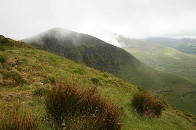 Photo could not load
Q5307 : Cloudy Summit
kevin higgins
Hill facts and local notes
Classifications
Elevation
486m
1,594 ft
Prominence
123m
Coordinates
52.1979, -10.1368
Q539072
OS Map
70
At the Summit
The summit features a large cairn, which provides a perfect spot for a summit selfie, along with panoramic views of the surrounding valleys.
Terrain & Geology
Slievenagower is primarily composed of granite, giving it a rugged and resilient structure, characteristic of many peaks in the Mourne range.
Views & Scenery
From the summit, you can see the expansive Mourne Mountains, as well as the sprawling views towards the coast and the Irish Sea.
History & Heritage
Name Origin
The name Slievenagower is derived from the Irish 'Sliabh na gCon', meaning 'mountain of the dogs', presumably referring to local legend or wildlife.
Historical Significance
Slievenagower has held cultural significance for local communities and is a part of the legendary stories surrounding the Mourne Mountains.
Getting There & Facilities
Check current local access restrictions, parking rules and transport timetables before travelling. These notes do not confirm public access to the summit.
Parking
There is a car park at the start of the Mourne Wall track near the village of Newcastle, approximately 5 km away.
Public Transport
Regular bus services run from the nearby town of Newcastle, offering access to the Mourne Mountain region.
Nearby Facilities
Newcastle offers various facilities, including cafes, restaurants, and public toilets. It's the perfect place to refuel after a hike!
Safety Information
Known Hazards
- Loose rocks, unpredictable weather conditions, and steep sections that require careful navigation.
General Safety Tips
- Check weather conditions before setting out
- Carry appropriate clothing and equipment
- Let someone know your planned route
- Take a map, compass, and GPS device
- Carry emergency supplies: food, water, first aid kit, torch
Hills
Some common questions about the hills answered
Are there group walks up Slievenagower?
Many walkers use Walkmates to join or organise walks with others. You can check for group walks around Slievenagower through the maps
Are there other walkers around Slievenagower?
Activity varies by location and time, but Walkmates lets you see whether others have shared walks or shown interest in this area. Find other people through the walking friends search walking friends for Slievenagower search or of course create your own walk for Slievenagower
Can I organise a walk to Slievenagower?
Yes. If there aren’t any walks listed already, you can create a walk and make it available for others to join.
If you're signed up to Walkmates, you can create a walk to Slievenagower.
How do I find a walk up this hill?
There are often multiple ways to walk this hill, depending on experience and route preference. Walkmates helps you explore walks and routes that others have shared.
Can I suggest a new route up Slievenagower?
Yes. You can suggest or create routes to share with others. Walkmates focuses on the social side of walking, so routes are used to help people organise walks and explore areas together, rather than as detailed navigation tools or route libraries.
Other uses really appreciate knowledgeable walkers sharing their routes. Share your favourite route to Slievenagower here
The is an error or something incorrect about this hill. How do I let you know?
We always strive to keep the information on Walkmates as accurate as possible. If you find an error, please let us know through the contact form and we'll aim to correct it as quickly as possible
Community Discussion
Comments
Location
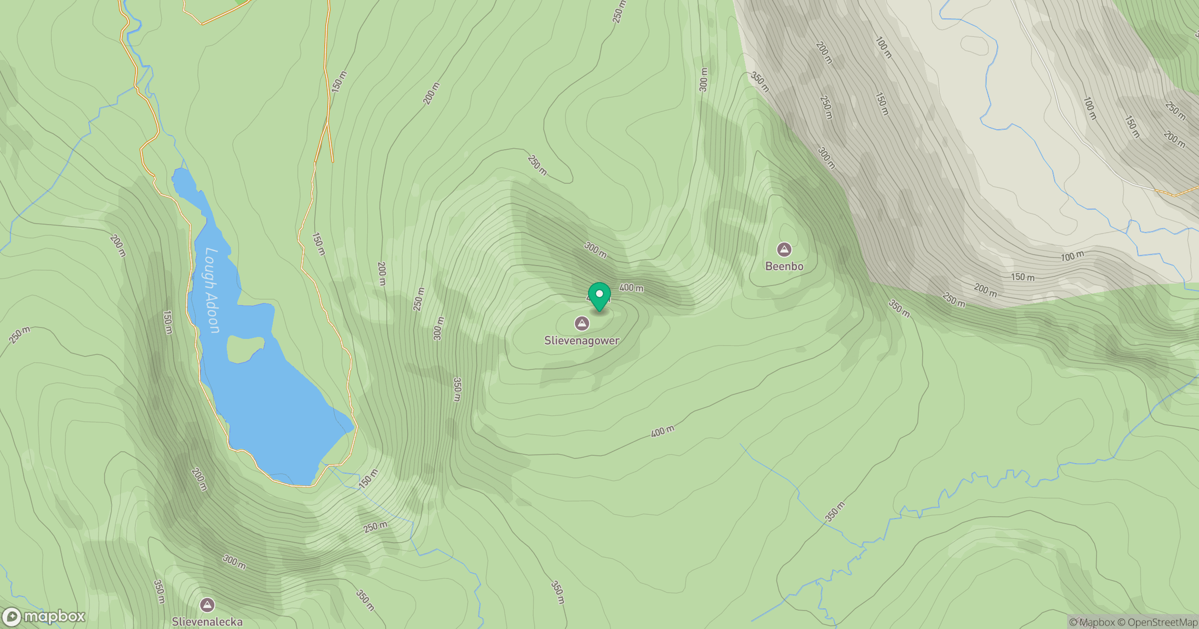
Grid reference: Q539072
View on OpenStreetMapOpens a map in a new tab, centred on the hill.
Hills within 30 km
Straight-line distance, not a walking route or confirmation of access.
No comments yet. Be the first.