
Knockafeehane
Good walks are even better shared.
Overview
Knockafeehane: A Hidden Gem in County Kerry
Nestled in the stunning Slieve Mish Mountains, Knockafeehane beckons to hikers with its rich scenery and accessible routes. This modest hill, standing at an elevation of 694 meters, is a true Marilyn, providing a splendid vista without demanding the strenuous efforts often associated with higher peaks.
Geology
Knockafeehane is primarily composed of sandstone, interspersed with pockets of limestone. This unique geological composition is a product of millions of years of sedimentary processes and provides an insight into the earth's evolutionary narrative.
Route Description
The most popular route begins at Feohanagh village, a pleasant little spot perfect for parking your car and setting off on your adventure. The route stretches approximately 6.5 km and takes around 3.5 hours to complete. It's considered moderately challenging, giving a fair bit of exercise without leaving you gasping for breath at the summit.
Terrain
Expect a mix of grassy slopes, rocky outcrops, and a few deceptively boggy patches—make sure your boots are up to the job! The ascent is gradual but rewarding as you plot your path upwards.
Summit Features
Upon reaching the summit, hikers are greeted by a stone cairn that seems to wave a friendly hello. The views from here are nothing short of spectacular, with panoramic landscapes that offer a feast for the eyes.
Views
The highlight of this climb is undoubtedly the breathtaking panorama. The Slieve Mish range stretches out before you, and on clear days, the Atlantic Ocean sparkles enticingly in the distance. For the best views, spring and autumn are your best bets, boasting clear skies and vibrant colours.
Hazards
Always keep an eye on the weather as it can change faster than a cheetah on roller skates. Sudden fog can sweep in and obscure the trail, making navigation tricky, so ensure you're well-prepared with a map or a navigation tool.
Nearby Summits
If you fancy a double-header, nearby peaks such as Baurtregaum and Brandon Hill stand tall and proud, waiting for intrepid hikers to tackle their trails.
Access
Feohanagh provides the best access point, with ample parking and a few nearby public transport options, although be prepared to wait for buses if you rely on them. The nearest town, Camp, is a short drive away and has limited facilities, so pack your snacks!
Facilities
While local eateries are few in number, a café or two can be found in nearby Camp, ensuring you won't have to rough it completely.
History
The name Knockafeehane harkens back to its Irish roots, meaning 'the hill of Fiachna', which speaks of its local lore. Its cultural significance remains strong among hikers and nature enthusiasts alike, making it a cherished landmark in County Kerry.
So, grab your walking boots, a good sense of adventure, and perhaps a cheeky sandwich, and head out to explore the beauty of Knockafeehane!
Explore routes near Knockafeehane
Public walks starting within 80 km of this hill. Nearby does not mean a route reaches the summit; check its map and access before setting out.
No public routes are currently listed within 80 km of Knockafeehane on Walkmates. This does not mean there are no paths here. Explore the map and check local access information before planning a walk.
Route planning notes
These notes describe possible approaches, not verified navigable routes or permission to cross land. Check current paths, local access rules and conditions before setting out.
Feohanagh to Knockafeehane
An exciting trek starting from Feohanagh village, offering a mix of paths and open country before ascending towards the summit.
Make a day of it, together
Find someone to share the walk with, or organise a day out along a route you like.
Hill facts and local notes
Classifications
Elevation
300m
984 ft
Prominence
133m
Coordinates
52.1476, -10.0226
Q616014
OS Map
71
At the Summit
The summit boasts a small stone cairn and excellent views of the surrounding countryside.
Terrain & Geology
Primarily composed of sandstone, with some limestone deposits, highlighting the area's geological history of sedimentary processes.
Views & Scenery
From the summit, one can see the rolling hills of the Slieve Mish range and, on a clear day, the Atlantic Ocean shimmering in the distance.
History & Heritage
Name Origin
The name 'Knockafeehane' derives from the Irish 'Cnoc Fiachna', meaning 'the hill of Fiachna'.
Historical Significance
It is a part of local folklore and has been a notable landmark for walkers and hikers for generations.
Getting There & Facilities
Check current local access restrictions, parking rules and transport timetables before travelling. These notes do not confirm public access to the summit.
Parking
Parking available at the end of the access road from Feohanagh, with enough space for several vehicles.
Public Transport
Buses run from Tralee to Feohanagh, although services are infrequent, so plan ahead if you're relying on them!
Nearby Facilities
There are limited facilities in nearby Feohanagh, so it’s wise to bring your own supplies. Nearest cafes and toilets can be found in Camp.
Safety Information
Known Hazards
- Be wary of sudden weather changes, particularly cloud cover; it can roll in faster than a cat on a hot tin roof.
General Safety Tips
- Check weather conditions before setting out
- Carry appropriate clothing and equipment
- Let someone know your planned route
- Take a map, compass, and GPS device
- Carry emergency supplies: food, water, first aid kit, torch
Hills
Some common questions about the hills answered
Are there group walks up Knockafeehane?
Many walkers use Walkmates to join or organise walks with others. You can check for group walks around Knockafeehane through the maps
Are there other walkers around Knockafeehane?
Activity varies by location and time, but Walkmates lets you see whether others have shared walks or shown interest in this area. Find other people through the walking friends search walking friends for Knockafeehane search or of course create your own walk for Knockafeehane
Can I organise a walk to Knockafeehane?
Yes. If there aren’t any walks listed already, you can create a walk and make it available for others to join.
If you're signed up to Walkmates, you can create a walk to Knockafeehane.
How do I find a walk up this hill?
There are often multiple ways to walk this hill, depending on experience and route preference. Walkmates helps you explore walks and routes that others have shared.
Can I suggest a new route up Knockafeehane?
Yes. You can suggest or create routes to share with others. Walkmates focuses on the social side of walking, so routes are used to help people organise walks and explore areas together, rather than as detailed navigation tools or route libraries.
Other uses really appreciate knowledgeable walkers sharing their routes. Share your favourite route to Knockafeehane here
The is an error or something incorrect about this hill. How do I let you know?
We always strive to keep the information on Walkmates as accurate as possible. If you find an error, please let us know through the contact form and we'll aim to correct it as quickly as possible
Community Discussion
Comments
Location
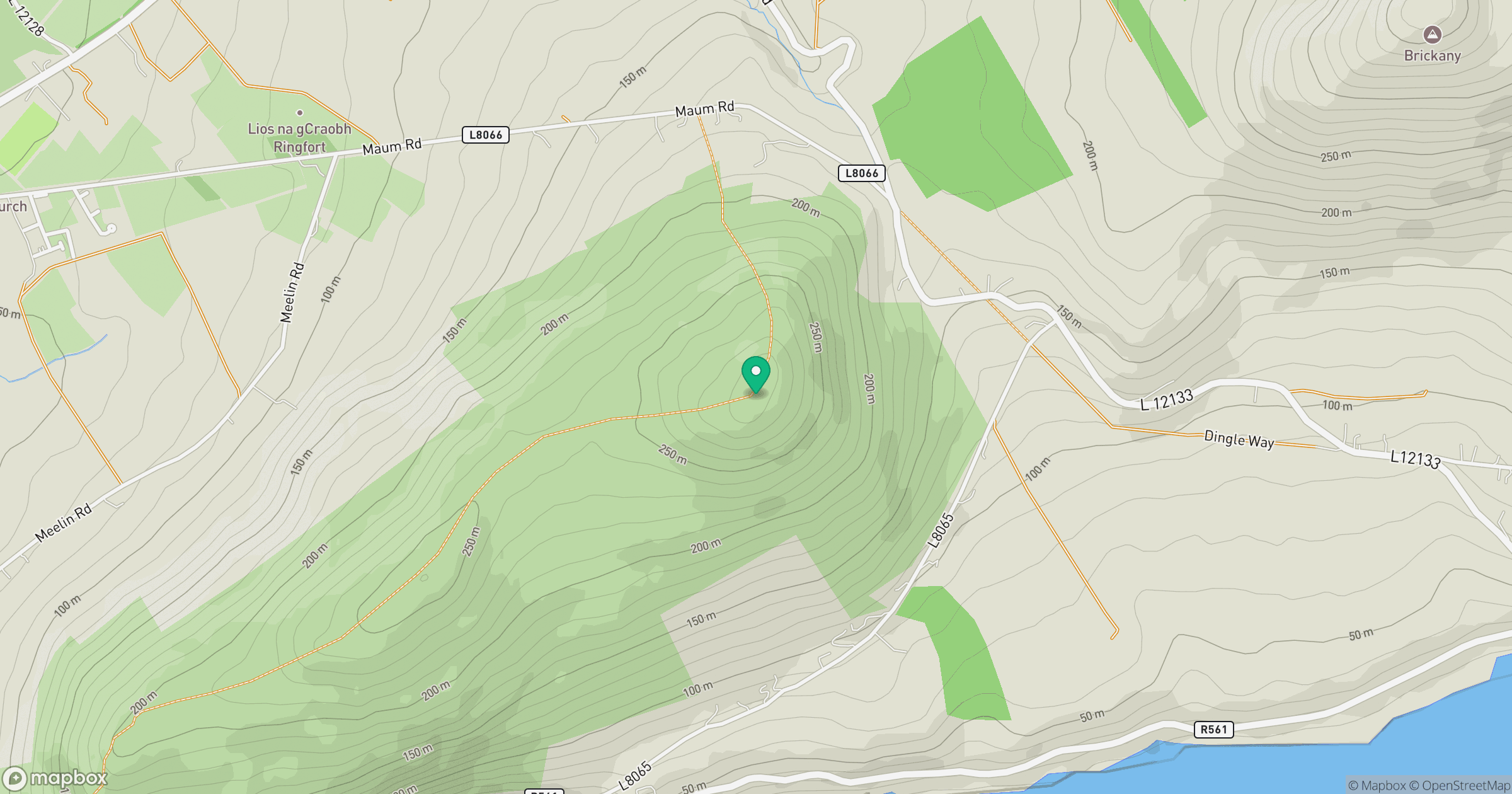
Grid reference: Q616014
View on OpenStreetMapOpens a map in a new tab, centred on the hill.
Hills within 30 km
Straight-line distance, not a walking route or confirmation of access.
No comments yet. Be the first.