

Brandon Mountain
Good walks are even better shared.
Q4611 : Brandon Mountain from Brandon Peak
Colin Park Photo source
Overview
Brandon Mountain, also known as Mount Brandon or Cnoc Bréanainn, rises to 951.7 m on County Kerry’s Dingle Peninsula. A traditional pilgrimage mountain, it has an exposed summit ridge above steep eastern corries and lakes. The western Saints’ Route starts at Baile Breac; the eastern Faha approach climbs through the corrie. Both need fitness, mountain navigation and suitable weather. The technical Faha Ridge is a separate scrambling route.
Brandon Mountain
Overview
Brandon Mountain, also called Mount Brandon or Cnoc Bréanainn, is the 951.7 m high point of the Dingle Peninsula in County Kerry. Its catalogue prominence is 927 m. The surveyed summit is ground within 1 m of the trig point at Q 46044 11608, close to a large cairn and cross. The mountain requires fitness, navigation skills and suitable weather.
Routes
Saints’ Route from Baile Breac
From the western car park at Baile Breac (Ballybrack), Q 434 094, follow the pilgrimage path and crosses to the summit. Return by the same path to the same car park. This is approximately 7 km out and back, with a sustained steep climb and exposure to Atlantic weather.
Faha and the Paternoster Lakes
From the Faha road-end parking at Q 494 120, above Cloghane, pass the grotto and follow the path below Faha Ridge into the corrie. Climb the steep Éisc gully to the main ridge and turn south to the summit. Retrace this line to Faha, approximately 9 km in total. Hands may be needed in the gully; only ascend if you can safely reverse it. The narrow technical Faha Ridge crest is a separate scrambling route.
Neither outing is a crossing to the opposite trailhead. The full Brandon range traverse has different endpoints, and the Dingle Way’s shoulder crossing does not reach this summit.
Access and parking
Use the Baile Breac western car park or the small Faha road-end parking for the route you have chosen. Keep narrow lanes, gates and working access clear. Follow local notices and respect the landowners and sheep grazing on these slopes. Leave dogs at home and stay on established paths to protect fragile upland vegetation.
Terrain and safety
The western line is a steep grassy pilgrimage path; the eastern line crosses rough rock and boulders and climbs a steep gully. Eastern cliff edges and the exposed summit ridge become especially dangerous in wind or cloud. Markers are not a substitute for navigation skills. Carry a map, compass, warm layers, waterproofs, food, water and a headtorch, and allow enough daylight to return. Snow and ice can require winter mountaineering skills, an ice axe and crampons. In an emergency call 112 or 999 and ask for Gardaí and Mountain Rescue.
Geology and views
Old Red Sandstone, Dingle Beds and conglomerates form the mountain landscape. Glaciers cut corries and cliffs and left the stepped Paternoster lake basins. In clear weather the summit looks over Brandon Bay, the Dingle coast, Smerwick Harbour and offshore islands, as well as the Brandon range.
Transport and facilities
Local Link services serve villages on either side of the mountain, not the two mountain trailheads. Confirm current stops, operating days, onward travel and the last return bus before planning a hike around them. Obtain food and water in the villages or Dingle and check business opening and toilet arrangements before setting out.
Name and pilgrimage
Cnoc Bréanainn means “Brendan’s hill”, after St Brendan the Navigator. The mountain has a long pilgrimage tradition. The Saints’ Road runs from Ventry towards the summit; the short Baile Breac return described here covers only its mountain section. Medieval accounts of Brendan’s experiences are religious tradition.
Explore routes near Brandon Mountain
Walks starting near this hill. Open a route to check its map, distance and full itinerary.
Route planning notes
These notes describe possible approaches. Check a route's map and access information when planning your walk.
Saints’ Route from Baile Breac: summit return
Start at the Baile Breac (Ballybrack) car park, Irish Grid Q 434 094, on the western side. Follow the established pilgrimage path, waymarkers and Stations of the Cross uphill to Brandon Mountain’s summit. Return down the same western path to Baile Breac. The published out-and-back is approximately 7 km. This is a sustained, exposed mountain climb; the crosses do not replace navigation skills in cloud.
Faha and the Paternoster Lakes: summit return
Start and finish at the road-end parking at Faha, Q 494 120, above Cloghane. Pass the grotto and follow the mountain path beneath Faha Ridge into the corrie above the Paternoster Lakes. Climb the steep Éisc gully to the main ridge, turn south to the summit, then retrace the gully, corrie path and grotto to Faha. The published return is approximately 9 km. Hands may be needed in the gully: only ascend if you can safely reverse it. This route avoids the technical Faha Ridge crest.
Make a day of it, together
Find someone to share the walk with, or organise a day out along a route you like.
Photo Gallery
View all Photo could not load
Q4611 : Brandon Mountain from Brandon Peak
Colin Park
 Photo could not load
Q4611 : Remains of St Brendan's oratory, Brandon
Jim Barton
 Photo could not load
Q4611 : Summit of Mount Brandon on a cold, snowy day
Alpin Stewart
 Photo could not load
Q4611 : Summit of Mount Brandon in sunshine
George Causley
 Photo could not load
Q4611 : Summit of Mount Brandon in the cloud
Sharon Loxton
 Photo could not load
Q4611 : Furthest West
Adam Ward
 Photo could not load
Q4611 : Exotic Visitor
kevin higgins
Hill facts and local notes
Classifications
Elevation
952m
3,122 ft
Prominence
927m
Coordinates
52.2351, -10.2543
Q460116
OS Map
70
At the Summit
The surveyed high point is ground within 1 m of the trig point at Irish Grid Q 46044 11608. A large cairn and summit cross stand nearby. The catalogue height is 951.7 m; the cross is a landmark close to the measured high point.
Terrain & Geology
The Brandon landscape is underlain by Devonian sedimentary rocks, including Old Red Sandstone and Dingle Beds, with conglomerates also present. Ice carved the eastern corries, steep cliffs and stepped lake basins. The National Parks and Wildlife Service records the chain of Paternoster lakes beneath the Brandon range.
Views & Scenery
In clear weather the outlook includes Brandon Bay, the Dingle Peninsula’s coast, Smerwick Harbour, the Three Sisters and offshore islands including Great Blasket. The Brandon ridge and Faha Ridge frame the mountain views; cloud can hide them completely.
History & Heritage
Name Origin
Cnoc Bréanainn means “Brendan’s hill”, referring to St Brendan the Navigator. Paul Tempan records Brandon Mountain as the Ordnance Survey name. The name is Irish in origin.
Historical Significance
Brandon has a long pilgrimage tradition associated with St Brendan the Navigator. The Saints’ Road links Ventry with the mountain; the Baile Breac summit return is only its upper mountain section. Medieval stories of Brendan’s time on the mountain belong to religious tradition, rather than proof of the events they describe.
Getting There & Facilities
Parking
For the western Saints’ Route, use the car park at Baile Breac (Ballybrack), Irish Grid Q 434 094. For the eastern lakes route, use the road-end parking at Faha, Q 494 120, above Cloghane. These are different trailheads on opposite sides of the mountain. Space at Faha is limited and the approach lanes are narrow; keep gates, passing places and working access clear. Follow parking and access signs on arrival.
Public Transport
TFI Local Link lists route 273 serving Cloghane (An Clochán), and route 268 serving An Fheothanach and An Cuas on the western side. These village stops are not the Faha or Baile Breac trailheads. Check current stops, operating days and last buses with Local Link Kerry, and arrange the onward journey and return before committing to a mountain day.
Nearby Facilities
Cloghane has O’Connors Bar and Restaurant, with more food and supplies in Dingle. Check business opening and toilet arrangements before relying on them. Carry enough food and drinking water for the entire return walk; plan provisions before reaching either mountain start.
Safety Information
Known Hazards
- Brandon rises directly above the Atlantic coast. Strong winds and low cloud can arrive quickly; avoid the high routes in gales and carry a map and compass you can use. Identify your return before leaving the summit.
- There are severe drops on the eastern side of the summit ridge. Keep away from cliff edges, especially in cloud or strong wind.
- The Faha lakes route has a steep rocky gully at the Éisc. Hands may be needed, and descending it can be harder than ascending. Do not climb it unless you can return safely; wet rock and loose stones demand care.
- The Faha Ridge crest is a separate, exposed scrambling route, not the ordinary path beneath it. Do not follow the crest as an improvised alternative to the lakes route.
- These slopes are grazed by sheep. Leave dogs at home, keep to established paths and respect landowners and local access notices. Park without blocking gates, narrow lanes or emergency access.
- In an emergency call 112 or 999, ask for Gardaí and then Mountain Rescue. Carry warm layers, waterproofs, food, water and a headtorch.
Seasonal Hazards
Wind, rain and low cloud are concerns throughout the year. Snow and ice make the steep approaches and exposed ridges much more serious, requiring winter mountaineering skills and suitable equipment, potentially including an ice axe and crampons. Allow for short winter daylight and slippery ground after rain; check the mountain forecast before setting out.
General Safety Tips
- Check weather conditions before setting out
- Carry appropriate clothing and equipment
- Let someone know your planned route
- Take a map, compass, and GPS device
- Carry emergency supplies: food, water, first aid kit, torch
Hills
Some common questions about the hills answered
Are there group walks up Brandon Mountain?
Many walkers use Walkmates to join or organise walks with others. You can check for group walks around Brandon Mountain through the maps
Are there other walkers around Brandon Mountain?
Activity varies by location and time, but Walkmates lets you see whether others have shared walks or shown interest in this area. Find other people through the walking friends search walking friends for Brandon Mountain search or of course create your own walk for Brandon Mountain
Can I organise a walk to Brandon Mountain?
Yes. If there aren’t any walks listed already, you can create a walk and make it available for others to join.
If you're signed up to Walkmates, you can create a walk to Brandon Mountain.
How do I find a walk up this hill?
There are often multiple ways to walk this hill, depending on experience and route preference. Walkmates helps you explore walks and routes that others have shared.
Can I suggest a new route up Brandon Mountain?
Yes. You can suggest or create routes to share with others. Walkmates focuses on the social side of walking, so routes are used to help people organise walks and explore areas together, rather than as detailed navigation tools or route libraries.
Other uses really appreciate knowledgeable walkers sharing their routes. Share your favourite route to Brandon Mountain here
The is an error or something incorrect about this hill. How do I let you know?
We always strive to keep the information on Walkmates as accurate as possible. If you find an error, please let us know through the contact form and we'll aim to correct it as quickly as possible
Community Discussion
Comments
Location
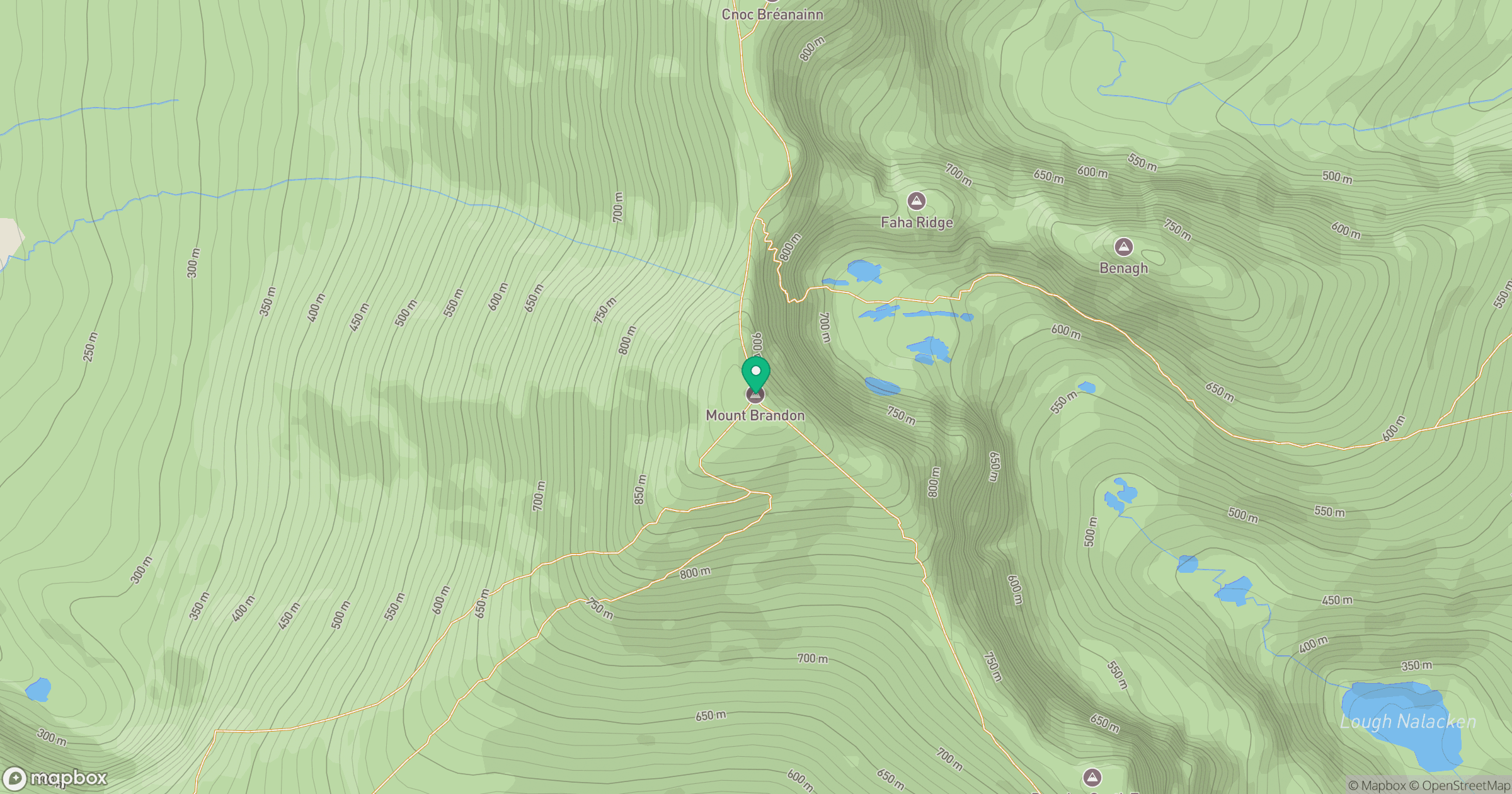
Grid reference: Q460116
View on OpenStreetMapOpens a map in a new tab, centred on the hill.
No comments yet. Be the first.