

Faill an tSais
Good walks are even better shared.
Overview
Faill an tSais
Overview
Nestled in the stunning Scottish Highlands, Faill an tSais stands proud at 744 meters. Its rugged charm and panoramic views make it a must-visit for outdoor lovers.
Geology
This mighty Munro boasts ancient metamorphic rocks, including schist and gneiss. The glacial whispers of the past are evident, making it a fascinating spot for geology buffs to ponder how many millions of years it took to shape this beauty.
Routes
The West Glen Tarbert Circuit is a lovely circular trek that offers a moderate challenge, while the east ascent from Inverneill will test your grit, but reward you spectacularly!
Summit Features
At the summit, you’ll find a humble stone cairn. It’s a great place to catch your breath and snap a selfie, or ponder the universe – or just enjoy the scenery.
Terrain Type
Prepare for a playful mix of rocky pathways, grassy patches, and some delightful boggy bits that add an element of surprise. Don’t forget your walking poles – they can help you navigate the quirks of Highland terrain.
Views
Be mesmerised by views of Loch Fyne and the Kintyre Peninsula. On a clear day, look out for the majestic mountains of Arran in the distance. Late spring and early autumn offer the clearest vistas.
Hazards
Mountain weather can turn on you faster than a highland dance, so always be prepared. Watch for loose rocks and deep bogs that will try to test your balance.
Nearby Summits
Don’t stop at Faill an tSais! Nearby you’ll find Beinn an Nòid and Beinn Bhreac, both of which offer their own unique challenges and stunning views.
Access
Parking is at a premium near Glen Tarbert, so try to arrive early. There are limited public transport options, so having a car might be the best way to go. Tarbert is where you'll find the nearest town facilities, including some excellent cafes.
Facilities
Enjoy a well-deserved treat in Tarbert post-hike; the local cafés and pub serve up some delicious grub and a fine cup of tea – perfect for recovering after your adventure!
History
The name Faill an tSais tells us a story, referring to the cliffs that result from centuries of geological magic. It’s a site rich in local folklore, where every stone may have a tale to tell.
Conclusion
An ascent of Faill an tSais promises not just exercise but a journey through time, nature, and an unbeatable sense of achievement. So lace up those boots and get ready for an adventure!
Explore routes near Faill an tSais
Public walks starting within 80 km of this hill. Nearby does not mean a route reaches the summit; check its map and access before setting out.
No public routes are currently listed within 80 km of Faill an tSais on Walkmates. This does not mean there are no paths here. Explore the map and check local access information before planning a walk.
Route planning notes
These notes describe possible approaches, not verified navigable routes or permission to cross land. Check current paths, local access rules and conditions before setting out.
West Glen Tarbert Circuit
A circular route starting from Tarbert, allowing hikers to enjoy the stunning views while tackling the slopes of Faill an tSais.
East Ascent from Inverneill
This ascent provides a direct route from the east. A bit steep in places, but the views on the ascent are truly worth the effort.
Make a day of it, together
Find someone to share the walk with, or organise a day out along a route you like.
Photo Gallery
View all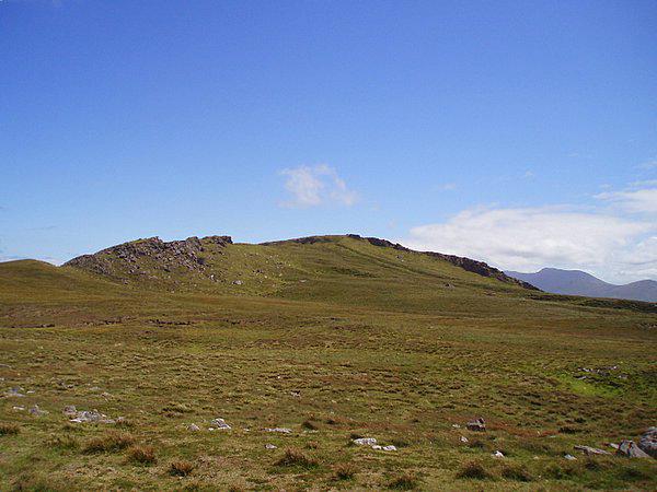 Photo could not load
Q4915 : Ridge in the bog
Sharon Loxton
Hill facts and local notes
Classifications
Elevation
431m
1,413 ft
Prominence
109m
Coordinates
52.2662, -10.2036
Q496149
OS Map
70
At the Summit
The summit features a modest stone cairn, which may not compete with the Eiffel Tower in aesthetics, but certainly offers a nice photo opportunity against the breathtaking backdrop.
Terrain & Geology
The mountain is predominantly composed of ancient metamorphic rocks, typical of the region, with fascinating glacial features that tell tales of a time when the landscape was shaped by ice. Expect plenty of schist and some gneiss to keep the geology enthusiasts smiling.
Views & Scenery
From the summit, one can enjoy sweeping views of Loch Fyne, the Kintyre Peninsula, and, on a clear day, the mountains of Arran. Keep your eyes peeled for soaring eagles!
History & Heritage
Name Origin
The name Faill an tSais translates roughly to 'Cliff of the Saise', reflecting the rugged features of the mountain, perhaps hinting at some historical tales of woe or wisdom.
Historical Significance
The area is steeped in local folklore, with many stories woven into the fabric of Highland life, from ancient battles to romantic escapades.
Getting There & Facilities
Check current local access restrictions, parking rules and transport timetables before travelling. These notes do not confirm public access to the summit.
Parking
There is a small parking area in Glen Tarbert near the starting point for the West Glen Tarbert Circuit. Spaces are limited, but arriving early can save you the hassle of parking further away.
Public Transport
Public transport options are sparse, but buses from Tarbert connect to larger towns and cities. Check local services for schedules, as they can be as predictable as a Scottish summer.
Nearby Facilities
Facilities in Tarbert include several cafes and the friendly local pub. Always a good idea to refuel with a bit of cake or a hearty meal before your adventure!
Safety Information
Known Hazards
- As with many Highland climbs, be cautious of sudden weather changes, loose rocks, and the occasional bog that may happily swallow a shoe if you're not paying attention.
General Safety Tips
- Check weather conditions before setting out
- Carry appropriate clothing and equipment
- Let someone know your planned route
- Take a map, compass, and GPS device
- Carry emergency supplies: food, water, first aid kit, torch
Hills
Some common questions about the hills answered
Are there group walks up Faill an tSais?
Many walkers use Walkmates to join or organise walks with others. You can check for group walks around Faill an tSais through the maps
Are there other walkers around Faill an tSais?
Activity varies by location and time, but Walkmates lets you see whether others have shared walks or shown interest in this area. Find other people through the walking friends search walking friends for Faill an tSais search or of course create your own walk for Faill an tSais
Can I organise a walk to Faill an tSais?
Yes. If there aren’t any walks listed already, you can create a walk and make it available for others to join.
If you're signed up to Walkmates, you can create a walk to Faill an tSais.
How do I find a walk up this hill?
There are often multiple ways to walk this hill, depending on experience and route preference. Walkmates helps you explore walks and routes that others have shared.
Can I suggest a new route up Faill an tSais?
Yes. You can suggest or create routes to share with others. Walkmates focuses on the social side of walking, so routes are used to help people organise walks and explore areas together, rather than as detailed navigation tools or route libraries.
Other uses really appreciate knowledgeable walkers sharing their routes. Share your favourite route to Faill an tSais here
The is an error or something incorrect about this hill. How do I let you know?
We always strive to keep the information on Walkmates as accurate as possible. If you find an error, please let us know through the contact form and we'll aim to correct it as quickly as possible
Community Discussion
Comments
Location
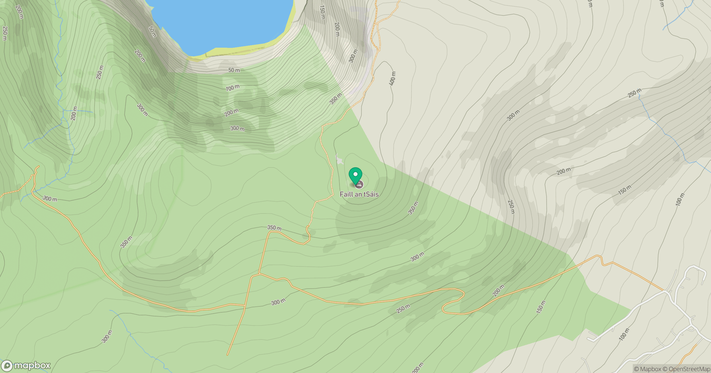
Grid reference: Q496149
View on OpenStreetMapOpens a map in a new tab, centred on the hill.
Hills within 30 km
Straight-line distance, not a walking route or confirmation of access.
No comments yet. Be the first.