

Slappers Hill
Good walks are even better shared.
Overview
Slappers Hill: The Outcrop of Adventure
Slappers Hill, standing at an unassuming 228 meters, may not be the largest peak in Dartmoor, but it offers a pleasantly challenging hike complemented by breathtaking vistas. Situated near the heart of Dartmoor National Park, this Marilyn captures the essence of the rugged charm of the region.
Geological Wonders
The granite bedrock that makes up Slappers Hill showcases the legacy of ancient volcanic activity. The rock formations not only provide a stable footing for avid hikers but also tell the story of Dartmoor's geological evolution. Explore the landscape, and you can almost hear the whispers of the past.
The Journey Begins
Starting from Norsworthy Bridge, you'll embark on a 5.5 km route that is moderate in difficulty. As your trek unfolds, expect to be enveloped in a kaleidoscope of colours—from the verdant greens of the grassy fields to the lavender hues of blooming heather.
Reaching the Summit
Upon reaching the summit, you'll see a modest stone outcrop where hikers often rest and engage in spirited discussions about the essential gear and the best hiking snacks. With views extending over Dartmoor, including the charming Burrator Reservoir, it's a perfect spot for a well-deserved break.
Seasonal Highlights
Best times to visit? Spring and autumn have you covered. Spring brings colour and life, while autumn offers the ethereal light that brings a photographer's dream to reality.
Safety and Hazards
Although Slappers Hill is generally manageable, do watch out for slippery conditions following rain. The twisting paths can be obscured by fog, so a reliable map and compass are essential, just in case.
Nearby Peaks
If you're feeling adventurous, pair your trip to Slappers Hill with a visit to nearby Crockern Tor and Great Mis Tor, both of which promise stunning panoramas and additional hiking tales to spin.
Access and Facilities
Before setting off, park at the Norsworthy Bridge, where free parking means extra pounds for biscuits! Public transport options are available, with regular buses connecting Plymouth to Yelverton, setting you up for a fine day out in nature.
Conclusion
In summary, Slappers Hill may not steal the show like some of its taller Dartmoor cousins, yet it remains a delightful spot for hikers looking for a taste of the wild in an easily accessible package. Don’t forget your camera, some snacks, and the finest walking boots you can find.
Whether you're a seasoned peak-bagger or a curious newbie, Slappers Hill welcomes all those eager to embrace its charm. Happy hiking!
Explore routes near Slappers Hill
Public walks starting within 80 km of this hill. Nearby does not mean a route reaches the summit; check its map and access before setting out.
Salcombe, Batson Creek and Snapes Point estuary circuit
View route
Moretonhampstead to Lustleigh: Wray Valley woodland railway trail
View route
Exe Estuary Trail: Topsham station to Exmouth station
View route
Exeter Canal, Double Locks and Countess Wear river circuit
View route
Route planning notes
These notes describe possible approaches, not verified navigable routes or permission to cross land. Check current paths, local access rules and conditions before setting out.
Norsworthy Bridge to Slappers Hill
A scenic route that begins at Norsworthy Bridge, weaving through heather and bracken before ascending to the summit.
Make a day of it, together
Find someone to share the walk with, or organise a day out along a route you like.
Photo Gallery
View all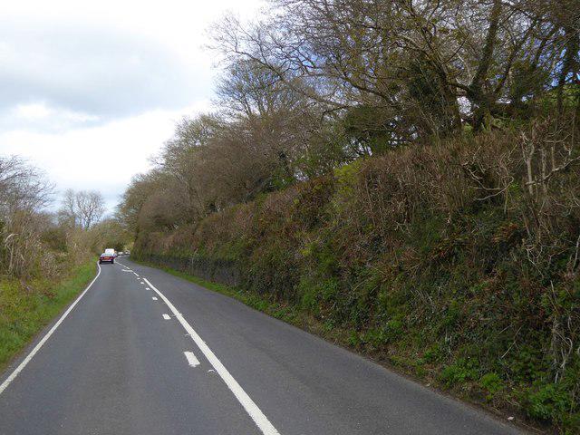 Photo could not load
SX8953 : A379 climbing towards Hillhead
David Smith
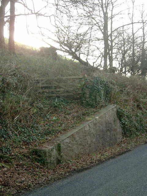 Photo could not load
SX8953 : Field entrance off the A379
Gordon Brown
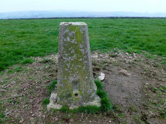 Photo could not load
SX8953 : Slappers Hill
Rude Health
Hill facts and local notes
Classifications
Elevation
179m
586 ft
Prominence
125m
Coordinates
50.3683, -3.5549
SX895532
OS Map
202
Explorer: OL20E
At the Summit
At the summit, you'll find a small stone outcrop providing a perfect resting spot, possibly engaging in a debate with your fellow hikers about which is the best biscuit to snack on.
Terrain & Geology
Slappers Hill is primarily composed of granite, a remnant of Dartmoor's volcanic past, which adds an interesting touch to your journey. This sturdy rock withstands the elements remarkably well, making it an ideal companion for your hike.
Views & Scenery
From the top, one can view the sprawling Dartmoor landscape, with the twisty River Plym and the iconic Burrator Reservoir sparkling in the distance.
History & Heritage
Name Origin
The name 'Slappers' is thought to derive from the Old English word for 'to glide or slide', perhaps a nod to the way the mists dance across the hills.
Historical Significance
Like many peaks in Dartmoor, Slappers Hill holds folklore significance, being part of the rich tapestry of stories related to the mythical giantess Tewkesbury.
Getting There & Facilities
Check current local access restrictions, parking rules and transport timetables before travelling. These notes do not confirm public access to the summit.
Parking
There is a parking area at Norsworthy Bridge which offers ample space for cars and is free of charge.
Public Transport
Regular bus services operate from Plymouth to nearby Yelverton, with a short walk to the start of your hike at Norsworthy Bridge.
Nearby Facilities
While there are no facilities on the hill itself, Yelverton offers several cafés and toilets. Always handy to stock up on snacks before your adventure.
Safety Information
Known Hazards
- Wet ground can lead to slippery conditions, so do take care if the weather has been unkind. Fog may obscure paths, making navigation tricky.
General Safety Tips
- Check weather conditions before setting out
- Carry appropriate clothing and equipment
- Let someone know your planned route
- Take a map, compass, and GPS device
- Carry emergency supplies: food, water, first aid kit, torch
Hills
Some common questions about the hills answered
Are there group walks up Slappers Hill?
Many walkers use Walkmates to join or organise walks with others. You can check for group walks around Slappers Hill through the maps
Are there other walkers around Slappers Hill?
Activity varies by location and time, but Walkmates lets you see whether others have shared walks or shown interest in this area. Find other people through the walking friends search walking friends for Slappers Hill search or of course create your own walk for Slappers Hill
Can I organise a walk to Slappers Hill?
Yes. If there aren’t any walks listed already, you can create a walk and make it available for others to join.
If you're signed up to Walkmates, you can create a walk to Slappers Hill.
How do I find a walk up this hill?
There are often multiple ways to walk this hill, depending on experience and route preference. Walkmates helps you explore walks and routes that others have shared.
Can I suggest a new route up Slappers Hill?
Yes. You can suggest or create routes to share with others. Walkmates focuses on the social side of walking, so routes are used to help people organise walks and explore areas together, rather than as detailed navigation tools or route libraries.
Other uses really appreciate knowledgeable walkers sharing their routes. Share your favourite route to Slappers Hill here
The is an error or something incorrect about this hill. How do I let you know?
We always strive to keep the information on Walkmates as accurate as possible. If you find an error, please let us know through the contact form and we'll aim to correct it as quickly as possible
Community Discussion
Comments
Location
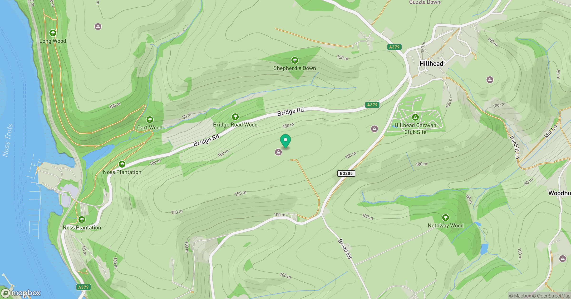
Grid reference: SX895532
View on OpenStreetMapOpens a map in a new tab, centred on the hill.
Hills within 30 km
Straight-line distance, not a walking route or confirmation of access.
No comments yet. Be the first.