

Skiddaw Middle Top
Good walks are even better shared.
Overview
Skiddaw Middle Top
Introduction
Situated in the heart of the picturesque Lake District, Skiddaw Middle Top is a charming peak that tempts hikers with its rolling vistas and inviting trails. It’s not quite the highest peak in the Lake District, but its stunning views more than make up for it.
Geology
As mentioned, Skiddaw Middle Top's geological foundation comprises ancient Skiddaw slate. These rock layers not only offer a lesson in Earth's history but provide a stark beauty as you traverse its rugged surfaces. Plus, spotting unique rock formations recently exposed can make you feel like an amateur geologist on the hunt for treasure!
Access
Getting to Skiddaw Middle Top is a breeze. The nearest parking can be found at Carlside car park, situated conveniently off the A591. If you're relying on public transport, Keswick offers frequent bus services from nearby towns, perfect for those who fancy leaving the car behind. Plus, post-hike, you'll find plenty of cafés in Keswick to reward yourself with a hearty slice of cake.
The Routes
The suggested route via Dash Valley is moderately challenging, taking around 4.5 hours to complete and covering approximately 9.5 km. As you navigate through lush valleys and alongside bubbling streams, the ascent becomes a true adventure. And remember: don’t forget to take pictures along the way for your collection of summit selfies!
Summit Features
Upon reaching the summit, you’ll be greeted by a sturdy cairn and a handy stone wind shelter, just in case Mother Nature decides to throw a tantrum. The panoramic views are nothing short of extraordinary, offering glimpses of Keswick, Derwentwater, and beyond.
Hazards
While the walk is manageable, always keep an eye out for slippery rocks—trust me, it’s not fun to slip and slide your way down! Weather in the Lake District can change swiftly, so packing a waterproof jacket might just save your day.
Nearby Summits
Make sure to check out the nearby Skiddaw (931 m) and Blencathra (868 m) once you've conquered Skiddaw Middle Top. Both offer their unique challenges and equally impressive views.
Conclusion
In summary, Skiddaw Middle Top is a stellar stop for any outdoor enthusiast. With its pleasant trails, rich scenery, and historical backdrop, it truly embodies the spirit of the Lake District. So pack your bags, put on your walking boots, and head out for an unforgettable adventure!
Explore routes near Skiddaw Middle Top
Walks starting near this hill. Open a route to check its map, distance and full itinerary.
Whinlatter dark skies walk
View route
Whinlatter dark skies walk
View route
Binsey from Binsey Lodge Direct Out and Back Wainwright
View route
Brae Fell from Longlands Wainwright
View route
Route planning notes
These notes describe possible approaches. Check a route's map and access information when planning your walk.
Skiddaw via the Dash Valley
A popular route starting from the picturesque Dash Valley, this trail winds up through lush valleys and alongside streams, offering a firm workout and spectacular views as you ascend.
Make a day of it, together
Find someone to share the walk with, or organise a day out along a route you like.
Photo Gallery
View all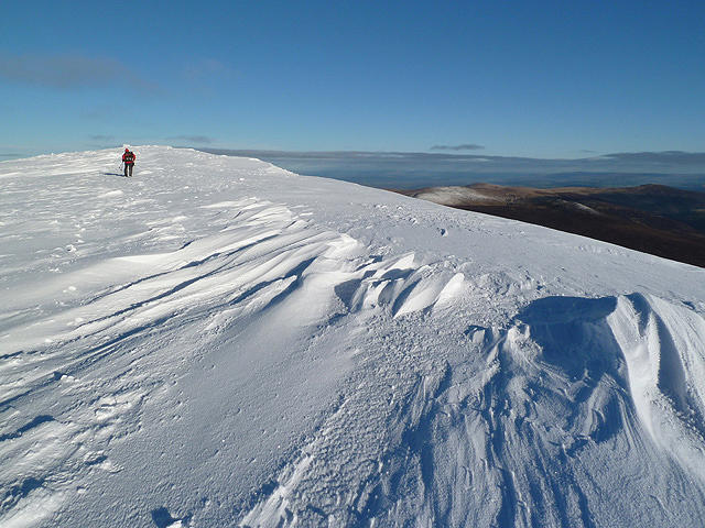 Photo could not load
NY2628 : Snow patterns on Skiddaw
Walter Baxter
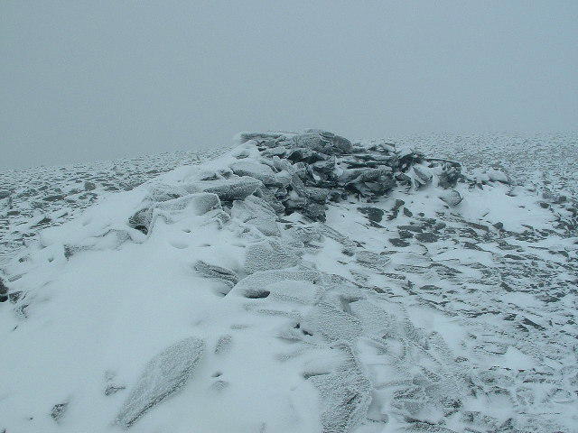 Photo could not load
NY2629 : Summit Shelter, Skiddaw Summit
Nigel Homer
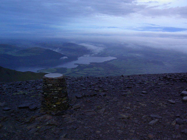 Photo could not load
NY2629 : Skiddaw Summit at Sunrise
Charles Rispin
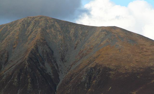 Photo could not load
NY2629 : Skiddaw and Little Man
Steve Partridge
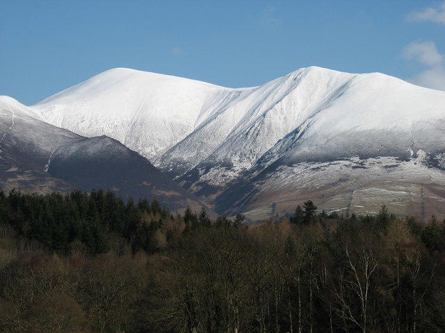 Photo could not load
NY2629 : The Skiddaw range under snow
David Purchase
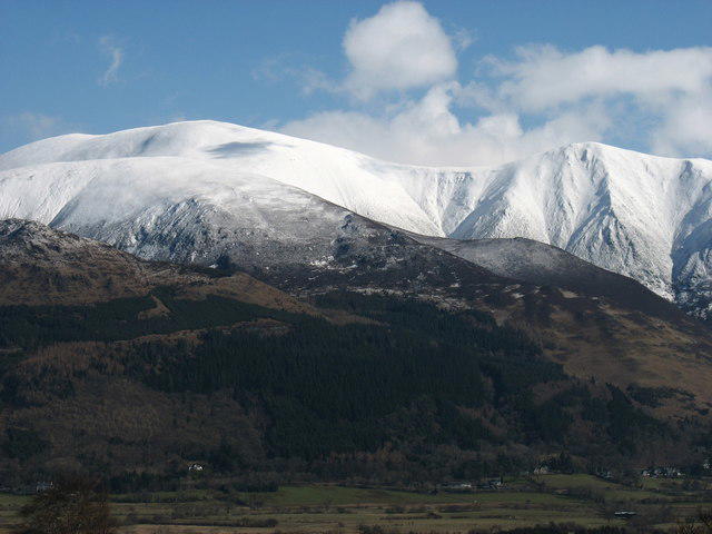 Photo could not load
NY2629 : The Skiddaw range under snow
David Purchase
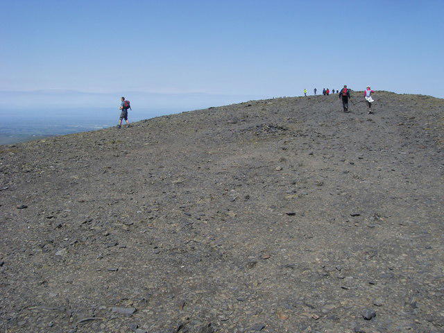 Photo could not load
NY2628 : Skiddaw South Top
Shaun Ferguson
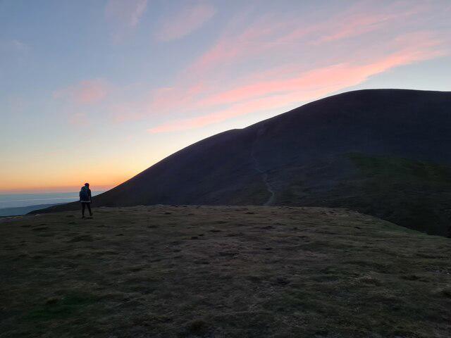 Photo could not load
NY2528 : View of Skiddaw South from Carl Side
Robert Dworak
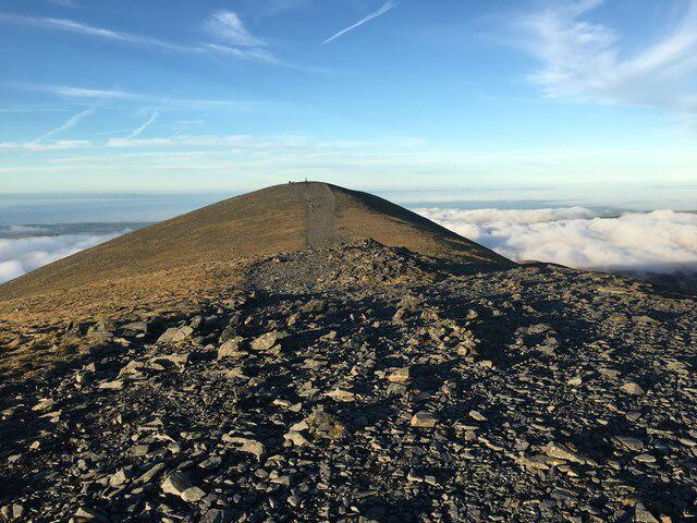 Photo could not load
NY2628 : Path towards the summit of Skiddaw
Steven Brown
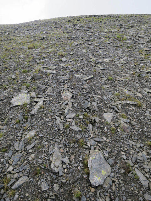
NY2528 : Sorted scree, Skiddaw
Hugh Venables
Hill facts and local notes
Classifications
Elevation
929m
3,047 ft
Prominence
10m
Coordinates
54.6491, -3.1474
NY260288
OS Map
89 90
Explorer: OL4S
At the Summit
The summit is marked by a substantial cairn and a stone wind shelter, perfect for catching your breath or pretending you're summiting a peak in the Himalayas.
Terrain & Geology
Skiddaw Middle Top is primarily composed of Skiddaw slate, which is a sedimentary rock formed from layers of mudstone. The area's geology dates back around 500 million years, making it a fascinating spot for any rock hound.
Views & Scenery
From the summit, you can see the breathtaking sights of Keswick, Derwentwater, and the distant peaks of the Helvellyn range. On a clear day, you might even spot the Isle of Skye!
History & Heritage
Name Origin
The name 'Skiddaw' is thought to come from the Old Norse word 'skidh' meaning 'shining', likely referring to its prominent, gleaming summits.
Historical Significance
Skiddaw is an iconic mountain in the Lake District, holding historical significance as one of the first to be climbed for recreation in the early 19th century.
Getting There & Facilities
Parking
There is parking available at the Carlside car park, just off the A591 road, which provides direct access to the footpaths leading up to Skiddaw Middle Top.
Public Transport
Keswick has frequent bus services from major towns, making it fairly easy to reach without a car. The nearest bus stop is in Keswick town centre.
Nearby Facilities
Keswick offers various facilities, including cafés, restaurants, and public toilets, ensuring that you don’t have to venture too far for a slice of cake after your climb.
Safety Information
Known Hazards
- Be cautious of slippery rocks, particularly after rain, and watch for sudden weather changes, which can occur more often than you can say 'pack the raincoat!'
General Safety Tips
- Check weather conditions before setting out
- Carry appropriate clothing and equipment
- Let someone know your planned route
- Take a map, compass, and GPS device
- Carry emergency supplies: food, water, first aid kit, torch
Hills
Some common questions about the hills answered
Are there group walks up Skiddaw Middle Top?
Many walkers use Walkmates to join or organise walks with others. You can check for group walks around Skiddaw Middle Top through the maps
Are there other walkers around Skiddaw Middle Top?
Activity varies by location and time, but Walkmates lets you see whether others have shared walks or shown interest in this area. Find other people through the walking friends search walking friends for Skiddaw Middle Top search or of course create your own walk for Skiddaw Middle Top
Can I organise a walk to Skiddaw Middle Top?
Yes. If there aren’t any walks listed already, you can create a walk and make it available for others to join.
If you're signed up to Walkmates, you can create a walk to Skiddaw Middle Top.
How do I find a walk up this hill?
There are often multiple ways to walk this hill, depending on experience and route preference. Walkmates helps you explore walks and routes that others have shared.
Can I suggest a new route up Skiddaw Middle Top?
Yes. You can suggest or create routes to share with others. Walkmates focuses on the social side of walking, so routes are used to help people organise walks and explore areas together, rather than as detailed navigation tools or route libraries.
Other uses really appreciate knowledgeable walkers sharing their routes. Share your favourite route to Skiddaw Middle Top here
The is an error or something incorrect about this hill. How do I let you know?
We always strive to keep the information on Walkmates as accurate as possible. If you find an error, please let us know through the contact form and we'll aim to correct it as quickly as possible
Community Discussion
Comments
Location
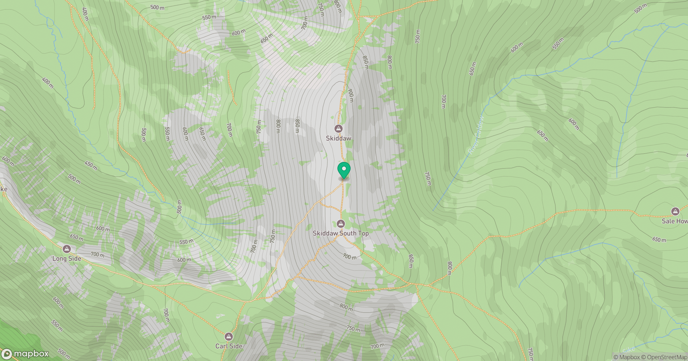
Grid reference: NY260288
View on OpenStreetMapOpens a map in a new tab, centred on the hill.
Nearby Hills
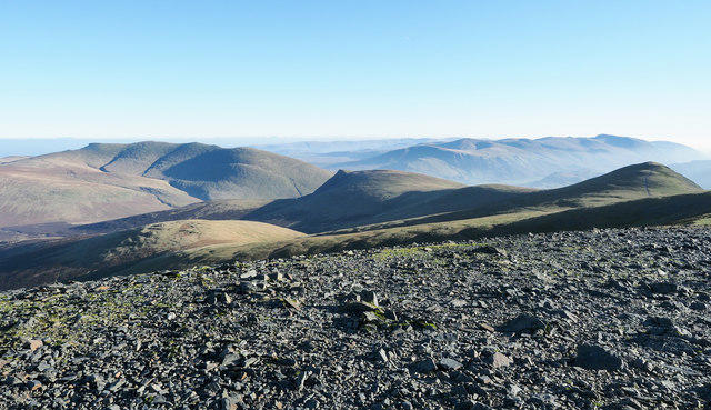
Skiddaw
930m

Blencathra - Hallsfell Top
868m
Grisedale Pike
790m
Crag Hill [Eel Crag]
839m
Grasmoor
852m
No comments yet. Be the first.