

Skiddaw Little Man
Good walks are even better shared.
Overview
Skiddaw Little Man is an 865m Wainwright above Keswick, reached from Gale Road by a steep climb over Lesser Man, with wide views across Derwentwater.
Skiddaw Little Man
Skiddaw Little Man rises to 865m above Keswick, a separate Wainwright on the southern side of the Skiddaw massif. Its position gives it an open outlook across Derwentwater and the surrounding fells, making it worth visiting even when Skiddaw itself is not on the day's plan. The climb from Gale Road is substantial: a high starting point saves some ascent, but this is still a mountain walk. Summit details
The summit and its setting
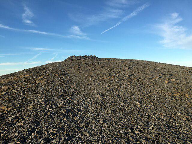
The lower cairned top reached from Jenkin Hill is Lesser Man. Continue beyond it to reach Little Man. A cairn marks the familiar summit area, while the recorded high point is a rock about five metres north of the cairn. The summit grid reference is NY266277. Summit record
On a clear day, look south over Keswick and Derwentwater, west towards the north-western fells, and east towards Blencathra. Skiddaw's higher ridge stands close by to the north-west. Cloud can hide this whole outlook, so a clear mountain forecast matters more than a particular season. Andrew's Walks, The Great Outdoors
The massif belongs to the Skiddaw Group, an ancient sedimentary succession including mudstone, siltstone and sandstone. The familiar name “Skiddaw slate” does not mean the whole mountain consists of a single rock type. British Geological Survey
Two walks from Gale Road
Little Man and back: allow roughly 3–4 hours for about 7.5km in reasonable, snow-free conditions. From the car park behind Latrigg, take the signed Skiddaw path past the Hawell Monument and climb the long, steep path towards Jenkin Hill. Before the gate around NY271275, leave the main track on the left for Lesser Man, then continue to Little Man. Return over Lesser Man to the junction and descend by the same Skiddaw path to the car park. Andrew's Walks, The Great Outdoors
Skiddaw with Little Man: a longer outing from the same car park can use the main path around Little Man to reach Skiddaw, then visit Little Man and Lesser Man on the return before rejoining the Jenkin Hill descent. This circuit is about 10km with 700m of ascent. Allow around 4–5 hours, more for rests or difficult conditions, and plan the summit-ridge section and return before setting off. Do not improvise a descent towards Millbeck or Carl Side if your intended finish is Gale Road. WalkLakes route guide
Longer combinations with Lonscale Fell need their own route plan: some descend to Whit Beck, where high water can prevent a safe crossing.
Getting there
The road-end parking is normally called Gale Road or Latrigg car park. The National Park gives its location as NY281253, reached via Applethwaite or Ormathwaite. Do not rely on a postcode alone to identify the final lane. Follow current parking notices and leave gates, passing places and access clear. There are no toilets or refreshments on the fell; use Keswick before setting out. National Park access information
For a car-free day, buses serve Keswick, including Stagecoach's X4/X5 connection with Penrith railway station. Walkers can approach Gale Road from Keswick via Spooney Green Lane and the paths around Latrigg, then retrace that approach at the end. This adds distance and climbing beyond the figures above. Check the current timetable and last return; the mountain start should not be treated as a bus stop. Stagecoach, Keswick approach
Conditions and preparation
Expect steep stony climbing, some grass and loose or slippery ground. The name “tourist path” does not remove the need for navigation: mist can obscure junctions, and the upper slopes are exposed to strong winds. Turn back if conditions exceed the group's ability.
Snow and ice can turn these paths into a winter mountaineering outing. Carry suitable clothing, food, water, a map and compass you can use, and a torch. Check a mountain forecast, allow enough daylight for the whole return, and tell someone your plan. National Park walking safety
Explore routes near Skiddaw Little Man
Public walks starting within 80 km of this hill. Nearby does not mean a route reaches the summit; check its map and access before setting out.
Derwentwater Walk: full lakeside circuit from Keswick
View route
Mungrisdale Common and Bowscale Fell from Mosedale Valley Wainwright
View route
Binsey from Binsey Lodge Direct Out and Back Wainwright
View route
Brae Fell from Longlands Wainwright
View route
Route planning notes
These notes describe possible approaches, not verified navigable routes or permission to cross land. Check current paths, local access rules and conditions before setting out.
Little Man from Gale Road, returning the same way
Gale Road/Latrigg car park, Hawell Monument, Jenkin Hill path, Lesser Man and Little Man; retrace to the same car park. About 7.5km for the full return. Allow 3–4 hours in reasonable snow-free conditions.
Skiddaw and Little Man from Gale Road
Use the main Skiddaw path around Little Man to Skiddaw, then visit Little Man and Lesser Man on the return and descend via Jenkin Hill to the original car park. Around 10km/700m ascent for the complete circuit; allow 4–5 hours. Consult the linked WalkLakes route for the summit-ridge detail.
Make a day of it, together
Find someone to share the walk with, or organise a day out along a route you like.
Photo Gallery
View all Photo could not load
NY2627 : Path on Little Man
Steven Brown
 Photo could not load
NY2627 : Descending Skiddaw Little Man
Michael Graham
 Photo could not load
NY2627 : On Skiddaw Little Man
Michael Graham
 Photo could not load
NY2627 : Hazy view from Skiddaw Lesser Man
Derek Voller
 Photo could not load
NY2627 : The Skiddaw range under snow
David Purchase
 Photo could not load
NY2627 : Skiddaw Little Man
Richard Webb
 Photo could not load
NY2627 : Summit Cairn, Skiddaw Little Man
Michael Graham
 Photo could not load
NY2627 : Skiddaw Little Man
Shaun Ferguson
 Photo could not load
NY2627 : Skiddaw Little Man from the Lesser Man
David Purchase

NY2627 : The summit of Skiddaw Little Man
Walter Baxter
Hill facts and local notes
Classifications
Elevation
865m
2,838 ft
Prominence
61m
Coordinates
54.6399, -3.1376
NY266277
OS Map
89 90
Explorer: OL4S
At the Summit
A cairn marks the familiar summit area; the recorded highest point is a rock about 5m north of it. Lesser Man is the lower cairned top on the south-eastern approach.
Terrain & Geology
The Skiddaw massif belongs to the Skiddaw Group, a sedimentary succession including mudstone, siltstone and sandstone. The traditional name Skiddaw slate does not describe a single uniform rock type.
Views & Scenery
Keswick and Derwentwater to the south, the north-western fells to the west, Blencathra to the east and the higher Skiddaw ridge nearby. Visibility depends on cloud and weather.
History & Heritage
Historical Significance
The Hawell Monument on the approach commemorates the area's shepherding family. Little Man is one of Wainwright's Northern Fells.
Getting There & Facilities
Check current local access restrictions, parking rules and transport timetables before travelling. These notes do not confirm public access to the summit.
Parking
Gale Road/Latrigg car park at the road end, NY281253, reached via Applethwaite or Ormathwaite. Follow current notices and keep access clear.
Public Transport
Stagecoach X4/X5 connects Penrith railway station with Keswick. From Keswick, an approach via Spooney Green Lane and Latrigg adds walking distance and ascent to the Gale Road routes. Check current timetables and the last return.
Nearby Facilities
Use toilets and refreshments in Keswick before setting out. There are no facilities on the fell; carry food and water.
Safety Information
Known Hazards
- Steep ascent and descent; loose or slippery stones.
- Strong wind and mist on exposed upper slopes; navigation is required at path junctions.
- Snow and ice can require winter mountaineering skills and equipment.
- Longer Lonscale Fell circuits may cross Whit Beck; high water can make that return unsafe.
Seasonal Hazards
Snow, ice, strong winds and short daylight increase the seriousness of the walk. A clear valley does not guarantee suitable summit conditions.
General Safety Tips
- Check weather conditions before setting out
- Carry appropriate clothing and equipment
- Let someone know your planned route
- Take a map, compass, and GPS device
- Carry emergency supplies: food, water, first aid kit, torch
Hills
Some common questions about the hills answered
Are there group walks up Skiddaw Little Man?
Many walkers use Walkmates to join or organise walks with others. You can check for group walks around Skiddaw Little Man through the maps
Are there other walkers around Skiddaw Little Man?
Activity varies by location and time, but Walkmates lets you see whether others have shared walks or shown interest in this area. Find other people through the walking friends search walking friends for Skiddaw Little Man search or of course create your own walk for Skiddaw Little Man
Can I organise a walk to Skiddaw Little Man?
Yes. If there aren’t any walks listed already, you can create a walk and make it available for others to join.
If you're signed up to Walkmates, you can create a walk to Skiddaw Little Man.
How do I find a walk up this hill?
There are often multiple ways to walk this hill, depending on experience and route preference. Walkmates helps you explore walks and routes that others have shared.
Can I suggest a new route up Skiddaw Little Man?
Yes. You can suggest or create routes to share with others. Walkmates focuses on the social side of walking, so routes are used to help people organise walks and explore areas together, rather than as detailed navigation tools or route libraries.
Other uses really appreciate knowledgeable walkers sharing their routes. Share your favourite route to Skiddaw Little Man here
The is an error or something incorrect about this hill. How do I let you know?
We always strive to keep the information on Walkmates as accurate as possible. If you find an error, please let us know through the contact form and we'll aim to correct it as quickly as possible
Community Discussion
Comments
Location
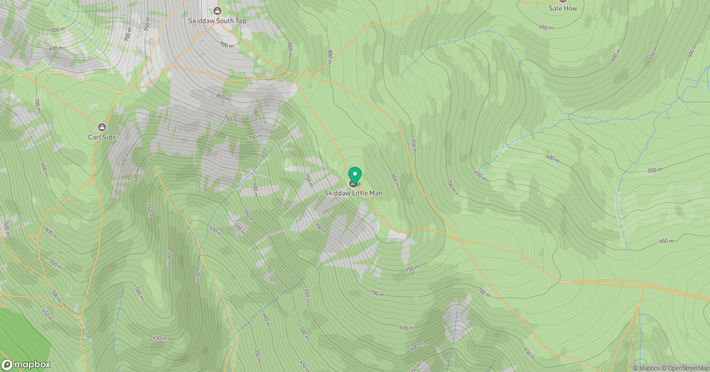
Grid reference: NY266277
View on OpenStreetMapOpens a map in a new tab, centred on the hill.
Hills within 30 km
Straight-line distance, not a walking route or confirmation of access.
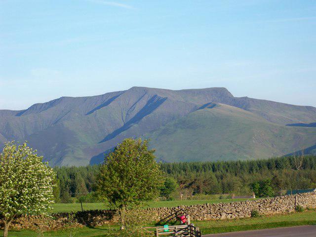
Skiddaw
930m
Blencathra - Hallsfell Top
868m

Grisedale Pike
790m

Crag Hill [Eel Crag]
839m

Fleetwith Pike
649m
No comments yet. Be the first.